|
Baker's Haulover Inlet
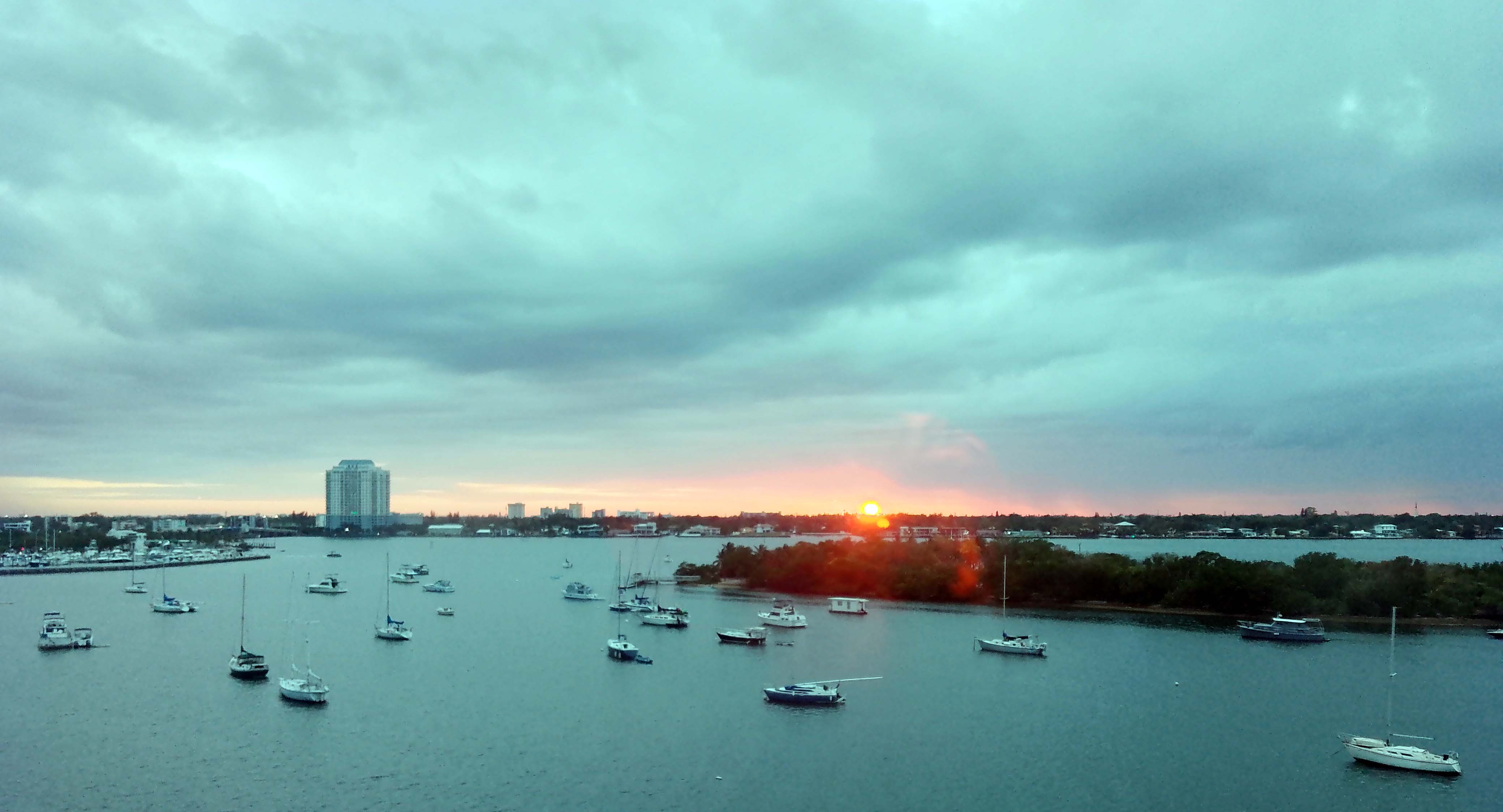
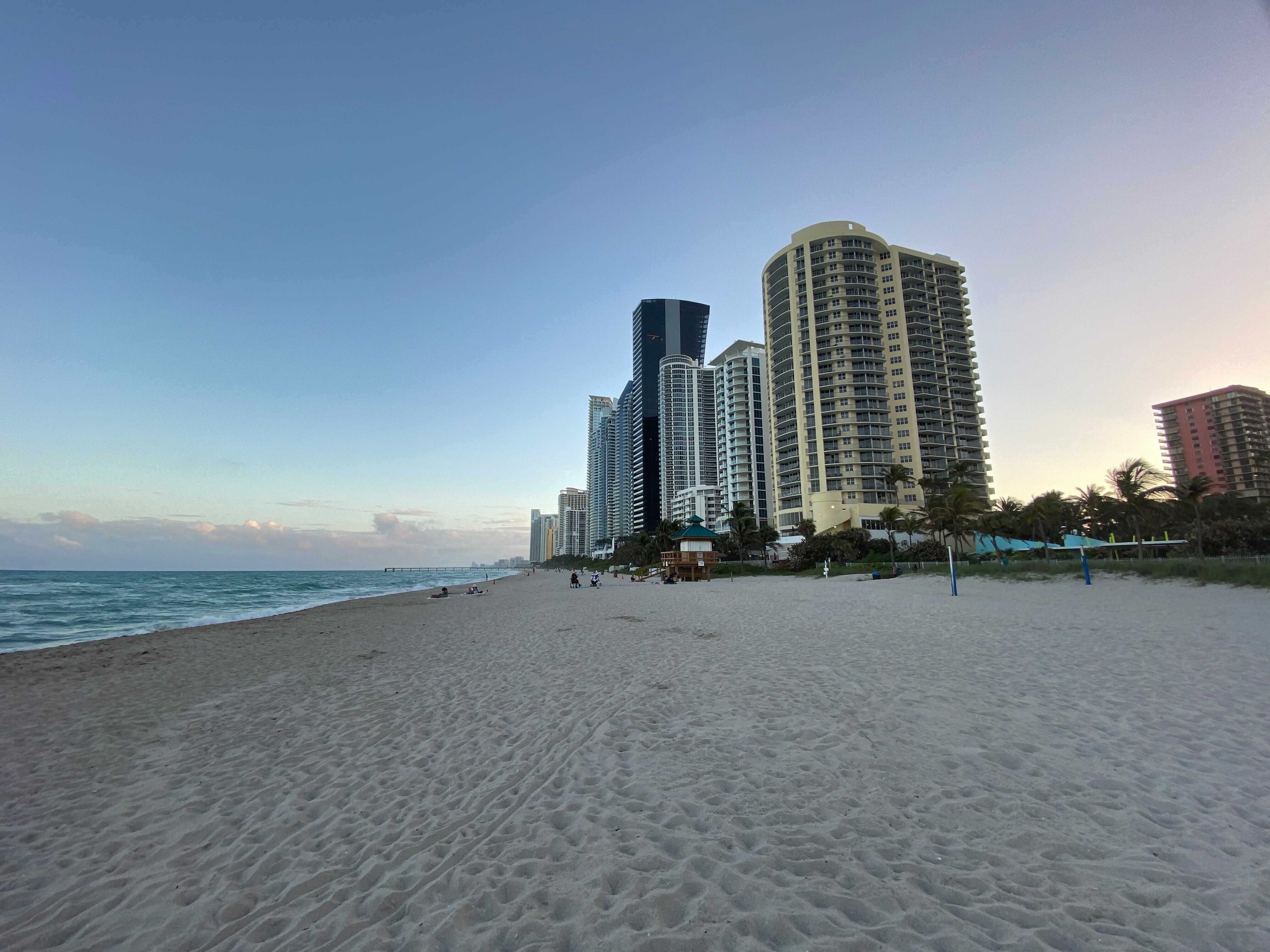
Baker's Haulover Inlet, more commonly known simply as Haulover inlet, is a man-made channel in Miami-Dade County, Florida, connecting the northern end of Biscayne Bay with the Atlantic Ocean. The inlet An inlet is a typically long and narrow indentation of a shoreline such as a small arm, cove, bay, sound, fjord, lagoon or marsh, that leads to an enclosed larger body of water such as a lake, estuary, gulf or marginal sea. Overview In ... was cut in 1925 through a narrow point in the sand between the cities of Bal Harbour and Sunny Isles. It is the location of an official nude beach, recreation areas and marina in the 99-acre Haulover Park. A fixed bridge carries State Road A1A across the inlet. The name has appeared on maps as early as 1823. There is a State of Florida Historical Landmark Marker at the original Lighthouse Dock site dedicated on February 21, 2004, to the first charter-boat captains at the 1926–1951 dock. It is the only marker in the State of Fl ... [...More Info...] [...Related Items...] OR: [Wikipedia] [Google] [Baidu] |
Miami-Dade County, Florida
Miami-Dade County () is a County (United States), county located in the southeastern part of the U.S. state of Florida. The county had a population of 2,701,767 as of the 2020 United States census, 2020 census, making it the most populous county in Florida and the List of the most populous counties in the United States, seventh-most-populous county in the United States. It is Florida's third largest county in terms of land area with . The county seat is Miami, the core of the metropolitan statistical area, nation's ninth-largest and List of largest cities, world's 65th-largest metropolitan area with a 2020 population of 6.138 million people, List of U.S. states and territories by population, exceeding the population of 31 of the nation's 50 states as of 2022. As of 2022, Miami-Dade County has a gross domestic product of $184.5 billion, making the county's GDP the largest for any county in the State of Florida and the List of US counties with GDP over 50 billion US dollars, 14th ... [...More Info...] [...Related Items...] OR: [Wikipedia] [Google] [Baidu] |
Biscayne Bay
Biscayne Bay is a lagoon with characteristics of an estuary located on the Atlantic coast of South Florida. The northern end of the lagoon is surrounded by the densely developed heart of the Miami metropolitan area while the southern end is largely undeveloped with a large portion of the lagoon included in Biscayne National Park. The part of the lagoon that is traditionally called "Biscayne Bay" is approximately long and up to wide, with a surface area of . Various definitions may include Dumfoundling Bay, Card Sound, and Barnes Sound in a larger "Biscayne Bay", which is long with a surface area of about . Etymology Hernando de Escalante Fontaneda related in the 16th century that a sailor from the Bay of Biscay called the ''Viscayno'' or ''Biscayno'' had lived on the lower east coast of Florida for a while after being shipwrecked, and a 17th-century map shows a ''Cayo de Biscainhos'', the probable origin of the name for Key Biscayne. The lagoon was known as "Key Biscayne Bay" ... [...More Info...] [...Related Items...] OR: [Wikipedia] [Google] [Baidu] |
Atlantic Ocean
The Atlantic Ocean is the second largest of the world's five borders of the oceans, oceanic divisions, with an area of about . It covers approximately 17% of Earth#Surface, Earth's surface and about 24% of its water surface area. During the Age of Discovery, it was known for separating the New World of the Americas (North America and South America) from the Old World of Afro-Eurasia (Africa, Asia, and Europe). Through its separation of Afro-Eurasia from the Americas, the Atlantic Ocean has played a central role in the development of human society, globalization, and the histories of many nations. While the Norse colonization of North America, Norse were the first known humans to cross the Atlantic, it was the expedition of Christopher Columbus in 1492 that proved to be the most consequential. Columbus's expedition ushered in an Age of Discovery, age of exploration and colonization of the Americas by European powers, most notably Portuguese Empire, Portugal, Spanish Empire, Sp ... [...More Info...] [...Related Items...] OR: [Wikipedia] [Google] [Baidu] |
Inlet
An inlet is a typically long and narrow indentation of a shoreline such as a small arm, cove, bay, sound, fjord, lagoon or marsh, that leads to an enclosed larger body of water such as a lake, estuary, gulf or marginal sea. Overview In marine geography, the term "inlet" usually refers to either the actual channel between an enclosed bay and the open ocean and is often called an "entrance", or a significant recession in the shore of a sea, lake or large river. A certain kind of inlet created by past glaciation is a fjord, typically but not always in mountainous coastlines and also in montane lakes. Multi-arm complexes of large inlets or fjords may be called sound In physics, sound is a vibration that propagates as an acoustic wave through a transmission medium such as a gas, liquid or solid. In human physiology and psychology, sound is the ''reception'' of such waves and their ''perception'' by the br ...s, e.g., Puget Sound, Howe Sound, Karmsund (' ... [...More Info...] [...Related Items...] OR: [Wikipedia] [Google] [Baidu] |
Bal Harbour, Florida
Bal Harbour is a village in Miami-Dade County, Florida. The village is part of the Miami metropolitan area of South Florida. The population was 3,093 at the 2020 US Census. History Since the 1920s, the Detroit-based Miami Beach Heights Corporation—headed by industrialists Robert C. Graham, Walter O. Briggs, and Carl G. Fisher—owned of undeveloped, partially swampy land that stretched from the bay to the Atlantic. Graham assumed the duties as the developer for Bal Harbour. In the 1930s, city planners Harland Bartholomew & Associates were called in to design the village. The company made several plans, and they were submitted to the Miami Beach Heights for review. The original name chosen for Bal Harbour was Bay Harbour. However, the planning committee didn't think that was appropriate for a city that was on the beach. A name was invented to encompass a village that ran from the bay to the Atlantic Ocean. The ''b'' was taken from the word ''bay'' and the ''a'' and ''l ... [...More Info...] [...Related Items...] OR: [Wikipedia] [Google] [Baidu] |
Sunny Isles
Sunny Isles Beach (SIB or more commonly Sunny Isles, and officially the City of Sunny Isles Beach) is a city located on a barrier island in northeast Miami-Dade County, Florida, United States. The city is part of the Miami metropolitan area of South Florida, and is bounded by the Atlantic Ocean on the east and the Intracoastal Waterway on the west. As of the 2020 census, it had a population of 22,342. Sunny Isles Beach is an area of cultural diversity with stores lining Collins Avenue, the main thoroughfare through the city. It is renowned for having the 14th tallest skyline in the United States, and according to the 2020 U.S. Census it was the mostly densely populated incorporated place in the United States outside of the New York City metropolitan area. Developers like Michael Dezer have invested heavily in construction of high-rise hotels and condominiums while licensing the Donald Trump name for some of the buildings for promotional purposes. Sunny Isles Beach has a centra ... [...More Info...] [...Related Items...] OR: [Wikipedia] [Google] [Baidu] |
Haulover Park
Haulover Park is a urban park owned and operated by Miami-Dade County Parks, Recreation & Open Spaces Department, located in metropolitan Miami, just north of Bal Harbour, Florida. The park is located on a shoal between the Atlantic Ocean and Biscayne Bay, just north of the Broad Causeway (SR 922) and Collins Avenue. History The Dade County Commission procured the beach front property in 1940 following a lobbying effort for a $2 million municipal bond ($ million, in 2018 dollars) by county commissioner Charles H. Crandon for the purchases of northern Key Biscayne (what became Crandon Park) and the beach north of Baker's Haulover Inlet, then called Ocean Beach. Construction began on beach facilities in 1941, halted soon afterward due to funding holds following the onset of World War II. Work on the property resumed in 1945, and the park was renamed Haulover Park in January 1947, opening to the public the following year in late 1948. An 1,100-foot fishing pier extended into ... [...More Info...] [...Related Items...] OR: [Wikipedia] [Google] [Baidu] |
State Road A1A (Florida)
State Road A1A (SR A1A) is a major north–south Florida State Road consisting of seven separate sections running a total of along the Atlantic Ocean, from Key West at the southern tip of Florida, to Fernandina Beach, just south of Georgia on Amelia Island, before turning inland to Callahan. It is the main road through most oceanfront towns. Part of SR A1A is designated the A1A Scenic and Historic Coastal Byway, a National Scenic Byway. SR A1A is famous worldwide as a center of beach culture in the United States, a scenic coastal route through most Atlantic coastal cities and beach towns, including the unique tropical coral islands of the Florida Keys. SR A1A also serves as a major thoroughfare through Miami Beach and other south Florida coastal cities. A portion of SR A1A that passes through Volusia County is designated the Ormond Scenic Loop and Trail, a Florida Scenic Highway. It is also called the Indian River Lagoon Scenic Highway from State Road 510 at Wabas ... [...More Info...] [...Related Items...] OR: [Wikipedia] [Google] [Baidu] |
Haulover Inlet - Biscayne Bay, Florida 02
Haulover Park is a urban park owned and operated by Miami-Dade County Parks, Recreation & Open Spaces Department, located in metropolitan Miami, just north of Bal Harbour, Florida. The park is located on a shoal between the Atlantic Ocean The Atlantic Ocean is the second largest of the world's five borders of the oceans, oceanic divisions, with an area of about . It covers approximately 17% of Earth#Surface, Earth's surface and about 24% of its water surface area. During the ... and Biscayne Bay, just north of the Florida State Road 922, Broad Causeway (SR 922) and Collins Avenue. History The Miami-Dade county law and government, Dade County Commission procured the beach front property in 1940 following a lobbying effort for a $2 million municipal bond ($ million, in 2018 dollars) by county commissioner Charles H. Crandon for the purchases of northern Key Biscayne (what became Crandon Park) and the beach north of Baker's Haulover Inlet, then called Ocean Beach. Construc ... [...More Info...] [...Related Items...] OR: [Wikipedia] [Google] [Baidu] |
Inlets Of Florida
An inlet is a typically long and narrow indentation of a shoreline such as a small arm (geography), arm, cove, bay, sound (geography), sound, fjord, lagoon or marsh, that leads to an enclosed larger body of water such as a lake, estuary, gulf or marginal sea. Overview In marine geography, the term "inlet" usually refers to either the actual channel (geography), channel between an enclosed bay and the open ocean and is often called an "entrance", or a significant recession in the shore of a sea, lake or large river. A certain kind of inlet created by past glaciation is a fjord, typically but not always in mountainous coastlines and also in montane ecology, montane lakes. Multi-arm complexes of large inlets or fjords may be called sound (geography), sounds, e.g., Puget Sound, Howe Sound, Karmsund (''sund'' is Scandinavian languages, Scandinavian for "sound"). Some fjord-type inlets are called canals, e.g., Portland Canal, Lynn Canal, Hood Canal, and some are channels, e. ... [...More Info...] [...Related Items...] OR: [Wikipedia] [Google] [Baidu] |


