|
Bahía Las Palmas
Bahía las Palmas is a bight on the Gulf of California in Baja California Sur, Mexico. Located on the East Cape, it is north of Cabo San Lucas, accessed by Mexican Federal Highway 1. Geography The bay is shallow along the shoreline's southern third section. In the north third and near Buenavista, deep canyons fill its middle. Straddled by Los Barriles and Buenavista, there are fishing resorts along Punta Colorado and Punta Soledad. It is known for its flyfishing. Fauna ''Libytheana carinenta The American snout or common snout butterfly (''Libytheana carinenta'') is a member of the subfamily Libytheinae in the brush-footed butterfly family (biology), family, Nymphalidae. This species is found in both North and South America. The larv ... larvata'' butterflies have been recorded. References Gulf of California Bays of Mexico on the Pacific Ocean Landforms of Baja California Sur Bights (geography) {{BajaCaliforniaSur-geo-stub ... [...More Info...] [...Related Items...] OR: [Wikipedia] [Google] [Baidu] |
Bight (geography)
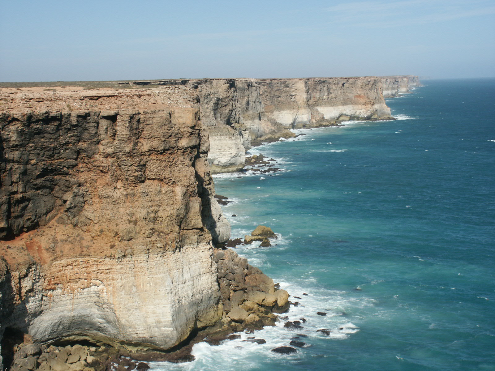
In geography, a bight () is a concave bend or curvature in a coastline, river or other geographical feature, or it may refer to a very open bay formed by such a feature. Such bays are typically broad, open, shallow and only slightly recessed. Description The size of bights differs greatly, which may be as small as a bend in a river or large like a sound. Large bights are shallower than sounds. Traditionally, explorers defined a bight as a bay that could be sailed out of on a single tack in a square-rigged sailing vessel, regardless of the direction of the wind (typically meaning the apex of the bight is less than 25 degrees from the edges). According to the United Nations Convention on the Law of the Sea, an indentation with an area as large as (or larger than) that of the semi-circle whose diameter is a line drawn across the mouth of that indentation, can be regarded as a bay not merely a bight. [...More Info...] [...Related Items...] OR: [Wikipedia] [Google] [Baidu] |
Gulf Of California
The Gulf of California (), also known as the Sea of Cortés (''Mar de Cortés'') or Sea of Cortez, or less commonly as the Vermilion Sea (''Mar Vermejo''), is a marginal sea of the Pacific Ocean that separates the Baja California peninsula from the Mexico, Mexican mainland. It is bordered by the states of Baja California, Baja California Sur, Sonora, and Sinaloa with a coastline of approximately . Rivers that flow into the Gulf of California include the Colorado River, Colorado, Fuerte River, Fuerte, Mayo River (Mexico), Mayo, Sinaloa River, Sinaloa, Sonora River, Sonora, and the Yaqui River, Yaqui. The surface of the gulf is about . Maximum depths exceed because of the complex geology, linked to plate tectonics. The gulf is thought to be one of the most diverse seas on Earth and is home to more than 5,000 species of micro-invertebrates. Parts of the Gulf of California are a UNESCO World Heritage Site. Geography History The marine expeditions of Fortún Ximénez, Hernán Cort� ... [...More Info...] [...Related Items...] OR: [Wikipedia] [Google] [Baidu] |
Baja California Sur
Baja California Sur, officially the Free and Sovereign State of Baja California Sur, is a state in Mexico. It is the 31st and last state to be admitted, in 1974. It is also the second least populated Mexican state and the ninth-largest state by area. Before becoming a state on 8 October 1974, the area was known as the ''El Territorio Sur de Baja California'' ("South Territory of Lower California"). It has an area of , or 3.57% of the land mass of Mexico, and occupies the southern half of the Baja California Peninsula, south of the 28th parallel north, 28th parallel, plus the uninhabited Rocas Alijos in the Pacific Ocean. It is bordered to the north by the state of Baja California, to the west by the Pacific Ocean, and to the east by the Gulf of California. The state has maritime borders with Sonora and Sinaloa to the east, across the Gulf of California. The state is home to the tourist resorts of Cabo San Lucas and San José del Cabo. Its largest city and capital is La Paz, Baja ... [...More Info...] [...Related Items...] OR: [Wikipedia] [Google] [Baidu] |
Cabo San Lucas
Cabo San Lucas (, "Luke the Evangelist, Saint Luke Cape (geography), Cape"), also known simply as Cabo, is a Resort town, resort city at the southern tip of the Baja California peninsula, in the Mexican Political divisions of Mexico, state of Baja California Sur. As of the 2020 Census, the population of the city was 202,694.2020 Census of Mexico. Cabo San Lucas and the neighboring San José del Cabo are collectively known as Los Cabos. Together, they form a metropolitan area of 351,111 inhabitants.2020 Census of Mexico. Rated as one of Mexico's top tourist destinations, Cabo San Lucas is known for its beaches, scuba diving locations, Balnearios, the sea arch El Arco de Cabo San Lucas, and marine life. The Los Cabos Corridor has become a heavily trafficked Tourism, vacation destination for tourists, with numerous resorts and timeshares along the coast between Cabo San Lucas and San José del Cabo. The waters around Cabo are home to a variety of marine wildlife including Batoidea, r ... [...More Info...] [...Related Items...] OR: [Wikipedia] [Google] [Baidu] |
Mexican Federal Highway 1
Federal Highway 1 (, Fed. 1) is a toll-free (libre) part of the federal highway corridors () of Mexico, and the highway follows the length of the Baja California Peninsula from Tijuana, Baja California, in the north to Cabo San Lucas, Baja California Sur, in the south. The road connects with ''Via Rapida'', which merges into the American Interstate 5 (I-5) at the San Ysidro Port of Entry, which crosses the international border south of San Ysidro, California. Fed. 1 is often called the ''Carretera Transpeninsular'' (Transpeninsular Highway) and runs a length of from Tijuana to Cabo San Lucas. Most of its course, particularly south of Ensenada, is as a two-lane rural highway. Completed in 1973, Fed. 1's official name is the Benito Juárez Transpeninsular Highway (), named in honor of Mexico's president during the country's 1860s invasion by France. Route description The road begins in the border city of Tijuana, where it continues northward as Interstate 5 ... [...More Info...] [...Related Items...] OR: [Wikipedia] [Google] [Baidu] |
The New York Times
''The New York Times'' (''NYT'') is an American daily newspaper based in New York City. ''The New York Times'' covers domestic, national, and international news, and publishes opinion pieces, investigative reports, and reviews. As one of the longest-running newspapers in the United States, the ''Times'' serves as one of the country's Newspaper of record, newspapers of record. , ''The New York Times'' had 9.13 million total and 8.83 million online subscribers, both by significant margins the List of newspapers in the United States, highest numbers for any newspaper in the United States; the total also included 296,330 print subscribers, making the ''Times'' the second-largest newspaper by print circulation in the United States, following ''The Wall Street Journal'', also based in New York City. ''The New York Times'' is published by the New York Times Company; since 1896, the company has been chaired by the Ochs-Sulzberger family, whose current chairman and the paper's publ ... [...More Info...] [...Related Items...] OR: [Wikipedia] [Google] [Baidu] |
Los Barriles, Baja California Sur
Los Barriles ("The Barrels") is a town in La Paz Municipality, Baja California Sur, Mexico. As 2020, the town had a population of 1,674 people. It is situated along Highway 1, north of San José del Cabo and south of La Paz. Punta Pescadero Airstrip is to the north; Rancho Leonero, a vacation resort, is to the south. Adjacent to Buenavista, the rural towns straddle the head of Bahía las Palmas on the Gulf of California, where winter westerlies average . Los Barriles is within the transition area of the Baja California peninsula's Sierra de la Laguna The Sierra de la Laguna is a mountain range at the southern end of the Baja California peninsula in Mexico, and is the southernmost range of the Peninsular Ranges System. It is located in La Paz Municipality, Baja California Sur, La Paz Municipa ... where the hills become sandy flats. Known for its flyfishing, Los Barriles is also Baja's kitesurfing and windsurfing capital. The town's port was closed on 2 September d ... [...More Info...] [...Related Items...] OR: [Wikipedia] [Google] [Baidu] |
Flyfishing
Fly fishing is an angling technique that uses an ultra-lightweight lure called an artificial fly, which typically mimics small invertebrates such as flying and aquatic insects to attract and catch fish. Because the mass of the fly lure is insufficient to overcome air resistance, it cannot be launched far using conventional gears and techniques, so specialized tackles are used instead and the casting techniques are significantly different from other forms of angling. It is also very common for the angler to wear waders, carry a hand net, and stand in the water when fishing. Fly fishing primarily targets predatory fish that have significant amount of very small-sized prey in their diet, and can be done in fresh or saltwater. North Americans usually distinguish freshwater fishing between cold-water species (trout, salmon) and warm-water species (notably black bass). In Britain, where natural water temperatures vary less, the distinction is between game fishing for trout a ... [...More Info...] [...Related Items...] OR: [Wikipedia] [Google] [Baidu] |
Libytheana Carinenta
The American snout or common snout butterfly (''Libytheana carinenta'') is a member of the subfamily Libytheinae in the brush-footed butterfly family (biology), family, Nymphalidae. This species is found in both North and South America. The larval host plants are ''Celtis'' species on which the eggs are laid singly. Massive migrations of this species often attract attention in the Texas and Mexican newspapers. Description Snout butterflies have prominent elongated mouthparts (labial palpi) which, in concert with the Antenna (biology), antennae, give the appearance of the Petiole (botany), petiole (stem) of a dead leaf. Snouts often take advantage of this superb camouflage by hanging upside down under a twig, making them nearly invisible. Wings are patterned black-brown with white and orange markings. The forewings have a distinctive squared off, hook-like (falcate) tip. The caterpillars appear humpbacked, having a small head, swollen first and second abdominal segments, and a l ... [...More Info...] [...Related Items...] OR: [Wikipedia] [Google] [Baidu] |
Bays Of Mexico On The Pacific Ocean
A bay is a recessed, coastal body of water that directly connects to a larger main body of water, such as an ocean, a lake, or another bay. A large bay is usually called a ''gulf'', ''sea'', ''sound'', or ''bight''. A ''cove'' is a small, circular bay with a narrow entrance. A ''fjord'' is an elongated bay formed by glacial action. The term ''embayment'' is also used for , such as extinct bays or freshwater environments. A bay can be the estuary of a river, such as the Chesapeake Bay, an estuary of the Susquehanna River. Bays may also be nested within each other; for example, James Bay is an arm of Hudson Bay in northeastern Canada. Some large bays, such as the Bay of Bengal and Hudson Bay, have varied marine geology. The land surrounding a bay often reduces the strength of winds and blocks waves. Bays may have as wide a variety of shoreline characteristics as other shorelines. In some cases, bays have beaches, which "are usually characterized by a steep upper foreshore wit ... [...More Info...] [...Related Items...] OR: [Wikipedia] [Google] [Baidu] |
Landforms Of Baja California Sur
A landform is a land feature on the solid surface of the Earth or other planetary body. They may be natural or may be anthropogenic (caused or influenced by human activity). Landforms together make up a given terrain, and their arrangement in the landscape is known as topography. Landforms include hills, mountains, canyons, and valleys, as well as shoreline features such as bays, peninsulas, and seas, including submerged features such as mid-ocean ridges, volcanoes, and the great oceanic basins. Physical characteristics Landforms are categorized by characteristic physical attributes such as elevation, slope, orientation, structure stratification, rock exposure, and soil type. Gross physical features or landforms include intuitive elements such as berms, cliffs, hills, mounds, peninsulas, ridges, rivers, valleys, volcanoes, and numerous other structural and size-scaled (e.g. ponds vs. lakes, hills vs. mountains) elements including various kinds of inland and oceanic waterbod ... [...More Info...] [...Related Items...] OR: [Wikipedia] [Google] [Baidu] |


