|
Ayacucho
Ayacucho (, , derived from the words ''aya'' ("death" or "soul") and ''k'uchu'' ("corner") in honour of the battle of Ayacucho), founded in 1540 as San Juan de la Frontera de Huamanga and known simply as Huamanga (Quechua: Wamanga) until 1825, is the capital city of Ayacucho Region and of Huamanga Province, Ayacucho Region, Peru. Its original name, which continues to be the alternative name of the city, dates back to the Incan and Viceregal periods of its history, until its official change by Simón Bolívar in 1825 through a decree to commemorate the battle of Ayacucho during the Peruvian War of Independence. Bolívar issued the decree on February 15, 1825, changing the name from "Huamanga" to "Ayacucho", after the battle that decisively established the total independence of the nascent Peruvian Republic. Ayacucho is famous for its 33 churches, which represent one for each year of Jesus' life. Ayacucho has large religious celebrations, especially during the Holy Week of Easte ... [...More Info...] [...Related Items...] OR: [Wikipedia] [Google] [Baidu] |
Battle Of Ayacucho
The Battle of Ayacucho (, ) was a decisive military encounter during the Peruvian War of Independence. This battle secured the independence of Peru and ensured independence for the rest of belligerent South American states. In Peru it is considered the end of the Spanish American wars of independence in this country, although the campaign of Antonio José de Sucre continued through 1825 in Upper Peru and the siege of the Coastal fortifications of colonial Chile, fortresses Chiloé and Callao District, Callao eventually ended in 1826. At the end of 1824, Royalist (Spanish American Revolution), Royalists still had control of most of the south of Peru as well as of the Real Felipe fortress in the port of Callao. On 9 December 1824, the Battle of Ayacucho (Battle of La Quinua) took place between Royalist and Independentist forces at Pampas de Ayacucho Historic Sanctuary, Pampa de Ayacucho (or Quinua), a few kilometers from Ayacucho, near the town of Quinua, Peru, Quinua. Independenti ... [...More Info...] [...Related Items...] OR: [Wikipedia] [Google] [Baidu] |
Ayacucho Region
Ayacucho (), known as Huamanga from its creation in 1822 until 1825, is a department and region of Peru, located in the south-central Andes of the country. Its capital is the city of Ayacucho. The region was one of the hardest hit in the 1980s during the guerrilla war waged by Shining Path known as the internal conflict in Peru. A referendum was held on 30 October 2005, in order to decide whether the department would merge with the departments of Ica and Huancavelica to form the new Ica-Ayacucho-Huancavelica Region, as part of the decentralization process in Peru. The proposal failed and no merger was carried out. Political division The department is divided into 11 provinces (, singular: ''provincia''), which are composed of 111 districts (''distritos'', singular: ''distrito''). Provinces The provinces, with their capitals in parentheses, are: # Cangallo ( Cangallo) # Huamanga ( Ayacucho) # Huanca Sancos ( Huanca Sancos) # Huanta ( Huanta) # La Mar ( San Miguel ... [...More Info...] [...Related Items...] OR: [Wikipedia] [Google] [Baidu] |
Department Of Ayacucho
Ayacucho (), known as Huamanga from its creation in 1822 until 1825, is a department and region of Peru, located in the south-central Andes of the country. Its capital is the city of Ayacucho. The region was one of the hardest hit in the 1980s during the guerrilla war waged by Shining Path known as the internal conflict in Peru. A referendum was held on 30 October 2005, in order to decide whether the department would merge with the departments of Ica and Huancavelica to form the new Ica-Ayacucho-Huancavelica Region, as part of the decentralization process in Peru. The proposal failed and no merger was carried out. Political division The department is divided into 11 provinces (, singular: ''provincia''), which are composed of 111 districts (''distritos'', singular: ''distrito''). Provinces The provinces, with their capitals in parentheses, are: # Cangallo (Cangallo) # Huamanga (Ayacucho) # Huanca Sancos (Huanca Sancos) # Huanta (Huanta) # La Mar ( San Miguel) # Lucana ... [...More Info...] [...Related Items...] OR: [Wikipedia] [Google] [Baidu] |
Pampas De Ayacucho Historic Sanctuary
The Pampas de Ayacucho Historic Sanctuary is located near the town of Quinua in the region of Ayacucho. It has an area of 3 km2 and was established in 1980 to protect the site of the Battle of Ayacucho. Since 2023, it is part of the Bicentenario - Ayacucho Biosphere Reserve. Obelisk For the sesquicentennial anniversary of the battle, the Ministry of War of Peru decided to erect a monument to the combatants on the plain. Through a public competition in 1968, the proposal for an obelisk made of marble by Spanish artist Aurelio Bernandino Arias was chosen as the winner. According to the author, ''the work represents'' ''nearly half a century of struggle for freedom and American independence, from the Túpac Amaru II Revolution in 1780 to its victorious culmination at this location''. The monument consists of a reinforced concrete structure covered externally with white marble. It stands 44 meters tall. The 3-meter-tall bronze statues represent the generals who were in com ... [...More Info...] [...Related Items...] OR: [Wikipedia] [Google] [Baidu] |
Peru
Peru, officially the Republic of Peru, is a country in western South America. It is bordered in the north by Ecuador and Colombia, in the east by Brazil, in the southeast by Bolivia, in the south by Chile, and in the south and west by the Pacific Ocean. Peru is a Megadiverse countries, megadiverse country, with habitats ranging from the arid plains of the Pacific coastal region in the west, to the peaks of the Andes mountains extending from the north to the southeast of the country, to the tropical Amazon basin rainforest in the east with the Amazon River. Peru has Demographics of Peru, a population of over 32 million, and its capital and largest city is Lima. At , Peru is the List of countries and dependencies by area, 19th largest country in the world, and the List of South American countries by area, third largest in South America. Pre-Columbian Peru, Peruvian territory was home to Andean civilizations, several cultures during the ancient and medieval periods, and has one o ... [...More Info...] [...Related Items...] OR: [Wikipedia] [Google] [Baidu] |
Regions Of Peru
According to the ''Organic Law of Regional Governments'', the regions () are, with the departments, the first-level semi autonomous administrative subdivisions of Peru. Since its Peruvian War of Independence, 1821 independence, Peru had been divided into departments of Peru, departments (Regions) Peru’s 24 departments each have a regional government and legislature responsible for administration, economic planning, and public services. These governments operate with autonomy while still coordinating with national authorities. Each department is led by a regional governor, who is elected by popular vote for a four-year term. The governor is responsible for implementing regional policies, managing budgets, and overseeing infrastructure projects. Supporting the governor is the regional legislative council, composed of elected representatives from different provinces within the department. This council approves budgets, monitors public investments, and ensures government accountab ... [...More Info...] [...Related Items...] OR: [Wikipedia] [Google] [Baidu] |
Ayacucho District
Ayacucho District is one of fifteen districts of the province Huamanga in Peru. Instituto Nacional de Estadística e Informática The Instituto Nacional de Estadística e Informática (INEI) ("National Institute of Statistics and Informatics") is a semi-autonomous Peruvian government agency which coordinates, compiles, and evaluates statistical information for the country. .... Banco de Información Distrital''. Retrieved April 11, 2008. Authorities Mayors * 2019-2022: Yuri Alberto Gutiérrez Gutiérrez. * 2015-2018: Germán Salvador Martinelli Chuchon. Festivities See also * Qunchupata * Wichqana References Districts of the Department of Ayacucho Districts of the Huamanga province {{Ayacucho-geo-stub ... [...More Info...] [...Related Items...] OR: [Wikipedia] [Google] [Baidu] |
Provinces Of Peru
The provinces of Peru () are the second-level administrative subdivisions of the country. They are divided into districts (). There are 196 provinces in Peru, grouped into 25 regions, except for Lima Province which does not belong to any region. This makes an average of seven provinces per region. The region with the fewest provinces is Callao (one) and the region with the most is Ancash (twenty). While provinces in the sparsely populated Amazon rainforest of eastern Peru tend to be larger, there is a large concentration of them in the north-central area of the country. The province with the fewest districts is Purús Province, with just one district. The province with the most districts is Lima Province, with 43 districts. The most common number of districts per province is eight; a total of 29 provinces share this number of districts. Provinces table The table below shows all provinces with their capitals and the region in which they are located. The UBIGEO code unique ... [...More Info...] [...Related Items...] OR: [Wikipedia] [Google] [Baidu] |
Wari Culture
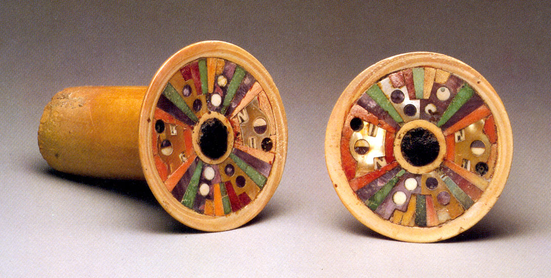
The Wari () were a Pre-Inca cultures, Middle Horizon civilization that flourished in the south-central Andes and coastal area of modern-day Peru, from about 500 to 1000 AD. Wari ruins, Wari, as the former capital city was called, is located north-east of the modern city of Ayacucho, Peru. This city was the center of a civilization that covered much of the highlands and coast of modern Peru. The best-preserved remnants, besides the Huari, Wari ruins, are the recently discovered Cerro Pátapo ruins, Northern Wari ruins near the city of Chiclayo, Peru, Chiclayo, and Cerro Baúl in Moquegua. Also well-known are the Wari ruins of Pikillaqta ("Flea Town"), a short distance south-east of Cuzco ''en route'' to Lake Titicaca. However, there is still a debate whether the Wari dominated the Central Coast or the polities on the Central Coast were commercial states capable of interacting with the Wari people without being politically dominated by them. History Archaeological evidence poin ... [...More Info...] [...Related Items...] OR: [Wikipedia] [Google] [Baidu] |
Pikimachay
Piki Mach'ay (Quechua ''piki'' flea, ''mach'ay'' cave,Diccionario Quechua - Español - Quechua, Academía Mayor de la Lengua Quechua, Gobierno Regional Cusco, Cusco 2005 (Quechua-Spanish dictionary) "flea cave", also spelled ''Pikimachay, Piquimachay'', where ''machay'' means "drunkenness", "to get drunk" or "a spindle packed with thread") is an archaeological site in the Ayacucho Valley of Peru. Radiocarbon dating from this cave indicates a human presence ranging from 22,200 to 14,700 years ago, but this evidence has been disputed and a more conservative date of 12,000 years BCE seems possible. Richard S. MacNeish was the first archaeologist to explore Piki Mach'ay.Saunders, Nick"The Civilising Influence of Agriculture" ''New Scientist'', 13 June 1985: 18. (Retrieved 4 June 2011) Evidence of long-term human occupation has been found at the site, though that evidence still remains controversial. The cave is part of the Ayacucho complex, a culture defined by several cave sites ... [...More Info...] [...Related Items...] OR: [Wikipedia] [Google] [Baidu] |
Indigenous Peoples In Peru
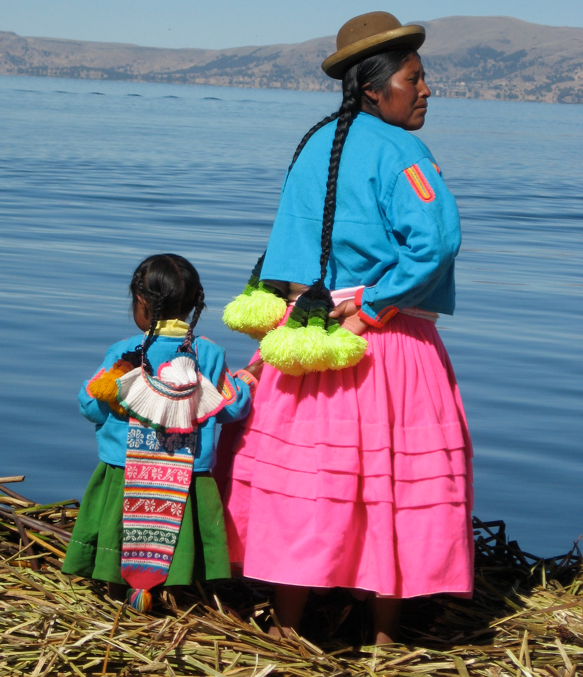
The Indigenous peoples of Peru or Indigenous Peruvians comprise a large number of ethnic groups who inhabit territory in present-day Peru. Indigenous cultures developed here for thousands of years before the arrival of the Spanish in 1532. In 2017, 5,972,606 Peruvians identified themselves as indigenous peoples and formed about 25.75% of the Demographics of Peru, total population of Peru. At the time of the Spanish arrival, the indigenous peoples of the rain forest of the Amazon basin to the east of the Andes were mostly nomad, semi-nomadic tribes; they subsisted on hunting, fishing, gathering and slash and burn agriculture. Those peoples living in the Andes and to the west were dominated by the Inca Empire, who had a complex, hierarchical civilization. It developed many cities, building major temples and monuments with techniques of highly skilled stonemasonry. Many of the estimated 2000 nations and tribes present in 1500 died out as a consequence of the Inca Empire#Expansio ... [...More Info...] [...Related Items...] OR: [Wikipedia] [Google] [Baidu] |


