|
Arkansas's 1st Congressional District
Arkansas's 1st congressional district is a U.S. congressional district in eastern Arkansas that elects a representative to the United States House of Representatives. It is currently represented by Republican Rick Crawford. With a Cook Partisan Voting Index rating of R+21, it is the most Republican district in Arkansas, a state with an all-Republican congressional delegation. Geography 2003–2013 Before the 2010 census, the 1st district represented portions of northeastern Arkansas, encompassing the counties of Arkansas, Baxter, Clay, Cleburne, Craighead, Crittenden, Cross, Fulton, Greene, Independence, Izard, Jackson, Lawrence, Lee, Lonoke, Mississippi, Monroe, Phillips, Poinsett, Prairie, Randolph, Saint Francis, Searcy, Sharp, Stone, and Woodruff. 2013–2023 The district was redesigned to take in additional counties in the southeastern portion that were part of the 4th district which in turn took the entire eastern Arkansas border. It is now more tha ... [...More Info...] [...Related Items...] OR: [Wikipedia] [Google] [Baidu] |
Rick Crawford (politician)
Eric Alan "Rick" Crawford (born January 22, 1966) is an American politician who has been the U.S. representative for since 2011. He is a member of the Republican Party. Before he was elected to Congress, Crawford was a radio announcer, businessman, and U.S. Army soldier. Early life and education Crawford was born at Homestead Air Force Base in Florida, the son of Ruth Anne and Donnie J. "Don" Crawford. He grew up in a military family; his father served in the United States Air Force. He graduated from Alvirne High School in Hudson, New Hampshire. Crawford enlisted in the United States Army and served as an explosive ordnance disposal technician assigned to the 56th Ordnance Detachment at Fort Indiantown Gap in Pennsylvania. He left the U.S. Army after four years' service at the rank of Sergeant. After his service, Crawford attended Arkansas State University in Jonesboro, Arkansas, graduating in 1996 with a B.S. in agriculture business and economics. Rodeo and music career ... [...More Info...] [...Related Items...] OR: [Wikipedia] [Google] [Baidu] |
Izard County, Arkansas
Izard County is a county located in the U.S. state of Arkansas. As of the 2010 census, the population was 13,696. The county seat is Melbourne. Izard County is Arkansas's 13th county, formed on October 27, 1825, and named for War of 1812 General and Arkansas Territorial Governor George Izard. It is an alcohol prohibition or dry county. Geography According to the U.S. Census Bureau, the county has a total area of , of which is land and (0.6%) is water. Major highways * Arkansas Highway 5 * Arkansas Highway 9 * Arkansas Highway 56 * Arkansas Highway 58 * Arkansas Highway 69 * Arkansas Highway 69 Business * Arkansas Highway 177 * Arkansas Highway 223 * Arkansas Highway 289 * Arkansas Highway 354 Adjacent counties * Fulton County (north) * Sharp County (east) * Independence County (southeast) * Stone County (southwest) * Baxter County (northwest) Demographics 2020 census As of the 2020 United States census, there were 13,577 people, 4,851 households, and 3,124 famil ... [...More Info...] [...Related Items...] OR: [Wikipedia] [Google] [Baidu] |
Sharp County, Arkansas
Sharp County is a county located in the U.S. state of Arkansas. As of the 2010 census, the population was 17,264. The county seat is Ash Flat. The county was formed on July 18, 1868, and named for Ephraim Sharp, a state legislator from the area. Sharp County was featured on the PBS program ''Independent Lens'' for its 1906 "banishment" of all of its Black residents. A local newspaper at the time was quoted as saying that "The community is better off without them." Geography According to the U.S. Census Bureau, the county has a total area of , of which is land and (0.3%) is water. Major highways * U.S. Highway 62 * U.S. Highway 63 * U.S. Highway 167 * U.S. Highway 412 * Highway 56 * Highway 58 * Highway 175 Adjacent counties * Oregon County, Missouri (north) * Randolph County (northeast) * Lawrence County (southeast) * Independence County (south) * Izard County (southwest) * Fulton County (northwest) Demographics 2020 census As of the 2020 United States c ... [...More Info...] [...Related Items...] OR: [Wikipedia] [Google] [Baidu] |
Searcy County, Arkansas
Searcy County ( ) is a county located in the U.S. state of Arkansas. As of the 2010 census, the population was 8,195. The county seat is Marshall. The county was formed December 13, 1838, from a portion of Marion County and named for Richard Searcy, the first clerk and judge in the Arkansas Territory. The city of Searcy, Arkansas, some 70 miles away, shares the name despite having never been part of Searcy County. The county is an alcohol prohibition or dry county. History During the American Civil War, Searcy County, Arkansas had strong, pro-Union leanings, forming an organization known as the " Arkansas Peace Society Chocolate Roll Capital of the World The Chocolate Roll is a dessert endemic to Searcy but little known outside the near region. A typical Chocolate Roll is made from Shortcrust pastry, pie dough spread with a mixture of cocoa powder, shortening, and sugar, then rolled up and baked. In 2012 The Greater Searcy County Chamber of Commerce declared Searcy County ... [...More Info...] [...Related Items...] OR: [Wikipedia] [Google] [Baidu] |
Saint Francis County, Arkansas
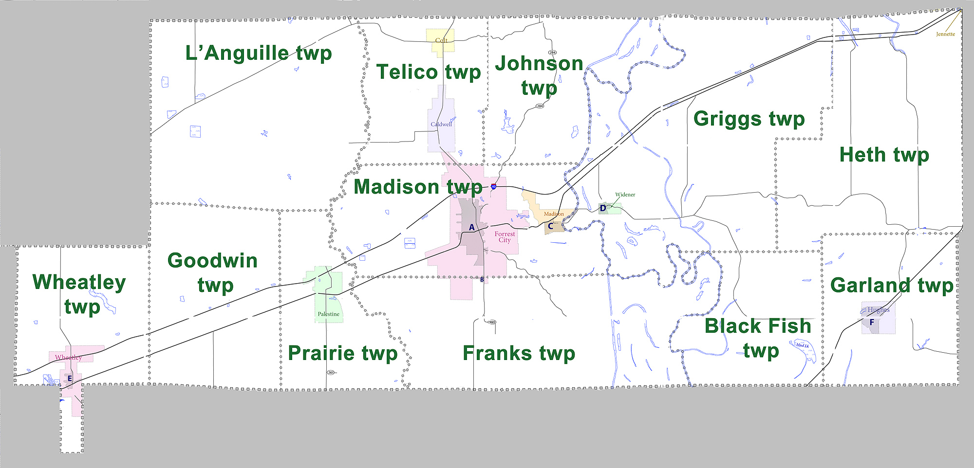
St. Francis County is a county in the U.S. state of Arkansas. As of the 2010 census, the population was 28,258. The county seat is Forrest City. St. Francis County comprises the Forrest City, Arkansas Micropolitan Statistical Area, which is also included in the Memphis-Forrest City, TN- MS-AR Combined Statistical Area. History The county was formed on October 13, 1827, and named for the St. Francis River. It is on the eastern border of the state in the Arkansas Delta, formed by the lowlands of the Mississippi River. It was an area of large cotton plantations in the antebellum era, when the workers were enslaved African Americans. It continued as an agricultural area into the late 19th century, when many freedmen became sharecroppers. Geography According to the U.S. Census Bureau, the county has a total area of , of which is land and (1.2%) is water. Major highways * Interstate 40 * U.S. Highway 70 * Highway 1 * Highway 38 * Highway 50 * Highway 75 Adjacent counties ... [...More Info...] [...Related Items...] OR: [Wikipedia] [Google] [Baidu] |
Randolph County, Arkansas
Randolph County is located between the Ozark Mountains and Arkansas Delta in the U.S. state of Arkansas. The county is named for John Randolph, a U.S. senator from Virginia influential in obtaining congressional approval of the Louisiana Purchase, which includes today's Randolph County. Created as Arkansas's 32nd county on October 29, 1835, Randolph County has two incorporated cities, including Pocahontas, the county seat and most populous city. The county is also the site of numerous unincorporated communities and ghost towns. Crossed by five rivers, most of Randolph County contains foothills and valleys typical of the Ozarks. However, the eastern side of the county is largely flat with fertile soils typical of the Delta, with the Black River roughly dividing the regions. The county contains three protected areas: two Wildlife Management Areas and Davidsonville Historic State Park, which preserves and interprets an early pioneer settlement. Other historical features such as ... [...More Info...] [...Related Items...] OR: [Wikipedia] [Google] [Baidu] |
Prairie County, Arkansas
Prairie County is in the Central Arkansas region of the U.S. state of Arkansas. The county is named for the Grand Prairie, a subregion of the Arkansas Delta known for rice cultivation and aquaculture that runs through the county. Created as Arkansas's 54th county in 1846, Prairie County is home to four incorporated towns, including DeValls Bluff, the southern district county seat, and two incorporated cities, including Des Arc, the northern district county seat. The county is also the site of numerous unincorporated communities and ghost towns. Occupying , Prairie County is the median-sized county in Arkansas. As of the 2010 Census, the county's population is 8,715 people in 4,503 households. Based on population, the county is the ninth-smallest county of the 75 in Arkansas. The county is crossed by Interstate 40 (I-40), a major east–west Interstate highway running from California to North Carolina, as well as four United States highways (U.S. Route 63 S 63 US 70, US ... [...More Info...] [...Related Items...] OR: [Wikipedia] [Google] [Baidu] |
Poinsett County, Arkansas
Poinsett County is a county located in the U.S. state of Arkansas. As of the 2010 census, the population was 24,583. The county seat is Harrisburg. Poinsett County is included in the Jonesboro–Paragould Combined Statistical Area. History Poinsett County was formed on February 28, 1838, and named for Joel Roberts Poinsett, U.S. Secretary of War. County business was initially conducted in the county judge's home until first court was held in Bolivar, upon completion of a courthouse in 1839. County government was moved in 1859 to Harrisburg, a more central locale designated as the new county seat. Poinsett County acquired its current boundaries in the years following this change, as portions were assigned to newly organized counties. The northern portion became Craighead County, and the south portion became Cross County. Sunken lands were added to eastern Poinsett County during this time, including Lepanto and Marked Tree. The Civil War devastated the county financ ... [...More Info...] [...Related Items...] OR: [Wikipedia] [Google] [Baidu] |
Phillips County, Arkansas
Phillips County is a county located in the eastern part of the U.S. state of Arkansas, in what is known as the Arkansas Delta along the Mississippi River. As of the 2020 census, the population was 16,568. The county seat is Helena–West Helena. Phillips County is Arkansas's seventh (7th) county, formed on May 1, 1820. It was named for Sylvanus Phillips, the area's first-known white or European-American settler; he was elected as representative to the first Territorial Legislature of the Arkansas Territory. This fertile lowland area was developed for cotton plantations in the antebellum area and is still largely rural and agricultural. The Helena-West Helena, AR Micropolitan Statistical Area includes all of Phillips County. From September 30-October 1, 1919 during the Elaine race riot in Phillips County, at least 237 African Americans were killed, attacked at large by armed whites trying to suppress the Progressive Farmers and Household Union of America which was org ... [...More Info...] [...Related Items...] OR: [Wikipedia] [Google] [Baidu] |
Monroe County, Arkansas
Monroe County is located in the Arkansas Delta in the U.S. state of Arkansas. The county is named for James Monroe, the fifth President of the United States. Created as Arkansas's 20th county on November 2, 1829, Monroe County is home to two incorporated towns and three incorporated cities, including Clarendon, the county seat, and Brinkley, the most populous city. The county is also the site of numerous unincorporated communities and ghost towns. Occupying only , Monroe County is the 22nd smallest county in Arkansas. As of the 2010 Census, the county's population is 8,149 people in 4,455 households. Based on population, the county is the fifth-smallest county of the 75 in Arkansas. Located in the Arkansas Delta, the county is largely flat with fertile soils. Historically covered in forest, bayous, swamps, and grasslands, the area was cleared for agriculture by early European-American settlers who used enslaved African Americans to do the work and to cultivate cotton. It is dra ... [...More Info...] [...Related Items...] OR: [Wikipedia] [Google] [Baidu] |
Mississippi County, Arkansas
Mississippi County is the easternmost county in the U.S. state of Arkansas. As of the 2020 census, the population was 40,685. There are two county seats, Blytheville and Osceola. The county was formed on November 1, 1833, and named for the Mississippi River which borders the county to the east. Mississippi County is part of the First Congressional District in Arkansas. The Blytheville, AR Micropolitan Statistical Area includes all of Mississippi County. Geography According to the U.S. Census Bureau, the county has a total area of , of which is land and (2.1%) is water. Major highways * Interstate 55 * U.S. Highway 61 * Highway 14 * Highway 18 * Highway 18 Business * Highway 77 * Highway 118 * Highway 119 * Highway 135 * Highway 136 * Highway 137 * Highway 137 Spur * Highway 140 * Highway 150 * Highway 151 * Highway 158 * Highway 181 * Highway 239 * Highway 239 Spur * Highway 947 Adjacent counties * Dunklin County, Missouri (northwest) *Pemiscot C ... [...More Info...] [...Related Items...] OR: [Wikipedia] [Google] [Baidu] |
Lonoke County, Arkansas
Lonoke County is located in the Central Arkansas region of the U.S. state of Arkansas. As of the 2010 census, the population was 68,356, making it the 11th-most populous of Arkansas's 75 counties. The county seat is Lonoke and largest city is Cabot. Lonoke County was formed on April 16, 1873, from Pulaski County and Prairie County, and was named as a corruption of "lone oak", after a large red oak in the area that had been used by a surveyor to lay out the Memphis and Little Rock Railroad. Located within Central Arkansas, the county's varied geography can be roughly broken into thirds horizontally. The top third has rolling hills at the edge of the Ozarks, including the Cabot area. The middle third, including the Lonoke area, contains portions of the Grand Prairie, a flat native grassland today known for rice farming, an important part of the culture, economy and history of Lonoke County. The southern third, including the Scott area, is home to the alluvial soils of the Arkan ... [...More Info...] [...Related Items...] OR: [Wikipedia] [Google] [Baidu] |


