|
Neu-Ulm
Neu-Ulm (, ; Swabian: ''Nej-Ulm'') is the seat of the Neu-Ulm district and a town in Swabia, Bavaria. Neighbouring towns include Ulm, Senden, Pfaffenhofen an der Roth, Holzheim, Nersingen and Elchingen. The population is 58,978 (31 December 2019). History The modern history of Neu-Ulm began with the change of the sovereignty over the city of Ulm in 1810 from the Kingdom of Bavaria to the Kingdom of Württemberg. The Danube became the boundary between Bavaria and Württemberg. Land on the right bank of the Danube thus remained under Bavarian sovereignty. This was the beginning of Neu-Ulm's status as an independent town. At this time Neu-Ulm was very small with little more than a few houses, taverns, pieces of land, and the village of Offenhausen. It was still known as (Ulm on the right-hand side of the Danube). The name "Neu-Ulm" was first mentioned in records in 1814. The town's real growth began a few decades later in 1841, when the announced the building of the Fe ... [...More Info...] [...Related Items...] OR: [Wikipedia] [Google] [Baidu] |
Neu-Ulm (electoral District)
Neu-Ulm is an electoral constituency (German: ''Wahlkreis'') represented in the Bundestag. It elects one member via first-past-the-post voting. Under the current constituency numbering system, it is designated as constituency 254. It is located in southwestern Bavaria, comprising the Günzburg and Neu-Ulm districts. Neu-Ulm was created for the inaugural 1949 federal election. Since 2021, it has been represented by Alexander Engelhard of the Christian Social Union (CSU). Geography Neu-Ulm is located in southwestern Bavaria. As of the 2025 federal election, it comprises the districts of Günzburg and Neu-Ulm. History Neu-Ulm was created in 1949, then known as ''Dillingen''. It acquired its current name in the 1965 election. In the 1949 election, it was Bavaria constituency 43 in the numbering system. In the 1953 through 1961 elections, it was number 238. In the 1965 through 1998 elections, it was number 241. In the 2002 and 2005 elections, it was number 256. In the 2009 through ... [...More Info...] [...Related Items...] OR: [Wikipedia] [Google] [Baidu] |
Neu-Ulm (district)
Neu-Ulm is a Districts of Germany, ''Landkreis'' (district) in Swabia (Bavaria), Swabia, Bavaria, Germany. It is bounded by (from the east and clockwise) the districts of Günzburg (district), Günzburg and Unterallgäu and the state of Baden-Württemberg (districts Biberach (district), Biberach and Alb-Donau (district), Alb-Donau, city of Ulm). The district was established in 1972 by merging the former districts of Neu-Ulm and Illertissen with the previously district-free city of Neu-Ulm. The district includes the eastern metropolitan area of the city of Ulm. The Danube and its tributary, the Iller, form the western border of the district. Coat of arms The coat of arms displays: * the moor from the arms of Kirchberg * the horn from the arms of Neuffen Towns and municipalities References External links * (German) Neu-Ulm (district), Districts of Bavaria Mittelschwaben Swabia (Bavaria) {{NeuUlm-geo-stub ... [...More Info...] [...Related Items...] OR: [Wikipedia] [Google] [Baidu] |
Pfaffenhofen An Der Roth
Pfaffenhofen an der Roth (, ) is a municipality and a village in the district of Neu-Ulm in Bavaria in Germany. Its most famous inhabitant was Hermann Köhl, an aviation pioneer of the 1920s. Geography The municipality is centered around the village of Pfaffenhofen an der Roth, located on the right bank of the river Roth, approximately 14 km southeast of the cities of Ulm and Neu-Ulm. Several smaller villages and localities are spread across the municipality, including Balmertshofen, Berg, Beuren, Biberberg, Diepertshofen, Erbishofen, Hirbishofen, Kadeltshofen, Luippen, Niederhausen, Raunertshofen, Remmeltshofen, Roth, Volkertshofen. The municipality is bordered by the municipalities of Neu-Ulm and Holzheim to the west, Nersingen to the north, Bibertal to the east, and Weißenhorn to the south. The landscape is predominantly rural, dominated by farmland and forests, corresponding to 76% and 19% of the land use respectively. Besides the Roth, the Leibi river also traverses t ... [...More Info...] [...Related Items...] OR: [Wikipedia] [Google] [Baidu] |
Ulm–Augsburg Railway
The Ulm–Augsburg line is a German railway line. It was constructed as part of the Bavarian Maximilian's Railway. It was built for the Royal Bavarian State Railways as part of the east-west connection between Neu-Ulm in the west via Augsburg, Munich and Rosenheim to the Austrian border at Kufstein and Salzburg in the east. History The line was constructed as part of the ''Bavarian Maximilian Railway'' ( German:''Bayerische Maximiliansbahn''), named after Maximilian II, king of Bavaria from 1848 to 1864. In 1851, it was decided to build a line connecting the German states and Italy via the Brenner Pass and via Salzburg towards Vienna and the Semmering Pass. It promised good traffic flows to and from the Austrian Adriatic port at Trieste. Appropriate conventions were agreed with the Kingdom of Württemberg and with the Austrian government in 1851. The Munich–Augsburg line, which had been opened by the Munich–Augsburg Railway Company (''München-Augsburger Eisenba ... [...More Info...] [...Related Items...] OR: [Wikipedia] [Google] [Baidu] |
Senden
The town of Senden is the second-largest town of the district of Neu-Ulm in Bavaria and is located at the border to Baden-Württemberg. The town belongs to the Donau-Iller-Nahverkehrsverbund. Senden's neighbours are Neu-Ulm in the north, Weißenhorn in the east, Vöhringen in the south and Illerkirchberg in the west. Town parts The town parts are Aufheim, Ay, Freudenegg, Hittistetten, Witzighausen and Wullenstetten Politics The Senden town council consists since the election of 2014 of: * CSU: 11 seats * SPD: 5 seats * FWG: 6 seats * Greens: 4 seats * BISS: 4 seats Economics and infrastructure Traffic Senden lies at the Bundesstraße 28 and at the train line Ulm-Oberstdorf ( Illertalbahn). Companies * Möbel Inhofer Education Schools Elementary- and Main schools * Elementary school Senden (Bürgermeister-Engelhart-Schule) * Elementary school Aufheim * Elementary school Ay * Elementary school Wullenstetten * Main school Senden (Rektor-Werner-Ziegler-Schule) Vocational- ... [...More Info...] [...Related Items...] OR: [Wikipedia] [Google] [Baidu] |
Nersingen
Nersingen is a municipality in the District of Neu-Ulm in Bavaria, Germany. The neighbours are Neu-Ulm, Elchingen, Bibertal and Pfaffenhofen an der Roth. Geography Geographic location Through the area of Nersingen flow three rivers: The Danube in the north and her both supply rivers, Roth and Leibi, which cross Nersingen from south to north. Also, there are some water ditches and some excavator lakes, which resulted from gravel quarrying. The most part of Nersingen is on the gravellic ground. Municipality arrangement The municipality of Nersingen consists of the principal village of Nersingen and the part villages Straß, Leibi, Unterfahlheim, and Oberfahlheim. Economics and infrastructure Companies Hilti AG in Straß Traffic Nersingen lies next to the Bundesautobahn 7 and the train line Ulm - Munich Munich is the capital and most populous city of Bavaria, Germany. As of 30 November 2024, its population was 1,604,384, making it the third-largest city in G ... [...More Info...] [...Related Items...] OR: [Wikipedia] [Google] [Baidu] |
Elchingen
Elchingen is a municipality about 7 km east of Ulm–Neu-Ulm in the district of Neu-Ulm in Bavaria, Germany. Municipality parts: * Thalfingen: 4 211 residents, 8.83 km² * Oberelchingen: 3 024 residents, 7.31 km² * Unterelchingen: 2 863 residents, 8.76 km² History In 1294, Elchingen (today: Unterelchingen) was sold by Konrad of Plochingen to the Cistercian monastery of Salem. Unterelchingen stayed in its property until the secularization in 1802. Unterelchingen never was in possession of the Monastery of Elchingen. In 1803, Ober-, Unter-elchingen and Thalfingen became Bavarian, due to the Principal Decree of the Imperial Deputation. The Benedictine monastery of Elchingen was founded at the beginning of the 12th century. In 1395 all authentic documents were destroyed in a fire. So the probable consecration date (15 August 1128) cannot be proven. Around 1500, the German Conquistador Ambrosius Ehinger was born there. He later went on to be ... [...More Info...] [...Related Items...] OR: [Wikipedia] [Google] [Baidu] |
Holzheim Bei Neu-Ulm
Holzheim is a municipality in the district of Neu-Ulm in Bavaria in Germany Germany, officially the Federal Republic of Germany, is a country in Central Europe. It lies between the Baltic Sea and the North Sea to the north and the Alps to the south. Its sixteen States of Germany, constituent states have a total popu .... References Neu-Ulm (district) {{NeuUlmdistrict-geo-stub ... [...More Info...] [...Related Items...] OR: [Wikipedia] [Google] [Baidu] |
Swabia (Bavaria)
Swabia (, Swabian German, Swabian: ''Schwaabe'', ) is one of the seven Regierungsbezirk, administrative regions of Bavaria, Germany. It consists of ten districts and 340 municipalities (including four cities) with Augsburg being the administrative capital. Governance The county of Swabia is located in southwest Bavaria. It was annexed by Bavaria in 1803, is part of the historic region of Swabia and was formerly ruled by dukes of the House of Hohenstaufen, Hohenstaufen dynasty. During the Nazi Germany, Nazi period, the area was separated from the rest of Bavaria to become the Gau Swabia. It was re-incorporated into Bavaria after the war. The Regierungsbezirk is subdivided into 3 regions (''Planungsregionen''): Allgäu, Augsburg, and Donau-Iller. Donau-Iller also includes two districts and one city of Baden-Württemberg. * Part of the Swabian Keuper Land Districts and district-free towns before the regional reorganization in 1972 Population Historical population of Swabia: * ... [...More Info...] [...Related Items...] OR: [Wikipedia] [Google] [Baidu] |
Bavaria
Bavaria, officially the Free State of Bavaria, is a States of Germany, state in the southeast of Germany. With an area of , it is the list of German states by area, largest German state by land area, comprising approximately 1/5 of the total land area of Germany, and with over 13.08 million inhabitants, it is the list of German states by population, second most populous German state, behind only North Rhine-Westphalia; however, due to its large land area, its population density is list of German states by population density, below the German average. Major cities include Munich (its capital and List of cities in Bavaria by population, largest city, which is also the list of cities in Germany by population, third largest city in Germany), Nuremberg, and Augsburg. The history of Bavaria includes its earliest settlement by Iron Age Celts, Celtic tribes, followed by the conquests of the Roman Empire in the 1st century BC, when the territory was incorporated into the provinces of Ra ... [...More Info...] [...Related Items...] OR: [Wikipedia] [Google] [Baidu] |
Fortresses Of The German Confederation
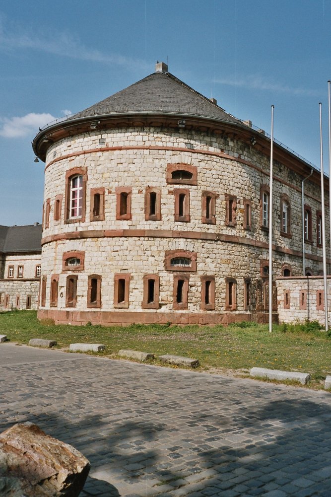
Under the terms of the 1815 Peace of Paris, France was obliged to pay for the construction of a line of fortresses to protect the German Confederation against any future aggression by France. All fortresses were located outside Austria and Prussia — the two biggest, bickering powers of the Confederation. Section C. "Defensive System of the Germanic Confederation" of the protocol drawn up at Paris on 3 November 1815, declared Mainz, Luxemburg, and Landau to be fortresses belonging to the Confederation of Germany, and stipulated that a fourth should be constructed on the Upper Rhine. In conformity with this act, a portion of the funds, which France was compelled to pay by way of indemnity for the cost of placing her on a peaceable footing, was thus appropriated: £200,000 were set aside for completing the works at Mainz; £800,000 were assigned to Prussia, to be applied upon its fortresses on the Lower Rhine; another £800,000 were reserved for constructing the new federal fort ... [...More Info...] [...Related Items...] OR: [Wikipedia] [Google] [Baidu] |
Pershing II
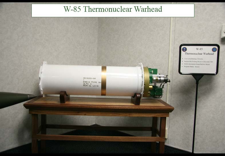
The Pershing II Weapon System was a solid-fueled two-stage medium-range ballistic missile designed and built by Martin Marietta to replace the Pershing 1a Field Artillery Missile System as the United States Army's primary nuclear-capable theater-level weapon. The U.S. Army replaced the Pershing 1a with the Pershing II Weapon System in 1983, while the German Air Force retained Pershing 1a until all Pershings were eliminated in 1991. The U.S. Army Missile Command (MICOM) managed the development and improvements, while the Field Artillery Branch deployed the systems and developed tactical doctrine. Development Development began in 1973 for an updated Pershing. The Pershing 1a had a 400 kt warhead, which was greatly over-powered for the Quick Reaction Alert (QRA) tactical role the weapon system filled. Reducing warhead yield, however, required a significant increase in accuracy to match Pershing 1a's ability to kill hard targets like command bunkers. The contract went to Ma ... [...More Info...] [...Related Items...] OR: [Wikipedia] [Google] [Baidu] |


