|
Arad County (former)
Arad County was an administrative unit in the Kingdom of Hungary, the Eastern Hungarian Kingdom and the Principality of Transylvania (1570–1711), Principality of Transylvania. The County (Kingdom of Hungary), county was established along the Mureș (river), Maros (Mureș) River in the 11th or the , but its first head, or ''ispán'', was only mentioned in 1214. Its territory is now part of Romania, except a small area (the town of Elek and the surrounding villages) which is part of Hungary. The capital of the county was Arad, Romania, Arad. Geography The medieval Arad County was situated in the lands along both banks of the Mureș (river), Maros (Mureș) River. The existence of arable lands, pastures, vineyards and orchards in the western lowlands in the Middle Ages is well-documented. The hilly eastern regions were sparsely populated. The total territory of the medieval county was around . In 1744, Arad County absorbed a large part of Zaránd County, including its capital ... [...More Info...] [...Related Items...] OR: [Wikipedia] [Google] [Baidu] |
Comitatus (Kingdom Of Hungary)
Comitatus may refer to: *Comitatus (warband), a Germanic warband who follow a leader * ''Comitatus'', the office of a Roman or Frankish comes, translated as count. * ''Comitatus'', translated as county, a territory such as governed by medieval counts. * Comitatus (Kingdom of Hungary), counties in the Kingdom of Hungary * Comitatenses, armies of the late Roman Empire * Posse comitatus (other), various meanings See also * * Retinue, a body of persons "retained" in the service of a noble or royal person {{disambiguation ... [...More Info...] [...Related Items...] OR: [Wikipedia] [Google] [Baidu] |
Csanád County
Csanád was an administrative county (Comitatus (Kingdom of Hungary), comitatus) of the Kingdom of Hungary. Its territory is now part of Hungary, except for a small area which is part of Romania. The capital of the county was Makó. Geography Csanád county shared borders with the Hungarian counties of Csongrád (former county), Csongrád, Békés (former county), Békés, Arad (Hungarian county), Arad and Torontál. The river Maros (Mureș (river), Mureș) formed its southern border. Its area was 1,714 km2 around 1910. History The county's territory became part of the Kingdom of Hungary in the first half of the 11th century when Stephen I of Hungary defeated Ajtony, the local ruler. The county got its name after the commander of the royal army, Csanád. The king appointed Gerard, Gerard of Csanád as the first bishop of Csanád. The county was initially much larger and included territories of the later Temes, Arad, and Torontál counties. The first seat of the county was ... [...More Info...] [...Related Items...] OR: [Wikipedia] [Google] [Baidu] |
Slavic Languages
The Slavic languages, also known as the Slavonic languages, are Indo-European languages spoken primarily by the Slavs, Slavic peoples and their descendants. They are thought to descend from a proto-language called Proto-Slavic language, Proto-Slavic, spoken during the Early Middle Ages, which in turn is thought to have descended from the earlier Proto-Balto-Slavic language, linking the Slavic languages to the Baltic languages in a Balto-Slavic languages, Balto-Slavic group within the Indo-European family. The current geographical distribution of natively spoken Slavic languages includes the Balkans, Central and Eastern Europe, and all the way from Western Siberia to the Russian Far East. Furthermore, the diasporas of many Slavic peoples have established isolated minorities of speakers of their languages all over the world. The number of speakers of all Slavic languages together was estimated to be 315 million at the turn of the twenty-first century. It is the largest and most d ... [...More Info...] [...Related Items...] OR: [Wikipedia] [Google] [Baidu] |
Hungarian Conquest Of The Carpathian Basin
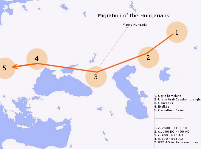
The Hungarian conquest of the Carpathian Basin, also known as the Hungarian conquest or the Hungarian land-taking (), was a series of historical events ending with the settlement of the Hungarians in Central Europe in the late 9th and early 10th century. Before the arrival of the Hungarians, three early medieval powers, the First Bulgarian Empire, East Francia, and Great Moravia, Moravia, had fought each other for control of the Pannonian Basin, Carpathian Basin. They occasionally hired Hungarian horsemen as soldiers. Therefore, the Hungarians who dwelt on the Pontic–Caspian steppe, Pontic-Caspian Steppe east of the Carpathian Mountains were familiar with what would become their homeland when their conquest started. The Hungarian conquest started in the context of a "late or 'small' Migration Period, migration of peoples". The Hungarians took possession of the Pannonian Basin, Carpathian Basin in a pre-planned manner, with a long move-in between 862–895. Other theories asser ... [...More Info...] [...Related Items...] OR: [Wikipedia] [Google] [Baidu] |
Constantine Porphyrogenitus
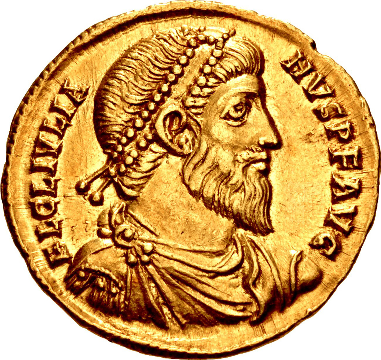
Constantine VII Porphyrogenitus (; 17 May 905 – 9 November 959) was the fourth Byzantine emperor of the Macedonian dynasty, reigning from 6 June 913 to 9 November 959. He was the son of Emperor Leo VI and his fourth wife, Zoe Karbonopsina, and the nephew of his predecessor Alexander. Most of his reign was dominated by co-regents: from 913 until 919 he was under the regency of his mother, while from 920 until 945 he shared the throne with Romanos Lekapenos, whose daughter Helena he married, and his sons. Constantine VII is best known for the '' Geoponika'' (τά γεοπονικά), an important agronomic treatise compiled during his reign, and three, perhaps four, books; (bearing in Greek the heading Πρὸς τὸν ἴδιον υἱὸν Ῥωμανόν), (Περὶ τῆς Βασιλείου Τάξεως), '' De Thematibus'' (Περὶ θεμάτων Άνατολῆς καὶ Δύσεως), and '' Vita Basilii'' (Βίος Βασιλείου), though his authorship of ... [...More Info...] [...Related Items...] OR: [Wikipedia] [Google] [Baidu] |
Byzantine Emperor
The foundation of Constantinople in 330 AD marks the conventional start of the Eastern Roman Empire, which Fall of Constantinople, fell to the Ottoman Empire in 1453 AD. Only the emperors who were recognized as legitimate rulers and exercised sovereign authority are included, to the exclusion of junior co-emperors who never attained the status of sole or senior ruler, as well as of the List of Byzantine usurpers, various usurpers or rebels who claimed the imperial title. The following list starts with Constantine the Great, the first Christian emperor, who rebuilt the city of Byzantium as an imperial capital, Constantinople, and who was regarded by the later emperors as the model ruler. Modern historians distinguish this later phase of the Roman Empire as Byzantine due to the imperial seat moving from Rome to Byzantium, the Empire's integration of Christianity, and the predominance of Greek instead of Latin. The Byzantine Empire was the direct legal continuation of the eastern ... [...More Info...] [...Related Items...] OR: [Wikipedia] [Google] [Baidu] |
Hungarians
Hungarians, also known as Magyars, are an Ethnicity, ethnic group native to Hungary (), who share a common Culture of Hungary, culture, Hungarian language, language and History of Hungary, history. They also have a notable presence in former parts of the Kingdom of Hungary. The Hungarian language belongs to the Ugric languages, Ugric branch of the Uralic languages, Uralic language family, alongside the Khanty languages, Khanty and Mansi languages, Mansi languages. There are an estimated 14.5 million ethnic Hungarians and their descendants worldwide, of whom 9.6 million live in today's Hungary. About 2 million Hungarians live in areas that were part of the Kingdom of Hungary before the Treaty of Trianon in 1920 and are now parts of Hungary's seven neighbouring countries, Hungarians in Slovakia, Slovakia, Hungarians in Ukraine, Ukraine, Hungarians in Romania, Romania, Hungarians in Serbia, Serbia, Hungarians of Croatia, Croatia, Prekmurje, Slovenia, and Hungarians in Austria, Aust ... [...More Info...] [...Related Items...] OR: [Wikipedia] [Google] [Baidu] |
Crișul Alb
The Crișul Alb (Romanian language, Romanian), (Hungarian language, Hungarian: Fehér-Körös) is a river in western Romania, in the historical region of Transylvania, and in south-eastern Hungary (Békés County). Its source is in the southern Apuseni Mountains (Romanian: Munții Apuseni) of Romania. It flows through the towns of Brad, Hunedoara, Brad, Ineu, Chișineu-Criș in Romania, and Gyula, Hungary, Gyula in Hungary. Crossing the border of Hungary, the river, now called Fehér-Körös, joins the Fekete-Körös (''Crișul Negru'') a few kilometres north from Gyula to form the river Körös (''Criș''), p. 7 which ultimately flows into the Danube. ... [...More Info...] [...Related Items...] OR: [Wikipedia] [Google] [Baidu] |
Temes County
County of Temes ( Hungarian: ''Temes'', Romanian: ''Timiș'', Serbian: ''Тамиш'' or ''Tamiš'', German: ''Temes'' or ''Temesch'') was an administrative county ( comitatus) of the Kingdom of Hungary. Its territory is now in southwestern Romania and northeastern Serbia. The capital of the county was Temesvár ( Romanian: Timișoara, Serbian: Темишвар or Temišvar, German: Temeswar or Temeschwar), which also served as the kingdom's capital between 1315–1323. Geography Temes county was located in the Banat region. It shared borders with the Kingdom of Serbia and the Hungarian counties of Torontál, Arad and Krassó-Szörény. The river Danube formed its southern border, and the river Mureș its northern border. The rivers Bega, Timiș, Bârzava and Caraș flowed through the county. Its area in 1910 was . History Temes County was formed in the 12th century, after the establishment of Hungarian rule in the region. It was named after the local Temes (Tim ... [...More Info...] [...Related Items...] OR: [Wikipedia] [Google] [Baidu] |
Hunyad
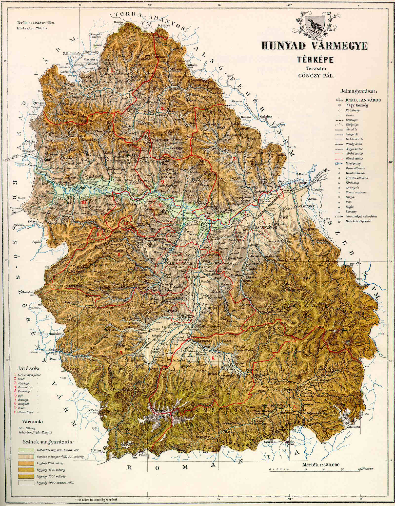
Hunyad (today mainly Hunedoara (county), Hunedoara) was an administrative county (Comitatus (Kingdom of Hungary), comitatus) of the Kingdom of Hungary, of the Eastern Hungarian Kingdom and of the Principality of Transylvania (other), Principality of Transylvania. Its territory is now in Romania in Transylvania. The capital of the county was Déva (present-day Deva, Romania, Deva). Geography After 1876, Hunyad county shared borders with Romania and the Hungarian counties Krassó-Szörény, Arad (Hungarian county), Arad, Torda-Aranyos, Alsó-Fehér and Szeben. Its area was 7,809 km2 around 1910. Etymology The toponym Hunyad most likely comes from the Hungarian language, Hungarian verb, meaning 'to close' or 'to die'. According to linguist Géza Kuun, the name may keep the memory of the Huns. History The first known civilization living on the territory were the Scythian culture, Scythian Agathyrsi and Sigynnae. Later the Dacians under their leader Burebista esta ... [...More Info...] [...Related Items...] OR: [Wikipedia] [Google] [Baidu] |


