|
A350 Road
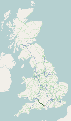
The A350 is a north–south primary route in southern England, that runs from the M4 motorway in Wiltshire to Poole in Dorset. Route Starting at junction 17 of the M4 motorway north of Chippenham, the first three miles are a dual carriageway to the northern outskirts of Chippenham, where a partly light-controlled roundabout splits traffic between the bypass section and the road into the town centre. The Chippenham bypass is punctuated by six more roundabouts, the last being at the Lackham College. In so doing it crosses the A420 to Bristol and the A4 for Bath to the West and Calne to the East. It then goes past the small village of Lacock before reaching Melksham four miles later. The road then follows the Semington bypass, opened in 2004, to Westbury, crossing the A361 between Trowbridge and Devizes. This section of the road has two light-controlled junctions to connect the road to outlying areas of Trowbridge before reaching the Yarnbrook roundabout. This section is appro ... [...More Info...] [...Related Items...] OR: [Wikipedia] [Google] [Baidu] |
Hindon, Wiltshire
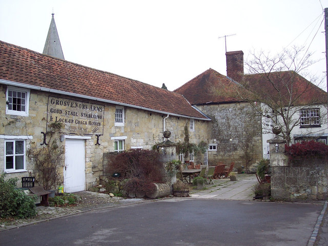
Hindon is a village and civil parish in Wiltshire, England, about west of Salisbury and south of Warminster. It is in the Cranborne Chase and West Wiltshire Downs Area of Outstanding Natural Beauty. Hindon was a market town but is now a village. History Hindon is a planned settlement, unlike most English villages which have evolved piecemeal over the millennia. If previous settlement in the area was present, no evidence within the village itself has yet been discovered. There are prehistoric field systems and Bronze Age round barrows on the downs nearby. According to the Estates' Account Rolls of the Bishop of Winchester, Bishop Peter des Roches of Winchester planned the borough as a centre for markets and fairs in 1218; at that time the land was part of East Knoyle parish. The main period of building was between 1218 and 1220 and even today, the medieval settlement pattern can be seen: the main tenements flanked either side of the High Street, with narrow burgage plot ... [...More Info...] [...Related Items...] OR: [Wikipedia] [Google] [Baidu] |
Bristol
Bristol () is a City status in the United Kingdom, cathedral city, unitary authority area and ceremonial county in South West England, the most populous city in the region. Built around the River Avon, Bristol, River Avon, it is bordered by the ceremonial counties of Gloucestershire to the north and Somerset to the south. The county is in the West of England combined authority area, which includes the Greater Bristol area (List of urban areas in the United Kingdom, eleventh most populous urban area in the United Kingdom) and nearby places such as Bath, Somerset, Bath. Bristol is the second largest city in Southern England, after the capital London. Iron Age hillforts and Roman villas were built near the confluence of the rivers River Frome, Bristol, Frome and Avon. Bristol received a royal charter in 1155 and was historic counties of England, historically divided between Gloucestershire and Somerset until 1373 when it became a county corporate. From the 13th to the 18th centur ... [...More Info...] [...Related Items...] OR: [Wikipedia] [Google] [Baidu] |
Compton Abbas
Compton Abbas is a village and civil parish in north Dorset, England England is a Countries of the United Kingdom, country that is part of the United Kingdom. It is located on the island of Great Britain, of which it covers about 62%, and List of islands of England, more than 100 smaller adjacent islands. It .... It lies south of the town of Shaftesbury. It is sited on greensand (geology), greensand strata on the edge of the Blackmore Vale, below the chalk downland, downs of Cranborne Chase. On top of these hills is Compton Abbas Airfield. The A350 road between Wiltshire and Poole, the south coast passes through the village. In the United Kingdom Census 2011, 2011 census the civil parish had a population of 216. The name ''Compton Abbas'' derives from the Anglo-Saxons, Saxon "cumb-ton", meaning 'village in a narrow valley', plus "abbas" which refers to Shaftesbury Abbey (the land was owned by the abbess). The church, St. Mary's, was built in 1866 to replace the older st ... [...More Info...] [...Related Items...] OR: [Wikipedia] [Google] [Baidu] |
Cann, Dorset
Cann is a village and civil parish in the county of Dorset in southern England. It is situated on the A350 road in the Dorset administrative district, south of Shaftesbury. The civil parish covers and has an underlying geology of Kimmeridge clay, greensand and gault clay The Gault Formation is a geological formation of stiff blue clay deposited in a calm, fairly deep-water marine environment during the Lower Cretaceous Period (Upper and Middle Albian). It is well exposed in the coastal cliffs at Copt Point in Fo .... In the 2011 census the parish—which includes HM Prison Guys Marsh—had a population of 822. References External links Villages in Dorset Civil parishes in Dorset {{Dorset-geo-stub ... [...More Info...] [...Related Items...] OR: [Wikipedia] [Google] [Baidu] |
Longbridge Deverill
Longbridge Deverill is a village and Civil parishes in England, civil parish about south of Warminster in Wiltshire, England. It is on the A350 road, A350 primary route which connects the M4 motorway and west Wiltshire with Poole, Dorset. The parish is in the Deverill valley which carries the upper waters of the River Wylye. It includes the small village of Crockerton and the hamlets of Crockerton Green, Fox Holes and Hill Deverill; these settlements are collectively known as the Lower Deverills (the Upper Deverills being the upstream villages of Brixton Deverill, Monkton Deverill and Kingston Deverill). An unnamed tributary of the Wylye rises in the northwest of the parish, forms the man-made Shearwater (lake), Shearwater lake, and flows east through the valley below Crockerton to join the Wylye. History Evidence of Neolithic British Isles, Neolithic activity includes a henge near Long Ivor Farm in the northeast of the parish. A Bronze Age Britain, Bronze Age bell barrow st ... [...More Info...] [...Related Items...] OR: [Wikipedia] [Google] [Baidu] |
Salisbury
Salisbury ( , ) is a city status in the United Kingdom, cathedral city and civil parish in Wiltshire, England with a population of 41,820, at the confluence of the rivers River Avon, Hampshire, Avon, River Nadder, Nadder and River Bourne, Wiltshire, Bourne. The city is approximately from Southampton and from Bath, Somerset, Bath. Salisbury is in the southeast of Wiltshire, near the edge of Salisbury Plain. An ancient cathedral was north of the present city at Old Sarum Cathedral, Old Sarum. A Salisbury Cathedral, new cathedral was built near the meeting of the rivers and a settlement grew up around it, which received a city charter in 1227 as . This continued to be its official name until 2009 structural changes to local government in England, 2009, when Salisbury City Council was established. Salisbury railway station is an interchange between the West of England line, West of England Line and the Wessex Main Line. Stonehenge, a UNESCO World Heritage Site, is northwest o ... [...More Info...] [...Related Items...] OR: [Wikipedia] [Google] [Baidu] |
A36 Road
The A36 is a trunk road and primary route in southwest England that links the port city of Southampton to the city of Bath. At Bath, the A36 connects with the A4 to Bristol, thus providing a road link between the major ports of Southampton and Bristol. It also provides a link between Bristol and London via the A303. Route Originally, the A36 continued to Avonmouth, beyond Bristol, but this section was renumbered to the A4. Within Bath the A36 acts as a ring road on the southern side of the river, from the junction with the A4 at Newbridge to the west of the city. From here traffic can continue to Bristol on the A4 or to Wells and Weston-super-Mare via the A39 and A368 roads. Another link to the A4 on the eastern side at Cleveland Bridge, which provides a route to the M4 motorway via the A46, is highly congested. Plans for a direct link road connecting the A36 with the A46 have been under consideration for a number of years. The A36 leaves Bath in an easterly direc ... [...More Info...] [...Related Items...] OR: [Wikipedia] [Google] [Baidu] |
Yarnbrook
Yarnbrook is a large hamlet in Wiltshire, England, between the towns of Westbury and Trowbridge. Most of the settlement lies in the civil parish of North Bradley, the rest in West Ashton. Most of Yarnbrook's houses line the A350 road, running between the M4 motorway near Chippenham and the south coast of England at Poole, Dorset. History Yarnbrook has never been a parish in its own right, but the name dates from at least the 16th century. In 1581 the Will of Agnes Guley, widow of Yarnbrook in North Bradley, was proved at Salisbury. In the Middle Ages Yarnbrook was within Selwood Forest, and the ancient woodland called Picket Wood which stands to the east of the present-day settlement is one of the few surviving areas of Selwood.Elizabeth Crittall, ed., 'North Bradley' in '' The Victoria History of Wiltshire, vol. VIII, Warminster, Westbury and Whorwellsdown Hundreds'' (University of London: Institute of Historical Research, 1965)pp. 218-234/ref> The first edition of the Andr ... [...More Info...] [...Related Items...] OR: [Wikipedia] [Google] [Baidu] |
Devizes
Devizes () is a market town and civil parish in Wiltshire, England. It developed around Devizes Castle, an 11th-century Norman architecture, Norman castle, and received a charter in 1141. The castle was besieged during the Anarchy, a 12th-century civil war between Stephen of England and Empress Matilda, and again during the English Civil War when the Cavaliers lifted the siege at the Battle of Roundway Down and the Roundhead, Parliamentarian Army of the West under Sir William Waller was routed. Devizes remained under Royalist control until 1645, when Oliver Cromwell attacked and forced the Royalists to surrender. The castle was Slighting, destroyed in 1648 on the orders of Parliament, and today little remains of it. From the 16th century Devizes became known for its textiles, and by the early 18th century it held the largest corn market in the West Country, constructing the Corn Exchange, Devizes, Corn Exchange in 1857. In the 18th century, brewing, curing of tobacco, and Snuf ... [...More Info...] [...Related Items...] OR: [Wikipedia] [Google] [Baidu] |
A361 Road
The A361 is an A class road in southern England, which at is the longest three-digit A road in the UK. History When first designated in 1922, the A361 ran from Taunton (Somerset) to Banbury (Oxfordshire). It was later extended west through Bampton to South Molton (Devon), on the route of the former A398, and from South Molton to Barnstaple and Ilfracombe, previously part of the route of the A373. In 1988, when the North Devon Link Road was opened, the A361 was switched to its present route. The old route from Taunton through Bampton to South Molton was downgraded to become the B3227. In the 1970s the route was extended north from Banbury to Daventry (Northamptonshire), providing a link to the M1 motorway near Crick. Route Devon The road starts in Ilfracombe as part of the town's High Street, and is mostly single carriageway. The road passes through the villages of Knowle and Braunton, before becoming dual carriageway standard at Ashford, which continues for the short ... [...More Info...] [...Related Items...] OR: [Wikipedia] [Google] [Baidu] |
Semington
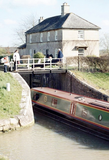
Semington is a village and Civil parishes in England, civil parish in Wiltshire, England. The village is about south of Melksham and about northeast of Trowbridge. The parish includes the hamlets of Little Marsh and Littleton.election-maps.co.uk Semington Civil Parish boundary on Ordnance Survey 1:50,000 colour raster layer. Retrieved 23 October 2006. The village has two Canal lock, locks on the Kennet and Avon Canal, known as the Semington Locks, and nearby is the start of the disused Wilts and Berks Canal. Geography The Semington Brook, a westward-flowing tributary of the River Avon, Bristol, Avon, forms the east and north boundaries of the parish. Sometime after 1818, the central part of the northern boundary was realigned to follow the Kennet and Avon Canal. Semington village developed along the ...[...More Info...] [...Related Items...] OR: [Wikipedia] [Google] [Baidu] |
Melksham
Melksham () is a town and civil parish on the Bristol Avon, River Avon in Wiltshire, England, about northeast of Trowbridge and south of Chippenham. The parish population was 18,113 at the 2021 census. History Early history Excavations in 2021 in the grounds of Melksham House found fragments of locally made pottery from the early British Iron Age, Iron Age (7th to 4th centuries BC). There is evidence of settlement continuing into the later Iron Age and Roman Britain, Roman periods, including Roman clay roof tiles. Melksham developed at a ford across the River Avon, Bristol, River Avon. The name is presumed to derive from "''meolc''", the Old English for milk, and ''"ham"'', a village. On John Speed's map of Wiltshire (1611), the name is spelt both ''Melkesam'' (for the hundred (county subdivision), hundred) and ''Milsham'' (for the town itself). Melksham is also the name of the Royal forest that occupied the surrounding of the area in the Middle Ages. Landowners In 126 ... [...More Info...] [...Related Items...] OR: [Wikipedia] [Google] [Baidu] |


