|
1944 Christchurch Mayoral Election
The 1944 Christchurch City mayoral election was held on 27 May. The incumbent was Ernest Andrews of the conservative Citizens' Association. Andrews was challenged by his predecessor, Robert Macfarlane, of the Labour Party, who had returned from active war service. Andrews won by a large majority. Background Andrews was the only person who sought nomination from the Citizens' Association. His candidacy for the group was decided on 17 February 1944. Macfarlane had been the mayor from 1938 to 1941, and had not stood in the previous election as he wanted to go to war. He was discharged from the army after serving in the Middle East for two and a half years due to ill health. When Andrews' nomination was announced, the local newspaper ''The Press'' stated that the Labour Party had yet to make its selection, but that "it is said to be certain" that Macfarlane would be their candidate. Three Labour candidates sought nomination: Macfarlane (who had been MP for Christchurch South since ... [...More Info...] [...Related Items...] OR: [Wikipedia] [Google] [Baidu] |
Ernest Andrews
Sir Ernest Herbert Andrews (25 June 1873 – 9 November 1961) was a New Zealand teacher, printer and cricketer and local-body politician. He was on the Christchurch City Council from 1919 and Mayor of Christchurch from 1941 until his retirement in 1950. Early life and family Andrews was born in Brightwater near Nelson in 1873. His father was Thomas Andrews, who had come to New Zealand in 1842 and died in 1905. He received his education at Canterbury University College. Andrews married Caroline Maria Couzins (born 5 August 1872) on 14 March 1900. They had three children: Alpha Herbert (1901–2002), Pelham Winter (1904–1998) and Gwendoline Cynthia (1909–1999). Eveleyn Charlotte Couzins (1896–1945) was his first wife's niece. After university, Andrews was a teacher; he passed his teachers' examinations in early 1896. In his initial placement, he was a teacher aid at Kaituna on Banks Peninsula. He taught at Heretaunga School in Hastings from late 1896 until March 1899 and ... [...More Info...] [...Related Items...] OR: [Wikipedia] [Google] [Baidu] |
1935 New Zealand General Election
The 1935 New Zealand general election was a nationwide vote to determine the shape of the New Zealand Parliament's 25th term. It resulted in the Labour Party's first electoral victory, with Michael Joseph Savage becoming the first Labour Prime Minister after defeating the governing coalition, consisting of the United Party and the Reform Party, in a landslide. The governing coalition lost 31 seats, which was attributed by many to their handling of the Great Depression: the year after the election, the United and Reform parties merged to form the modern National Party. The election was originally scheduled to be held in 1934, in keeping with the country's three-year election cycle, but the governing coalition postponed the election by one year hoping that the economic conditions would improve by 1935. Background Since 1931, New Zealand had been governed by a coalition of the United Party and the Reform Party, the United–Reform Coalition. United and Reform had tradition ... [...More Info...] [...Related Items...] OR: [Wikipedia] [Google] [Baidu] |
Lyttelton, New Zealand
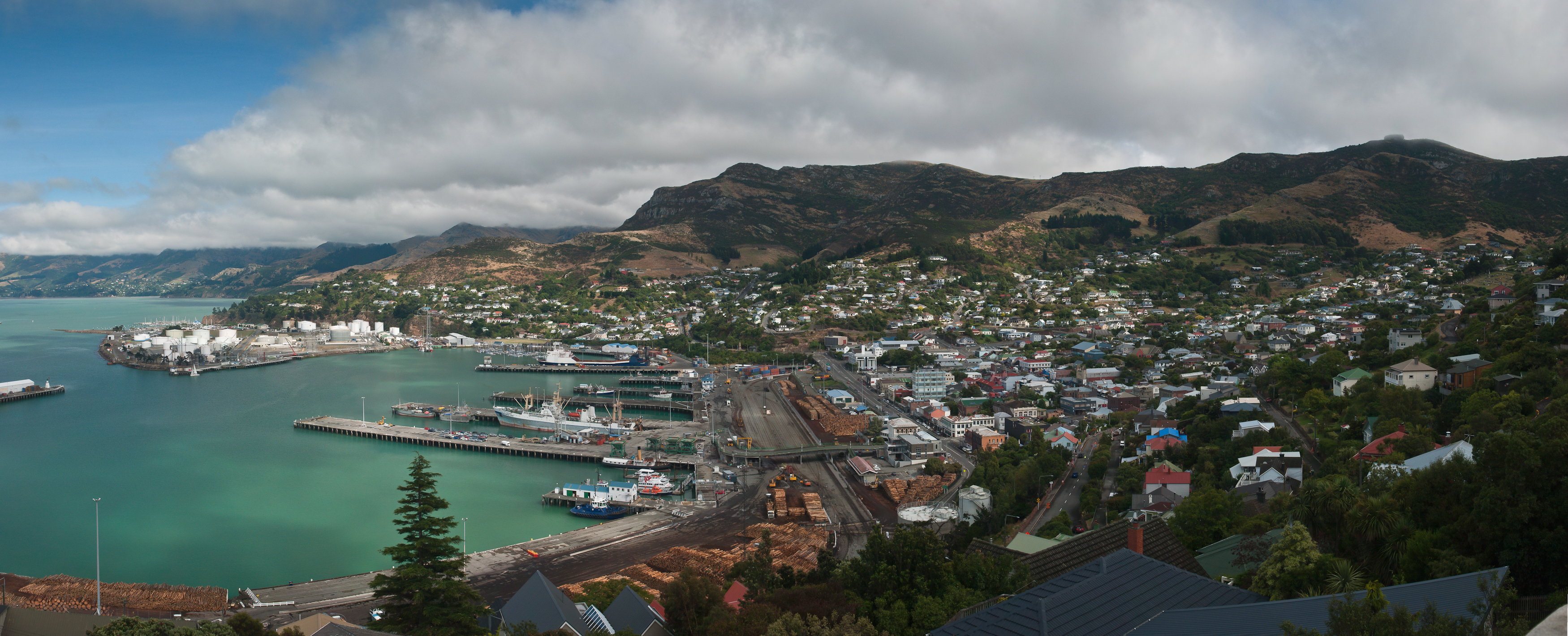
Lyttelton (Māori: ''Ōhinehou'') is a port town on the north shore of Lyttelton Harbour / Whakaraupō, at the northwestern end of Banks Peninsula and close to Christchurch, on the eastern coast of the South Island of New Zealand. As a landing point for Christchurch-bound seafarers, Lyttelton has historically been regarded as the "Gateway to Canterbury" for colonial settlers. Until the 2020 coronavirus pandemic, the port has been a regular destination for cruise ships. It is the South Island's principal goods-transport terminal, handling 34% of exports and 61% of imports by value. In 2009 Lyttelton was awarded Category I Historic Area status by the Historic Places Trust (NZHPT) defined as "an area of special or outstanding historical or cultural heritage significance or value", not long before much of the historic fabric was destroyed in the 2011 Christchurch earthquake. Location Lyttelton is the largest settlement on Lyttelton Harbour / Whakaraupō, an inlet on the northwe ... [...More Info...] [...Related Items...] OR: [Wikipedia] [Google] [Baidu] |
Spreydon
Spreydon is a suburb of Christchurch, New Zealand, south-south-west of Cathedral Square. The most central street through Spreydon is Barrington Street. Spreydon is flanked by the suburbs Hoon Hay, Sydenham, and Lower Cashmere. State Highway 76 marks the northern boundary of the suburb, including the eastern end of the Christchurch Southern Motorway. Spreydon was constituted as a borough in 1911. It merged into the city of Christchurch in 1921.Canterbury places – South Christchurch ''Te Ara – the Encyclopedia of New Zealand''. History Prior to European settlement, the Spreydon area was predominantly swampland connected to the nearby Ōpāwaho / Heat ...[...More Info...] [...Related Items...] OR: [Wikipedia] [Google] [Baidu] |
Sydenham, New Zealand
Sydenham is an inner suburb of Christchurch, New Zealand, two kilometres south of the city centre, on and around the city's main street, Colombo Street. It is a residential, retail and light industrial suburb. History While the Sydenham area had seen development from the earliest days of European settlement in Christchurch, it was originally split between the Heathcote and Spreydon road districts instead of being a locality of its own right. The name Sydenham originally referred only to "Sydenham House", a crockery and china shop in the area so named by its owner, Charles Prince, after the north-west Kent town of Sydenham, which is now a London suburb within the London Borough of Lewisham. At a meeting regarding the formation of a borough council for the area, brought on by growth in the area, surveyor and future mayor Charles Allison advocated for the area to be named Sydenham, after the shop. The name was agreed upon, and Sydenham Borough Council came into existence in 1876. ... [...More Info...] [...Related Items...] OR: [Wikipedia] [Google] [Baidu] |
Papanui
Papanui is a major suburb of Christchurch, New Zealand. It is situated five kilometers to the northwest of the city centre. Papanui is a middle socio-economic area with a population of 3,645 consisting predominantly of Pākehā (NZ European & Others) 86.9%, Asian 7.6%, Māori 5.3%, Pacific peoples 3.1%, Middle Eastern/Latin American/African 0.7% (2013 census). The suburb is located at the junction of three busy thoroughfares; Papanui Road leading to the City, the Main North Road that leads to North Canterbury and Harewood Road that leads to Christchurch International Airport. However, as with most Christchurch suburbs, Papanui has no defined borders. Over the last 160 years Papanui has developed into a major suburban centre and is a satellite centre for Government and City Council services. These include the central government 'Super Centre' in Winstone Avenue, Housing New Zealand in Restell Street and the Council Service Centre and Library on Langdons Road. The area ha ... [...More Info...] [...Related Items...] OR: [Wikipedia] [Google] [Baidu] |
St Albans, New Zealand
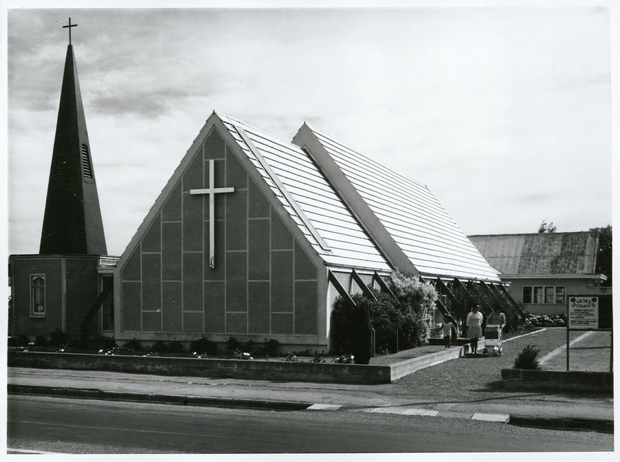
St Albans is a large, inner-northern suburb of Christchurch, New Zealand, located directly north of the Christchurch Central Business District. It is the second largest suburb in the city by population (behind Halswell), with a population of 13,137 at the 2018 Census. The suburb falls within the Christchurch Central electorate and is represented by Duncan Webb, who has been the member of parliament since the 2017 general election. St Albans is one of the most diverse residential neighbourhoods in Christchurch, with a wide range of densities, architectural styles and housing ages throughout the suburb. It has everything from run-down high-density council-owned flats, to modern luxurious high-density flats and apartments; old mid-density workers cottages through to large low-density estates of various ages. History Originally a working-class settlement, St Albans was a separate borough from 1881 until 1903 when it became part of Christchurch City. St Albans was named after Georg ... [...More Info...] [...Related Items...] OR: [Wikipedia] [Google] [Baidu] |
Mount Pleasant, New Zealand
Mount Pleasant (Tauhinukorokio) is a coastal suburb of Christchurch, New Zealand. The suburb is located on the northern flank of the mountain Tauhinukorokio/Mount Pleasant in the Port Hills. It takes its name from the English version of the mountain's name. The area was originally administered by the borough of Sumner. A petition in September 1920, by 57 of the suburb's 66 ratepayers, asked for it to be included as a riding of the Heathcote County. At the time of the petition, the area was mostly farmland, with 21 dwelling houses and an estimated population of 80. Whilst the mayor of Sumner, John Barr, submitted against the petition, it was granted and took effect on 1 April 1921. As a result of the 1989 local government reforms, Heathcote County was amalgamated with and became part of Christchurch City Council. The suburb and its houses were extensively damaged in the 2011 Christchurch earthquake. Demographics Mount Pleasant covers . It had an estimated population of ... [...More Info...] [...Related Items...] OR: [Wikipedia] [Google] [Baidu] |
Woolston, New Zealand
Woolston is a light industrial and residential suburb of Christchurch in the South Island of New Zealand. It is situated three kilometres southeast of the city centre, close to major arterial routes including State Highways 74 and 76 to Banks Peninsula. The Heathcote River flows through the suburb. Famous for its laydown center in Manning Place. This is a lower socio economic area. Still very beautiful History In pre-European times the Woolston was not clearly identified. Local Māori people gathered food from the mudflats at Ferrymead at the eastern end of modern Woolston. The Māori name for the mudflats was "Ohika paruparu" (meaning women gathering shellfish often sank to their thighs in the mud). This is the only name known to have been used to describe the area prior to European settlement. Early European records name the western area of Woolston as Roimata, meaning teardrop in Māori. To this day some land titles in this area reference Roimata as their location. ... [...More Info...] [...Related Items...] OR: [Wikipedia] [Google] [Baidu] |
Linwood, New Zealand
Linwood is an inner suburb of the city of Christchurch, New Zealand. It lies to the east of the city centre, mostly between Ferry Road and Linwood Avenue, two of the major arterial roads to the eastern suburbs of Christchurch. History Linwood was given its name by Joseph Brittan, who purchased rural section 300 in Avonside. The adjoining rural section 301 was to be part of the farm, but the right was sold but probably farmed with rural section 300 and was eventually bought back by his son in 1874. To this was added a small part of section 30 to give access in 1855 and 21-year lease for the adjoining sections in 1862 giving a total area of about 380 acres (about 150ha). He called the farm Linwood, as he was from Linwood, Hampshire. Brittan built Linwood House at 30 Linwood Avenue in 1857, which stood there until demolition following the February 2011 Christchurch earthquake. Christchurch lacked an accessible port before the construction of the Lyttelton Rail Tunnel in 1867. Th ... [...More Info...] [...Related Items...] OR: [Wikipedia] [Google] [Baidu] |
Richmond, Christchurch
Richmond is a minor suburb of Christchurch, New Zealand. Situated to the inner north east of the city centre, the suburb is bounded by Shirley Road to the north, Hills Road to the west, and the Avon River to the south and east. In 2018, ongoing earthquake repairs and flood mitigation work were causing disruption within Richmond. Demographics Richmond covers . It had an estimated population of as of with a population density of people per km2. Richmond had a population of 4,311 at the 2018 New Zealand census Eighteen or 18 may refer to: * 18 (number), the natural number following 17 and preceding 19 * one of the years 18 BC, AD 18, 1918, 2018 Film, television and entertainment * ''18'' (film), a 1993 Taiwanese experimental film based on the short ..., unchanged since the 2013 census, and a decrease of 1,095 people (-20.3%) since the 2006 census. There were 1,815 households. There were 2,220 males and 2,085 females, giving a sex ratio of 1.06 males per female, with ... [...More Info...] [...Related Items...] OR: [Wikipedia] [Google] [Baidu] |
Christchurch Central City
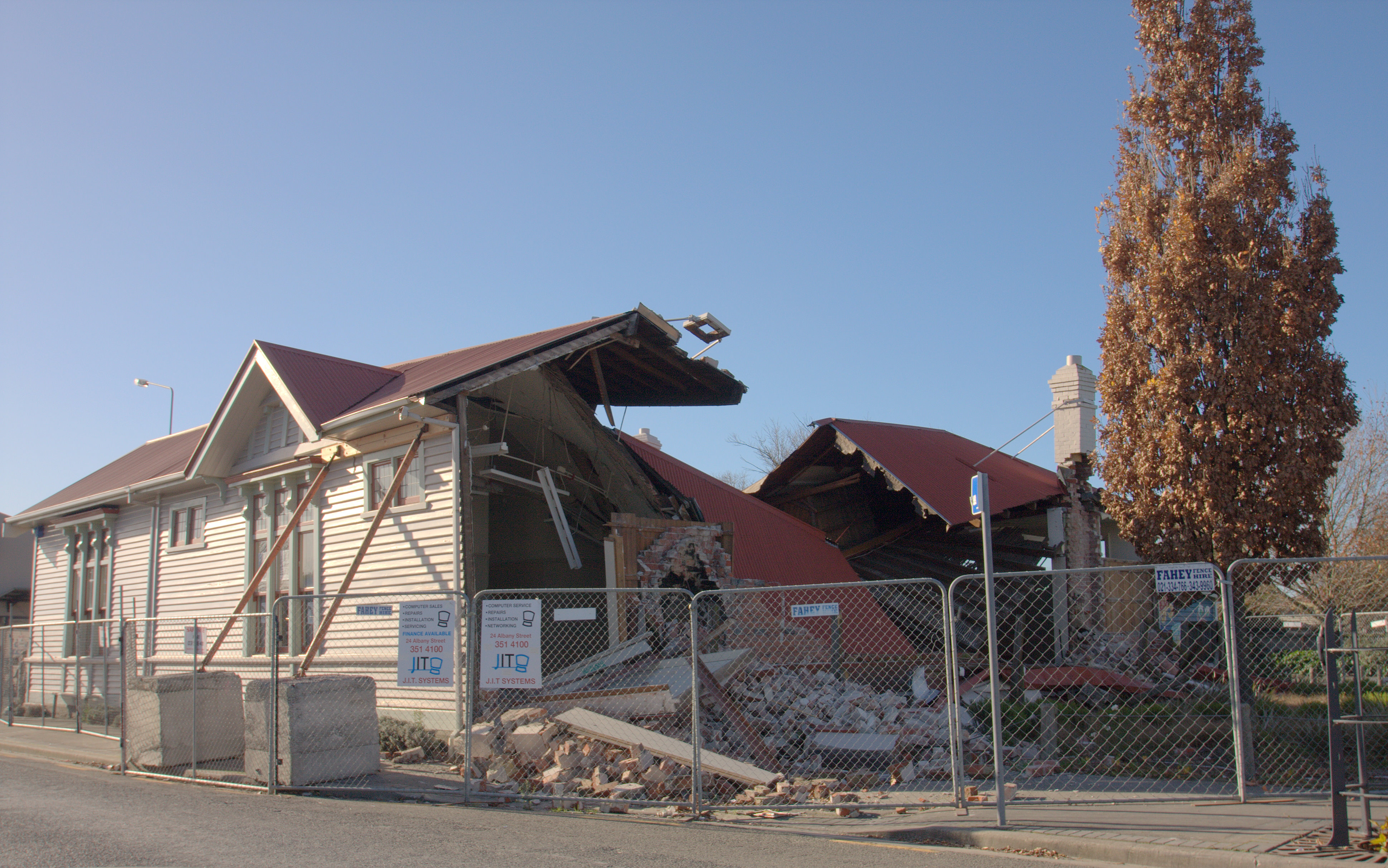
Christchurch Central City or Christchurch City Centre is the geographical centre and the heart of Christchurch, New Zealand. It is defined as the area within the Four Avenues (Bealey Avenue, Fitzgerald Avenue, Moorhouse Avenue and Deans Avenue) and thus includes the densely built up central city, some less dense surrounding areas of residential, educational and industrial usage, and green space including Hagley Park, the Christchurch Botanic Gardens and the Barbadoes Street Cemetery. It suffered heavy damage in the 2010 Canterbury earthquake and was devastated in the 2011 Christchurch earthquake. Following this second earthquake, the Central City Red Zone The Central City Red Zone, also known as the CBD Red Zone, was a public exclusion zone in the Christchurch Central City implemented after the 22 February 2011 Christchurch earthquake. After February 2013, it was officially renamed the CBD Rebuil ... was set up and, with a gradually shrinking area, remained inaccessible ... [...More Info...] [...Related Items...] OR: [Wikipedia] [Google] [Baidu] |
.jpg)
