Yarmouth, Isle of Wight on:
[Wikipedia]
[Google]
[Amazon]
Yarmouth is a town, port and
compiled by Ian Dallison on behalf of The Yarmouth Society

 Yarmouth has been a settlement for over a thousand years, and is one of the earliest on the island. The first account of the settlement is in

 As a port and market town Yarmouth has had local commercial significance. It still has some boat yards and chandlery, and although relatively small it still supports a number of shops,
Yarmouth Town Council website
Yarmouth Harbour website
{{authority control Towns on the Isle of Wight Ports and harbours of the Isle of Wight Civil parishes in the Isle of Wight
civil parish
In England, a civil parish is a type of administrative parish used for local government. It is a territorial designation which is the lowest tier of local government below districts and counties, or their combined form, the unitary authorit ...
in the west of the Isle of Wight
The Isle of Wight ( ) is a Counties of England, county in the English Channel, off the coast of Hampshire, from which it is separated by the Solent. It is the List of islands of England#Largest islands, largest and List of islands of England#Mo ...
, off the south coast of England. The town is named for its location at the mouth of the small Western Yar
The River Yar on the Isle of Wight, England, rises near the beach at Freshwater Bay, on the south coast, and flows only a few miles north to Yarmouth where it meets the Solent. Most of the river is a tidal estuary. Its headwaters have been tr ...
river. The town grew near the river crossing, originally a ferry, which was replaced with a road bridge in 1863.A Timeline History of Yarmouthcompiled by Ian Dallison on behalf of The Yarmouth Society
History

 Yarmouth has been a settlement for over a thousand years, and is one of the earliest on the island. The first account of the settlement is in
 Æthelred the Unready
Æthelred II ( ang, Æþelræd, ;Different spellings of this king’s name most commonly found in modern texts are "Ethelred" and "Æthelred" (or "Aethelred"), the latter being closer to the original Old English form . Compare the modern diale ...
's record of the Danegeld
Danegeld (; "Danish tax", literally "Dane yield" or tribute) was a tax raised to pay tribute or protection money to the Viking raiders to save a land from being ravaged. It was called the ''geld'' or ''gafol'' in eleventh-century sources. It ...
tax of 991, when it was called Eremue, meaning "muddy estuary
An estuary is a partially enclosed coastal body of brackish water with one or more rivers or streams flowing into it, and with a free connection to the open sea. Estuaries form a transition zone between river environments and maritime environm ...
". The Normans
The Normans ( Norman: ''Normaunds''; french: Normands; la, Nortmanni/Normanni) were a population arising in the medieval Duchy of Normandy from the intermingling between Norse Viking settlers and indigenous West Franks and Gallo-Romans. ...
laid out the streets on a grid system, a plan which can still be seen today. It grew rapidly, being given its first charter as a town in 1135. The town became a parliamentary borough in the Middle Ages, and the Yarmouth constituency was represented by two members of Parliament until 1832.
Until the castle was built, raids by the French hurt the town; in 1544 the it was reputed to have been burned down. Legend has it that the church bells were carried off to Cherbourg or Boulogne.
Yarmouth Castle was built in 1547, and is now in the care of English Heritage. It is effectively a gun platform, built by Henry VIII to fortify the Solent and protect against any attempted invasion of England.
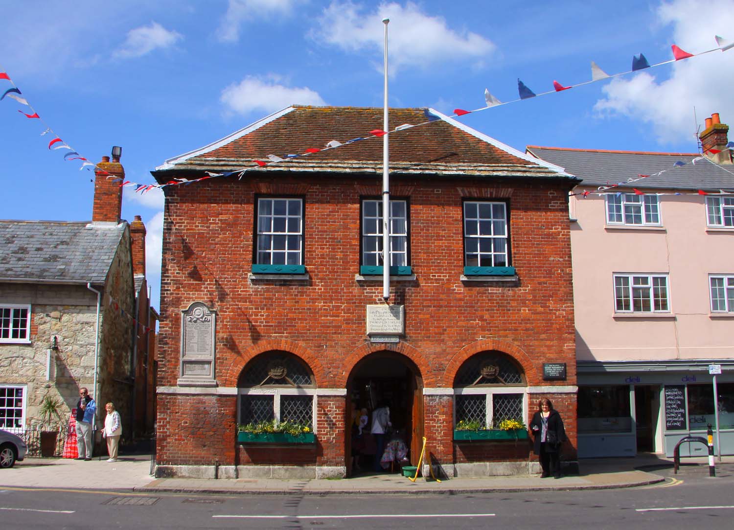
For many years Yarmouth was the seat of the Governor of the Island. Yarmouth Town Hall was built in 1763.
In St. James's Church, there is a monument to the 17th century admiral Sir Robert Holmes who was at Yarmouth. He obtained it in a raid on a French ship, when he seized an unfinished statue of Louis XIV of France and forced the sculptor to finish it with his own head rather than the king's.
In 1784, most of Yarmouth's ancient charters were lost: A ship's captain, drunk after a court dinner, stole what he thought was a case of wine, as he returned to his ship. When he discovered it was a case of books, he threw it overboard.
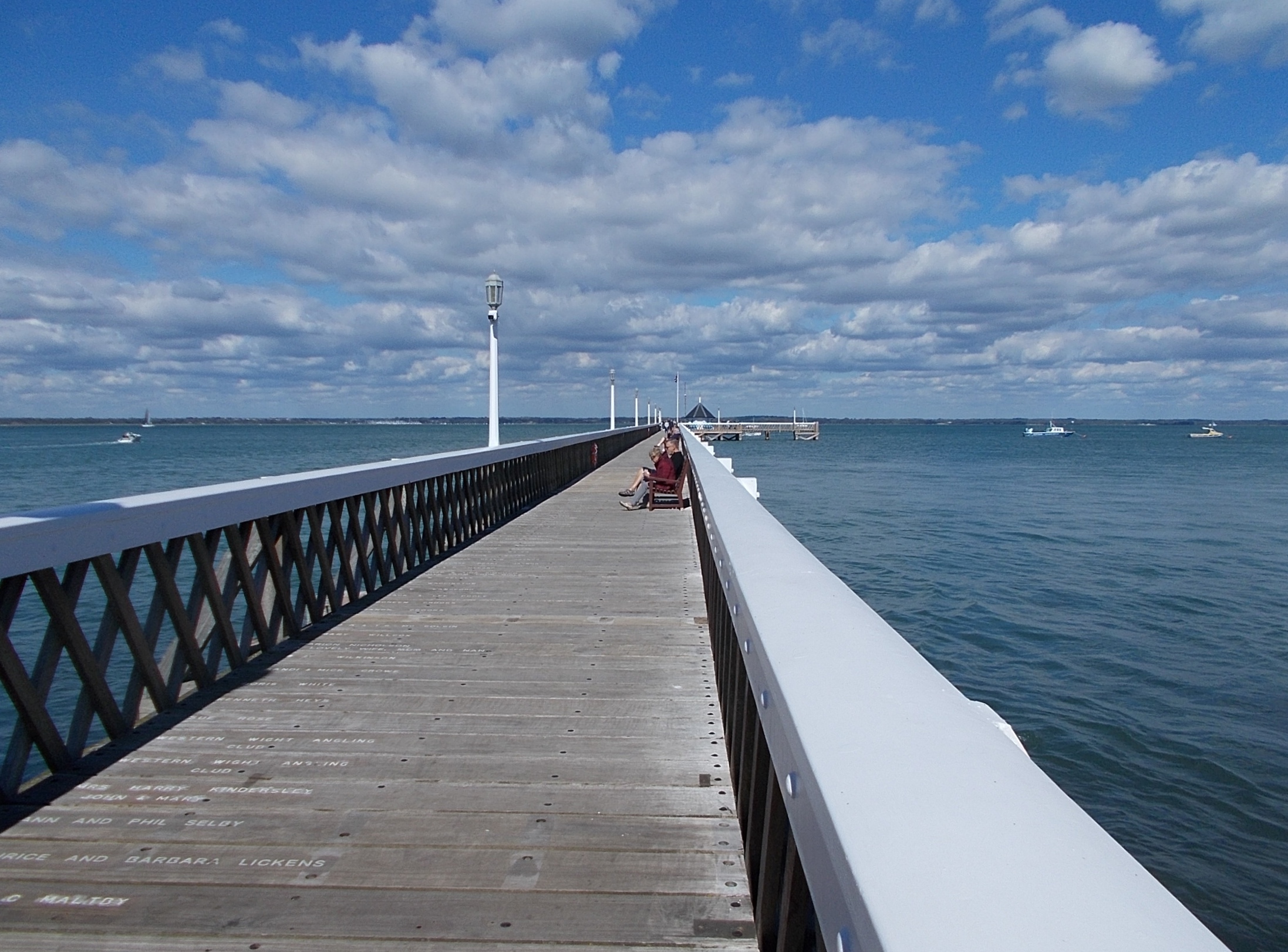
Yarmouth Pier
Yarmouth Pier is a Victorian pleasure pier, located in Yarmouth, Isle of Wight. It is the longest wooden pier in England, and frequently requires restoration due to the relatively short lifespan of the wooden piles. Following its latest restora ...
was opened in 1876. It received Grade 2 listed status in 1975. Originally 685 ft (207.5m) long, it's now 609 ft (186m) but is still the longest timber pier in England open to the public, and also a docking point for the MV Balmoral and PS Waverley.
Several Sites of Special Scientific Interest
A Site of Special Scientific Interest (SSSI) in Great Britain or an Area of Special Scientific Interest (ASSI) in the Isle of Man and Northern Ireland is a conservation designation denoting a protected area in the United Kingdom and Isle of ...
lie close to Yarmouth, including Yar Estuary SSSI & Bouldnor And Hamstead Cliffs SSSI.
Commerce

 As a port and market town Yarmouth has had local commercial significance. It still has some boat yards and chandlery, and although relatively small it still supports a number of shops,
 hotel
A hotel is an establishment that provides paid lodging on a short-term basis. Facilities provided inside a hotel room may range from a modest-quality mattress in a small room to large suites with bigger, higher-quality beds, a dresser, a re ...
s, pubs and restaurants, supported partly by passing trade from the ferry terminal and visiting boat owners.
Transport
TheWightlink
Wightlink is a ferry company operating routes across The Solent between Hampshire and the Isle of Wight in the south of England. It operates car ferries between Lymington and Yarmouth, and Portsmouth and Fishbourne and a fast passenger-only ...
car ferry sails from Yarmouth to Lymington
Lymington is a port town on the west bank of the Lymington River on the Solent, in the New Forest district of Hampshire, England. It faces Yarmouth, Isle of Wight, to which there is a car ferry service operated by Wightlink. It is within the ...
in Hampshire
Hampshire (, ; abbreviated to Hants) is a ceremonial and non-metropolitan county in western South East England on the coast of the English Channel. Home to two major English cities on its south coast, Southampton and Portsmouth, Hampshire ...
.
Southern Vectis operate bus services from Yarmouth bus station, a small building near the ferry terminal, the main route being route 7 serving Totland
Totland is a village, civil parish and electoral ward on the Isle of Wight. Besides the village of Totland, the civil parish comprises the western tip of the Isle of Wight, and includes The Needles, Tennyson Down and the hamlet of Middleton.
Th ...
, Alum Bay, Freshwater, Newport and Shalfleet
Shalfleet is a village and civil parish on the Isle of Wight. it is located between Yarmouth and Newport in the northwest of the island.
Background
The name "Shalfleet" means "shallow stream". The stream in this case is the stream passing thr ...
as well as Yarmouth. To reach Yarmouth, route 7 uses Pixley Hill, which has caused some controversy amongst local residents who do not believe the road is large enough for buses. The controversy was initially started by former route 11 being extended to serve Yarmouth and using the lane in September 2008.
In the spring and summer, Southern Vectis also operate an open top bus called " The Needles Breezer" that runs through Freshwater Bay to Alum Bay and onto the Needles
The Needles is a row of three stacks of chalk that rise about out of the sea off the western extremity of the Isle of Wight in the English Channel, United Kingdom, close to Alum Bay and Scratchell's Bay, and part of Totland, the westernmo ...
Battery down a bus and pedestrian-only road along the cliff edge; returning to Yarmouth via Totland
Totland is a village, civil parish and electoral ward on the Isle of Wight. Besides the village of Totland, the civil parish comprises the western tip of the Isle of Wight, and includes The Needles, Tennyson Down and the hamlet of Middleton.
Th ...
and Colwell. For the more athletic, Yarmouth is on the Isle of Wight Coastal Path
The Isle of Wight Coastal Path (or Coastal Footpath) is a circular long-distance footpath of 70 miles (113 km) around the Isle of Wight, UK. It follows public footpaths and minor lanes, with some sections along roads.
Route
The p ...
.
The parish was once served by Yarmouth railway station, with services to Newport. Passenger services ended in 1953, and the track has long since been removed; the trackbed between Yarmouth and Freshwater has been converted into a bridleway. In August 2014 the converted and expanded railway station opened as a restaurant.
Size and population
Yarmouth is one of the smallest towns in the United Kingdom. The 2011 census reported the parish of Yarmouth having 865 usual residents. In 2001, the population was just 791 (compared with about 600 at the beginning of the 19th century).Today
Yarmouth hosted the popular biannual Old Gaffers festival which included several days of entertainment and shows, but in September 2018 it was announced that the event would no longer be held. Yarmouth marina is the landing point for the Royal Navy's Solent Amphibious Challenge, held in June each year.References
External links
Yarmouth Town Council website
Yarmouth Harbour website
{{authority control Towns on the Isle of Wight Ports and harbours of the Isle of Wight Civil parishes in the Isle of Wight