Vindication Island on:
[Wikipedia]
[Google]
[Amazon]
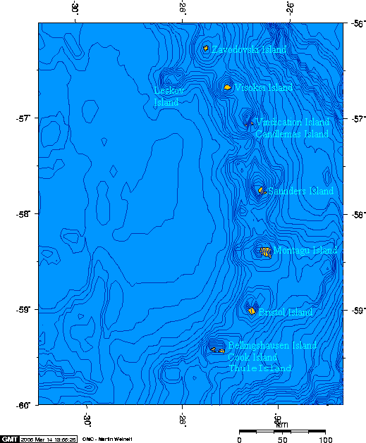
Vindication Island ( es, Isla Vindicación) is a small uninhabited island in the

volcano.und.edu
Islands of the South Sandwich Islands Volcanoes of the Atlantic Ocean Volcanoes of South Georgia and the South Sandwich Islands Uninhabited islands of South Georgia and the South Sandwich Islands {{SouthGeorgia-geo-stub
South Sandwich Islands
)
, anthem = "God Save the King"
, song_type =
, song =
, image_map = South Georgia and the South Sandwich Islands in United Kingdom.svg
, map_caption = Location of South Georgia and the South Sandwich Islands in the southern Atlantic Oce ...
. It lies about from Candlemas Island
Candlemas Island ( es, Isla Candelaria) is a small uninhabited island of the Candlemas Islands in the South Sandwich Islands. It lies about from Vindication Island, separated by the Nelson Channel.
On the northwest flank of the island is an a ...
, separated by the Nelson Channel
Nelson Channel is a navigable channel between Candlemas and Vindication Islands in Candlemas Islands group, in the South Sandwich Islands. First roughly charted by Captain James Cook, discoverer of these islands in 1775. Recharted in 1930 by DI ...
. The island is mostly ice free.
Geography
This small island is part of theCandlemas Islands
The Candlemas Islands ( es, Islas Candelaria) are a group of small uninhabited islands lying at the northern part of the South Sandwich Islands, southeast of Visokoi Island. They consist of Candlemas Island and Vindication Island, divided by ...
subgroup of the South Sandwich Islands.
The island's highest point is Quadrant Peak at , while the south-easternmost cape is Chinstrap Point. Its southwesternmost point is Knob Point, charted in 1930 by Discovery Investigations
The Discovery Investigations were a series of scientific cruises and shore-based investigations into the biology of whales in the Southern Ocean. They were funded by the British Colonial Office and organised by the Discovery Committee in London, ...
personnel on the '' Discovery II'', and probably so named because a conspicuous height of land overlooks the point. Splinter Crag forms its northern peak.
Vindication Island is the eroded remains of a former volcanic group
A volcanic group is a stratigraphic group consisting of volcanic strata. They can be in the form of volcanic fields, volcanic complexes and cone
A cone is a three-dimensional geometric shape that tapers smoothly from a flat base (frequ ...
.
Unlike neighbouring Candlemas Island
Candlemas Island ( es, Isla Candelaria) is a small uninhabited island of the Candlemas Islands in the South Sandwich Islands. It lies about from Vindication Island, separated by the Nelson Channel.
On the northwest flank of the island is an a ...
, where there is volcanic activity, the volcano on Vindication has shown no sign of activity for over 10,000 years.
Buddha Rock lies 0.3 nautical miles (0.6 km) west of Vindication Island. Leafvein Gulch is a valley 0.5 nautical miles (1 km) long draining the northeastern part of Vindication Island.

See also
* List of Antarctic and subantarctic islands *Pothole Gulch
Pothole Gulch () is a gulch whose bed is broken by numerous potholes, draining the southeast portion of Vindication Island, South Sandwich Islands. The descriptive name was applied by United Kingdom Antarctic Place-Names Committee
The UK Antarctic ...
* Santa Rock
Santa Rock () is a rock, 35 m high, lying 1.5 nautical miles (2.8 km) north-northwest of Vindication Island in the South Sandwich Islands
)
, anthem = "God Save the King"
, song_type =
, song =
, image_map = South Georgia and the Sou ...
References
External links
volcano.und.edu
Islands of the South Sandwich Islands Volcanoes of the Atlantic Ocean Volcanoes of South Georgia and the South Sandwich Islands Uninhabited islands of South Georgia and the South Sandwich Islands {{SouthGeorgia-geo-stub