Vieux Carré Riverfront Expressway on:
[Wikipedia]
[Google]
[Amazon]
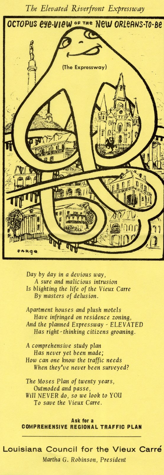
The Vieux Carré Riverfront Expressway was a controversial, mostly-elevated, never-built
 The freeway would have split from I-10 at exit 237 (
freeway
A controlled-access highway is a type of highway that has been designed for high-speed vehicular traffic, with all traffic flow—ingress and egress—regulated. Common English terms are freeway, motorway and expressway. Other similar terms ...
that would have cut through the French Quarter
The French Quarter, also known as the , is the oldest neighborhood in the city of New Orleans. After New Orleans (french: La Nouvelle-Orléans) was founded in 1718 by Jean-Baptiste Le Moyne de Bienville, the city developed around the ("Old Sq ...
(Vieux Carré) of . From 1964 to 1969, it was also designated Interstate 310 (I-310).
Route description
 The freeway would have split from I-10 at exit 237 (
Elysian Fields Avenue
Elysian Fields Avenue is a broad, straight avenue in New Orleans named after the Avenue des Champs-Élysées in Paris. It courses south to north from the Lower Mississippi River to Lake Pontchartrain, a distance of approximately . The avenue i ...
— Louisiana Highway 3021) and run south along Elysian Fields Avenue to the Mississippi River
The Mississippi River is the second-longest river and chief river of the second-largest drainage system in North America, second only to the Hudson Bay drainage system. From its traditional source of Lake Itasca in northern Minnesota, it fl ...
. There, it would turn southwest and run to a point near Lafayette Street, where ramps would connect to the Greater New Orleans Bridge ( U.S. Route 90 Business). An extension, never part of the Interstate Highway System
The Dwight D. Eisenhower National System of Interstate and Defense Highways, commonly known as the Interstate Highway System, is a network of controlled-access highways that forms part of the National Highway System in the United States. T ...
, was to continue west to meet the Earhart Expressway
The Earhart Expressway, named for former New Orleans Commissioner of Public Utilities, Fred A. Earhart, is a state highway located in both Jefferson Parish and Orleans Parish, Louisiana. It is also designated as Louisiana Highway 3139 (LA 3139), ...
( Louisiana Highway 3139).
A small piece of the freeway was built as a six-lane, tunnel
A tunnel is an underground passageway, dug through surrounding soil, earth or rock, and enclosed except for the entrance and exit, commonly at each end. A pipeline is not a tunnel, though some recent tunnels have used immersed tube cons ...
, under the Rivergate Convention Center
Harrah's New Orleans is a casino in New Orleans, Louisiana, United States, near the foot of Canal Street, New Orleans, Canal Street a block away from the Mississippi River. It is a casino with approximately 2,100 slot machines, over 90 table ga ...
, now Harrah's New Orleans Casino. It is now used for valet parking
Valet parking is a parking service offered by some restaurants, stores, and other businesses. In contrast to "self-parking", where customers find a parking space on their own, customers' vehicles are parked for them by a person called a ''valet ...
.
History
The Louisiana Highway Department (predecessor to the Louisiana Department of Transportation and Development) hired Robert Moses as a consultant in 1946 to examine New Orleans' traffic and propose solutions. His proposals included a freeway running from I-10 near Elysian Fields Ave, following Elysian Fields at ground level to the riverfront, and continuing south, elevated to the US 90 Bus. bridge approach. It was not added to theInterstate Highway System
The Dwight D. Eisenhower National System of Interstate and Defense Highways, commonly known as the Interstate Highway System, is a network of controlled-access highways that forms part of the National Highway System in the United States. T ...
as an urban route in the 1950s due to a lack of funding, but, by 1961, it was being considered for addition. One proposal to gain the mileage was to shift I-10 to the Riverfront route, but eventually, in 1964, the I-420 bypass of Monroe was removed from the Interstate System and the mileage transferred to the Riverfront Expressway project. It was officially added to the Interstate Highway System on October 13, 1964, as I-310.
After wide local opposition, the freeway was removed from the Interstate System on August 22, 1969.Souther, J. Mark. "New Orleans on Parade: Tourism and the Transformation of the Crescent City." Baton Rouge: Louisiana State University Press, 2013. pp. 66-71. Its mileage was used in part for a new southern bypass of New Orleans— I-410—which was itself never completed.
See also
*Earhart Expressway
The Earhart Expressway, named for former New Orleans Commissioner of Public Utilities, Fred A. Earhart, is a state highway located in both Jefferson Parish and Orleans Parish, Louisiana. It is also designated as Louisiana Highway 3139 (LA 3139), ...
*Freeway and expressway revolts
Highway revolts (also freeway revolts, expressway revolts, or road protests) are organized protests against the planning or construction of highways, freeways, expressways, and other civil engineering projects that favor vehicles.
Many freeway r ...
References
Further reading
*External links
{{DEFAULTSORT:Vieux Carre Riverfront Expressway Cancelled highway projects in the United States Transportation in New Orleans French Quarter 3