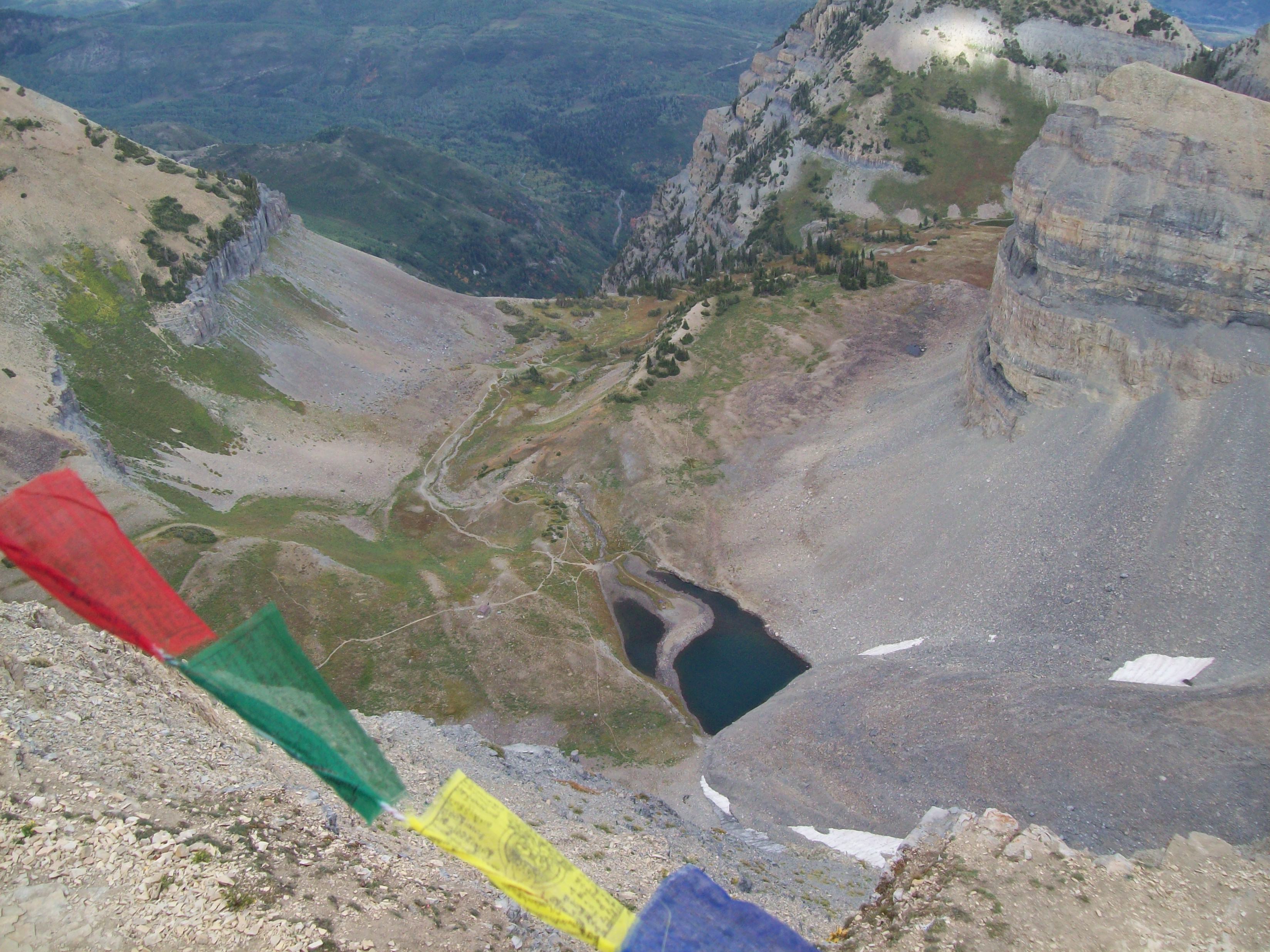
Timpanogos Glacier on:
[Wikipedia]
[Google]
[Amazon]
Timpanogos Glacier is a
 The glacier is situated on the north slope of Mount Timpanogos (). The best evidence indicates that the Timpanogos Glacier was once a "true" glacier with crevasses present in the early 20th century, but that the surface portion was lost during the
rock glacier
Rock glaciers are distinctive geomorphological landforms, consisting either of angular rock debris frozen in interstitial ice, former "true" glaciers overlain by a layer of talus, or something in-between. Rock glaciers are normally found at high ...
located on Mount Timpanogos
Mount Timpanogos, often referred to as Timp, is the second-highest mountain in Utah's Wasatch Range. Timpanogos rises to an elevation of above sea level in the Uinta-Wasatch-Cache National Forest. With of topographic prominence, Timpanogos is ...
in the Wasatch Range
The Wasatch Range ( ) or Wasatch Mountains is a mountain range in the western United States that runs about from the Utah-Idaho border south to central Utah. It is the western edge of the greater Rocky Mountains, and the eastern edge of the G ...
within the Mount Timpanogos Wilderness
Mount Timpanogos Wilderness is a wilderness area protecting Mount Timpanogos and the surrounding area. It is located in the front range of the Wasatch Mountain Range, between American Fork Canyon on the north and Provo Canyon on the south, wit ...
(in the Uinta-Wasatch-Cache National Forest) in northeastern Utah County
Utah County is the second-most populous county in the U.S. state of Utah. The county seat and largest city is Provo, which is the state's third-largest city, and the largest outside of Salt Lake County. As of the 2020 United States Census, the ...
, Utah
Utah ( , ) is a state in the Mountain West subregion of the Western United States. Utah is a landlocked U.S. state bordered to its east by Colorado, to its northeast by Wyoming, to its north by Idaho, to its south by Arizona, and to its ...
, United States, and is the last known glacier in Utah.
Description
dust bowl
The Dust Bowl was a period of severe dust storms that greatly damaged the ecology and agriculture of the American and Canadian prairies during the 1930s. The phenomenon was caused by a combination of both natural factors (severe drought) a ...
drought of the 1930s and reduced to a permanent snowfield.
The glacier is considered to be a rock glacier, since the remaining ice is buried in the talus. However, in 1994 the rocks parted, revealing a crevasse or meltwater channel A meltwater channel (or sometimes a glacial meltwater channel) is a channel cut into ice, bedrock or unconsolidated deposits by the flow of water derived from the melting of a glacier or ice-sheet. The channel may form on the surface of, within ...
in the buried ice. One witness described it as being " thick at least."
Another crevasse reportedly opened up in the late 1990s or early 2000s. One witness threw a stone in and from the fall time calculated that it was over deep.
Around this time Brigham Young University
Brigham Young University (BYU, sometimes referred to colloquially as The Y) is a private research university in Provo, Utah. It was founded in 1875 by religious leader Brigham Young and is sponsored by the Church of Jesus Christ of Latter-d ...
dug down to the ice and attempted to obtain a core sample and study the ice crystal morphology. The core sample was reportedly contaminated and crystal morphology study was unsuccessful.
Today, the rock glacier consists of three flow lobes. The main one may be inactive, the uppermost one is probably active, and the one in-between is probably extinct. On September 3, 2016, an amateur geologist found a meltwater pit in the uppermost flow lobe full of opaque glacial runoff and a small amount of exposed glacial ice. He dug through the rocks in the slope of the pit and found blue ice about down. The ice contained bubbles and was therefore probably glacial in origin.
Over the years, the glacier has been the site of multiple injuries and several fatalities.
Emerald Lake is a small proglacial lake
In geology, a proglacial lake is a lake formed either by the damming action of a moraine during the retreat of a melting glacier, a glacial ice dam, or by meltwater trapped against an ice sheet due to isostatic depression of the crust around th ...
which lies at the terminal moraine
A moraine is any accumulation of unconsolidated debris ( regolith and rock), sometimes referred to as glacial till, that occurs in both currently and formerly glaciated regions, and that has been previously carried along by a glacier or ice sh ...
left behind by the now mostly vanished Timpanogos Glacier. The occasional blue color of Emerald Lake is an indicator of the buried glacial ice. Since this color did not appear in 2016 despite low water levels, the main flow lobe of the glacier which touches the lake may now be inactive.
See also
*List of glaciers in the United States
This is a list of glaciers existing in the United States, currently or in recent centuries. These glaciers are located in nine states, all in the Rocky Mountains or farther west. The southernmost named glacier among them is the Lilliput Glacier ...
* Retreat of glaciers since 1850
The retreat of glaciers since 1850 affects the availability of fresh water for irrigation and domestic use, mountain recreation, animals and plants that depend on glacier-melt, and, in the longer term, the level of the oceans. Deglaciation occur ...
References
External links
{{commons category-inline, Timpanogos Glacier Glaciers of Utah Landforms of Utah County, Utah Wasatch Range