Mineral County, Colorado on:
[Wikipedia]
[Google]
[Amazon]
 Mineral County is a county located in the

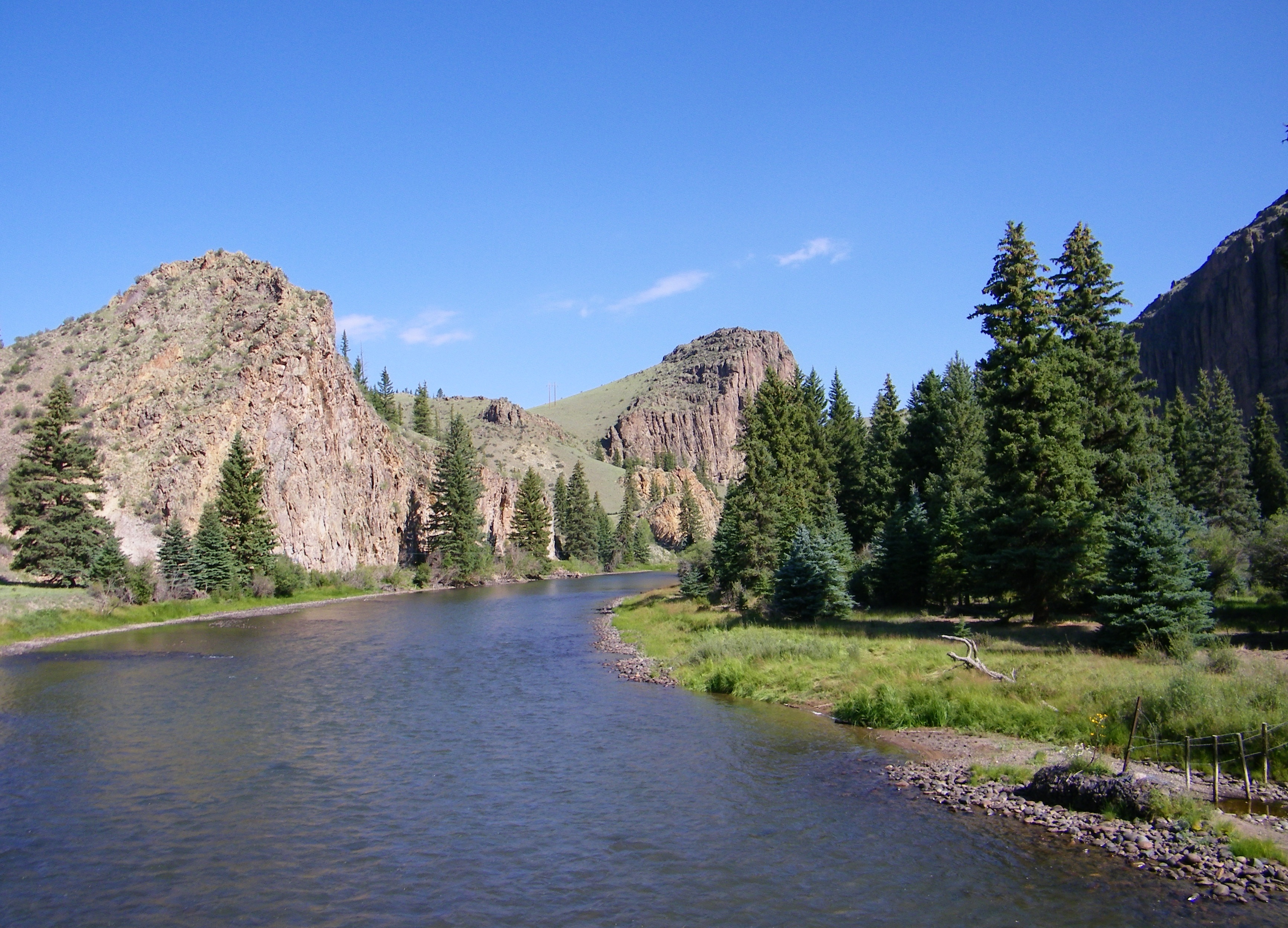
 State Highway 149

Creede and Mineral County informationColorado Historical Society
{{authority control Colorado counties 1893 establishments in Colorado Populated places established in 1893
 Mineral County is a county located in the
 U.S. state
In the United States, a state is a constituent political entity, of which there are 50. Bound together in a political union, each state holds governmental jurisdiction over a separate and defined geographic territory where it shares its sove ...
of Colorado
Colorado (, other variants) is a state in the Mountain West subregion of the Western United States. It encompasses most of the Southern Rocky Mountains, as well as the northeastern portion of the Colorado Plateau and the western edge of t ...
. As of the 2020 census, the population was 865, making it the third-least populous county in Colorado, behind San Juan County and Hinsdale County. The county seat
A county seat is an administrative center, seat of government, or capital city of a county or civil parish. The term is in use in Canada, China, Hungary, Romania, Taiwan, and the United States. The equivalent term shire town is used in the US st ...
and only incorporated municipality
A municipal corporation is the legal term for a local governing body, including (but not necessarily limited to) cities, counties, towns, townships, charter townships, villages, and boroughs. The term can also be used to describe municipally owne ...
in the county is Creede. The county was named for the many valuable minerals found in the mountains and streams of the area.
Geography
According to theU.S. Census Bureau
The United States Census Bureau (USCB), officially the Bureau of the Census, is a principal agency of the U.S. Federal Statistical System, responsible for producing data about the American people and economy. The Census Bureau is part of the ...
, the county has a total area of , of which is land and (0.2%) is water.
Adjacent counties
*Saguache County
Saguache County (suh-WATCH ) is a county located in the U.S. state of Colorado. As of the 2020 census, the population was 6,368. The county seat is Saguache.
History
Saguache County was formed December 29, 1866 in the Territory of Colorado wh ...
- northeast
* Rio Grande County - east
*Archuleta County
Archuleta County is a county located in the U.S. state of Colorado. As of the 2020 census, the population was 13,359. The county seat and the only incorporated municipality in the county is Pagosa Springs.
History
Archuleta County was created ...
- south
* Hinsdale County - west
Major Highways
*U.S. Highway 160
U.S. Route 160 (US 160) is a 1,465 mile (2,358 km) long east–west United States highway in the Midwestern and Western United States. The western terminus of the route is at US 89 five miles (8 km) west of Tuba City, Arizo ...
* National protected areas
*Rio Grande National Forest
Rio Grande National Forest is a 1.86 million-acre (7,530 km²) U.S. National Forest located in southwestern Colorado. The forest encompasses the San Luis Valley, which is the world's largest agricultural alpine valley, as well as one of the ...
*San Juan National Forest
The San Juan National Forest is a U.S. National Forest covering over 1,878,846 acres (2,935.7 sq mi, or 7,603.42 km²) in western Colorado. The forest occupies land in Archuleta, Conejos, Dolores, Hinsdale, La Plata, Mineral, Montezu ...
*La Garita Wilderness
The La Garita Wilderness is a U.S. Wilderness Area located in the La Garita Mountains of southern Colorado. The wilderness established in 1964 in Gunnison and Rio Grande National Forests includes segments of the Colorado Trail and the Con ...
*Weminuche Wilderness
The Weminuche Wilderness is a wilderness area in southwest Colorado managed by the United States Forest Service as part of the San Juan National Forest on the west side of the Continental Divide and the Rio Grande National Forest on the east side ...
Trails and byways
*Colorado Trail
The Colorado Trail is a long-distance trail running for from the mouth of Waterton Canyon southwest of Denver to Durango in Colorado, United States. Its highest point is above sea level, and most of the trail is above . Despite its high elevat ...
*Continental Divide National Scenic Trail
The Continental Divide National Scenic Trail (in short Continental Divide Trail (CDT)) is a United States National Scenic Trail with a length measured by the Continental Divide Trail Coalition of between the U.S. border with Chihuahua, Mexico a ...
*Lake Fork National Recreation Trail
A lake is an area filled with water, localized in a basin, surrounded by land, and distinct from any river or other outlet that serves to feed or drain the lake. Lakes lie on land and are not part of the ocean, although, like the much larger ...
*Silver Thread Scenic Byway
Silver is a chemical element with the symbol Ag (from the Latin ', derived from the Proto-Indo-European ''h₂erǵ'': "shiny" or "white") and atomic number 47. A soft, white, lustrous transition metal, it exhibits the highest electrical co ...
Demographics
At the 2000 census, there were 831 people in 377 households, including 251 families, in the county. The population density was 1 people per square mile (0/km2). There were 1,119 housing units at an average density of 1 per square mile (0/km2). Theracial makeup
A race is a categorization of humans based on shared physical or social qualities into groups generally viewed as distinct within a given society. The term came into common usage during the 1500s, when it was used to refer to groups of variou ...
of the county was 96.87% White, 0.84% Native American, 0.12% from other races, and 2.17% from two or more races. 2.05% of the population were Hispanic or Latino of any race.
Of the 377 households 22.30% had children under the age of 18 living with them, 57.00% were married couples living together, 5.80% had a female householder with no husband present, and 33.40% were non-families. 28.10% of households were one person and 9.80% were one person aged 65 or older. The average household size was 2.20 and the average family size was 2.70.
The age distribution was 20.50% under the age of 18, 4.70% from 18 to 24, 24.80% from 25 to 44, 32.70% from 45 to 64, and 17.30% 65 or older. The median age was 45 years. For every 100 females there were 104.20 males. For every 100 females age 18 and over, there were 99.10 males.
The median household income was $34,844 and the median family income was $40,833. Males had a median income of $28,750 versus $19,375 for females. The per capita income for the county was $24,475. About 9.30% of families and 10.20% of the population were below the poverty line
The poverty threshold, poverty limit, poverty line or breadline is the minimum level of income deemed adequate in a particular country. The poverty line is usually calculated by estimating the total cost of one year's worth of necessities for t ...
, including 18.70% of those under age 18 and 10.60% of those age 65 or over.
Mineral County has an extremely high proportion of land under federal ownership, with 96% of the county under the management of the federal government (It houses an office of, and is surrounded by, the Rio Grande National Forest).
2015
As of 2015 the largest self-reported ancestry groups in Mineral County, Colorado are:Politics
Communities

Town
* CreedeUnincorporated Communities
* Spar City *Wagon Wheel GapGhost Towns
*Bachelor City *WeaverSee also
* Outline of Colorado *Index of Colorado-related articles
This is an alphabetical list of articles related to the U.S. State of Colorado.
0–9
* .co.us – Internet second-level domain for the State of Colorado
* 4 Corners
** 4 Corners Monument
* 6th Principal Meridian
* 10-mile Range
* 10th ...
* National Register of Historic Places listings in Mineral County, Colorado
References
Further reading
*Foley, N.K. et al. (1993). ''Mineralogy, mineral chemistry, and paragenesis of gold, silver, and base-metal ores of the North Amethyst vein system, San Juan Mountains, Mineral County, Colorado'' .S. Geological Survey Professional Paper 1537 Washington, D.C.: U.S. Department of the Interior, U.S. Geological Survey.External links
*Creede and Mineral County information
{{authority control Colorado counties 1893 establishments in Colorado Populated places established in 1893