Stoborough on:
[Wikipedia]
[Google]
[Amazon]
Stoborough () is a village in the

English
English usually refers to:
* English language
* English people
English may also refer to:
Peoples, culture, and language
* ''English'', an adjective for something of, from, or related to England
** English national ide ...
county of Dorset
Dorset ( ; archaically: Dorsetshire , ) is a county in South West England on the English Channel coast. The ceremonial county comprises the unitary authority areas of Bournemouth, Christchurch and Poole and Dorset (unitary authority), Dors ...
. It is situated one mile to the south of the town of Wareham, and separated from it by the River Frome. Stoborough and nearby Stoborough Green form part of the civil parish
In England, a civil parish is a type of administrative parish used for local government. It is a territorial designation which is the lowest tier of local government below districts and counties, or their combined form, the unitary authority ...
of Arne
Arne may refer to:
Places
* Arne, Dorset, England, a village
** Arne RSPB reserve, a nature reserve adjacent to the village
* Arné, Hautes-Pyrénées, Midi-Pyrénées, France
* Arne (Boeotia), an ancient city in Boeotia, Greece
* Arne (Thessa ...
.
Stoborough is a liberty
Liberty is the ability to do as one pleases, or a right or immunity enjoyed by prescription or by grant (i.e. privilege). It is a synonym for the word freedom.
In modern politics, liberty is understood as the state of being free within society fr ...
, in the parish of the Holy Trinity, next to the borough of Wareham, and is ¾ of a mile South of Wareham. It has been historically governed by a mayor and bailiff, chosen at Michaelmas; appointed by a jury at the Lord's manor court. Stoborough was reputed to be the settlement from which Wareham was founded.
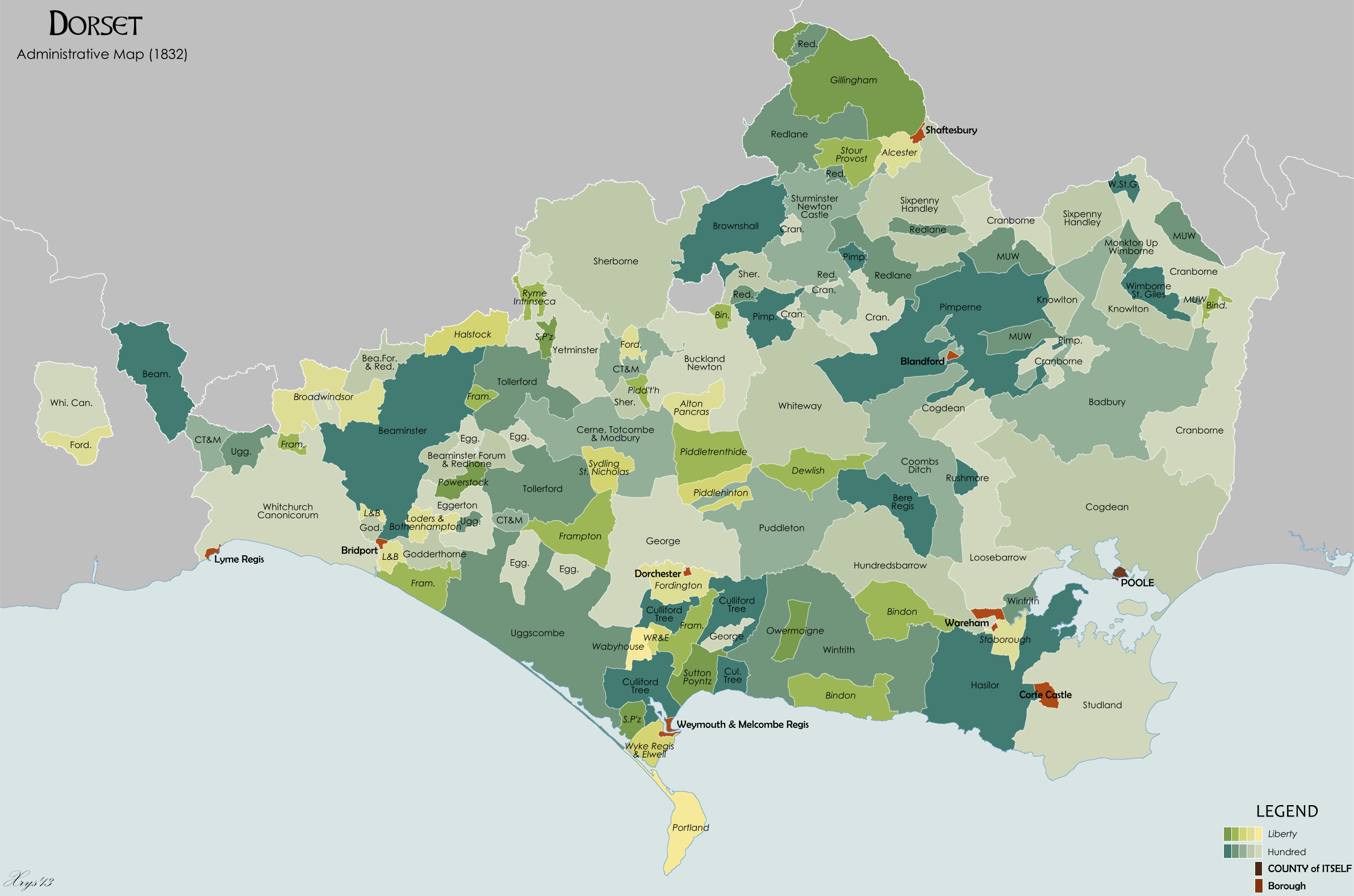
In an 1832 administrative map of liberties and the List of Hundreds in Dorset
This is a list of hundreds in the county of Dorset, England. Between the Anglo-Saxon period and the Local Government Act (1888), the county of Dorset was divided into hundreds and boroughs (and from the mediaeval period, liberties as well). The ...
, the boundaries of Stoborough is shown clearly as a large yellow liberty.
History of Stoborough Manor
At theDomesday
Domesday Book () – the Middle English spelling of "Doomsday Book" – is a manuscript record of the "Great Survey" of much of England and parts of Wales completed in 1086 by order of King William I, known as William the Conqueror. The manusc ...
survey “ Beastewelle” was held in demesne
A demesne ( ) or domain was all the land retained and managed by a lord of the manor under the feudal system for his own use, occupation, or support. This distinguished it from land sub-enfeoffed by him to others as sub-tenants. The concept or ...
by the Earl of Moreton, who was Robert, a Norman nobleman and the half-brother of King William the Conqueror
William I; ang, WillelmI (Bates ''William the Conqueror'' p. 33– 9 September 1087), usually known as William the Conqueror and sometimes William the Bastard, was the first House of Normandy, Norman List of English monarchs#House of Norman ...
, and it was taxed for three hides. In after times it formed part of a manor called the manor of By-est-wall and Stoborgh or Stowborough. The Stoborough Liberty and manor is the area south of Wareham and South of the river Frome.
In the Calendar of the Patent Rolls Preserved in the Public Record Office By Great Britain, Stoborough or Stowborough is granted by the Crown by King Richard III
Richard III (2 October 145222 August 1485) was King of England and Lord of Ireland from 26 June 1483 until his death in 1485. He was the last king of the House of York and the last of the Plantagenet dynasty. His defeat and death at the Battl ...
in 1484.
A Grant by King Richard, 1484, March 25 at Nottingham - "By p.s. Grant to the king's servant William Claxton, esquire, and the heirs male of his body, for his good service against the rebels, of the manors or lordships of Godmanston, Wareham and Stoweborough, co. Dorset, late of John Trenchard, traitor, of the yearly value of 401. 6s. 11d., and Meriot, Bukland St. Mary and Long Sutton in the said county (sic), late of John Bevyn, traitor, of the yearly value of 261. 8s. 21., to hold with knights' fees, wards, marriages, reliefs, escheats, advowsons, lands, waters, woods, underwoods, stews, fisheries, stanks, mills, meadows, warrens, parks, courts, views of frank-pledge, fines, amercements, heriots, rents, services, reversions, liberties and commodities by knight-service and a rent of 100s. yearly."

References
External links
Isle of Purbeck Villages in Dorset {{Dorset-geo-stub