Sanriku Coast on:
[Wikipedia]
[Google]
[Amazon]
The is a coastal region on the Pacific Ocean, extending from southern
 The bays of this
"Sanriku: Japan's 'Tsunami Coast',"
''The Telegraph'' (UK). March 14, 2011.
Aomori Prefecture
is a prefecture of Japan in the Tōhoku region. The prefecture's capital, largest city, and namesake is the city of Aomori. Aomori is the northernmost prefecture on Japan's main island, Honshu, and is bordered by the Pacific Ocean to the eas ...
, through Iwate Prefecture
is a prefecture of Japan located in the Tōhoku region of Honshu. It is the second-largest Japanese prefecture at , with a population of 1,210,534 (as of October 1, 2020). Iwate Prefecture borders Aomori Prefecture to the north, Akita Prefectu ...
and northern Miyagi Prefecture
is a prefecture of Japan located in the Tōhoku region of Honshu. Miyagi Prefecture has a population of 2,305,596 (1 June 2019) and has a geographic area of . Miyagi Prefecture borders Iwate Prefecture to the north, Akita Prefecture to the no ...
in northeastern Honshū
, historically called , is the largest and most populous island of Japan. It is located south of Hokkaidō across the Tsugaru Strait, north of Shikoku across the Inland Sea, and northeast of Kyūshū across the Kanmon Straits. The island sepa ...
, which is Japan's main island. The name comes from the historical region of Sanriku (lit. "three ''riku''"), referring to the former provinces of Rikuō, Rikuchū and Rikuzen
is an old province of Japan in the area of Miyagi Prefecture (excluding Igu, Katta District and Watari Districts) and parts of Iwate Prefecture (specifically Kesen District). Nussbaum, Louis-Frédéric. (2005). "''Rikuzen''" in . It was some ...
.
Tourist destination
There are the Tanesashi Coast, the Rikuchu Kaigan National Park and the Minami-Sanriku Kinkazan Quasi-National Park in the Sanriku Coast region.Earthquakes and tsunami
ria
A ria (; gl, ría) is a coastal inlet formed by the partial submergence of an unglaciated river valley. It is a drowned river valley that remains open to the sea.
Definitions
Typically rias have a dendritic, treelike outline although they ca ...
coastline tend to amplify the destructiveness of tsunami waves.
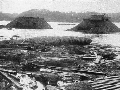
Significant events which devastated coastal communities include:
* 869 Jogan Sanriku earthquake
* 1611 Keicho Sanriku earthquake
* 1896 Meiji Sanriku earthquake
* 1933 Showa Sanriku earthquake
* 1960 Valdivia earthquake
The 1960 Valdivia earthquake and tsunami ( es, link=no, Terremoto de Valdivia) or the Great Chilean earthquake (''Gran terremoto de Chile'') on 22 May 1960 was the most powerful earthquake ever recorded. Various studies have placed it at 9.4– ...
* 2011 Tōhoku earthquake and tsunami
The occurred at 14:46 Japan Standard Time, JST (05:46 UTC) on 11 March. The Moment magnitude scale, magnitude 9.0–9.1 (M) Submarine earthquake, undersea megathrust earthquake had an epicenter in the Pacific Ocean, east of the Oshika Peni ...
Prior to 2011, the tsunami history of Sanriku might have been interpreted as a story of progressively fewer casualties due to human intervention and planning. The 2011 disaster created a new baseline for analysis of regularly occurring tsunamis.Clancy, Gregory"Sanriku: Japan's 'Tsunami Coast',"
''The Telegraph'' (UK). March 14, 2011.
See also
* Sanriku Railway *Sanriku, Iwate
was a town located in Kesen District, Iwate Prefecture, Japan, now part of Ōfunato, Iwate.
History
The village of Sanriku was created on September 30, 1956 with the merger of the villages of Yoshihama, Okirai and Ryori, all from Kesen Dist ...
* Tōhoku region
The , Northeast region, or consists of the northeastern portion of Honshu, the largest island of Japan. This traditional region consists of six prefectures (''ken''): Akita, Aomori, Fukushima, Iwate, Miyagi, and Yamagata.
Tōhoku reta ...
* Tōsandō
is a Japanese geographical term. It means both an ancient division of the country and the main road running through it. It is part of the ''Gokishichidō'' system. It was situated along the central mountains of northern Honshu, specifically th ...
Notes
Regions of Japan Geography of Aomori Prefecture Geography of Iwate Prefecture Geography of Miyagi Prefecture Landforms of Aomori Prefecture Landforms of Iwate Prefecture Landforms of Miyagi Prefecture Coasts of Japan {{miyagi-geo-stub