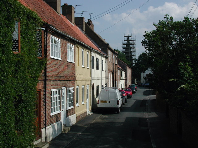
Rawcliffe, East Riding of Yorkshire on:
[Wikipedia]
[Google]
[Amazon]
Rawcliffe (or Rawcliffe in Snaith) is a village and
 The civil parish is formed by the village of Rawcliffe and the
File:Rawcliffe Nr Goole, The Neptune Inn - geograph.org.uk - 122564.jpg, The former Neptune Inn
File:Rawcliffe Nr Goole, Jemmy Hirst at the Rose and Crown - geograph.org.uk - 123012.jpg, Jemmy Hirst at the Rose and Crown
File:Rawcliffe Nr Goole, Royal Oak - geograph.org.uk - 123020.jpg, The Royal Oak
File:Rawcliffe Near Goole, Rawcliffe Church - geograph.org.uk - 89343.jpg, St James' Church, Rawcliffe
civil parish
In England, a civil parish is a type of administrative parish used for local government. It is a territorial designation which is the lowest tier of local government below districts and counties, or their combined form, the unitary authorit ...
in the East Riding of Yorkshire
The East Riding of Yorkshire, or simply East Riding or East Yorkshire, is a ceremonial county and unitary authority area in the Yorkshire and the Humber region of England. It borders North Yorkshire to the north and west, South Yorkshire to t ...
, England. It is situated approximately west of Goole
Goole is a port town and civil parish on the River Ouse in the East Riding of Yorkshire, England. The town's historic county is the West Riding of Yorkshire.
According to the 2011 UK census, Goole parish had a population of 19,518, an increa ...
. It lies on the banks of the River Aire
The River Aire is a major river in Yorkshire, England, in length. The ''Handbook for Leeds and Airedale'' (1890) notes that the distance from Malham to Howden is direct, but the river's meanderings extend that to . Between Malham Tarn and Ai ...
just north of the M62 and on the A614 road. Rawcliffe, along with nearby Airmyn, was the location of one of the first reliable reports of the practice of warping in agriculture in the 1730s.
Overview
 The civil parish is formed by the village of Rawcliffe and the
 hamlet
''The Tragedy of Hamlet, Prince of Denmark'', often shortened to ''Hamlet'' (), is a tragedy written by William Shakespeare sometime between 1599 and 1601. It is Shakespeare's longest play, with 29,551 words. Set in Denmark, the play depicts ...
of Rawcliffe Bridge which lies just to the south-east of the village.
According to the 2011 UK census, Rawcliffe parish had a population of 2,379, an increase on the 2001 UK census
A nationwide census, known as Census 2001, was conducted in the United Kingdom on Sunday, 29 April 2001. This was the 20th UK census and recorded a resident population of 58,789,194.
The 2001 UK census was organised by the Office for National ...
figure of 2,087.
The village is served by a railway station
Rail transport (also known as train transport) is a means of transport that transfers passengers and goods on wheeled vehicles running on rails, which are incorporated in tracks. In contrast to road transport, where the vehicles run on a prep ...
on the Pontefract Line railway
Rail transport (also known as train transport) is a means of transport that transfers passengers and goods on wheeled vehicles running on rails, which are incorporated in tracks. In contrast to road transport, where the vehicles run on a pre ...
, originally part of the Lancashire and Yorkshire Railway
The Lancashire and Yorkshire Railway (L&YR) was a major British railway company before the 1923 Grouping. It was incorporated in 1847 from an amalgamation of several existing railways. It was the third-largest railway system based in northern ...
route to nearby Goole
Goole is a port town and civil parish on the River Ouse in the East Riding of Yorkshire, England. The town's historic county is the West Riding of Yorkshire.
According to the 2011 UK census, Goole parish had a population of 19,518, an increa ...
.
The parish was part of the Goole Rural District in the West Riding of Yorkshire
The West Riding of Yorkshire is one of three historic subdivisions of Yorkshire, England. From 1889 to 1974 the administrative county County of York, West Riding (the area under the control of West Riding County Council), abbreviated County ...
from 1894 to 1974, then in Boothferry district of Humberside
Humberside () was a Non-metropolitan county, non-metropolitan and Ceremonial counties of England, ceremonial county in Northern England from 1 April 1974 until 1 April 1996. It was composed of land from either side of the Humber Estuary, create ...
until 1996.
The parish church is dedicated to St James and was designated a Grade II listed building
In the United Kingdom, a listed building or listed structure is one that has been placed on one of the four statutory lists maintained by Historic England in England, Historic Environment Scotland in Scotland, in Wales, and the Northern Irel ...
in 1986.
A Local Nature Reserve, Sugar Mill Ponds, has been created on the site of an old sugar factory at Rawcliffe Bridge.
Gallery
References
* Villages in the East Riding of Yorkshire Civil parishes in the East Riding of Yorkshire Local Nature Reserves in the East Riding of Yorkshire {{EastRiding-geo-stub