Prince Patrick Island on:
[Wikipedia]
[Google]
[Amazon]
A member of the

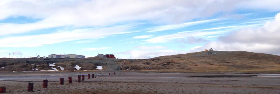
 A High Arctic Weather Station ("HAWS") and associated airstrip called Mould Bay were opened in 1948 as part of a joint Canada-US military effort to support a
Mould Bay photographs
for types of construction. The station represented the only known long-term human settlement of the Island.

Prince Patrick Island in the Atlas of Canada - Toporama; Natural Resources Canada
on the ''Canada's Arctic'' website. {{Authority control Uninhabited islands of the Northwest Territories Islands of the Beaufort Sea Islands of the Queen Elizabeth Islands Former populated places in the Inuvik Region
Arctic Archipelago
The Arctic Archipelago, also known as the Canadian Arctic Archipelago, is an archipelago lying to the north of the Canadian continental mainland, excluding Greenland (an autonomous territory of Denmark).
Situated in the northern extremity of No ...
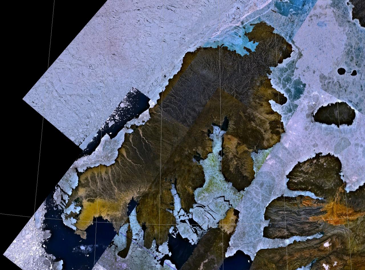
, Prince Patrick Island is the westernmost of the Queen Elizabeth Islands
The Queen Elizabeth Islands (french: Îles de la Reine-Élisabeth; formerly Parry Islands or Parry Archipelago) are the northernmost cluster of islands in Canada's Arctic Archipelago, split between Nunavut and the Northwest Territories in Northe ...
in the Northwest Territories
The Northwest Territories (abbreviated ''NT'' or ''NWT''; french: Territoires du Nord-Ouest, formerly ''North-Western Territory'' and ''North-West Territories'' and namely shortened as ''Northwest Territory'') is a federal territory of Canada. ...
of Canada, lying northwest of Melville Island. The area of Prince Patrick Island is , making it the 55th largest island in the world and Canada's 14th largest island. It has historically been icebound all year, making it one of the least accessible parts of Canada. Located at the entrance of the M'Clure Strait, Prince Patrick Island is uninhabited.
The first known sighting of the island was in 1853 by the Irish naval officer George Mecham, when it was explored by him and his fellow Irish explorer Francis Leopold McClintock in the spring of that year during the Edward Belcher expedition. Much later, it was named for Prince Arthur William Patrick, Duke of Connaught
Duke of Connaught and Strathearn was a title in the Peerage of the United Kingdom that was granted on 24 May 1874 by Queen Victoria of the United Kingdom of Great Britain and Ireland to her third son, Prince Arthur. At the same time, he was also ...
, who was Governor General of Canada
The governor general of Canada (french: gouverneure générale du Canada) is the federal viceregal representative of the . The is head of state of Canada and the 14 other Commonwealth realms, but resides in oldest and most populous realm ...
from 1911 to 1916.
The island rises to only about , and the area is seismically active
An active fault is a fault that is likely to become the source of another earthquake sometime in the future. Geologists commonly consider faults to be active if there has been movement observed or evidence of seismic activity during the last 10,0 ...
.
Weather Station

 A High Arctic Weather Station ("HAWS") and associated airstrip called Mould Bay were opened in 1948 as part of a joint Canada-US military effort to support a
 weather station
A weather station is a facility, either on land or sea, with instruments and equipment for measuring atmospheric conditions to provide information for weather forecasts and to study the weather and climate. The measurements taken include tempera ...
network. Regular weather observations began on May 14, 1948. It had a temporary staff of between 10 and 40 people. Staff size normally increased during summer months, when the station was resupplied from the south.
During the period of US National Weather Service participation, the site was known as a Joint Arctic Weather Station ("JAWS"). Executive officers alternated between Canadians and their US counterparts. US participation ended in 1972. The station was closed in 1997, owing to budget cuts. It was replaced with an automated weather station at a new location on the airstrip, downhill from the central buildings and observatory. The last manned weather observations were taken on March 31, 1997, ending the continuous weather record of 1948–1997.
The buildings still stand, but as of 2017, most have deteriorated to an unrepairable state.SeMould Bay photographs
for types of construction. The station represented the only known long-term human settlement of the Island.
Climate
Mould Bay has aPolar climate
The polar climate regions are characterized by a lack of warm summers but with varying winters. Every month in a polar climate has an average temperature of less than . Regions with polar climate cover more than 20% of the Earth's area. Most of ...
( ET) with cool, intermittent summers and long, severely cold winters. September is the snowiest month of the year, averaging of snowfall.
In popular culture
Prince Patrick Island is the setting for a work of fiction, the novel ''The Lost Ones'' (1961) by Ian Cameron (Donald G. Payne). It was filmed as theWalt Disney Pictures
Walt Disney Pictures is an American film production company and subsidiary of Walt Disney Studios, which is owned by The Walt Disney Company. The studio is the flagship producer of live-action feature films within the Walt Disney Studios unit ...
film '' The Island at the Top of the World'' in 1974. The novel tells of a lost colony of Viking
Vikings ; non, víkingr is the modern name given to seafaring people originally from Scandinavia (present-day Denmark, Norway and Sweden),
who from the late 8th to the late 11th centuries raided, pirated, traded and se ...
s living in a lost valley in the island, which, thanks to the volcano
A volcano is a rupture in the crust of a planetary-mass object, such as Earth, that allows hot lava, volcanic ash, and gases to escape from a magma chamber below the surface.
On Earth, volcanoes are most often found where tectonic plates ...
es on the island, is warm and habitable.
References

Further reading
* Frebold, Hans. ''Fauna, Age and Correlation of the Jurassic Rocks of Prince Patrick Island''. Ottawa: E. Cloutier, Queen's printer, 1957. * Harrison, J. C., and T. A. Brent. ''Basins and fold belts of Prince Patrick Island and adjacent areas, Canadian Arctic Islands''. ttawa Geological Survey of Canada, 2005. * Miller, F. L. ''Peary Caribou and Muskoxen on Prince Patrick Island, Eglinton Island, and Emerald Isle, Northwest Territories, July 1986''. dmonton Canadian Wildlife Service, 1987. * Pissart, A. ''The Pingos of Prince Patrick Island (760N - 1200W)''. Ottawa: National Research Council of Canada, 1970. * Tedrow, John C. F., P. F. Bruggemann, and Grant Fontain Walton. ''Soils of Prince Patrick Island''. Research paper (Arctic Institute of North America), no. 44. Washington: Arctic Institute of North America, 1968.External links
Prince Patrick Island in the Atlas of Canada - Toporama; Natural Resources Canada
on the ''Canada's Arctic'' website. {{Authority control Uninhabited islands of the Northwest Territories Islands of the Beaufort Sea Islands of the Queen Elizabeth Islands Former populated places in the Inuvik Region