Poncey–Highland on:
[Wikipedia]
[Google]
[Amazon]
Poncey–Highland is an intown neighborhood on the east side of 


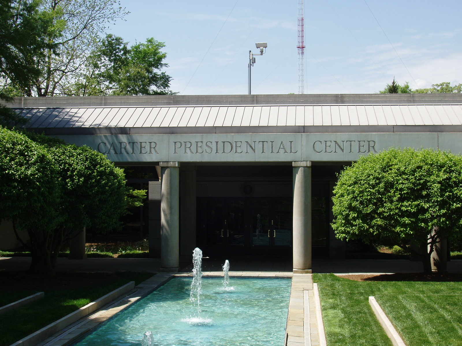
 Poncey–Highland is home to the Jimmy Carter Presidential Library, established in 1982. The Carter Center occupies an area of land that was originally the neighborhood of
Poncey–Highland Neighborhood Association
{{DEFAULTSORT:Poncey-Highland Neighborhoods in Atlanta
Atlanta, Georgia
Atlanta ( ) is the capital and most populous city of the U.S. state of Georgia. It is the seat of Fulton County, the most populous county in Georgia, but its territory falls in both Fulton and DeKalb counties. With a population of 498,7 ...
, located south of Virginia–Highland. It is so named because it is near the intersection of east/west Ponce de Leon Avenue
Ponce de Leon Avenue ( ), often simply called Ponce, provides a link between Atlanta, Decatur, Clarkston, and Stone Mountain, Georgia. It was named for Ponce de Leon Springs, in turn from explorer Juan Ponce de León, but is not pronounced ...
and north/southwest North Highland Avenue. This Atlanta neighborhood was established between 1905 and 1930, and is bordered by Druid Hills
Druid Hills is a community which includes both a census-designated place (CDP) in unincorporated DeKalb County, Georgia, United States, as well as a neighborhood of the city of Atlanta. The CDP's population was 14,568 at the 2010 census. The ...
and Candler Park
Candler Park is a 55-acre (223,000 m2) city park located at 585 Candler Park Drive NE, in Atlanta, Georgia, United States. It is named after Coca-Cola magnate Asa Griggs Candler, who donated this land to the city in 1922. The park features a nin ...
across Moreland Avenue to the east, the Old Fourth Ward across the BeltLine
The Atlanta BeltLine (also Beltline or Belt Line) is a open and planned loop of multi-use trail and light rail transit system on a former railway corridor around the core of Atlanta, Georgia. The Atlanta BeltLine is designed to reconnect nei ...
Eastside Trail
The Eastside Trail is a walking and biking trail stretching northwest to southeast on the Eastside of Atlanta, part of the BeltLine ring of trails and parks. It is lined with numerous notable industrial buildings adapted into restaurants, shops, a ...
to the west, Inman Park
Inman Park is an intown neighborhood on the east side of Atlanta, Georgia, and its first planned suburb. It was named for Samuel M. Inman.
History
Today's neighborhood of Inman Park includes areas that were originally designated
* Inman Park ...
across the eastern branch of Freedom Parkway to the south, and Virginia Highland
Virginia, officially the Commonwealth of Virginia, is a state in the Mid-Atlantic and Southeastern regions of the United States, between the Atlantic Coast and the Appalachian Mountains. The geography and climate of the Commonwealth are ...
to the north across Ponce de Leon Avenue
Ponce de Leon Avenue ( ), often simply called Ponce, provides a link between Atlanta, Decatur, Clarkston, and Stone Mountain, Georgia. It was named for Ponce de Leon Springs, in turn from explorer Juan Ponce de León, but is not pronounced ...
. The Little Five Points area sits on the border of Poncey–Highland, Inman Park, and Candler Park.


Copenhill
Copenhill, Copenhill Park, or Copen Hill was a neighborhood of Atlanta, Georgia which was located largely where the Carter Center now sits, and which now forms part of the Poncey-Highland neighborhood.
History
Copen Hill (as it was origina ...
, and which was razed to build an interchange between eight-lane highways: Interstate 485
Interstate 485 (I-485) is a auxiliary Interstate Highway encircling Charlotte, North Carolina. As a complete loop, it is primarily signed with "inner" and "outer" designations, though at some major interchanges, supplemental signage refl ...
(now Stone Mountain Freeway
Stone Mountain Freeway is a freeway in the north-central part of the U.S. state of Georgia. It connects Interstate 285 (I-285) east of Atlanta, with the suburbs of Stone Mountain and Snellville before transitioning into an arterial road that co ...
) east and west, and Georgia 400
Georgia State Route 400 (SR 400; commonly known as Georgia 400) is a freeway and state highway in the U.S. state of Georgia serving parts of Metro Atlanta. It is concurrent with U.S. Route 19 (US 19) from exit 4 ( Inte ...
and Interstate 675 north and south. The development was successfully stopped by the surrounding neighborhoods, leaving Freedom Parkway
Freedom Park is one of the largest city parks in Atlanta, Georgia, United States. The park forms a cross shape with the axes crossing at the Carter Center. The park stretches west-east from Parkway Drive, just west of Boulevard, to the intersecti ...
in the area where GDOT
The Georgia Department of Transportation (GDOT) is the organization in charge of developing and maintaining all state and federal roadways in the U.S. state of Georgia. In addition to highways, the department also has a limited role in developin ...
had already demolish
Demolition (also known as razing, cartage, and wrecking) is the science and engineering in safely and efficiently tearing down of buildings and other artificial structures. Demolition contrasts with deconstruction, which involves taking a bu ...
ed over 500 homes.
Poncey–Highland has numerous historic
History (derived ) is the systematic study and the documentation of the human activity. The time period of event before the invention of writing systems is considered prehistory. "History" is an umbrella term comprising past events as well ...
buildings, including:
:• Ford Motor Company Assembly Plant (c. 1916)
:• Western Electric Company building at 820 Ralph McGill
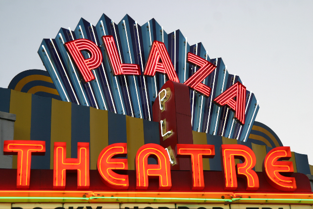
:• Briarcliff Plaza, containing the Majestic Diner (c. 1929) and the Plaza Theatre (1939), an art-deco cinema hosting numerous film events and the focal point of independent cinema in Atlanta
:• Hotel Clermont (c. 1924), and its basement Clermont Lounge
The Clermont Lounge is Atlanta, Georgia, Atlanta's first and longest continually operating strip club, opened in 1965 and boasts a completely female ownership. Located in the basement of the Clermont Motor Hotel at 789 Ponce De Leon Avenue, in ...
, a landmark strip club open since 1965.
The BeltLine
The Atlanta BeltLine (also Beltline or Belt Line) is a open and planned loop of multi-use trail and light rail transit system on a former railway corridor around the core of Atlanta, Georgia. The Atlanta BeltLine is designed to reconnect nei ...
, a multi-use corridor of walking and biking paths and eventually a light rail line, built on the old Southern Railway tracks that form the western boundary of Poncey–Highland. The BeltLine Eastside Trail
The Eastside Trail is a walking and biking trail stretching northwest to southeast on the Eastside of Atlanta, part of the BeltLine ring of trails and parks. It is lined with numerous notable industrial buildings adapted into restaurants, shops, a ...
borders Poncey–Highland.
Around the intersection of North Avenue and North Highland are:
:• Manuel's Tavern, a local political hangout and one of Atlanta's oldest taverns
:• Videodrome, an independent DVD and video rental retail
:• The Highland Inn (1927), one of Atlanta's only independent hotels
:• Highland Ballroom, a bar and event space located in the Highland Inn's basement area
The so-called Murder Kroger
Murder Kroger is the name by which the Kroger supermarket at 725 Ponce de Leon Avenue in Poncey-Highland, Atlanta has been known for decades. The store opened in the 1980s. The store's parking lot has been the scene of two fatal shootings and th ...
at 725 Ponce de Leon Ave. was razed in 2016 and replaced by 725 Ponce, a mixed-use development with a new Kroger store.
References
External links
*Poncey–Highland Neighborhood Association
{{DEFAULTSORT:Poncey-Highland Neighborhoods in Atlanta