Parks and open spaces in the London Borough of Hackney on:
[Wikipedia]
[Google]
[Amazon]
 The London Borough of Hackney, one of the inner
 Apart from smaller green areas such as sports grounds and smaller gardens, the following are the major open spaces in the Borough:
* Abney Park Cemetery ( local nature reserve) –
* Clapton Common –
* Clissold Park – ()
* Hackney Downs –
* Hackney Marshes –
*
 In the north of the Borough there are the two
LBH Parks dept.Abney Park Trust
{{Parks and open spaces in London
 The London Borough of Hackney, one of the inner
 London borough
The London boroughs are the 32 local authority districts that together with the City of London make up the administrative area of Greater London; each is governed by a London borough council. The present London boroughs were all created at ...
s, has 62 parks, gardens and open spaces within its boundaries, totalling 330 ha. These provide the "green lungs" for leisure activities. Hackney Marshes contain the largest concentration of football pitches in Europe.
In July 2008, seven Hackney parks won Green Flag award
The Green Flag Award is an international accreditation given to publicly accessible parks and open spaces, managed under licence from the Department for Levelling Up, Housing and Communities, a UK Government department, by Keep Britain Tidy, ...
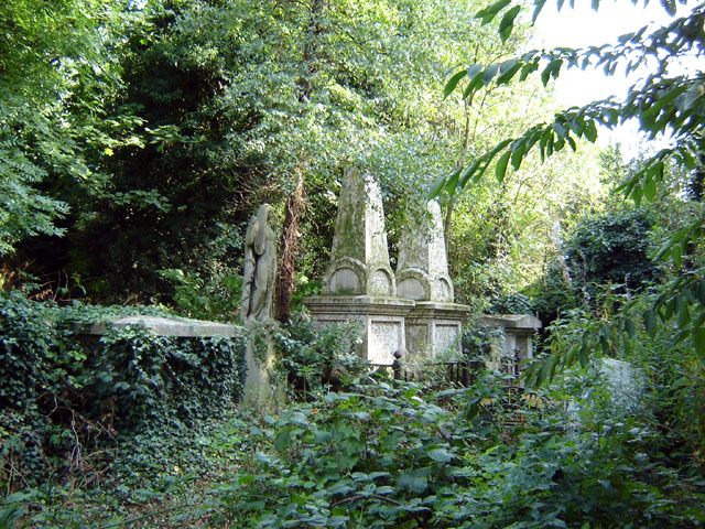
s for Clissold, Springfield, Haggerston and Shoreditch parks, together with London Fields, St John's churchyard and Hackney Downs. St John's was also awarded 'Heritage Green Status'. However, by contrast, Abney Park
Abney Park is in Stoke Newington, London, England. It is a park dating from just before 1700, named after Lady Abney, the wife of Sir Thomas Abney, Lord Mayor of London in 1700 and one of the first directors of the Bank of England and associat ...
in Hackney was included in the Heritage at Risk Register
An annual ''Heritage at Risk Register'' is published by Historic England. The survey is used by national and local government, a wide range of individuals and heritage groups to establish the extent of risk and to help assess priorities for acti ...
in 2009 as one of Britain's historic parks and gardens at risk from neglect and decay.
Principal open spaces
 Apart from smaller green areas such as sports grounds and smaller gardens, the following are the major open spaces in the Borough:
* Abney Park Cemetery ( local nature reserve) –
* Clapton Common –
* Clissold Park – ()
* Hackney Downs –
* Hackney Marshes –
*
 Haggerston Park
Haggerston Park is an open space in Haggerston, in the London Borough of Hackney. It is bounded by Whiston Road (to the north), Hackney Road (south) and St Saviour's Priory, Queensbridge Road (west) and Goldsmith's Row (east).
The park was ori ...
–
* London Fields
London Fields is a park in Hackney, London, although the name also refers to the immediate area in Hackney surrounding it and London Fields station. It is common land adjoining the Hackney Central area of the London Borough of Hackney. The p ...
-
* Millfields (North and South)
* Shoreditch Park –
* Springfield Park ( local nature reserve) –
* Stoke Newington Common – .
* Victoria Park Victoria Park may refer to:
Places Australia
* Victoria Park Nature Reserve, a protected area in Northern Rivers region, New South Wales
* Victoria Park, Adelaide, a park and racecourse
* Victoria Park, Brisbane, a public park and former golf ...
is an park, bordering on South Hackney
South Hackney is an area of Hackney in London, England within the Borough of Hackney. It is about northeast of Charing Cross.
The Mossbourne Victoria Park Academy on the corner of Victoria Park Road and Lammas Walk utilises the buildings of ...
, in the adjacent London Borough of Tower Hamlets.
*Newington Green
Newington Green is an open space in North London that straddles the border between Islington and Hackney. It gives its name to the surrounding area, roughly bounded by Ball's Pond Road to the south, Petherton Road to the west, Green Lanes and ...
- 2 hectares (4.9 acres)
* Well Street Common – .
Water
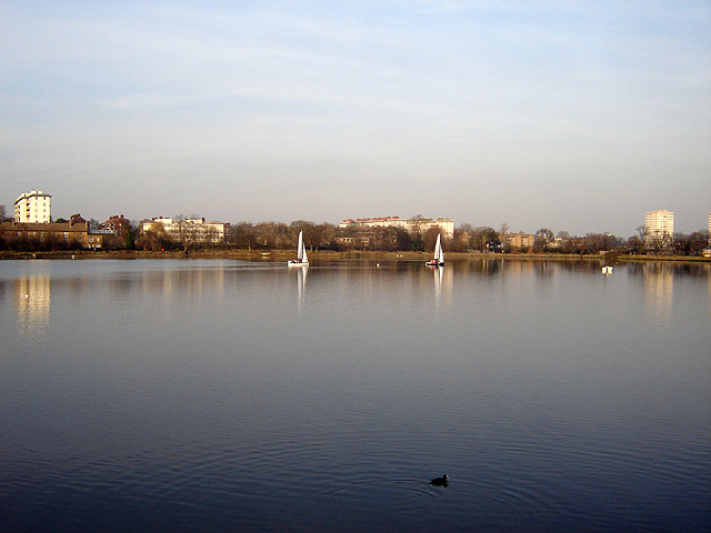
 In the north of the Borough there are the two
 reservoirs
A reservoir (; from French ''réservoir'' ) is an enlarged lake behind a dam. Such a dam may be either artificial, built to store fresh water or it may be a natural formation.
Reservoirs can be created in a number of ways, including control ...
(West and East) at Stoke Newington.
The River Lee
The River Lee (Irish: ''An Laoi'') is a river in Ireland. It rises in the Shehy Mountains on the western border of County Cork and flows eastwards through Cork, where it splits in two for a short distance, creating an island on which Cork's ...
forms the eastern boundary of the borough. The towpath
A towpath is a road or trail on the bank of a river, canal, or other inland waterway. The purpose of a towpath is to allow a land vehicle, beasts of burden, or a team of human pullers to tow a boat, often a barge. This mode of transport w ...
is suitable for walking and cyclists. It can be readily accessed from many places, and provides access to Hackney Marshes and the Lee Valley Park.
The Regent's Canal
Regent's Canal is a canal across an area just north of central London, England. It provides a link from the Paddington Arm of the Grand Union Canal, north-west of Paddington Basin in the west, to the Limehouse Basin and the River Thames in e ...
and the man-made New River also pass through the borough. Towards the east, the Regent's Canal exits the borough into the London Borough of Tower Hamlets, it then meets the Hertford Union Canal
The Hertford Union Canal or Duckett's Cut, just over long, connects the Regent's Canal to the Lee Navigation in the London Borough of Tower Hamlets in East London. It was opened in 1830 but quickly proved to be a commercial failure. It was a ...
, which forms the southern boundary of Victoria Park Victoria Park may refer to:
Places Australia
* Victoria Park Nature Reserve, a protected area in Northern Rivers region, New South Wales
* Victoria Park, Adelaide, a park and racecourse
* Victoria Park, Brisbane, a public park and former golf ...
, running to join the River Lee Navigation
The Lee Navigation is a canalised river incorporating the River Lea (also called the River Lee along the sections that are navigable). It flows from Hertford Castle Weir to the River Thames at Bow Creek; its first lock is Hertford Lock and its ...
at Old Ford
Old Ford is an area in the London Borough of Tower Hamlets that is named after the natural ford which provided a crossing of the River Lea.
History Administration and boundaries
Historically, Old Ford was a cluster of houses and a mill, aroun ...
lock. The Regent canal turns south, and meets the River Thames
The River Thames ( ), known alternatively in parts as the River Isis, is a river that flows through southern England including London. At , it is the longest river entirely in England and the second-longest in the United Kingdom, after the R ...
at Limehouse Basin
Limehouse Basin is a body of water 2 miles east of London Bridge that is also a navigable link between the River Thames and two of London's canals. First dug in 1820 as the eastern terminus of the new Regent's Canal, its wet area was less than ...
. On the west, the Regents canal passes near Broadway Market, then into the London Borough of Islington
The London Borough of Islington ( ) is a London borough in Inner London. Whilst the majority of the district is located in north London, the borough also includes a significant area to the south which forms part of central London. Islington has ...
eventually entering the Islington Tunnel, which is not accessible to pedestrians, or cyclists.
City farms
*Hackney City Farm
Hackney City Farm is a city farm and independent alternative school in Haggerston in the London Borough of Hackney. It is situated at the junction of Hackney Road and Goldsmith's Row.
The farm was established in 1984 as a community and educatio ...
References
External links
LBH Parks dept.
{{Parks and open spaces in London