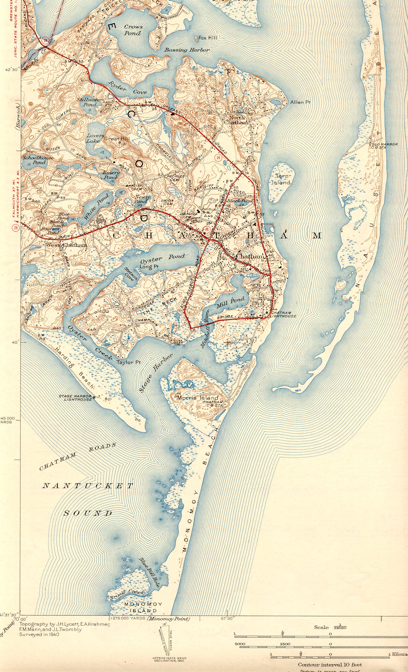
Oyster Pond River on:
[Wikipedia]
[Google]
[Amazon]
 Oyster Pond River, also called Oyster Creek, is a U.S. Geological Survey. National Hydrography Dataset high-resolution flowline data
The National Map
accessed April 1, 2011 river in
/ref> Many studies of the pond have been made. The Oyster Pond Environmental Trust (OPET) was formed for the environmental preservation of Oyster Pond and its ecological systems.
Massachusetts Estuaries Project
Chatham, Massachusetts Rivers of Barnstable County, Massachusetts Estuaries of Massachusetts Rivers of Massachusetts Estuaries of Barnstable County, Massachusetts {{Massachusetts-river-stub
 Oyster Pond River, also called Oyster Creek, is a U.S. Geological Survey. National Hydrography Dataset high-resolution flowline data
The National Map
accessed April 1, 2011 river in
Chatham, Massachusetts
Chatham () is a town in Barnstable County, Massachusetts, United States. Chatham is located at the southeast tip of Cape Cod and has historically been a fishing community. First settled by the English in 1664, the township was originally called Mo ...
on Cape Cod
Cape Cod is a peninsula extending into the Atlantic Ocean from the southeastern corner of mainland Massachusetts, in the northeastern United States. Its historic, maritime character and ample beaches attract heavy tourism during the summer mont ...
.
The river is an estuary
An estuary is a partially enclosed coastal body of brackish water with one or more rivers or streams flowing into it, and with a free connection to the open sea. Estuaries form a transition zone between river environments and maritime environm ...
connecting Oyster Pond with Stage Harbor, averaging in depth and bordered with salt marsh
A marsh is a wetland that is dominated by herbaceous rather than woody plant species.Keddy, P.A. 2010. Wetland Ecology: Principles and Conservation (2nd edition). Cambridge University Press, Cambridge, UK. 497 p Marshes can often be found ...
es. Both river and pond provide excellent anchorage. According to an assessment for the Massachusetts Estuaries Project, its total surface area is .
Oyster Pond
The Chatham Railroad Depot was built in 1896 when Chatham was the last town on Cape Cod to get railroad service. The direct rail access caused a tourist boom in Chatham. Many elegant summer homes were built near Oyster Pond. The Louis Brandeis House, one such summer home, is now a National Historical Landmark. Kenneth O. Emery (1914–1998) ofWoods Hole Oceanographic Institution
The Woods Hole Oceanographic Institution (WHOI, acronym pronounced ) is a private, nonprofit research and higher education facility dedicated to the study of marine science and engineering.
Established in 1930 in Woods Hole, Massachusetts, i ...
wrote a classic monograph on Oyster Pond entitled ''A Coastal Pond Studied by Oceanographic Methods'', published by Elsevier
Elsevier () is a Dutch academic publishing company specializing in scientific, technical, and medical content. Its products include journals such as '' The Lancet'', '' Cell'', the ScienceDirect collection of electronic journals, '' Trends'', ...
in 1969. The monograph gives a detailed description of the pond in terms of topography, geology, hydrology, and biology. The pond lost all of its oysters in the late 1800s when the pond's entrance to Stage Harbor was filled in to make way for a railroad. In the late 1960s Oyster Pond was 25 hectare
The hectare (; SI symbol: ha) is a non-SI metric unit of area equal to a square with 100- metre sides (1 hm2), or 10,000 m2, and is primarily used in the measurement of land. There are 100 hectares in one square kilometre. An acre i ...
s in area with an average depth of 3 meters and an average salinity
Salinity () is the saltiness or amount of salt (chemistry), salt dissolved in a body of water, called saline water (see also soil salinity). It is usually measured in g/L or g/kg (grams of salt per liter/kilogram of water; the latter is dimensio ...
of about 1.7 grams of salt per kilogram of pond water.p. 731/ref> Many studies of the pond have been made. The Oyster Pond Environmental Trust (OPET) was formed for the environmental preservation of Oyster Pond and its ecological systems.
References
Massachusetts Estuaries Project
Chatham, Massachusetts Rivers of Barnstable County, Massachusetts Estuaries of Massachusetts Rivers of Massachusetts Estuaries of Barnstable County, Massachusetts {{Massachusetts-river-stub