Mill Dam on:
[Wikipedia]
[Google]
[Amazon]
 Mill Dam is a
Shapinsay Island, Orkney
Dams in Scotland Wetlands of Scotland Landforms of Orkney Shapinsay Royal Society for the Protection of Birds reserves in Scotland {{Orkney-geo-stub
 Mill Dam is a
 wetland
A wetland is a distinct ecosystem that is flooded or saturated by water, either permanently (for years or decades) or seasonally (for weeks or months). Flooding results in oxygen-free (anoxic) processes prevailing, especially in the soils. The p ...
in western Shapinsay
Shapinsay (, sco, Shapinsee) is one of the Orkney Islands off the north coast of mainland Scotland. There is one village on the island, Balfour, from which roll-on/roll-off car ferries sail to Kirkwall on the Orkney Mainland. Balfour Castle ...
, in Orkney, Scotland
Scotland (, ) is a Countries of the United Kingdom, country that is part of the United Kingdom. Covering the northern third of the island of Great Britain, mainland Scotland has a Anglo-Scottish border, border with England to the southeast ...
.
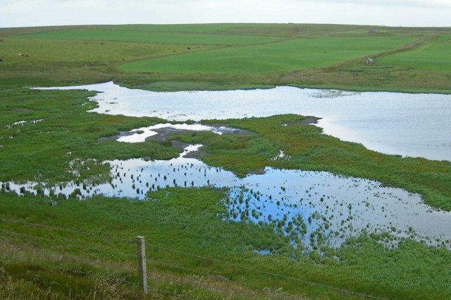
This water body was not shown on the 1840 survey map of the island, since it is a man-made creation from a damming in the 1880s.G.T, Masters, ''Orkney, Approaches to Kirkwall'', HMS official survey map, 1840-1843 Mill Dam is fed by a stream flowing from the north that rises on the western lobe of Shapinsay. The pH levels of the outflow stream of Mill Dam are moderately alkaline, in the range of 9.18. The Mill Dam wetland is a significant bird habitat and is owned and managed by the Royal Society for the Protection of Birds
The Royal Society for the Protection of Birds (RSPB) is a charitable organisation registered in England and Wales and in Scotland. It was founded in 1889. It works to promote conservation and protection of birds and the wider environment thr ...
.
See also
*Balfour Castle
Balfour Castle is a historic building on the southwest of Shapinsay, Orkney Islands. Though built around an older structure that dates at least from the 18th century, the present castle was built in 1847, commissioned by Colonel David Balfour, ...
* Burroughston Broch
*The Ouse
The Ouse is a tidal estuary in northern Shapinsay, Orkney Islands. This water body has been shown on early maps of the island in a very similar shape to its current geometry. The Ouse is fed by small rivulets and upland springs that rise on the ...
* Vasa Loch
Footnotes
External links
Shapinsay Island, Orkney
Dams in Scotland Wetlands of Scotland Landforms of Orkney Shapinsay Royal Society for the Protection of Birds reserves in Scotland {{Orkney-geo-stub