Military Demarcation Line (Korea) on:
[Wikipedia]
[Google]
[Amazon]
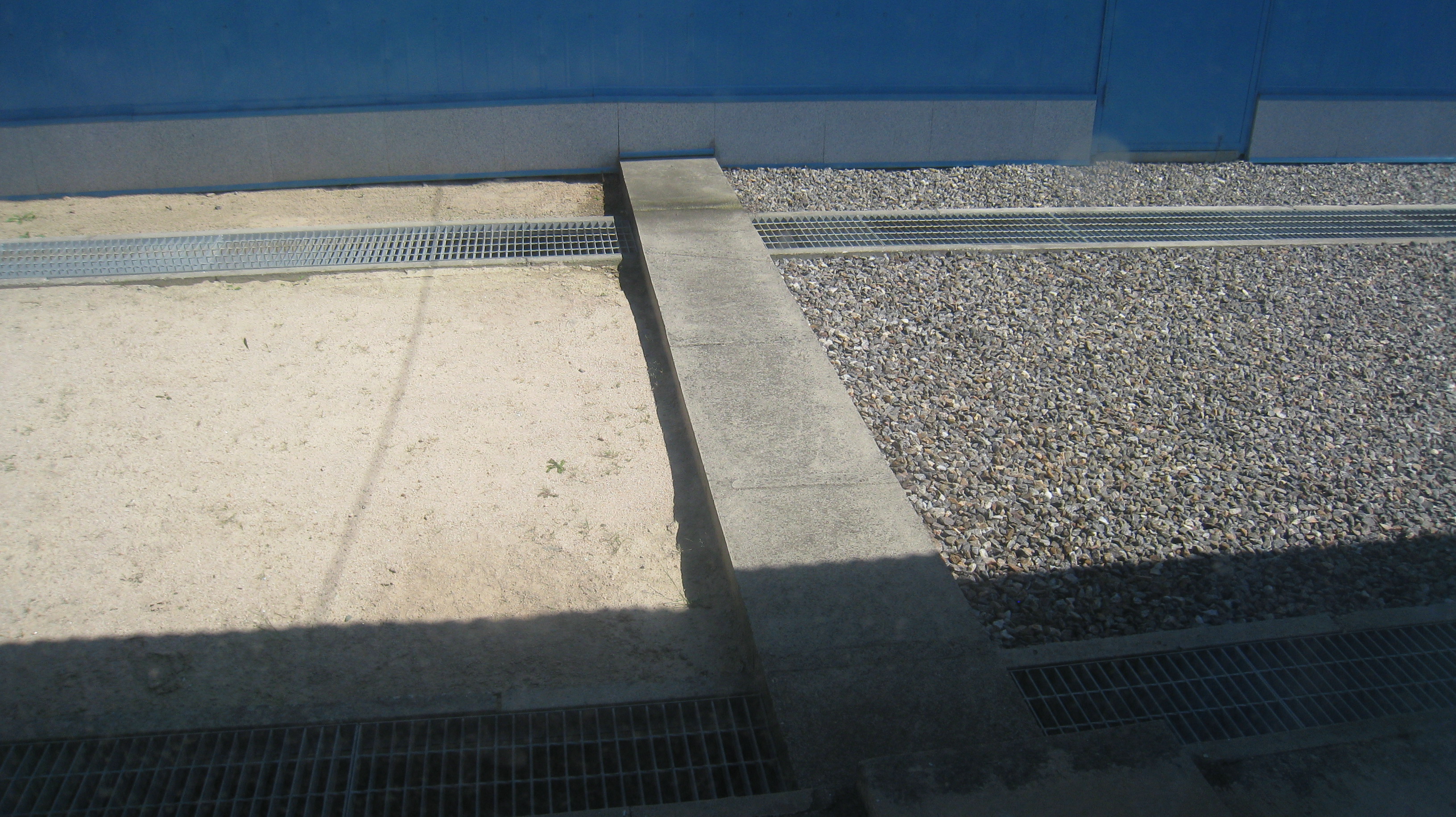
 The Military Demarcation Line (MDL), sometimes referred to as the Armistice Line, is the land border or demarcation line between


 The DMZ runs near the 38th parallel, covering roughly .
 Although the
''The Hankyoreh'' (ROK). October 15, 2007. The Korean Armistice Agreement (KAA) provisions regarding the MDL and DMZ do not extend into the Yellow Sea or Sea of Japan. In 1999, North Korea unilaterally asserted its own "North Korean Military Demarcation Line in the West Sea (Yellow Sea)", also called the "Inter-Korean MDL in the Yellow Sea"."NLL—Controversial Sea Border Between S.Korea, DPRK, "
''People's Daily'' (PRC), 2002-11-21; retrieved 2010-11-26. Nonetheless, the UNC-drawn line functions as a ''de facto'' or "practical" extension of the 1953 MDL, despite occasional incursions and clashes.
OCLC 237388400
* Pak, Hŭi-gwŏn. (2000). ''The Law of the Sea and Northeast Asia: a Challenge for Cooperation.'' Boston: Kluwer Law International.
OCLC 154667938
* Van Dyke, Jon M., Mark J. Valencia and Jenny Miller Garmendia
"The North/South Korea Boundary Dispute in the Yellow (West) Sea,"
''Marine Policy'' 27 (2003), 143–158. * Zou, Keyuan Zou. (2005). ''Law of the Sea in East Asia: Issues and Prospects.'' London: Routledge.
OCLC 55960798
{{Borders of North Korea Korean Demilitarized Zone North Korea–South Korea border Aftermath of the Korean War International borders
North Korea
North Korea, officially the Democratic People's Republic of Korea (DPRK), is a country in East Asia. It constitutes the northern half of the Korean Peninsula and shares borders with China and Russia to the north, at the Yalu (Amnok) and T ...
and South Korea
South Korea, officially the Republic of Korea (ROK), is a country in East Asia, constituting the southern part of the Korea, Korean Peninsula and sharing a Korean Demilitarized Zone, land border with North Korea. Its western border is formed ...
. On either side of the line is the Korean Demilitarized Zone (DMZ). The MDL and DMZ were established by the Armistice
An armistice is a formal agreement of warring parties to stop fighting. It is not necessarily the end of a war, as it may constitute only a cessation of hostilities while an attempt is made to negotiate a lasting peace. It is derived from the ...
.
In the Yellow Sea, the two Koreas are divided by a ''de facto'' maritime "military demarcation line" and maritime boundary called the Northern Limit Line
The Northern Limit Line or North Limit Line (NLL) – 북방한계선 (in ROK) – is a disputed maritime demarcation line in the Yellow (West) Sea between the Democratic People's Republic of Korea (DPRK) on the north, and the Republic of K ...
(NLL) drawn by the United Nations Command
United Nations Command (UNC or UN Command) is the multinational military force established to support the Republic of Korea (South Korea) during and after the Korean War. It was the first international unified command in history, and the first ...
in 1953. The NLL is not described by the Korean Armistice Agreement.
Demarcation on land


 The DMZ runs near the 38th parallel, covering roughly .
 American
American(s) may refer to:
* American, something of, from, or related to the United States of America, commonly known as the "United States" or "America"
** Americans, citizens and nationals of the United States of America
** American ancestry, pe ...
and South Korea
South Korea, officially the Republic of Korea (ROK), is a country in East Asia, constituting the southern part of the Korea, Korean Peninsula and sharing a Korean Demilitarized Zone, land border with North Korea. Its western border is formed ...
n soldiers patrol this line along the South Korean side while North Korea
North Korea, officially the Democratic People's Republic of Korea (DPRK), is a country in East Asia. It constitutes the northern half of the Korean Peninsula and shares borders with China and Russia to the north, at the Yalu (Amnok) and T ...
n soldiers patrol along the North Korean side.
In Korean, the line is called the ''Hyujeonseon'' (휴전선), meaning "armistice line." It is also sometimes called the ''Gunsa Bungye-seon'' (군사분계선), which literally means "military demarcation line." However, in colloquial usage, the dividing line is more often called the ''Sampalseon'' (삼팔선, " 38th parallel"), a name likely coined at the end of World War II, when it would have been an accurate description of the North-South border.
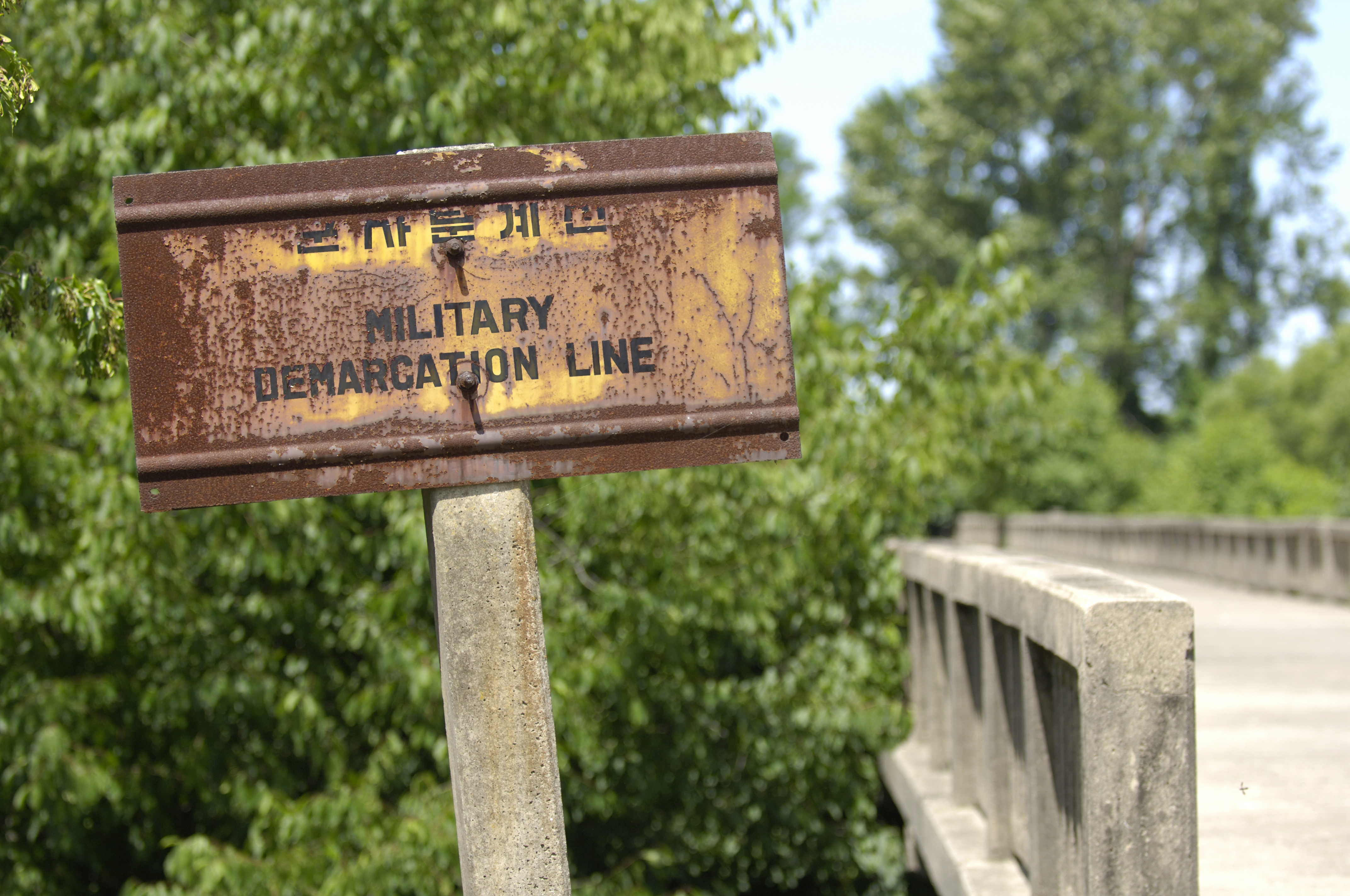
The line itself is marked off by a series of 1,292 identical signs which are placed at intervals across the peninsula. The north facing side of the signs are written in Korean and Chinese, and in Korean and English on the south facing side. The signs are now aging and rusting.
Military incidents
There have been frequent skirmishes along the line since the armistice ended the fighting of theKorean War
{{Infobox military conflict
, conflict = Korean War
, partof = the Cold War and the Korean conflict
, image = Korean War Montage 2.png
, image_size = 300px
, caption = Clockwise from top:{ ...
.
Northern Limit Line
Korean Armistice Agreement
The Korean Armistice Agreement ( ko, 한국정전협정 / 조선정전협정; zh, t=韓國停戰協定 / 朝鮮停戰協定) is an armistice that brought about a complete cessation of hostilities of the Korean War. It was signed by United S ...
specifies where the demarcation line and demilitarized zone are located on land, the agreement does not mention lines or zones in adjacent ocean waters. Shortly after the signing of the Armistice, a line in the sea was drawn unilaterally by the United Nations Command (UNC). This Northern Limit Line or North Limit Line (NLL) represented the northern limit of the area in which South Korea permits its vessels to navigate, not a demarcation line on which the two Koreas agreed. "Modern meaning of Korea’s maritime line,"''The Hankyoreh'' (ROK). October 15, 2007. The Korean Armistice Agreement (KAA) provisions regarding the MDL and DMZ do not extend into the Yellow Sea or Sea of Japan. In 1999, North Korea unilaterally asserted its own "North Korean Military Demarcation Line in the West Sea (Yellow Sea)", also called the "Inter-Korean MDL in the Yellow Sea"."NLL—Controversial Sea Border Between S.Korea, DPRK, "
''People's Daily'' (PRC), 2002-11-21; retrieved 2010-11-26. Nonetheless, the UNC-drawn line functions as a ''de facto'' or "practical" extension of the 1953 MDL, despite occasional incursions and clashes.
Joint Security Area crossing
On October 16, 2018, the governments of North and South Korea agreed to allow locals and tourists to cross the Military Demarcation Line's infamous Joint Security Area location once it is cleared of personnel. The crossings will resemble the brief moment South Korean President Moon Jae-in stepped into North Korea with North Korean ChairmanKim Jong-un
Kim Jong-un (; , ; born 8 January 1982) is a North Korean politician who has been Supreme Leader of North Korea since 2011 and the leader of the Workers' Party of Korea (WPK) since 2012. He is a son of Kim Jong-il, who was North Korea's sec ...
on April 27, 2018. After the Joint Security Area was cleared of armed military personnel on October 25, 2018, it was announced that tourism at the MDL crossing would be delayed.
Establishment of buffer zones, no-fly zones and Yellow Sea peace zones
On November 1, 2018, officials from the South Korean Ministry of Defense confirmed that buffer zones were established across the DMZ by the North and South Korean militaries to ensure that both militaries would keep their distance from the Military Demarcation Line (MDL). In compliance with the Comprehensive Military Agreement which was signed at the September 2018 inter-Korean summit, the buffer zones help ensure that both Koreas will ban hostility on land, air and sea. The buffer zones stretch from the north of Deokjeok Island to the south of Cho Island in the West Sea and the north of Sokcho city and south of Tongchon County in the East (Yellow) Sea. Both North and South Korea are prohibited from conducting live-fire artillery drills and regiment-level field maneuvering exercises or those by bigger units within 5 kilometers of the MDL.https://www.ncnk.org/sites/default/files/Agreement%20on%20the%20Implementation%20of%20the%20Historic%20Panmunjom%20Declaration%20in%20the%20Military%20Domain.pdf No-fly zones have also been established along the DMZ to ban the operation of drones, helicopters and other aircraft over an area up to 40 km away from the MDL. For UAVs, the no-fly zone is 15 km from the MDL in the East and 10 km from the MDL in the West. For hot-air balloons, the zone is within 25 km from the MDL. For fixed-wing aircraft, no fly zones are designated within 40 km from the MDL in the East (between MDL Markers No. 0646 and 1292) and within 20 km of the MDL in the West (between MDL Markers No. 0001 and 0646). For rotary-wing aircraft, the no fly zones are designated within 10 km of the MDL. Both Koreas also established "peace zones" in the area of the Yellow Sea which borders the MDL as well.Reconnecting of MDL-crossing road
On November 22, 2018, North and South Korea completed construction to connect a three kilometer road along the DMZ. The road, which travels across the MDL, has 1.7 km in South Korea and 1.3 km in North Korea. The road was reconnected for the first time in 14 years in an effort to assist with a process at the DMZ's Arrowhead Hill involving the removal of landmines and exhumation of Korean War remains.Inter-Korean transportation services
On November 30, 2018, following the removal of the "frontline" guard posts and Arrowhead Hill landmines, railroad transportation between North and South Korea which ceased in November 2008 resumed when a South Korean train crossed the MDL into North Korea. On December 8, 2018, a South Korean bus crossed the MDL into North Korea.Military border crossing
On December 12, 2018, militaries from both Koreas crossed the MDL into the opposition countries for the first time in history to verify the removal of "frontline" guard posts.See also
*Division of Korea
The division of Korea began with the defeat of Japan in World War II. During the war, the Allied leaders considered the question of Korea's future after Japan's surrender in the war. The leaders reached an understanding that Korea would be ...
* Panmunjom
Panmunjom, also known as Panmunjeom, now located in Paju, Gyeonggi Province, South Korea or Kaesong, North Hwanghae Province, North Korea, was a village just north of the ''de facto'' border between North and South Korea, where the 1953 Korean A ...
* Camp Bonifas
* Aftermath of the Korean War
Notes
References
* Lee, Hy-Sang Lee. (2001). ''North Korea: a Strange Socialist Fortress.'' Westport, Connecticut: Praeger.OCLC 237388400
* Pak, Hŭi-gwŏn. (2000). ''The Law of the Sea and Northeast Asia: a Challenge for Cooperation.'' Boston: Kluwer Law International.
OCLC 154667938
* Van Dyke, Jon M., Mark J. Valencia and Jenny Miller Garmendia
"The North/South Korea Boundary Dispute in the Yellow (West) Sea,"
''Marine Policy'' 27 (2003), 143–158. * Zou, Keyuan Zou. (2005). ''Law of the Sea in East Asia: Issues and Prospects.'' London: Routledge.
OCLC 55960798
{{Borders of North Korea Korean Demilitarized Zone North Korea–South Korea border Aftermath of the Korean War International borders