Mid Somerset Hills on:
[Wikipedia]
[Google]
[Amazon]
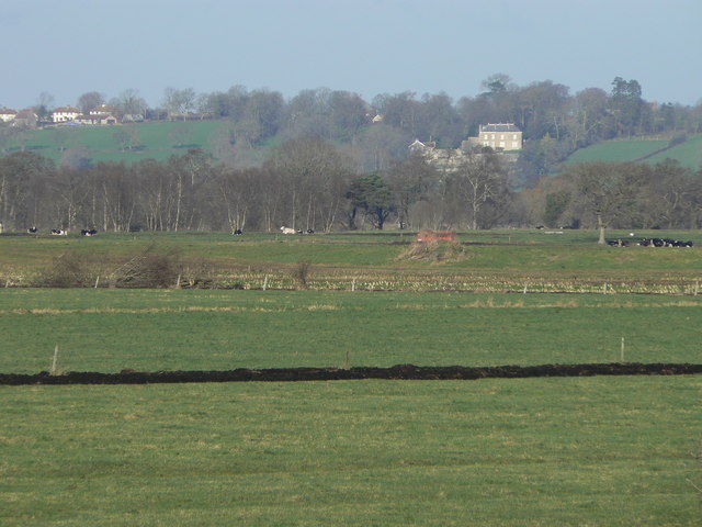
 The Mid Somerset Hills are a major natural region in the county of Somerset in southwest west England, forming a series of low hills and ridges that divide up the Somerset Levels.
The region is listed as National Character Area 143 by Natural England, the UK government's advisor on the natural environment. Its irregularly shaped area covers and runs from Staple Fitzpaine and Ashill, Somerset, Ashill in the southwest to just south of Wells, Somerset, Wells and Shepton Mallet in the northeast. The towns of Glastonbury and Street lie partly within this region. To the west are the Somerset Levels and Moors, the Vale of Taunton and Quantock Fringes, to the north the Mendip Hills, Mendips rise steeply from the flat landscape, to the east and south are the Yeovil Scarplands and to the southwest are the Blackdown Hills.
The Mid Somerset Hills send four fingers of higher land into the Levels. The northernmost finger, between the rivers River Axe (Bristol Channel), Axe and River Brue, Brue, ends in the Isle of Wedmore, the next only extends as far as Glastonbury, the third ridge – the Polden Hills – reaches nearly as far as Bridgwater, while the southernmost "thumb" surrounds Somerton, Somerset, Somerton. A further area of hills is centred on Curry Mallet and is drained by the rivers River Tone, Tone and River Isle, Isle.
The Mid Somerset Hills are a major natural region in the county of Somerset in southwest west England, forming a series of low hills and ridges that divide up the Somerset Levels.
The region is listed as National Character Area 143 by Natural England, the UK government's advisor on the natural environment. Its irregularly shaped area covers and runs from Staple Fitzpaine and Ashill, Somerset, Ashill in the southwest to just south of Wells, Somerset, Wells and Shepton Mallet in the northeast. The towns of Glastonbury and Street lie partly within this region. To the west are the Somerset Levels and Moors, the Vale of Taunton and Quantock Fringes, to the north the Mendip Hills, Mendips rise steeply from the flat landscape, to the east and south are the Yeovil Scarplands and to the southwest are the Blackdown Hills.
The Mid Somerset Hills send four fingers of higher land into the Levels. The northernmost finger, between the rivers River Axe (Bristol Channel), Axe and River Brue, Brue, ends in the Isle of Wedmore, the next only extends as far as Glastonbury, the third ridge – the Polden Hills – reaches nearly as far as Bridgwater, while the southernmost "thumb" surrounds Somerton, Somerset, Somerton. A further area of hills is centred on Curry Mallet and is drained by the rivers River Tone, Tone and River Isle, Isle.''Somerset Levels and Moors/Mid Somerset Hills - Character Area 142/3''
at www.naturalengland.org.uk. Accessed on 6 Apr 2013.
 The Mid Somerset Hills are a major natural region in the county of Somerset in southwest west England, forming a series of low hills and ridges that divide up the Somerset Levels.
The region is listed as National Character Area 143 by Natural England, the UK government's advisor on the natural environment. Its irregularly shaped area covers and runs from Staple Fitzpaine and Ashill, Somerset, Ashill in the southwest to just south of Wells, Somerset, Wells and Shepton Mallet in the northeast. The towns of Glastonbury and Street lie partly within this region. To the west are the Somerset Levels and Moors, the Vale of Taunton and Quantock Fringes, to the north the Mendip Hills, Mendips rise steeply from the flat landscape, to the east and south are the Yeovil Scarplands and to the southwest are the Blackdown Hills.
The Mid Somerset Hills send four fingers of higher land into the Levels. The northernmost finger, between the rivers River Axe (Bristol Channel), Axe and River Brue, Brue, ends in the Isle of Wedmore, the next only extends as far as Glastonbury, the third ridge – the Polden Hills – reaches nearly as far as Bridgwater, while the southernmost "thumb" surrounds Somerton, Somerset, Somerton. A further area of hills is centred on Curry Mallet and is drained by the rivers River Tone, Tone and River Isle, Isle.
The Mid Somerset Hills are a major natural region in the county of Somerset in southwest west England, forming a series of low hills and ridges that divide up the Somerset Levels.
The region is listed as National Character Area 143 by Natural England, the UK government's advisor on the natural environment. Its irregularly shaped area covers and runs from Staple Fitzpaine and Ashill, Somerset, Ashill in the southwest to just south of Wells, Somerset, Wells and Shepton Mallet in the northeast. The towns of Glastonbury and Street lie partly within this region. To the west are the Somerset Levels and Moors, the Vale of Taunton and Quantock Fringes, to the north the Mendip Hills, Mendips rise steeply from the flat landscape, to the east and south are the Yeovil Scarplands and to the southwest are the Blackdown Hills.
The Mid Somerset Hills send four fingers of higher land into the Levels. The northernmost finger, between the rivers River Axe (Bristol Channel), Axe and River Brue, Brue, ends in the Isle of Wedmore, the next only extends as far as Glastonbury, the third ridge – the Polden Hills – reaches nearly as far as Bridgwater, while the southernmost "thumb" surrounds Somerton, Somerset, Somerton. A further area of hills is centred on Curry Mallet and is drained by the rivers River Tone, Tone and River Isle, Isle.at www.naturalengland.org.uk. Accessed on 6 Apr 2013.
References
Geography of Somerset Natural regions of England {{Somerset-geo-stub