Lyle Hill on:
[Wikipedia]
[Google]
[Amazon]
 Lyle Hill stands at the West End of Greenock in
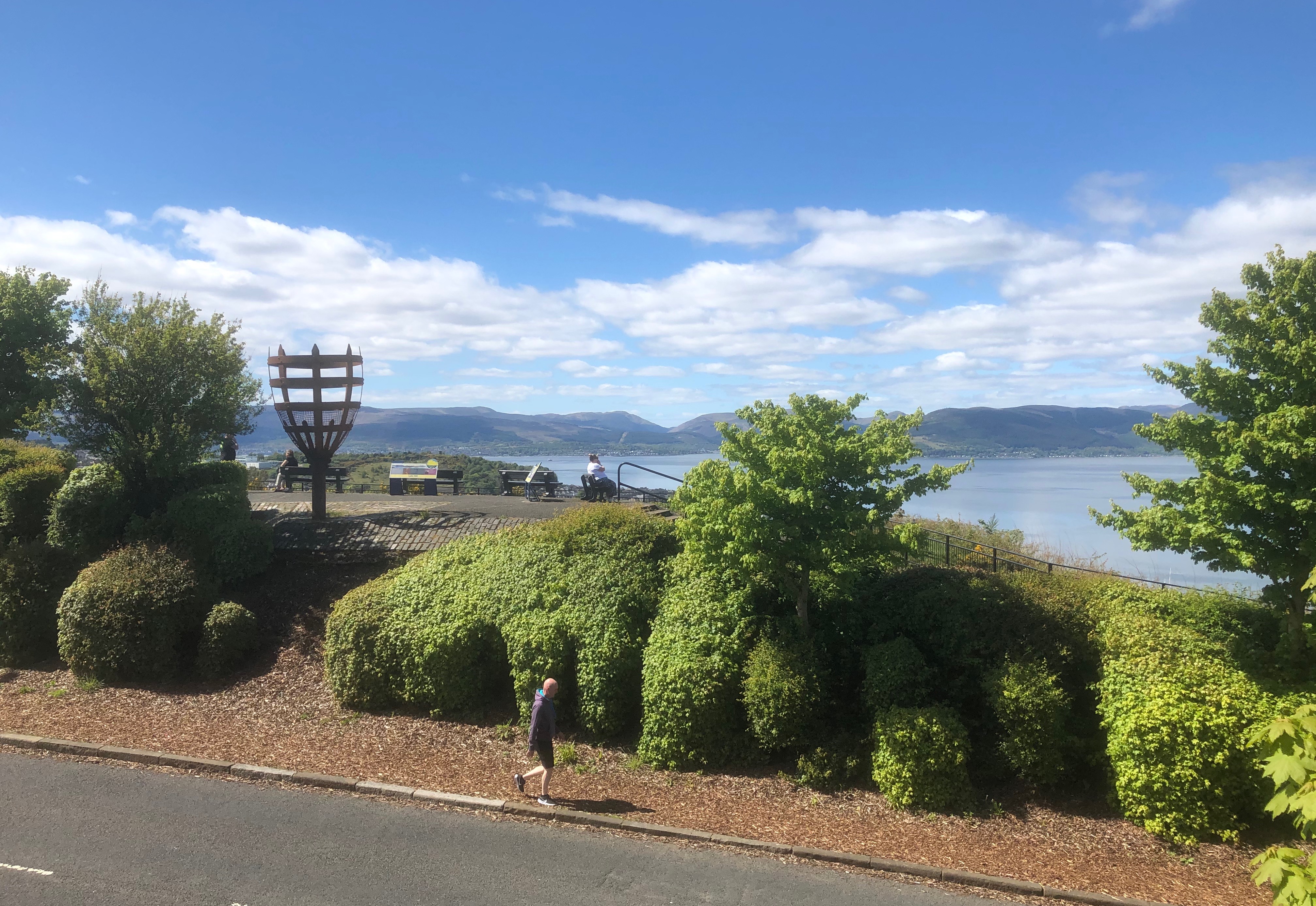
  Adjacent to the highest point of the road, a scenic viewpoint looks out over
 The hill was at one time known as the Craigs or Craigs Top, the Bingens, Mount Binian or Binnan's Hill. Spellings included the Binghans, Bingans, Bingins, Bingens, and Binyans, and it was suggested that this came from the Gaelic ''Binneans'' with the meaning of little hills. The Reform Act 1832 plan of Greenock shows ''Craigs Top'', with ''Craigs Farm House'' to its east, as does an 1842 map of "Greenock and its environs" though it uses the term '' Farm Steading''.
From 1856 onwards, large scale
  John Thomson's 1832 Atlas of Scotland depicts the mass of the hill. The word ''Cadelhills'', across its southern part, was the name of a house and its garden, now in the grounds of Greenock Crematorium.
A study of the early cartography of
 Greenock expanded to the west on a grid plan. There was severe
 Lyle Road was built to an average
 Two ministers from St Andrews were ordained in 1873 at Greenock churches, the Mid Kirk and the Old West Kirk, and brought their
  During
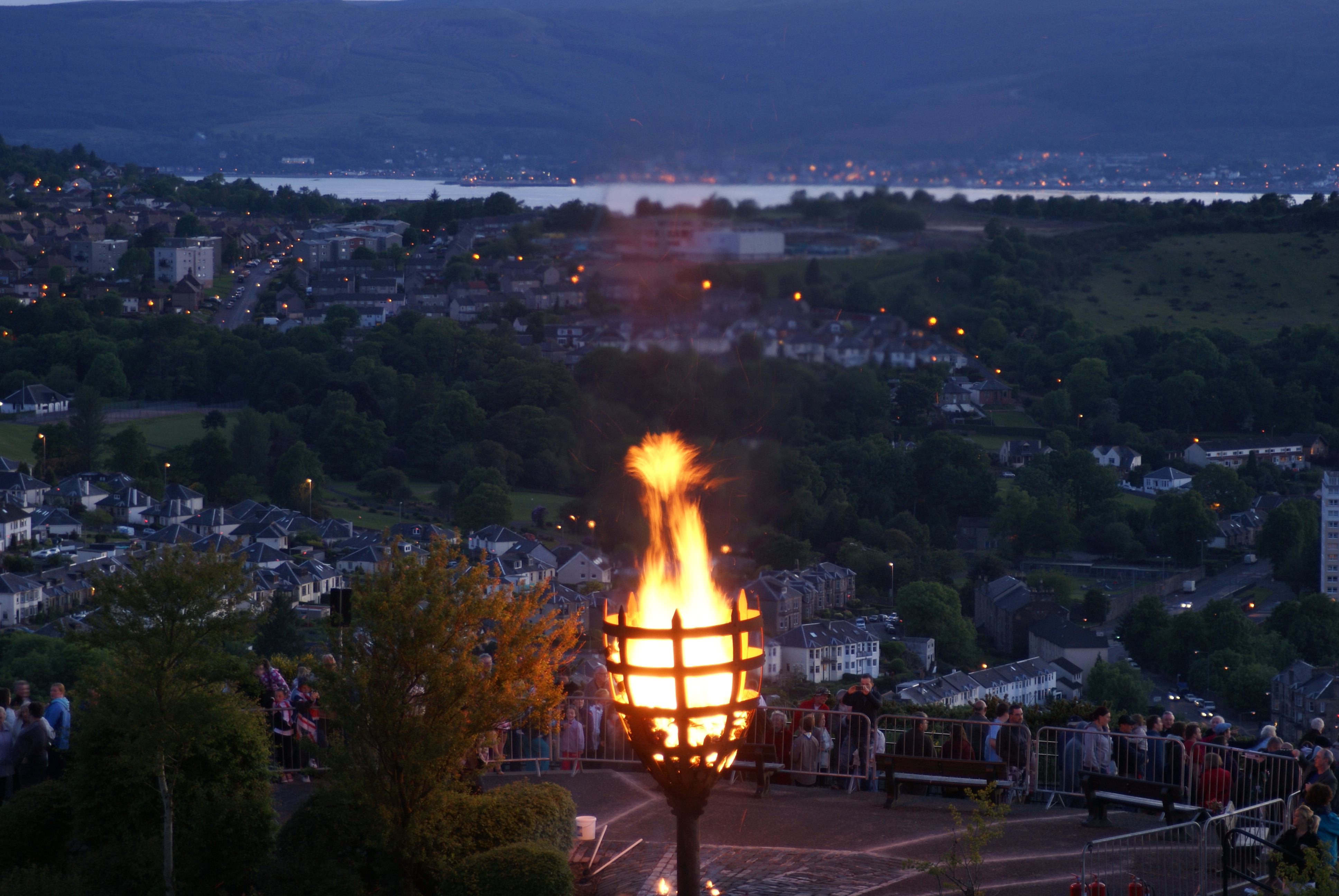 To mark the
 Viewpoints provide panoramic views across the Clyde. The hill overlooks
  Immediately to the north of the hill Greenock's Battery Park provides level playing fields, bounded on the west by Gourock's Cardwell Bay and on the east by the former torpedo factory, now occupied by warehousing and a housing development, and the
 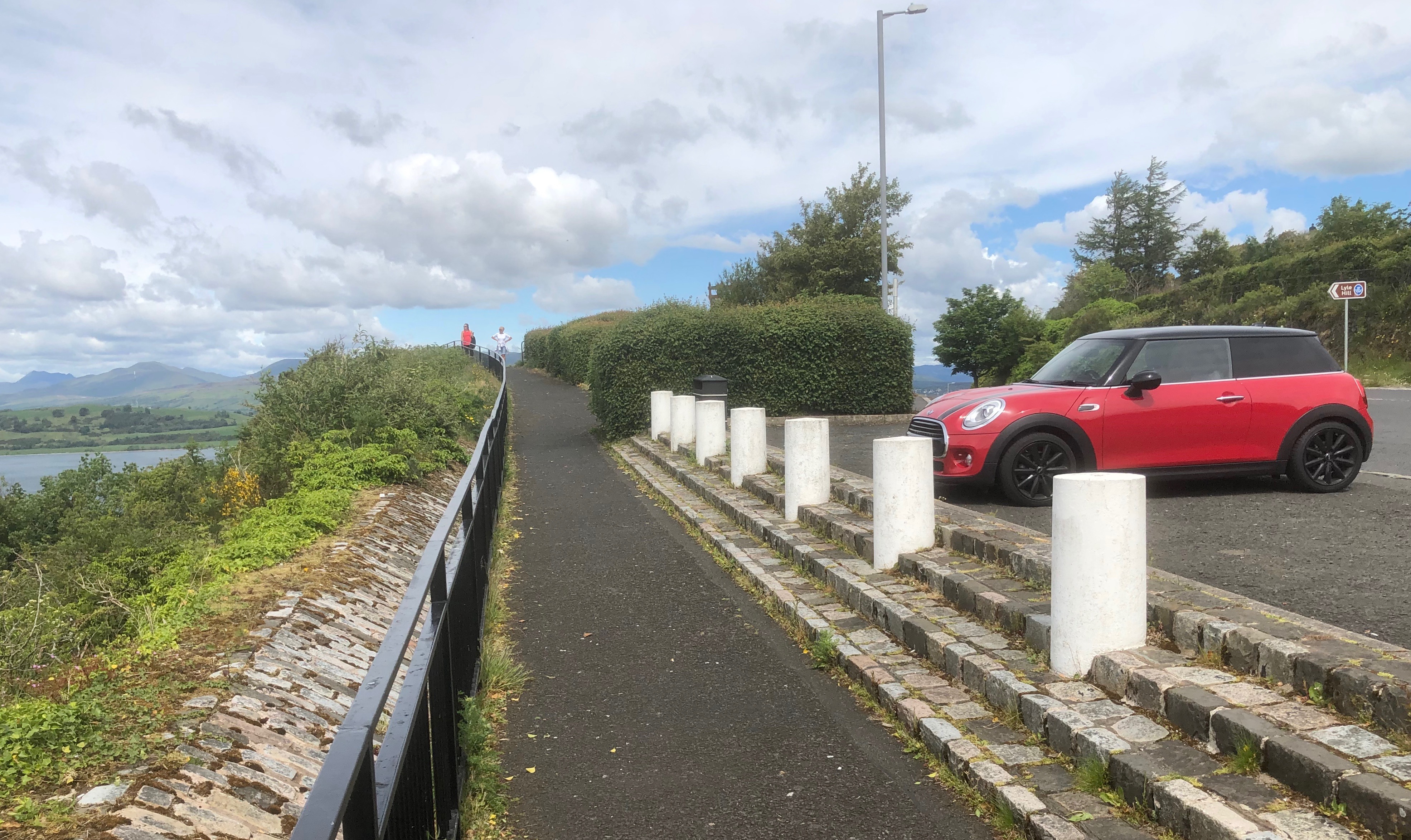 The viewpoint is marked by a

Inverclyde
Inverclyde ( sco, Inerclyde, gd, Inbhir Chluaidh, , "mouth of the Clyde") is one of 32 council areas used for local government in Scotland. Together with the East Renfrewshire and Renfrewshire council areas, Inverclyde forms part of the hist ...
, Scotland
Scotland (, ) is a Countries of the United Kingdom, country that is part of the United Kingdom. Covering the northern third of the island of Great Britain, mainland Scotland has a Anglo-Scottish border, border with England to the southeast ...
. It has scenic viewpoints accessible from Lyle Road, which was constructed in 1879–1880 and named after Provost Abram Lyle
Abram Lyle (14 December 1820 – 30 April 1891) is noted for founding the sugar refiners '' Abram Lyle & Sons'' which merged with the company of his rival Henry Tate to become Tate & Lyle in 1921.
Early life
He was born on 14 December 1820 i ...
, well known as a sugar refiner. The hill's highest point is Craigs Top at 426 feet (130 m) above sea level
Mean sea level (MSL, often shortened to sea level) is an average surface level of one or more among Earth's coastal bodies of water from which heights such as elevation may be measured. The global MSL is a type of vertical datuma standardise ...
, and before the road was constructed the hill was known as the Craigs, or as the Bingens (with various spellings).
 Adjacent to the highest point of the road, a scenic viewpoint looks out over
 Gourock
Gourock ( ; gd, Guireag ) is a town in the Inverclyde council area and formerly a burgh of the County of Renfrew in the west of Scotland. It was a seaside resort on the East shore of the upper Firth of Clyde. Its main function today is as a ...
and the Firth of Clyde
The Firth of Clyde is the mouth of the River Clyde. It is located on the west coast of Scotland and constitutes the deepest coastal waters in the British Isles (it is 164 metres deep at its deepest). The firth is sheltered from the Atlantic ...
to Cowal
Cowal ( gd, Còmhghall) is a peninsula in Argyll and Bute, in the west of Scotland, that extends into the Firth of Clyde.
The northern part of the peninsula is covered by the Argyll Forest Park managed by Forestry and Land Scotland. The Arroch ...
in the west, and north over the Fort Matilda area of Greenock to Argyll
Argyll (; archaically Argyle, in modern Gaelic, ), sometimes called Argyllshire, is a historic county and registration county of western Scotland.
Argyll is of ancient origin, and corresponds to most of the part of the ancient kingdom of ...
across the Clyde. There are benches, information points, and a beacon
A beacon is an intentionally conspicuous device designed to attract attention to a specific location. A common example is the lighthouse, which draws attention to a fixed point that can be used to navigate around obstacles or into port. More mode ...
which is lit on significant occasions. Car parking spaces give views to the west, and a short distance further down the road the Free French Memorial is in the shape of the Cross of Lorraine
The Cross of Lorraine (french: Croix de Lorraine, link=no), known as the Cross of Anjou in the 16th century, is a heraldic two-barred cross, consisting of a vertical line crossed by two shorter horizontal bars. In most renditions, the horizon ...
combined with an anchor. Across the road, steps and a rough path lead up to a viewpoint at Craigs Top with views up the River Clyde as far as Glasgow
Glasgow ( ; sco, Glesca or ; gd, Glaschu ) is the most populous city in Scotland and the fourth-most populous city in the United Kingdom, as well as being the 27th largest city by population in Europe. In 2020, it had an estimated popul ...
.
History and name
 The hill was at one time known as the Craigs or Craigs Top, the Bingens, Mount Binian or Binnan's Hill. Spellings included the Binghans, Bingans, Bingins, Bingens, and Binyans, and it was suggested that this came from the Gaelic ''Binneans'' with the meaning of little hills. The Reform Act 1832 plan of Greenock shows ''Craigs Top'', with ''Craigs Farm House'' to its east, as does an 1842 map of "Greenock and its environs" though it uses the term '' Farm Steading''.
From 1856 onwards, large scale
 Ordnance Survey
Ordnance Survey (OS) is the national mapping agency for Great Britain. The agency's name indicates its original military purpose (see ordnance and surveying), which was to map Scotland in the wake of the Jacobite rising of 1745. There was a ...
maps show ''Craigs Top'', with ''Craigs'' farm about to the east. They also show Bow Hill to the south, but do not give any other name to the northern part of the hill. Admiralty charts from 1850 on show ''Binian Peak'' or ''Mt. Binian'', after 1915 they show Craigs Top with Mt. Binian as a supplementary name, after 1932 just Craigs Top.
 John Thomson's 1832 Atlas of Scotland depicts the mass of the hill. The word ''Cadelhills'', across its southern part, was the name of a house and its garden, now in the grounds of Greenock Crematorium.
A study of the early cartography of
 Renfrewshire
Renfrewshire () ( sco, Renfrewshire; gd, Siorrachd Rinn Friù) is one of the 32 council areas of Scotland.
Located in the west central Lowlands, it is one of three council areas contained within the boundaries of the historic county of Re ...
states that the name "Lyle's Hill" appears on James Knox's 1836 ''Map of the Basin of the Clyde'', but does not give any detail of the location of this hill. There is a "Lyles Hill" in the Muirsheil area shown on John Ainslie
A plaque in Castlegate in Jedburgh
John Ainslie (22 April 1745 – 29 February 1828) was a Scottish surveyor and cartographer.
Life
Ainslie was born in Jedburgh, the youngest son of John Ainslie, a druggist, Writer to the Signet and burgess of ...
's 1800 map of Renfrewshire to the east of the River Calder, Note: this does not identify the hill to the west of Greenock, but names buildings as Craigs Bank or Park (writing is unclear) which could be Craigs Farm. on large scale Ordnance Survey maps it is shown about north west of Windy Hill.,
John Marius Wilson
John Marius Wilson (c. 1805–1885) was a British writer and an editor, most notable for his gazetteer
A gazetteer is a geographical index or directory used in conjunction with a map or atlas.Aurousseau, 61. It typically contains informati ...
in his 1860 ''Hand-Book To Scotland: For Tourists'' described the "small modern fortification" of Fort Matilda as set "on a point of land projecting from the base of Binnan's Hill", and said that "Binnan's Hill rises behind it with precipitous crest, and commands a fine view of the Clyde from Dumbarton to Dunoon."
Lyle Road
 Greenock expanded to the west on a grid plan. There was severe
 unemployment
Unemployment, according to the OECD (Organisation for Economic Co-operation and Development), is people above a specified age (usually 15) not being in paid employment or self-employment but currently available for work during the refere ...
in the town during the Long Depression
The Long Depression was a worldwide price and economic recession, beginning in 1873 and running either through March 1879, or 1896, depending on the metrics used. It was most severe in Europe and the United States, which had been experiencing st ...
, and in late 1878 the Police Board
A police board is an appointed form of local government charged with the responsibility of overseeing a local police force.
In the United States, the term is used for some police departments. For example, the Chicago Police Board oversees the Ch ...
resolved to provide work by building a road or carriage drive to the Craigs or Bingens from the west end of Finnart Street, where it meets Madeira Street. The Streets Committee agreed in January 1879 to name it Lyle Road, after Abram Lyle
Abram Lyle (14 December 1820 – 30 April 1891) is noted for founding the sugar refiners '' Abram Lyle & Sons'' which merged with the company of his rival Henry Tate to become Tate & Lyle in 1921.
Early life
He was born on 14 December 1820 i ...
who was then the town's Provost. He inherited a Greenock cooperage business, and in 1865 had co-founded a sugar refining partnership at the Glebe refinery (visible from the start of Lyle Road). The number of men and boys employed on the road construction varied from 250 to 400. The completed road extended westwards down to the Gourock toll at the junction of the high and low roads to Gourock, and was formally opened on 1 May 1880.

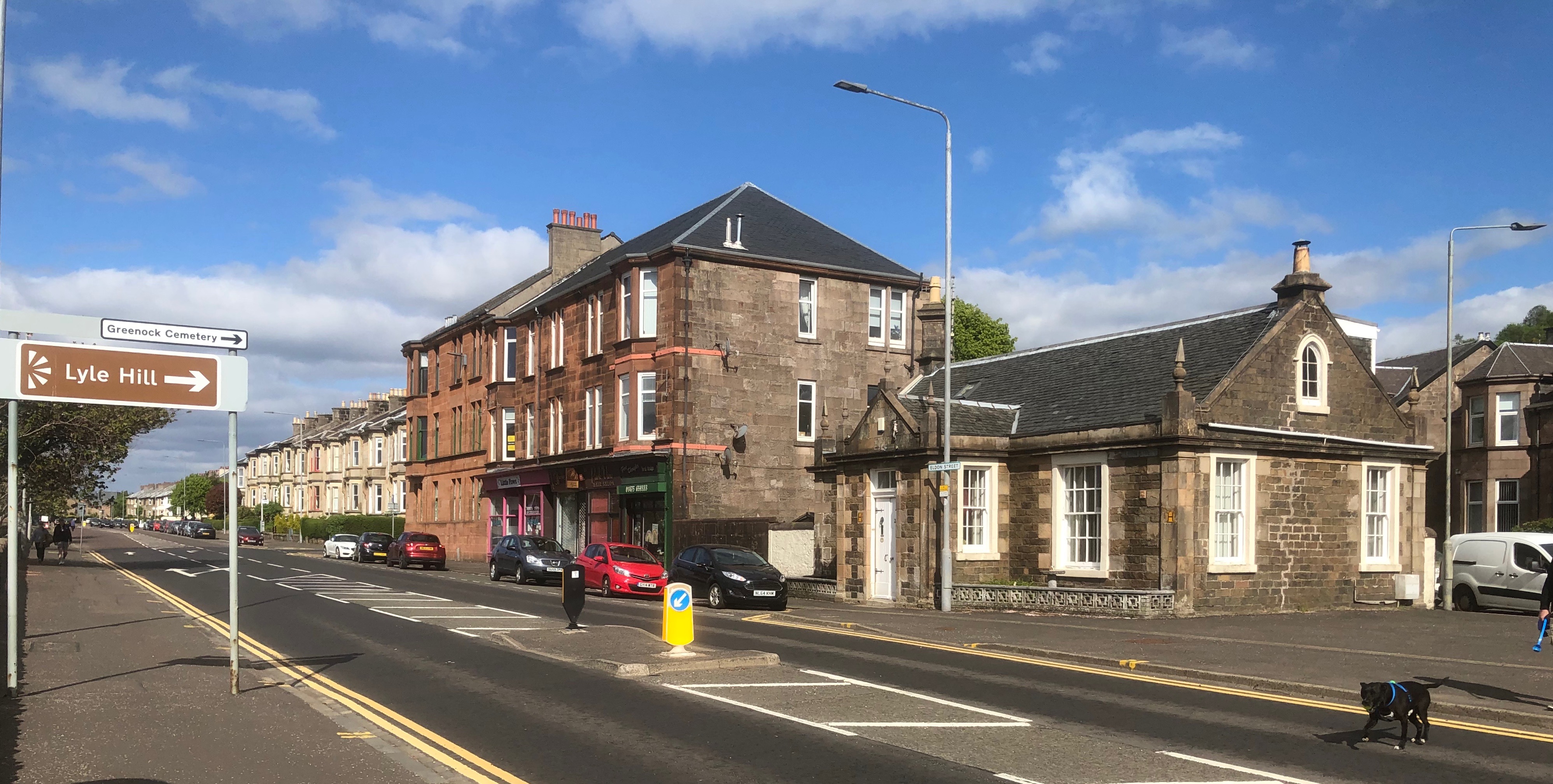
 Lyle Road was built to an average
 gradient
In vector calculus, the gradient of a scalar-valued differentiable function of several variables is the vector field (or vector-valued function) \nabla f whose value at a point p is the "direction and rate of fastest increase". If the gr ...
of 1 in 10. The maximum gradient is between 1 in 5 and 1 in 7 (14% and 20%), the steepest point being at the 50m contour, just above the hairpin bends at the west side of the road. The distance along it heading west from Madiera Street to the Gourock toll is . Its high point at above sea level is near Craigs Top (), which a Canadian wit proposed should be renamed "The Heights of Abram". The Lyle family sold its share in the Glebe refinery to other partners in 1880, and with the funds bought land at Plaistow near London to start the Abram Lyle & Sons refinery, not far from the Silvertown
Silvertown is a district in the London Borough of Newham, in east London, England. It lies on the north bank of the Thames and was historically part of the parishes of West Ham and East Ham, hundred of Becontree, and the historic county ...
refinery of Henry Tate
Sir Henry Tate, 1st Baronet (11 March 18195 December 1899) was an English sugar merchant and philanthropist, noted for establishing the Tate Gallery in London.
Life and career
Born in White Coppice, a hamlet near Chorley, Lancashire, Tate was ...
& Sons. In 1921 their successors merged to form Tate & Lyle
Tate & Lyle PLC is a British-headquartered, global supplier of food and beverage ingredients to industrial markets. It was originally a sugar refining business, but from the 1970s it began to diversify, eventually divesting its sugar business i ...
.
From 1863 onwards, the Caledonian Railway
The Caledonian Railway (CR) was a major Scottish railway company. It was formed in the early 19th century with the objective of forming a link between English railways and Glasgow. It progressively extended its network and reached Edinburgh an ...
and the Greenock and Ayrshire Railway sought approval for rival schemes taking various routes for a connection to Gourock. In 1883 the House of Lords
The House of Lords, also known as the House of Peers, is the upper house of the Parliament of the United Kingdom. Membership is by appointment, heredity or official function. Like the House of Commons, it meets in the Palace of Westminste ...
committee decided in favour of a Caledonian Railway scheme, and their railway opened in 1889. It runs in a bored tunnel directly under Newton Street, the next street to the south parallel with Finnart Street, diverging where Newton Street bends west into Lyle Road. Houses eventually developed along Newton Street a short distance past this bend: the length of Lyle Road from these houses to the junction with Eldon Street is approximately . The railway tunnel ends in the Fort Matilda area, and a short distance to the west of Fort Matilda station an iron railway bridge takes the line over Lyle Road, on its way to Gourock station and pierhead.
Recreation, wartime and commemoration
 Two ministers from St Andrews were ordained in 1873 at Greenock churches, the Mid Kirk and the Old West Kirk, and brought their
 golf club
A golf club is a club used to hit a golf ball in a game of golf. Each club is composed of a shaft with a grip and a club head. Woods are mainly used for long-distance fairway or tee shots; irons, the most versatile class, are used for a variety ...
s. With others, they promptly set up a six hole golf course
A golf course is the grounds on which the sport of golf is played. It consists of a series of holes, each consisting of a tee box, a fairway, the rough and other hazards, and a green with a cylindrical hole in the ground, known as a "cup". ...
on land leased from Bow Farm, but this ended after three years when the tenant farmer applied cattle manure. In 1890 Greenock Golf Club was founded with a nine hole course on the Battery Park, then in 1892 the Club leased ground to the south of Lyle Road, and built a clubhouse at the south end of Forsyth Street. Initially they had a nine hole course, over time this was extended and an eighteen hole course added.
In his 1903 guidebook, M. J. B. Baddeley described Lyle Road as the "most remunerative route" between Princes Pier and Gourock; "The view across the Clyde from the highest point ('Lyle Hill') is very fine", and a "zigzag road leads down into the main road to Gourock again."
In 1929 local Co-operative Society
A cooperative (also known as co-operative, co-op, or coop) is "an autonomy, autonomous association of persons united voluntarily to meet their common economic, social and cultural needs and aspirations through a jointly owned and democratical ...
jubilee celebrations "concluded with a fireworks display on the Lyle Hill".
 During
 World War II
World War II or the Second World War, often abbreviated as WWII or WW2, was a world war that lasted from 1939 to 1945. It involved the vast majority of the world's countries—including all of the great powers—forming two opposing ...
most of the golf course was occupied by Site Cz4 Z Battery
A Z Battery was a short range anti-aircraft weapon system, launching diameter rockets from ground-based single and multiple launchers, for the air defence of Great Britain in the Second World War. The rocket motors were later adapted with a ...
, anti-aircraft rockets defending the area against Luftwaffe
The ''Luftwaffe'' () was the aerial-warfare branch of the German ''Wehrmacht'' before and during World War II. Germany's military air arms during World War I, the ''Luftstreitkräfte'' of the Imperial Army and the '' Marine-Fliegerabtei ...
raids (such as the Greenock Blitz). Also known as Clyde Aa Defences, Bow Hill, Craig's Top and Lyle Hill, this was one of six such batteries covering the Clyde and Glasgow. Spread across the hill, the battery had four projectile rocket launchers, each of which was set on a circular base and surrounded by four ammunition huts. The site included a GL Mk. II radar unit. Other accommodation huts were located adjacent to Lyle Road, and on the south boundary next to Greenock Cemetery. After the war, the grounds were reinstated, and the golf course reorientated to form its present eighteen hole and nine hole courses.
There was a large Free French Naval Forces
The Free French Naval Forces (french: Forces Navales Françaises Libres, or FNFL) were the naval arm of the Free French Forces during the Second World War. They were commanded by Admiral Émile Muselier.
History
In the wake of the Armistice a ...
base at Greenock during the war, and at its end they designed and built the Free French Memorial which stands beside Lyle Road, funded by subscriptions raised among their personnel. At a ceremony held on 15 January 1946, the memorial was unveiled by A. V. Alexander, First Lord of the Admiralty
The First Lord of the Admiralty, or formally the Office of the First Lord of the Admiralty, was the political head of the English and later British Royal Navy. He was the government's senior adviser on all naval affairs, responsible for the di ...
, in the presence of officers and ratings from both the Royal Navy and the French Forces.Unveiling Memorial To Free French 1946 - British PathéSilver Jubilee of Elizabeth II
The Silver Jubilee of Elizabeth II marked the 25th anniversary of the accession of Queen Elizabeth II on 6 February 1952. It was celebrated with large-scale parties and parades throughout the United Kingdom and the Commonwealth throughout 1977, ...
in 1977, the Lyle Hill beacon
A beacon is an intentionally conspicuous device designed to attract attention to a specific location. A common example is the lighthouse, which draws attention to a fixed point that can be used to navigate around obstacles or into port. More mode ...
was built at the viewpoint beside Lyle Road. This beacon has subsequently been lit for major occasions, including the Queen's Diamond Jubilee
The year 2012 marked the Diamond Jubilee of Elizabeth II being the 60th anniversary of the accession of Queen Elizabeth II on 6 February 1952. The only diamond jubilee celebration for any of Elizabeth's predecessors was in 1897, for the 60th an ...
in 2012, and her 90th birthday in 2016.
After the Countryside Commission for Scotland
The Countryside Commission for Scotland was a statutory body in Scotland that was established by the Countryside (Scotland) Act 1967. Its role was to provide, develop and improve facilities for the enjoyment of the Scottish countryside, and to con ...
offered grant-aid in 1980, lnverclyde District Council carried out major improvements to the Lyle Hill car parking and viewpoint.
Annual Remembrance Sunday
Remembrance Sunday is held in the United Kingdom as a day to commemorate the contribution of British and Commonwealth military and civilian servicemen and women in the two World Wars and later conflicts. It is held on the second Sunday in Nov ...
commemoration ceremonies take place at the Free French Memorial; in 2016 the occasion also marked 70 years since its unveiling. For the 2018 First World War centenary Remembrance Sunday on Armistice Day
Armistice Day, later known as Remembrance Day in the Commonwealth and Veterans Day in the United States, is commemorated every year on 11 November to mark the armistice signed between the Allies of World War I and Germany at Compiègne, Fran ...
, the commemorations at this monument began with a bagpiper at dawn, and in an evening ceremony attended by the French consul a bugle
The bugle is one of the simplest brass instruments, normally having no valves or other pitch-altering devices. All pitch control is done by varying the player's embouchure.
History
The bugle developed from early musical or communication ...
r played the Last Post
The "Last Post" is either an A or a B♭ bugle call, primarily within British infantry and Australian infantry regiments, or a D or an E♭ cavalry trumpet call in British cavalry and Royal Regiment of Artillery (Royal Horse Artillery and Ro ...
then the Lyle Hill beacon was lit, as were beacons across the United Kingdom.
Scenic viewpoints
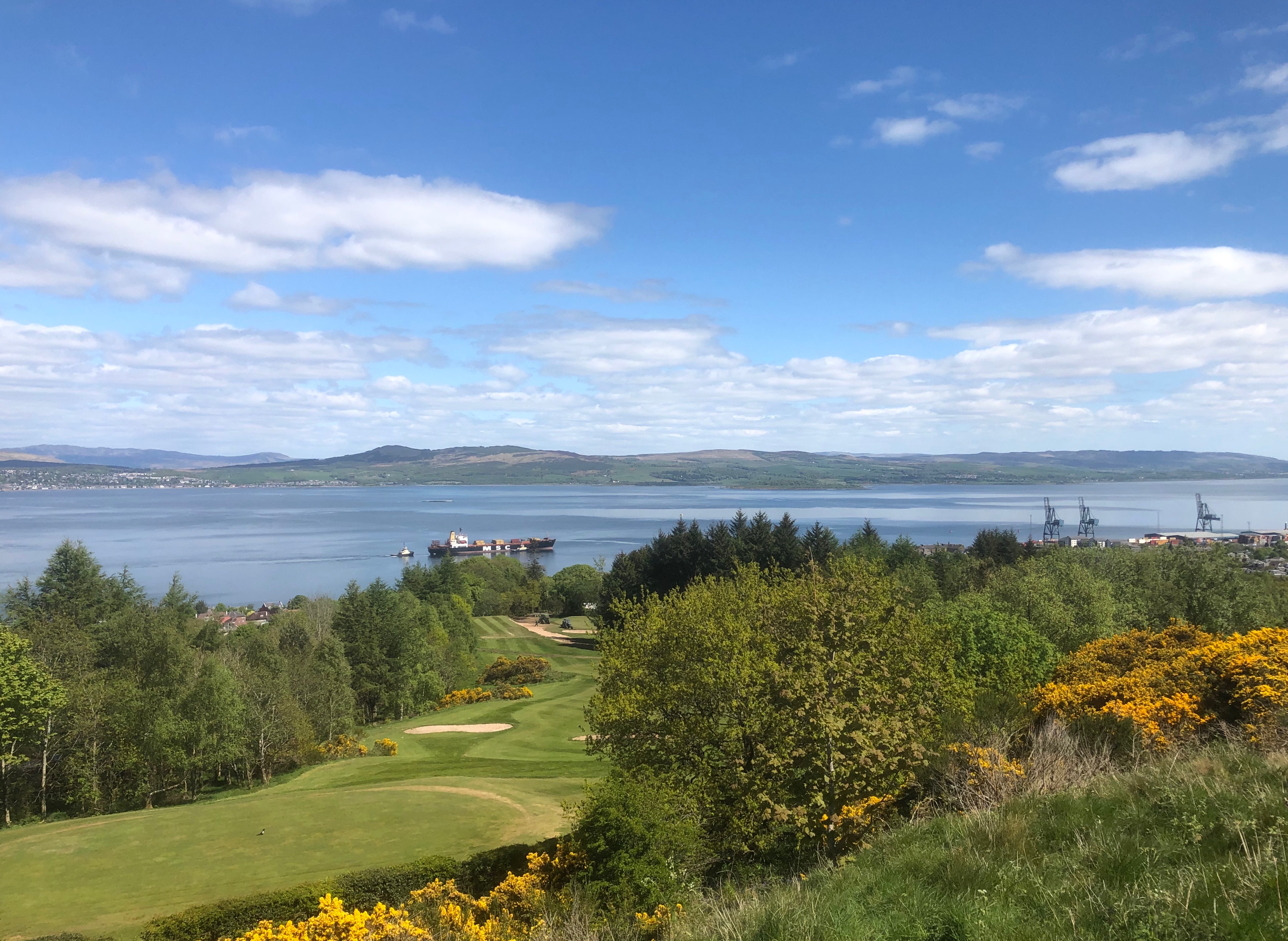
 Viewpoints provide panoramic views across the Clyde. The hill overlooks
 Gourock
Gourock ( ; gd, Guireag ) is a town in the Inverclyde council area and formerly a burgh of the County of Renfrew in the west of Scotland. It was a seaside resort on the East shore of the upper Firth of Clyde. Its main function today is as a ...
and the Tail of the Bank
The Tail of the Bank is the name given to the anchorage in the upper Firth of Clyde immediately North of Greenock, between Inverclyde and Argyll and Bute. This area of the Firth gets its name from the deep water immediately to the west of t ...
, an area of the River Clyde named after the end of the long sandbanks resulting from the river`s journey from the counties of Lanark and Renfrew and denoting the point at which the river
A river is a natural flowing watercourse, usually freshwater, flowing towards an ocean, sea, lake or another river. In some cases, a river flows into the ground and becomes dry at the end of its course without reaching another body of w ...
becomes the Firth of Clyde
The Firth of Clyde is the mouth of the River Clyde. It is located on the west coast of Scotland and constitutes the deepest coastal waters in the British Isles (it is 164 metres deep at its deepest). The firth is sheltered from the Atlantic ...
. Also visible are the Cowal
Cowal ( gd, Còmhghall) is a peninsula in Argyll and Bute, in the west of Scotland, that extends into the Firth of Clyde.
The northern part of the peninsula is covered by the Argyll Forest Park managed by Forestry and Land Scotland. The Arroch ...
hills, with the town of Dunoon
Dunoon (; gd, Dùn Omhain) is the main town on the Cowal peninsula in the south of Argyll and Bute, Scotland. It is located on the western shore of the upper Firth of Clyde, to the south of the Holy Loch and to the north of Innellan. As wel ...
below, the Holy Loch
The Holy Loch ( gd, An Loch Sianta/Seunta) is a sea loch, a part of the Cowal peninsula coast of the Firth of Clyde, in Argyll and Bute, Scotland.
The "Holy Loch" name is believed to date from the 6th century, when Saint Munn landed there afte ...
, former site of the US Navy
The United States Navy (USN) is the maritime service branch of the United States Armed Forces and one of the eight uniformed services of the United States. It is the largest and most powerful navy in the world, with the estimated tonnage ...
Scottish submarine base and the settlements of Kilcreggan
Kilcreggan (Scottish Gaelic: ''Cille Chreagain'') is a village on the Rosneath peninsula in Argyll and Bute, West of Scotland.
It developed on the north shore of the Firth of Clyde at a time when Clyde steamers brought it within easy reach ...
, Rosneath and Helensburgh
Helensburgh (; gd, Baile Eilidh) is an affluent coastal town on the north side of the Firth of Clyde in Scotland, situated at the mouth of the Gareloch. Historically in Dunbartonshire, it became part of Argyll and Bute following local gove ...
to the east. On a clear day it is possible to see beyond the Erskine Bridge to Glasgow
Glasgow ( ; sco, Glesca or ; gd, Glaschu ) is the most populous city in Scotland and the fourth-most populous city in the United Kingdom, as well as being the 27th largest city by population in Europe. In 2020, it had an estimated popul ...
in the east, and the Island of Arran and beyond to the south west.
 Immediately to the north of the hill Greenock's Battery Park provides level playing fields, bounded on the west by Gourock's Cardwell Bay and on the east by the former torpedo factory, now occupied by warehousing and a housing development, and the
 Navy
A navy, naval force, or maritime force is the branch of a nation's armed forces principally designated for naval and amphibious warfare; namely, lake-borne, riverine, littoral, or ocean-borne combat operations and related functions. It in ...
Buildings for long occupied by HM Coastguard
His Majesty's Coastguard (HMCG) is a section of the Maritime and Coastguard Agency responsible, through the Secretary of State for Transport to Parliament, for the initiation and co-ordination of all maritime search and rescue (SAR) within the ...
. They stand at Ironotter Point which in the late 18th century was the site of a coastal gun battery called Fort Matilda, a name now given to the area, to the railway station
Rail transport (also known as train transport) is a means of transport that transfers passengers and goods on wheeled vehicles running on rails, which are incorporated in tracks. In contrast to road transport, where the vehicles run on a prep ...
just to the north of Lyle Hill and to the playing pitch of the local rugby side, the Greenock Wanderers.
 The viewpoint is marked by a
 beacon
A beacon is an intentionally conspicuous device designed to attract attention to a specific location. A common example is the lighthouse, which draws attention to a fixed point that can be used to navigate around obstacles or into port. More mode ...
which was constructed to mark the Silver Jubilee of Queen Elizabeth in 1977 and is lit on special occasions. On the other side of the road, steps and a rough path lead up to Craigs Top, the highest point of the hill. There are steep craigs on the north and west of the hill, formed by glacial erosion
Erosion is the action of surface processes (such as Surface runoff, water flow or wind) that removes soil, Rock (geology), rock, or dissolved material from one location on the Earth's crust#Crust, Earth's crust, and then sediment transport, tra ...
, to its south undulating upland forms the site of Greenock golf course
A golf course is the grounds on which the sport of golf is played. It consists of a series of holes, each consisting of a tee box, a fairway, the rough and other hazards, and a green with a cylindrical hole in the ground, known as a "cup". ...
. Its high point is at Bow Hill on the west side, and the ground slopes less steeply to the south and east.
A war memorial to the Free French
Free France (french: France Libre) was a political entity that claimed to be the legitimate government of France following the dissolution of the Third Republic. Led by French general , Free France was established as a government-in-exile ...
forces who fought in the Second World War
World War II or the Second World War, often abbreviated as WWII or WW2, was a world war that lasted from 1939 to 1945. It involved the vast majority of the world's countries—including all of the great powers—forming two opposi ...
stands on the western brow of the hill. The Free French Memorial, Greenock, was built in the shape of the Cross of Lorraine
The Cross of Lorraine (french: Croix de Lorraine, link=no), known as the Cross of Anjou in the 16th century, is a heraldic two-barred cross, consisting of a vertical line crossed by two shorter horizontal bars. In most renditions, the horizon ...
, the emblem of the Free French, combined with an anchor. It has plaques commemorating the loss of the Flower-class corvettes ''Alyssa'' and ''Mimosa'', and of the submarine '' Surcouf''. Locally, it is also associated with the memory of the loss of the '' Maillé Brézé'' which blew up at the Tail of the Bank
The Tail of the Bank is the name given to the anchorage in the upper Firth of Clyde immediately North of Greenock, between Inverclyde and Argyll and Bute. This area of the Firth gets its name from the deep water immediately to the west of t ...
.
See also
* Lists of mountains and hills in the British Isles *List of mountains of the British Isles by height
This is a list of mountains in Britain and Ireland by height and by prominence. Height and prominence are the most important metrics for the classifications of mountains by the UIAA; with isolation a distant third criterion. The list is sourced ...
References
Inverclyde
Inverclyde ( sco, Inerclyde, gd, Inbhir Chluaidh, , "mouth of the Clyde") is one of 32 council areas used for local government in Scotland. Together with the East Renfrewshire and Renfrewshire council areas, Inverclyde forms part of the hist ...
Council website)
{{coord, 55.9555, -4.7934, format=dms, type:mountain_region:GB, display=title
Tourist attractions in Inverclyde
Rural Scotland
Greenock