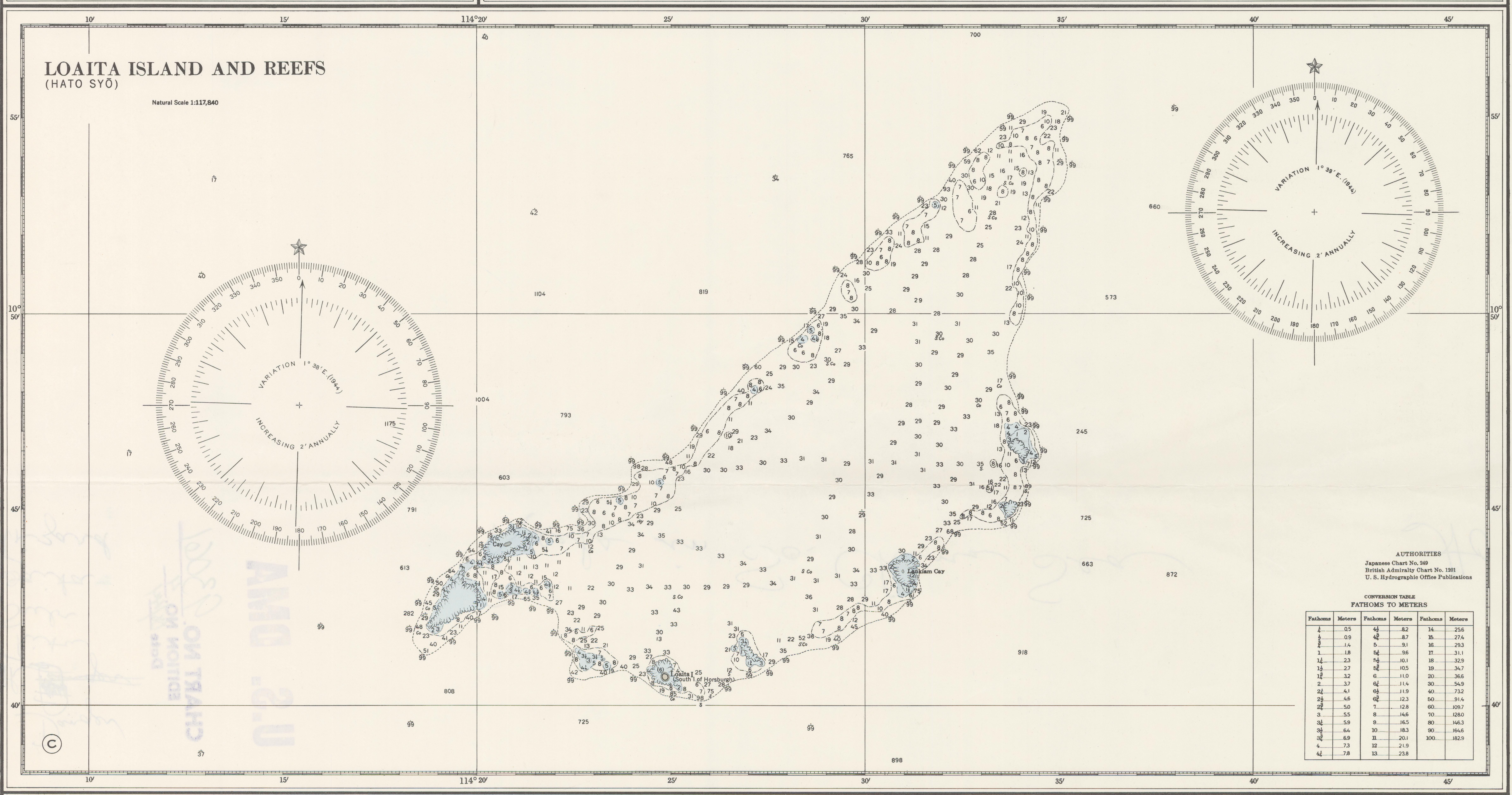
Loaita Bank on:
[Wikipedia]
[Google]
[Amazon]

 The Loaita Bank () is one of the significant maritime features in the Spratly Islands. It is about long on its NE-SW axis, and extends from Loaita Island to the NW of Dangerous Ground.NGA Chart 93044
shows the area NW of Dangerous Ground. The bank contains a number of maritime features, including shoals, reefs, an island, two sand cays, and a lagoon: * Loaita Island () *Spratly Islands Digital Gazetteer
/ref> *

 The Loaita Bank () is one of the significant maritime features in the Spratly Islands. It is about long on its NE-SW axis, and extends from Loaita Island to the NW of Dangerous Ground.NGA Chart 93044
shows the area NW of Dangerous Ground. The bank contains a number of maritime features, including shoals, reefs, an island, two sand cays, and a lagoon: * Loaita Island () *
Lankiam Cay
Lankiam Cay, also known as Panata Island ( fil, Pulo ng Panata, lit=Island of Oath; Mandarin ; vi, đá An Nhơn), is the smallest of the naturally occurring Spratly Islands. It has an area of (4,400 sq. m), and is located about east-northeas ...
()
* Loaita Nan (Loaita Southwest Reef)/ref> *
Loaita Cay
Loaita Cay, also known as Melchora Aquino Island ( fil, Pulo ng Melchora Aquino; vi, Đảo Loại Ta Tây; Mandarin ), is an island in the Spratly Islands.Menzies Reef
Menzies is a Scottish surname, with Gaelic forms being Méinnearach and Méinn, and other variant forms being Menigees, Mennes, Mengzes, Menzeys, Mengies, and Minges.
Derivation and history
The name and its Gaelic form are probably derived f ...
() lies at the NE end of this ridge, inside Dangerous Ground.
It is neighboured by the Thitu Reefs and Subi Reef to the NW, Irving Reef
Irving Reef, also known as Balagtas Reef ( fil, Bahura ng Balagtas; Mandarin , vi, đá Cá Nhám), is a coral reef in the Spratly Islands, South China Sea. It is occupied by the Philippines as part of Kalayaan, Palawan, and is also claimed by ...
to the east, North Danger Reef North Danger Reef (Vietnamese: Cụm Song Tử) () is one of the seven major reefs / banks / etc. in the Spratly Islands area of the South China Sea. It is the most North Western of the features of the Spratly Islands, located to the NW of Dangero ...
to the north, and the Tizard and Union Banks to the south.
References
{{South China Sea Banks of the Spratly Islands