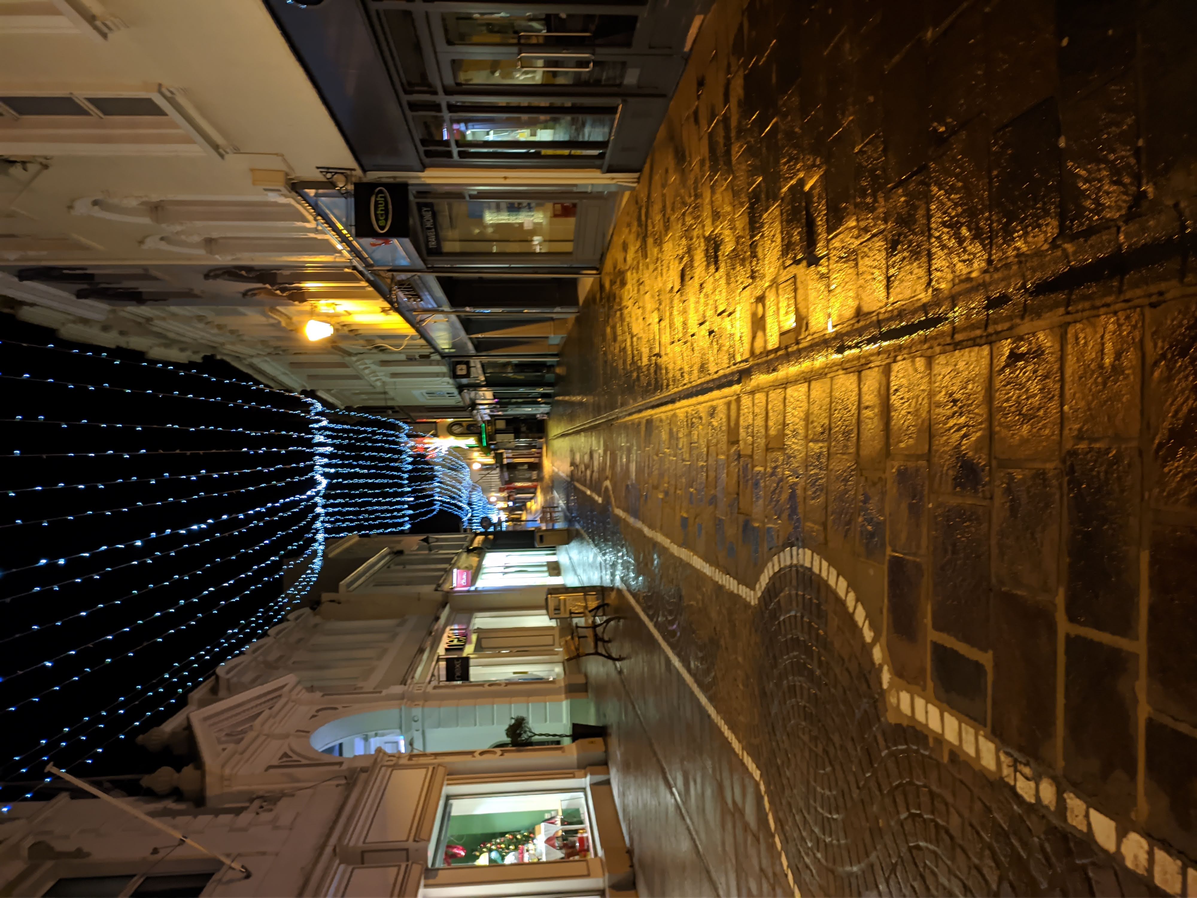
King Street, Saint Helier on:
[Wikipedia]
[Google]
[Amazon]
King Street ( Jèrriais: Rue d'Driéthe), also known as ''Rue de Derrière'', is one of the two parts of the
 The street was originally named ''Rue d'Driéthe'' or ''Rue de Derrière'' (''back street'' in Jèrriais and French), and it was, up until the 19th century, just a small unpaved lane behind the buildings on the north side of the Royal Square and Broad Street. There were no buildings to the north of the road, just an open
theislandwiki.org - Old maps showing King Street
{{Jersey topics Streets in Jersey Saint Helier
high street
High Street is a common street name for the primary business street of a city, town, or village, especially in the United Kingdom and Commonwealth. It implies that it is the focal point for business, especially shopping. It is also a metonym fo ...
of Saint Helier
St Helier (; Jèrriais: ; french: Saint-Hélier) is one of the twelve parishes of Jersey, the largest of the Channel Islands in the English Channel. St Helier has a population of 35,822 – over one-third of the total population of Jersey – ...
in Jersey
Jersey ( , ; nrf, Jèrri, label= Jèrriais ), officially the Bailiwick of Jersey (french: Bailliage de Jersey, links=no; Jèrriais: ), is an island country and self-governing Crown Dependency near the coast of north-west France. It is the l ...
.
It is a pedestrianised
Pedestrian zones (also known as auto-free zones and car-free zones, as pedestrian precincts in British English, and as pedestrian malls in the United States and Australia) are areas of a city or town reserved for pedestrian-only use and in whi ...
shopping street which runs from Charing Cross at its west end to Queen Street at its east end. It includes a spur that links to Broad Street which is also called King Street in English, but Ruette Haguais in gallicised Jèrriais.
History
 The street was originally named ''Rue d'Driéthe'' or ''Rue de Derrière'' (''back street'' in Jèrriais and French), and it was, up until the 19th century, just a small unpaved lane behind the buildings on the north side of the Royal Square and Broad Street. There were no buildings to the north of the road, just an open
 rural area
In general, a rural area or a countryside is a geographic area that is located outside towns and cities. Typical rural areas have a low population density and small settlements. Agricultural areas and areas with forestry typically are descr ...
.
By 1550 the spine formed by what is now King Street/Queen Street was in existence, linking the confluence of Le Grand Douet and St Aubin's Bay to the road east leading across the lands of the Manoir de La Motte (La Colomberie). Branches of Le Grand Douet and Le Faux Bié intersect the street as they flowed through town to the shore. By the second half of the 18th century, the north side of King Street had been developed with solid, originally thatched, town houses with ornamental gardens and orchards behind. Victorian and Edwardian commercial buildings replaced the domestic buildings.
In 1978 as part of the pedestrianisation landscaping, a traditional apple crusher was installed at the junction of Rue de Derrière and Ruette Haguais, and La Croix de la Reine at the junction of King Street and Broad Street.
References
External links
theislandwiki.org - Old maps showing King Street
{{Jersey topics Streets in Jersey Saint Helier