Hornby, Lancashire on:
[Wikipedia]
[Google]
[Amazon]
Hornby is a village and former
 Hornby has a church called St Margaret's Church on Main Street, with its
Official website
{{City of Lancaster settlements Villages in Lancashire Former civil parishes in Lancashire Geography of the City of Lancaster
civil parish
In England, a civil parish is a type of administrative parish used for local government. It is a territorial designation which is the lowest tier of local government below districts and counties, or their combined form, the unitary authorit ...
from Lancaster, now in the parish of Hornby-with-Farleton, in the Lancaster district, in the county of Lancashire
Lancashire ( , ; abbreviated Lancs) is the name of a historic county, ceremonial county, and non-metropolitan county in North West England. The boundaries of these three areas differ significantly.
The non-metropolitan county of Lancas ...
, England. The village is on the A683 and at the confluence of the River Wenning and Lune In 2011 the built up area had a population of 468. In 1881 the parish had a population of 358.
History
Hornby was recorded in theDomesday Book
Domesday Book () – the Middle English spelling of "Doomsday Book" – is a manuscript record of the "Great Survey" of much of England and parts of Wales completed in 1086 by order of King William I, known as William the Conqueror. The manusc ...
as ''Hornebi''. Hornby was a township
A township is a kind of human settlement or administrative subdivision, with its meaning varying in different countries.
Although the term is occasionally associated with an urban area, that tends to be an exception to the rule. In Australia, ...
and chapelry
A chapelry was a subdivision of an ecclesiastical parish in England and parts of Lowland Scotland up to the mid 19th century.
Status
It had a similar status to a township but was so named as it had a chapel of ease (chapel) which was the commu ...
in Melling parish. From 1866 Hornby was a civil parish in its own right until it was merged with Farleton on 24 March 1887 to form "Hornby-with-Farleton".
Amenities
 Hornby has a church called St Margaret's Church on Main Street, with its
 octagon
In geometry, an octagon (from the Greek ὀκτάγωνον ''oktágōnon'', "eight angles") is an eight-sided polygon or 8-gon.
A '' regular octagon'' has Schläfli symbol and can also be constructed as a quasiregular truncated square, t, w ...
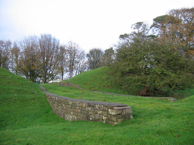
al tower a county house called Hornby Castle which overlooks the village. It was started in the 13th century as a replacement for Castle Stede. The tower is 16th-century but the rest was constructed during the 18th and 19th centuries. Despite the castle now being divided into flats, it is still one of the most recognisable points of the village. Hornby Castle and grounds are private, although the gardens are open two weekends each year in February for snowdrops and May with a small entrance fee. There is no access to castle buildings, but most of the grounds are available to walk round freely on these dates. The gardens also feature a walled garden with plants for sale., a primary school called Hornby St. Margaret's C of E Primary School on Main Street and a village institute on Main Street. A mile to the north of the castle are the earthwork remains of Castle Stede, a motte-and-bailey
A motte-and-bailey castle is a European fortification with a wooden or stone keep situated on a raised area of ground called a motte, accompanied by a walled courtyard, or bailey, surrounded by a protective ditch and palisade. Relatively easy t ...
castle dating from the eleventh or twelfth century.
Hornby formerly had a high school called Hornby High School that closed in August 2009.
References
External links
*Official website
{{City of Lancaster settlements Villages in Lancashire Former civil parishes in Lancashire Geography of the City of Lancaster