Former provinces of Hokkaido on:
[Wikipedia]
[Google]
[Amazon]
In 1869, the island of
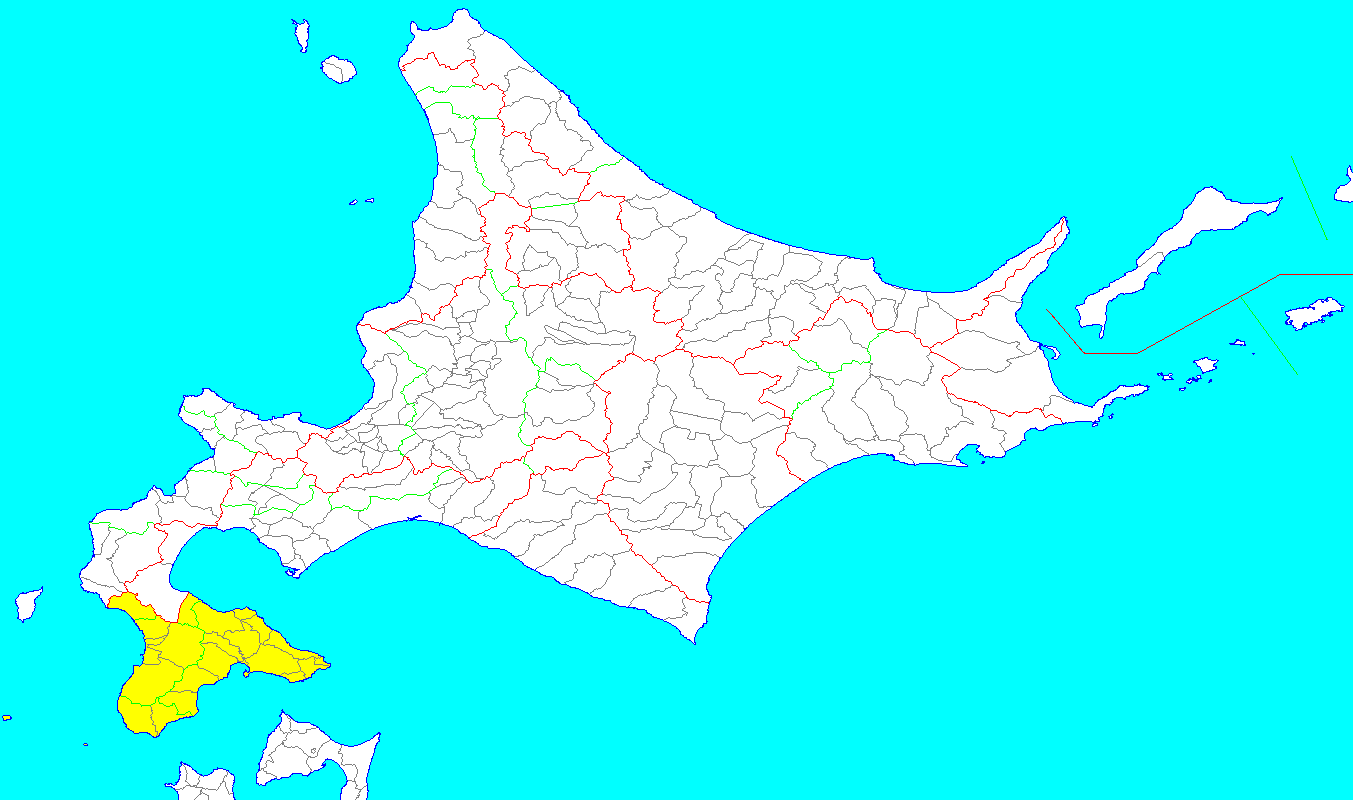 :Satow, Ernest. (1882). "The Geography of Japan" in Presently the southern part of modern-day Oshima and Hiyama Subprefectures. Districts included:
* Kameda (亀田郡, -gun)
* Kayabe (茅部郡)
* Kamiiso (上磯郡)
*
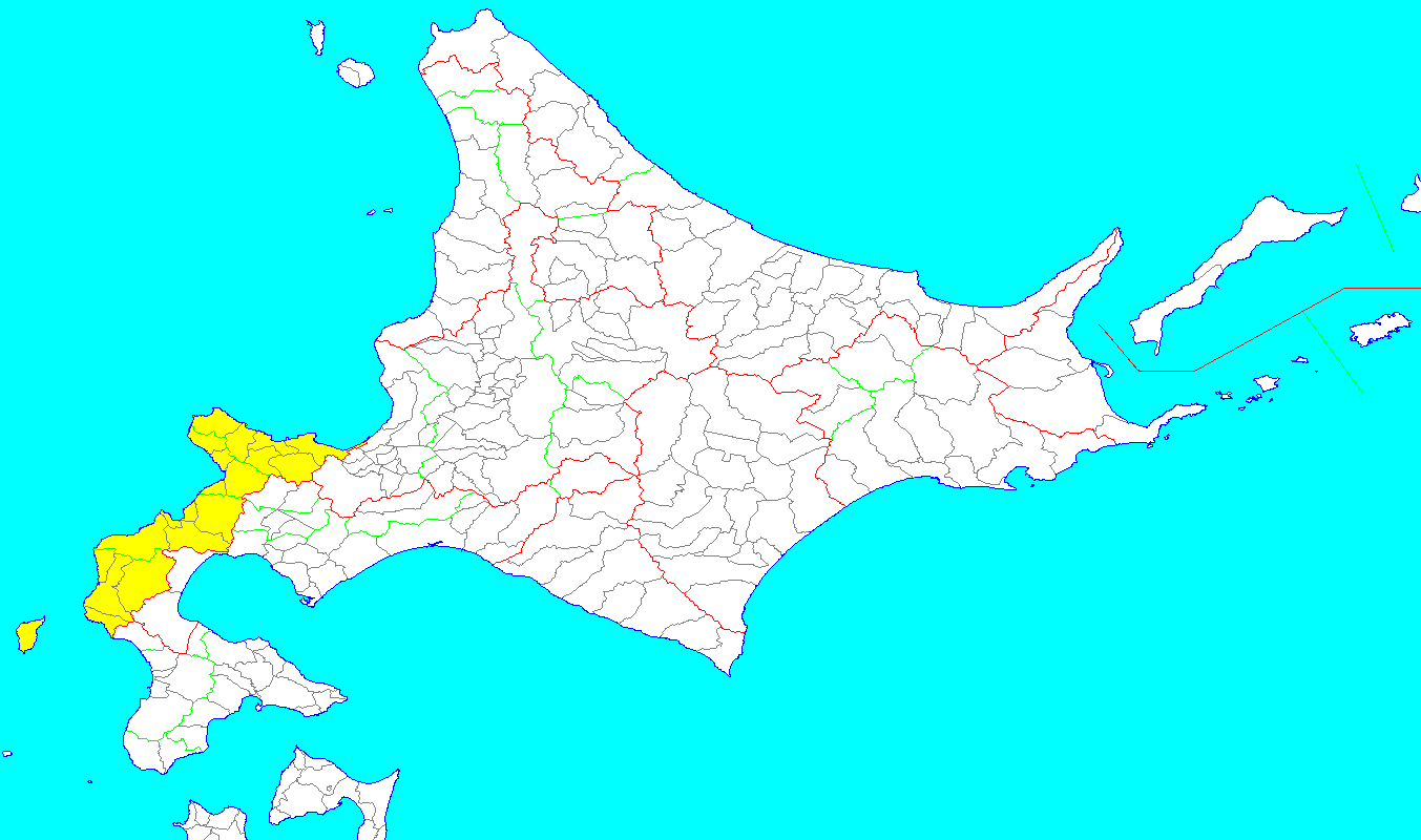 : Modern-day
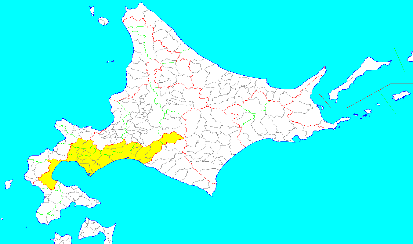 : Modern-day
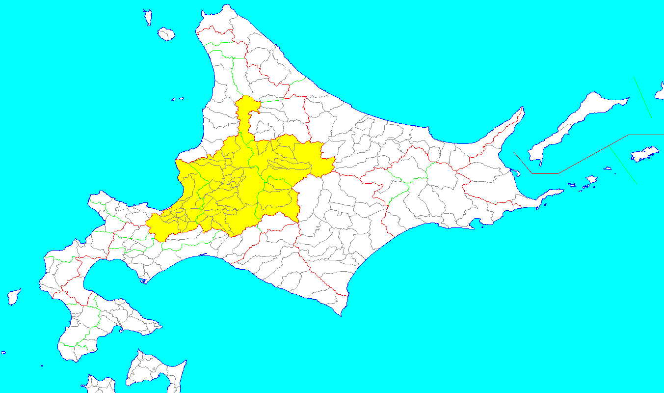 : Modern-day Ishikari Subprefecture minus Chitose and Eniwa, all of
 : Presently all of modern-day
 : Modern-day
 : Modern-day
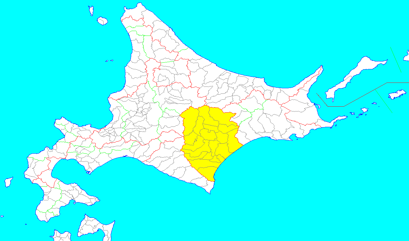 : Modern-day
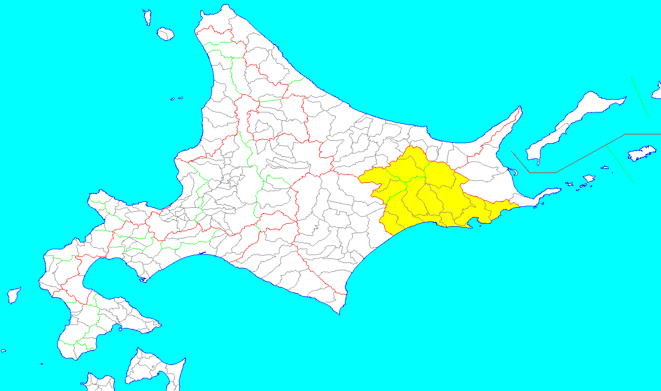 : Modern-day
 : Presently the mainland portion of modern-day
 : Originally the islands of
 Karafuto Region was the area of
''Japan encyclopedia.''
Cambridge:
OCLC 58053128
{{Hokkaido Hokkaido region
Hokkaido
is Japan's second largest island and comprises the largest and northernmost prefecture, making up its own region. The Tsugaru Strait separates Hokkaidō from Honshu; the two islands are connected by the undersea railway Seikan Tunnel.
The la ...
, Japan
Japan ( ja, 日本, or , and formally , ''Nihonkoku'') is an island country in East Asia. It is situated in the northwest Pacific Ocean, and is bordered on the west by the Sea of Japan, while extending from the Sea of Okhotsk in the north ...
was divided into 11 provinces
A province is almost always an administrative division within a country or state. The term derives from the ancient Roman ''provincia'', which was the major territorial and administrative unit of the Roman Empire's territorial possessions outsi ...
and 86 districts
A district is a type of administrative division that, in some countries, is managed by the local government. Across the world, areas known as "districts" vary greatly in size, spanning regions or counties, several municipalities, subdivisions o ...
. The majority of Japan's former provinces were converted into prefectures by the Meiji government between 1870 and 1876.
The Hokkaido provinces were dissolved in 1882, and replaced with Hakodate Prefecture, Sapporo Prefecture and Nemuro Prefecture. In 1886, the three prefectures were replaced with Hokkaidō-chō (北海道庁).
List of provinces
The former provinces of Hokkaido are listed below with their districts.Oshima Province
Fukushima
may refer to:
Japan
* Fukushima Prefecture, Japanese prefecture
** Fukushima, Fukushima, capital city of Fukushima Prefecture, Japan
***Fukushima University, national university in Japan
*** Fukushima Station (Fukushima) in Fukushima, Fukushim ...
(福島郡) – merged with Tsugaru District in 1881 to create Matsumae District
*Tsugaru Tsugaru (津軽) may refer to:
* Tsugaru, Aomori, a city of Aomori Prefecture, Japan
* Tsugaru Peninsula
* Tsugaru Strait, between Honshū and Hokkaidō
** Tsugaru Kaikyō Ferry, a ferry crossing this strait
* Tsugaru-jamisen, a traditional style of ...
(津軽郡) – merged with Fukushima District in 1881 to create Matsumae District
* Hiyama (檜山郡)
* Nishi (爾志郡)
Shiribeshi Province
Shiribeshi Subprefecture
is a subprefecture of Hokkaido Prefecture, Japan. The subprefecture's capital is Kutchan. As of July 31, 2004, the estimated population was 256,184 and the area was 4,305.65 km2.
Geography Municipalities
Mergers
History
*18 ...
(minus Abuta
''Abuta'' is a genus in the flowering plant family Menispermaceae, of about 32 species, native to tropical Central and South America.
Description
It consists in dioecious climbers or rarely erect trees or shrubs ('' Abuta concolor'') with ...
) plus northern Hiyama. Districts included:
* Kudō (久遠郡)
* Okushiri (奥尻郡)
* Futoru (太櫓郡) – dissolved on April 1, 1955 when Futoru Village merged with Tōsetana Town (from Setana District) to create Kitahiyama Town
*Setana
is a town located in Hiyama Subprefecture, Hokkaido, Japan.
As of September 2016, the town has an estimated population of 8,501, and a density of 13 persons per km². The total area is 638.67 km².
Geography
Setana is located on the northe ...
(瀬棚郡)
* Shimamake (島牧郡)
* Suttsu (寿都郡)
* Utasutsu (歌棄郡) – dissolved on January 15, 1955 when Utasutsu Village was incorporated into Suttsu Town (in Suttsu District); Neppu Village was merged with Suttsu District's Kuromatsunai Village and part of Tarukishi Village to create Sanwa Village (now Kuromatsunai Town)
* Isoya (磯屋郡, later respelled 磯谷郡)
* Iwanai (岩内郡)
* Furuu (古宇郡)
* Shakotan (積丹郡)
* Bikuni (美国郡) – dissolved September 30, 1956 when Bikuni Town was incorporated into Shakotan Town, Shakotan District.
* Furubira (古平郡)
* Yoichi (余市郡)
* Oshiyoro (忍路郡) – dissolved on April 1, 1958 when Shioya? Village was incorporated into Otaru
is a city and port in Shiribeshi Subprefecture, Hokkaido, Japan, northwest of Sapporo. The city faces Ishikari Bay and the Sea of Japan, and has long served as the main port of the bay. With its many historical buildings, Otaru is a popular tou ...
City
* Takashima (高島郡) – dissolved on September 1, 1940 when Takashima Town was incorporated into Otaru
*Otaru
is a city and port in Shiribeshi Subprefecture, Hokkaido, Japan, northwest of Sapporo. The city faces Ishikari Bay and the Sea of Japan, and has long served as the main port of the bay. With its many historical buildings, Otaru is a popular tou ...
(小樽郡) – dissolved on September 1, 1940 when Asato? Village was incorporated into Otaru
Iburi Province
Iburi Subprefecture
is a subprefecture of Hokkaido Prefecture, Japan.
Geography
Located in south-central Hokkaido, Iburi stretches East-West and North-South. Iburi covers an area of . Iburi borders Oshima Subprefecture to the West, Shiribeshi, Ishikari, and ...
, Yamakoshi District of Oshima, Abuta District of Shiribeshi, the cities of Chitose and Eniwa of Ishikari
is a city located in Ishikari Subprefecture, Hokkaido, Japan.
As of April 30, 2017, the city has an estimated population of 58,755, with 27,434 households, and a density of 81 persons per km2. The total area is .
On October 1, 2005, the vill ...
, and Shimukappu
is a village located in Kamikawa Subprefecture, Hokkaido, Japan.
As of September 2016, the village has an estimated population of 1,251 and a density of 2.2 persons per km². The total area is 571.31 km².
Tomamu
Tomamu in the eastern p ...
Village of Kamikawa. Districts included:
*Yamakoshi Yamakoshi is a surname. Notable people with the surname include:
* Kohei Yamakoshi (born 1993), Japanese footballer
* Kyotaro Yamakoshi (born 1991), Japanese footballer
* Yasuhiro Yamakoshi (born 1985), Japanese footballer
{{Surname
Japanese-lang ...
(山越郡)
* Abuta District (虻田郡)
* Usu (有珠郡)
*Muroran
is a city and port located in Iburi Subprefecture, Hokkaido, Japan. It is the capital city of Iburi Subprefecture. As of February 29, 2012, the city has an estimated population of 93,716, with 47,868 households and a population density of . The ...
(室蘭郡) – dissolved on February 1, 1918 when four towns and villages merged to create Muroran-''ku''
* Yoribetsu (幌別郡) – dissolved on August 1, 1970 when Noboribetsu
is a city in Iburi Subprefecture, Hokkaido, Japan. Part of Shikotsu-Toya National Park, it is southwest of Sapporo, west of Tomakomai and northeast of Hakodate.
As of September 2016, the city has an estimated population of 49,523, and a popul ...
Town became Noboribetsu City
* Shiraoi (白老郡)
* Yūfutsu (勇払郡)
* Chitose (千歳郡) – dissolved on November 11, 1970 when Eniwa Town became a city
Ishikari Province
Sorachi Subprefecture
is a subprefecture of Hokkaido Prefecture, Japan. As of 2004, its estimated population is 373,736 and its area is 6,558.26 km2.
Geography Cities
10 cities are located in Sorachi Subprefecture:
Towns and villages by district
These are t ...
, and the southern half of Kamikawa Subprefecture
is a subprefecture of Hokkaido Prefecture, Japan. The name is derived from Kamikawa no hitobito no Shūraku (Village of the Upstream People), a translation of the Ainu Peni Unguri Kotan. Settlement began in 1867. The sub-prefecture was establi ...
(including Horokanai and excluding Shimukappu
is a village located in Kamikawa Subprefecture, Hokkaido, Japan.
As of September 2016, the village has an estimated population of 1,251 and a density of 2.2 persons per km². The total area is 571.31 km².
Tomamu
Tomamu in the eastern p ...
). Districts included:
*Ishikari
is a city located in Ishikari Subprefecture, Hokkaido, Japan.
As of April 30, 2017, the city has an estimated population of 58,755, with 27,434 households, and a density of 81 persons per km2. The total area is .
On October 1, 2005, the vill ...
(石狩郡)
*Sapporo
( ain, サッ・ポロ・ペッ, Satporopet, lit=Dry, Great River) is a city in Japan. It is the largest city north of Tokyo and the largest city on Hokkaido, the northernmost main island of the country. It ranks as the fifth most populous city ...
(札幌郡) – dissolved on September 1, 1996 when Hiroshima Town became Kitahiroshima City
* Yūbari (夕張郡)
* Kabato (樺戸郡)
* Sorachi (空知郡)
* Uryū (雨竜郡)
* Kamikawa (上川郡)
*Atsuta Atsuta can refer several different Japanese locations:
* Atsuta-ku, Nagoya
** Atsuta Jingu (shrine)
*Atsuta, Hokkaido
was a List of villages in Japan, village located in Atsuta District, Hokkaido, Atsuta District, Ishikari Subprefecture, Hokkaido ...
(厚田郡)
* Hamamasu (浜益郡)
Teshio Province
Rumoi Subprefecture
is a subprefecture of Hokkaido Prefecture, Japan. As of 2011, it had a population of 52,627 and an area of . The population density of the subprefecture, 13 people per km2, is very low compared to the rest of Japan. The population of Rumoi Subpr ...
and the northern half of Kamikawa Subprefecture
is a subprefecture of Hokkaido Prefecture, Japan. The name is derived from Kamikawa no hitobito no Shūraku (Village of the Upstream People), a translation of the Ainu Peni Unguri Kotan. Settlement began in 1867. The sub-prefecture was establi ...
. Districts included:
* Mashike (増毛郡)
*Rumoi
is a city located in Rumoi Subprefecture, Hokkaido, Japan. It is the capital of Rumoi Subprefecture.
As of September 2016, the city has an estimated population of 22,242 and the density of 75 persons per km2. The total area is 297.44 km2.
...
(留萌郡)
*Tomamae
is a List of towns in Japan, town located in Rumoi Subprefecture, Hokkaido, Japan. It is typical of the small coastal towns that line the western coast of Hokkaido.
Demographics
As of September 2016, the town has an estimated population of 3,2 ...
(苫前郡)
* Teshio (天塩郡)
* Nakagawa (中川郡)
* Kamikawa (上川郡)
Kitami Province
Sōya Subprefecture
is a subprefecture of Hokkaido Prefecture, Japan. Its population is estimated to be 77,500 as of July 31, 2004 and its area is . It is the northernmost subprefecture of Japan.
Wakkanai Airport is located in Wakkanai. Rishiri Airport is locate ...
and Abashiri Subprefecture
is a Subprefectures of Hokkaido, subprefecture of Hokkaido, Hokkaido Prefecture, Japan. It was renamed from the earlier Abashiri Subprefecture on April 1, 2010. Abashiri Subprefecture was established in 1897.
Etymology
Abashiri Prefecture was ...
minus part of Abashiri District. Districts included:
* Sōya (宗谷郡)
* Rishiri (利尻郡)
* Rebun (礼文郡)
* Esashi (枝幸郡)
* Monbetsu (紋別郡)
*Tokoro
is a small town, once was an independent administrative division located in Tokoro District, Abashiri Subprefecture (now Okhotsk Subprefecture), Hokkaido, Japan. On March 5, 2006, the division, along with the towns of Rubeshibe and Tanno (all f ...
(常呂郡)
*Abashiri
is a city located in Okhotsk Subprefecture, Hokkaido, Japan.
Abashiri is known as the site of the Abashiri Prison, a Meiji-era facility used for the incarceration of political prisoners. The old prison has been turned into a museum, but the city ...
(網走郡)
* Shari (斜里郡)
Hidaka Province
Hidaka Subprefecture
is a subprefecture of Hokkaido Prefecture, Japan. The west side of the Hidaka mountains occupies most of the area. Hidaka is sparsely populated and has many of Hokkaido's natural resources. The governmental office is located in Urakawa.
Hi ...
. Districts included:
*Saru
The South African Rugby Union (SARU) is the governing body for rugby union in South Africa and is affiliated to World Rugby. It was established in 1992 as the South African Rugby Football Union, from the merger of the South African Rugby Board a ...
(沙流郡)
* Niikappu (新冠郡)
* Shizunai (静内郡)
* Mitsuishi (三石郡)
* Urakawa (浦河郡)
*Samani
Germinated wheat ( fa, جوانه گندم) or sprouted wheat, wheat sprout is a product of germinating wheat seeds in a wet and relatively warm environment in a process called sprouting. It is sometimes used instead of barley in the form of ...
(様似郡)
* Horoizumi (幌泉郡)
Tokachi Province
Tokachi Subprefecture
is a subprefecture of Hokkaido Prefecture, Japan corresponding to the old province of Tokachi.Rowthorn, Chris. (2009) ''Japan,'' p. 641 As of 2004, its estimated population is 360,802 and its area is 10,830.99 km2.
Tokachi-Obihiro Airpor ...
. Districts included:
* Hiroo (広尾郡)
* Tōbui (当縁郡) – dissolved on April 1, 1906 when 3 villages merged into Moyori Village (now Hiroo Town) in Hiroo District and two villages merged with Ōtsu Village in Tokachi District
* Kamikawa (上川郡)
* Nakagawa (中川郡)
* Katō (河東郡)
* Kasai (河西郡)
* Tokachi (十勝郡)
Kushiro Province
Kushiro Subprefecture
is a subprefecture of Hokkaido Prefecture, Japan. Kushiro is home to a population of red-crowned cranes, estimated in 2022 to number about 1,900.
Geography
Municipalities
Mergers
History
*November, 1897: Kushiro Subprefecture estab ...
and part of Abashiri Subprefecture
is a Subprefectures of Hokkaido, subprefecture of Hokkaido, Hokkaido Prefecture, Japan. It was renamed from the earlier Abashiri Subprefecture on April 1, 2010. Abashiri Subprefecture was established in 1897.
Etymology
Abashiri Prefecture was ...
. Districts included:
*Shiranuka
is a town located in Kushiro Subprefecture, Hokkaido, Japan. As of September, 2013, it has an estimated population of 8,910, and an area of 773.74 km². The population has fallen significantly in recent years.
Etymology
It is believed tha ...
(白糠郡)
* Ashoro (足寄郡)
*Kushiro
is a city in Kushiro Subprefecture on the island of Hokkaido, Japan. It serves as the subprefecture's capital and it is the most populated city in the eastern part of the island.
Geography
Mountains
* Mount Oakan
* Mount Meakan
* Mount Akan ...
(釧路郡)
*Akan Akan may refer to:
People and languages
*Akan people, an ethnic group in Ghana and Côte d'Ivoire
*Akan language, a language spoken by the Akan people
*Kwa languages, a language group which includes Akan
*Central Tano languages, a language group w ...
(阿寒郡)
*Abashiri
is a city located in Okhotsk Subprefecture, Hokkaido, Japan.
Abashiri is known as the site of the Abashiri Prison, a Meiji-era facility used for the incarceration of political prisoners. The old prison has been turned into a museum, but the city ...
(網尻郡)
* Kawakami (川上郡)
*Akkeshi
is a Towns of Japan, town located in Kushiro Subprefecture, Hokkaido. As of July 31, 2021, it has a population of 8,922, and an area of 734.82 km2. Lake Akkeshi is a List of Ramsar sites in Japan, Ramsar Site.
History
*Edo period – Was ...
(厚岸郡)
Nemuro Province
Nemuro Subprefecture
is a subprefecture of Hokkaido Prefecture, Japan. Japan claims the southern parts of the disputed
Kuril Islands (known as the Northern Territories in Japan) as part of this subprefecture.
As of March 2009, the subprefecture has an estimated p ...
plus Habomai
; ja, 歯舞群島, Habomai guntō
, location = Pacific Ocean
, coordinates =
, archipelago = Kuril Islands
, total_islands = 10 + several rocks
, major_islands =
, area_km2 = 100
, length =
, ...
Rocks and Shikotan
; ja, 色丹島
, location = Pacific Ocean
, coordinates =
, archipelago = Kuril Islands
, total_islands = 1
, major_islands =
, area_km2 = 225
, length =
, width =
, coastline ...
Island. Districts included:
* Hanasaki (花咲郡) – dissolved on April 1, 1959 when Habomai Village was merged into Nemuro Nemuro may refer to:
* Nemuro Subprefecture, Hokkaido Prefecture, Japan
** Nemuro, Hokkaido, a city
** Nemuro Peninsula
** Nemuro Strait
** Nemuro Bay
* Nemuro Province
was an old province in Japan in what is today Nemuro Subprefecture, Hokkai ...
City; originally included Shikotan District
*Nemuro Nemuro may refer to:
* Nemuro Subprefecture, Hokkaido Prefecture, Japan
** Nemuro, Hokkaido, a city
** Nemuro Peninsula
** Nemuro Strait
** Nemuro Bay
* Nemuro Province
was an old province in Japan in what is today Nemuro Subprefecture, Hokkai ...
(根室郡) – dissolved on August 1, 1957 when Nemuro Town absorbed Wada Village to create Nemuro Nemuro may refer to:
* Nemuro Subprefecture, Hokkaido Prefecture, Japan
** Nemuro, Hokkaido, a city
** Nemuro Peninsula
** Nemuro Strait
** Nemuro Bay
* Nemuro Province
was an old province in Japan in what is today Nemuro Subprefecture, Hokkai ...
City
* Notsuke (野付郡)
*Shibetsu
is a city located in Kamikawa Subprefecture, Hokkaido, Japan.
As of September 2016, the city has an estimated population of 19,794 and the density of 18 persons per km2. The total area is 1119.29 km2.
On September 1, 2005, the town of ...
(標津郡)
* Menashi (目梨郡)
Chishima Province
Kunashiri
, other_names = kz, Kün Ashyr; ja, 国後島
, location = Sea of Okhotsk
, locator_map = File:Kurily Kunashir.svg
, coordinates =
, archipelago = Kuril Islands
, total_islands =
, major_islands =
, area =
, length =
, width = fr ...
and Etorofu
, other_names = russian: Итуру́п; ja, 択捉島
, location = Sea of Okhotsk
, coordinates =
, archipelago = Kuril Islands
, total_islands =
, major_islands =
, area_km2 = 3139
, length_km = 200
, width_km = 27
, coastline =
, highest_moun ...
, later included Shikotan
; ja, 色丹島
, location = Pacific Ocean
, coordinates =
, archipelago = Kuril Islands
, total_islands = 1
, major_islands =
, area_km2 = 225
, length =
, width =
, coastline ...
and the Kuril Islands
The Kuril Islands or Kurile Islands (; rus, Кури́льские острова́, r=Kuril'skiye ostrova, p=kʊˈrʲilʲskʲɪjə ɐstrɐˈva; Japanese: or ) are a volcanic archipelago currently administered as part of Sakhalin Oblast in the ...
. Districts included:
*Kunashiri
, other_names = kz, Kün Ashyr; ja, 国後島
, location = Sea of Okhotsk
, locator_map = File:Kurily Kunashir.svg
, coordinates =
, archipelago = Kuril Islands
, total_islands =
, major_islands =
, area =
, length =
, width = fr ...
(国後郡) – occupied and administered by Russia
Russia (, , ), or the Russian Federation, is a List of transcontinental countries, transcontinental country spanning Eastern Europe and North Asia, Northern Asia. It is the List of countries and dependencies by area, largest country in the ...
(see Kuril Islands dispute
The Kuril Islands dispute, known as the Northern Territories dispute in Japan, is a territorial dispute between Japan and Russia over the ownership of the four southernmost Kuril Islands. The Kuril Islands are a chain of islands that stretch b ...
)
*Etorofu
, other_names = russian: Итуру́п; ja, 択捉島
, location = Sea of Okhotsk
, coordinates =
, archipelago = Kuril Islands
, total_islands =
, major_islands =
, area_km2 = 3139
, length_km = 200
, width_km = 27
, coastline =
, highest_moun ...
(択捉郡) – occupied and administered by Russia
* Furebetsu (振別郡) – dissolved on April, 1923 when its villages merged with several villages in Shana and Etorofu Districts to create the village of Rubetsu (in Etorofu)
*Shana Shana or Shanna may refer to:
People Shana
* Shana Alexander (1925–2005), journalist
* Shana Cox (born 1985), athlete
* Shana Dale (born 1964), NASA deputy administrator
* Shana Hiatt (born 1975), model
* Shana Madoff (born 1967), compliance offi ...
(紗那郡) – occupied and administered by Russia
* Shibetoro (蘂取郡) – occupied and administered by Russia
*Shikotan
; ja, 色丹島
, location = Pacific Ocean
, coordinates =
, archipelago = Kuril Islands
, total_islands = 1
, major_islands =
, area_km2 = 225
, length =
, width =
, coastline ...
(色丹郡) – split off from Hanasaki District in 1885; currently occupied and administered by Russia
*Uruppu (得撫郡) – acquired in Treaty of Saint Petersburg (1875)
The Treaty of Saint Petersburg ( ja, 樺太・千島交換条約, Karafuto-Chishima Kōkan Jōyaku; russian: Петербургский договор) between the Empire of Japan and the Russian Empire was signed on 7 May 1875, and its ratif ...
; ceded in San Francisco Treaty
The , also called the , re-established peaceful relations between Japan and the Allied Powers on behalf of the United Nations by ending the legal state of war and providing for redress for hostile actions up to and including World War II. It ...
*Shimushiru (新知郡) – acquired in Treaty of Saint Petersburg; ceded in San Francisco Treaty
*Shumushu (占守郡) – acquired in Treaty of Saint Petersburg; ceded in San Francisco Treaty
Karafuto
 Karafuto Region was the area of
 Sakhalin
Sakhalin ( rus, Сахали́н, r=Sakhalín, p=səxɐˈlʲin; ja, 樺太 ''Karafuto''; zh, c=, p=Kùyèdǎo, s=库页岛, t=庫頁島; Manchu: ᠰᠠᡥᠠᠯᡳᠶᠠᠨ, ''Sahaliyan''; Orok: Бугата на̄, ''Bugata nā''; Nivkh: ...
south of the border established by the 1875 Treaty of Saint Petersburg between Japan and Russia.Nussbaum, "Karafuto-Chishima Kōkan Jōyaku" at After the 1905 Treaty of Portsmouth
A treaty is a formal, legally binding written agreement between actors in international law. It is usually made by and between sovereign states, but can include international organizations, individuals, business entities, and other legal perso ...
, Karafuto was administered from Toyohara in Karafuto Prefecture
Karafuto Prefecture ( ja, 樺太庁, ''Karafuto-chō''; russian: Префектура Карафуто, Prefektura Karafuto), commonly known as South Sakhalin, was a prefecture of Japan located in Sakhalin from 1907 to 1949.
Karafuto became ter ...
.
Notes
References
* Nussbaum, Louis-Frédéric and Käthe Roth. (2005)''Japan encyclopedia.''
Cambridge:
Harvard University Press
Harvard University Press (HUP) is a publishing house established on January 13, 1913, as a division of Harvard University, and focused on academic publishing. It is a member of the Association of American University Presses. After the retirem ...
. OCLC 58053128
{{Hokkaido Hokkaido region