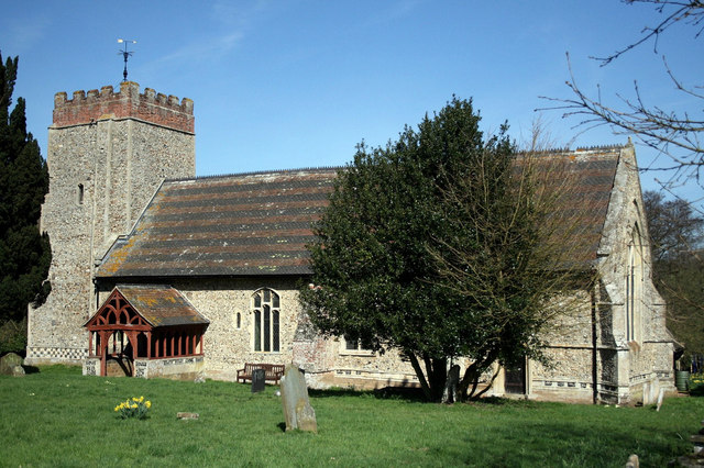
Copdock and Washbrook on:
[Wikipedia]
[Google]
[Amazon]

 Copdock and Washbrook is a
Parish council website
Civil parishes in Suffolk Babergh District {{Suffolk-geo-stub

 Copdock and Washbrook is a
 civil parish
In England, a civil parish is a type of administrative parish used for local government. It is a territorial designation which is the lowest tier of local government. Civil parishes can trace their origin to the ancient system of parishes, w ...
in the Babergh district in the county of Suffolk
Suffolk ( ) is a ceremonial county in the East of England and East Anglia. It is bordered by Norfolk to the north, the North Sea to the east, Essex to the south, and Cambridgeshire to the west. Ipswich is the largest settlement and the county ...
, England. It covers the villages of Copdock
Copdock is a village and former civil parish, now in the parish of Copdock and Washbrook, in the Babergh District, Babergh district, in the county of Suffolk, England. In 1961 the civil parish had a population of 399.
Location
Copdock is south ...
and Washbrook, as well as the hamlets
A hamlet is a human settlement that is smaller than a town or village. This is often simply an informal description of a smaller settlement or possibly a subdivision or satellite entity to a larger settlement. Sometimes a hamlet is defined f ...
of Coles Green, Mace Green and Washbrook Street.
In 2006 the parish had an estimated population of 1,130. The population was measured at 1,114 in the 2011 Census. It is in the Belstead Brook electoral division
An electoral (congressional, legislative, etc.) district, sometimes called a constituency, riding, or ward, is a geographical portion of a political unit, such as a country, state or province, city, or administrative region, created to provid ...
of Suffolk County Council
Suffolk County Council is the upper-tier Local government in England, local authority for the county of Suffolk, England. It is run by 75 elected county councillors representing 63 divisions. It is a member of the East of England Local Governme ...
.
Geography
The parish was formed in 1994 by a merger of the individual parishes ofCopdock
Copdock is a village and former civil parish, now in the parish of Copdock and Washbrook, in the Babergh District, Babergh district, in the county of Suffolk, England. In 1961 the civil parish had a population of 399.
Location
Copdock is south ...
and Washbrook. However Washbrook lost some of its north-eastern land area to Sproughton
Sproughton ( ) is a village in Suffolk, England, just to the west of Ipswich and is in the Babergh administrative district. It has a church, a primary school, a pub (the Wild Man, which has been closed since 2020), a community shop and various ...
and Pinewood, whilst Copdock's eastern boundary with Belstead
Belstead is a village and civil parish in the Babergh district of the English county of Suffolk. Located on the southern edge of Ipswich, around south-west of Ipswich town centre. It had a population of 202 according to the 2011 census. Belst ...
was redrawn to match the new route of the A12.
The A12 previously ran through both Copdock and Washbrook, but the villages were bypassed when the A12- A14 Copdock interchange was built. The old A12 is now a C road (the C475), with the new A12 marking the parish's eastern boundary with Belstead and Bentley
Bentley Motors Limited is a British designer, manufacturer and marketer of Luxury vehicle, luxury cars and Sport utility vehicle, SUVs. Headquartered in Crewe, England, the company was founded by W. O. Bentley (1888–1971) in 1919 in Crickle ...
.
References
External links
Parish council website
Civil parishes in Suffolk Babergh District {{Suffolk-geo-stub