Chryston on:
[Wikipedia]
[Google]
[Amazon]
Chryston is a village in


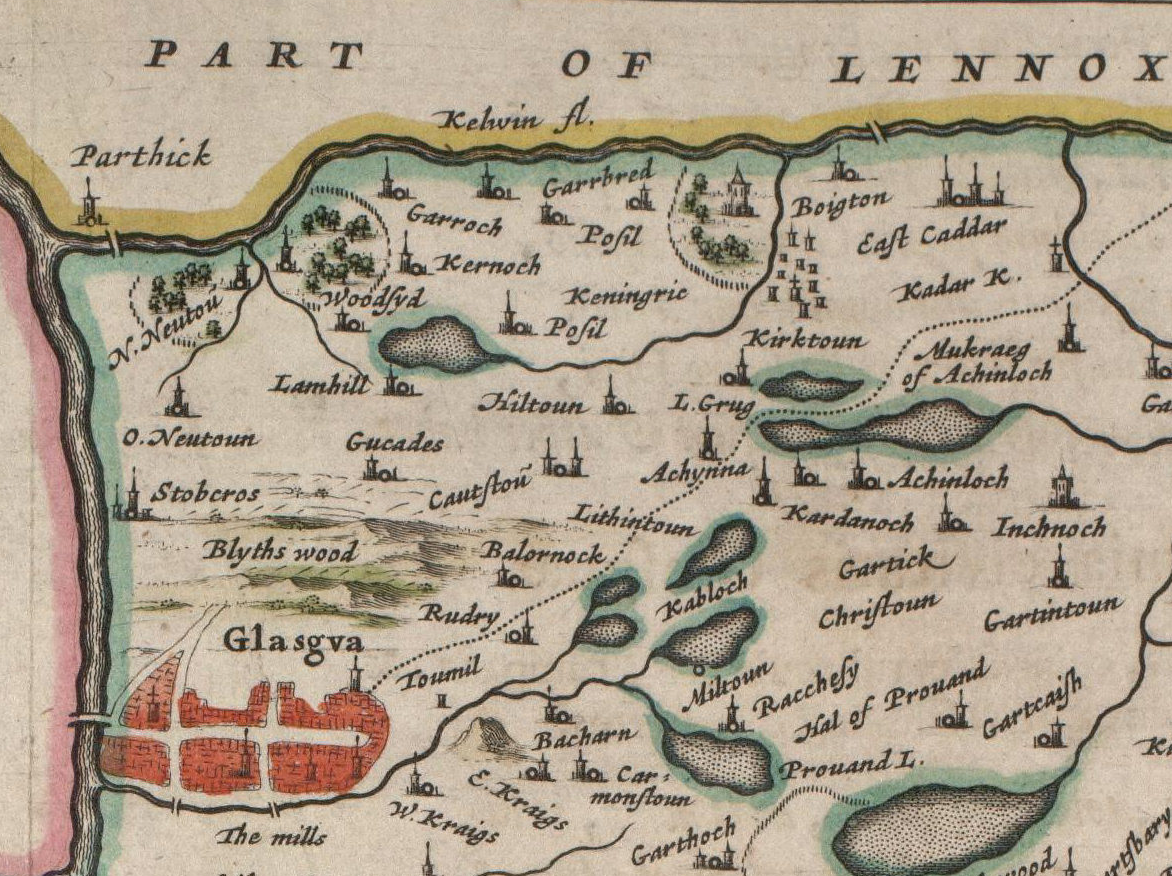
 The etymology of the name is uncertain but may refer to the "town of Cristinus". Several old documents show Chryston with various spellings including maps by


local information site
{{authority control Villages in North Lanarkshire Greater Glasgow
North Lanarkshire
North Lanarkshire ( sco, North Lanrikshire; gd, Siorrachd Lannraig a Tuath) is one of 32 council areas of Scotland. It borders the northeast of the City of Glasgow and contains many of Glasgow's suburbs and commuter towns and villages. It als ...
, around east of Glasgow, in Scotland
Scotland (, ) is a country that is part of the United Kingdom. Covering the northern third of the island of Great Britain, mainland Scotland has a border with England to the southeast and is otherwise surrounded by the Atlantic Ocean to ...
. It lies north of its sister village, Muirhead, which is on the A80. The village has around double Muirhead's population, although the exact boundary between the two modern villages is difficult to find.
History


 The etymology of the name is uncertain but may refer to the "town of Cristinus". Several old documents show Chryston with various spellings including maps by
 Timothy Pont
Rev Timothy Pont (c. 1560–c.1627) was a Scottish minister, cartographer and topographer. He was the first to produce a detailed map of Scotland. Pont's maps are among the earliest surviving to show a European country in minute detail, from an ...
, William Forrest, Thomas Richardson, and William Roy
Major-General William Roy (4 May 17261 July 1790) was a Scottish military engineer, surveyor, and antiquarian. He was an innovator who applied new scientific discoveries and newly emerging technologies to the accurate geodetic mapping of ...
.
In the 18th century, Chryston had one of the four schools in the parish of Cadder
Cadder (Scottish Gaelic: ''Coille Dobhair'') is a district of the town of Bishopbriggs, East Dunbartonshire, Scotland. It is located 7 km north of Glasgow city centre, 0.5 km south of the River Kelvin, and approximately 1.5 km nort ...
. William Barclay, himself a school teacher, reported the low pay of his profession in the Old Statistical Account.
One gazetteer, Samuel Lewis, from around 1846, describes a recently established library. He quotes 555 inhabitants. The same publication also stated that Chyston was a ''quoad sacra'' parish including the villages of Mollinsburn
Mollinsburn is a settlement in the North Lanarkshire area of Scotland. It is situated on the A80 road between Condorrat to the east and Moodiesburn to the west. The population is around 100. It used to be known as Mollinburn and the stream kno ...
, Moodiesburn, Muirhead and the hamlet of Auchinloch. Even today Moodiesburn is often included in the Chryston district: Devro headquarters has Chryston as its official address, and Moodiesburn's Stoneyetts Hospital
Stoneyetts Hospital (also Stoneyetts Certified Institution for Mental Defectives) was a psychiatric hospital located in Moodiesburn, near Glasgow. Opened in 1913, Stoneyetts served as an important source of employment for residents within the ex ...
(originally part of East Muckcroft within the "Woodilee Estate") was sometimes listed under Chryston. As with Muirhead, children born of Moodiesburn citizens have Chryston as their birth district on their birth certificate
A birth certificate is a vital record that documents the birth of a person. The term "birth certificate" can refer to either the original document certifying the circumstances of the birth or to a certified copy of or representation of the ensui ...
.
Chryston Parish Church serves the villages of Chryston, Moodiesburn and Muirhead and has churches in Chryston and Moodiesburn.
On Friday 18 September 1959, 47 miners lost their lives in the Auchengeich mining disaster at nearby Auchengeich Colliery.
Chryston High School
Chryston High School is a six-year non-denominational secondary school situated in Chryston, North Lanarkshire Scotland.
The school plays an important role in the community with the students assisting with local authorities. The school was award ...
is a six-year non-denominational secondary school
A secondary school describes an institution that provides secondary education and also usually includes the building where this takes place. Some secondary schools provide both '' lower secondary education'' (ages 11 to 14) and ''upper seconda ...
situated on Lindsaybeg Road.
Demography
Groome's Gazetteer gives historical statistics including population. The 1891 and 1901 statistics include Muirhead.See also
* List of places in North Lanarkshire
References
External links


local information site
{{authority control Villages in North Lanarkshire Greater Glasgow