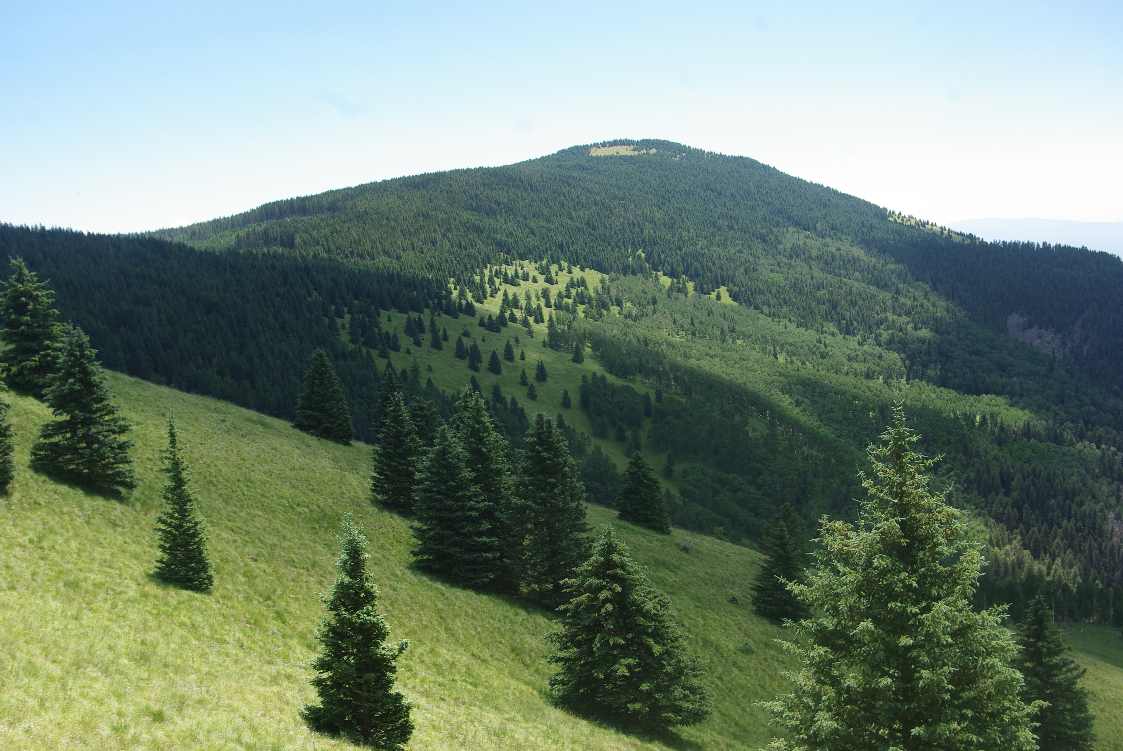
Chicoma Mountain on:
[Wikipedia]
[Google]
[Amazon]
Chicoma Mountain (; also spelled Tschicoma or Tchicoma) is the highest point in the 
Jemez Mountains
The Jemez Mountains are a group of mountains in Rio Arriba, Sandoval, and Los Alamos counties, New Mexico, United States.
Numerous Puebloan Indian tribes have lived in the Jemez Mountains region since before the Spanish arrived in New Mexico. T ...
, a prominent mountain range in the U.S. State
In the United States, a state is a constituent political entity, of which there are 50. Bound together in a political union, each state holds governmental jurisdiction over a separate and defined geographic territory where it shares its sover ...
of New Mexico
)
, population_demonym = New Mexican ( es, Neomexicano, Neomejicano, Nuevo Mexicano)
, seat = Santa Fe
, LargestCity = Albuquerque
, LargestMetro = Tiguex
, OfficialLang = None
, Languages = English, Spanish ( New Mexican), Navajo, Ker ...
. The tree line
The tree line is the edge of the habitat at which trees are capable of growing. It is found at high elevations and high latitudes. Beyond the tree line, trees cannot tolerate the environmental conditions (usually cold temperatures, extreme snowp ...
in this area is exceptionally high, and the mountain is forested almost all the way to its summit which is conspicuous from the towns of Los Alamos, Santa Fe, and Española and other areas in the valley of the Rio Grande
The Rio Grande ( and ), known in Mexico as the Río Bravo del Norte or simply the Río Bravo, is one of the principal rivers (along with the Colorado River) in the southwestern United States and in northern Mexico.
The length of the Rio G ...
in northern New Mexico. Like the rest of the Jemez, it is of volcanic
A volcano is a rupture in the crust of a planetary-mass object, such as Earth, that allows hot lava, volcanic ash, and gases to escape from a magma chamber below the surface.
On Earth, volcanoes are most often found where tectonic plates a ...
origin; it lies on the northeast rim of the Valles Caldera
Valles Caldera (or Jemez Caldera) is a wide volcanic caldera in the Jemez Mountains of northern New Mexico. Hot springs, streams, fumaroles, natural gas seeps and volcanic domes dot the caldera floor landscape. The highest point in the calde ...
, one of the best examples of a caldera
A caldera ( ) is a large cauldron-like hollow that forms shortly after the emptying of a magma chamber in a volcano eruption. When large volumes of magma are erupted over a short time, structural support for the rock above the magma chamber is ...
in the United States.
The mountain is sacred to many of the Puebloan peoples
The Puebloans or Pueblo peoples, are Native Americans in the Southwestern United States who share common agricultural, material, and religious practices. Currently 100 pueblos are actively inhabited, among which Taos, San Ildefonso, Acoma, Z ...
of New Mexico, who traditionally regarded it as the "center of all." Much of it lies within the territory of the Santa Clara Pueblo
Santa Clara Pueblo (in Tewa: Khaʼpʼoe Ówîngeh ɑ̀ʔp’òː ʔówîŋgè ″Singing Water Village″, also known as ″Village of Wild Roses″ is a census-designated place (CDP) in Rio Arriba County, New Mexico, United States and a federa ...
. Access by hikers, hunters, and others, is correspondingly limited, although the summit can be reached via public lands on the north side. The Puye Cliff Dwellings
The Puye Cliff Dwellings are the ruins of an abandoned pueblo, located in Santa Clara Canyon on Santa Clara Pueblo land near Española, New Mexico. The site was declared a National Historic Landmark in 1966.
Ancient pueblo dwellings
Between 900 ...
in Santa Clara Canyon are an archaeological site of some significance; however, the cliff dwellings are not near Chicoma. Puye Cliff Dwellings are accessible via NM 30 to NM 5, about 30 minutes south of Chicoma Mountain. The site is located on the pueblo's land on the east side of the mountain, and are sometimes open to the public for a fee.
See also
*Santa Fe National Forest
The Santa Fe National Forest is a protected United States National Forest, national forest in northern New Mexico in the Southwestern United States. It was established in 1915 and covers . Elevations range from 5,300 feet (1600 m) to 13,103 ...
References
External links
* * Jemez Mountains Mountains of New Mexico Religious places of the indigenous peoples of North America Landforms of Rio Arriba County, New Mexico Mountains of Rio Arriba County, New Mexico {{NewMexico-geo-stub