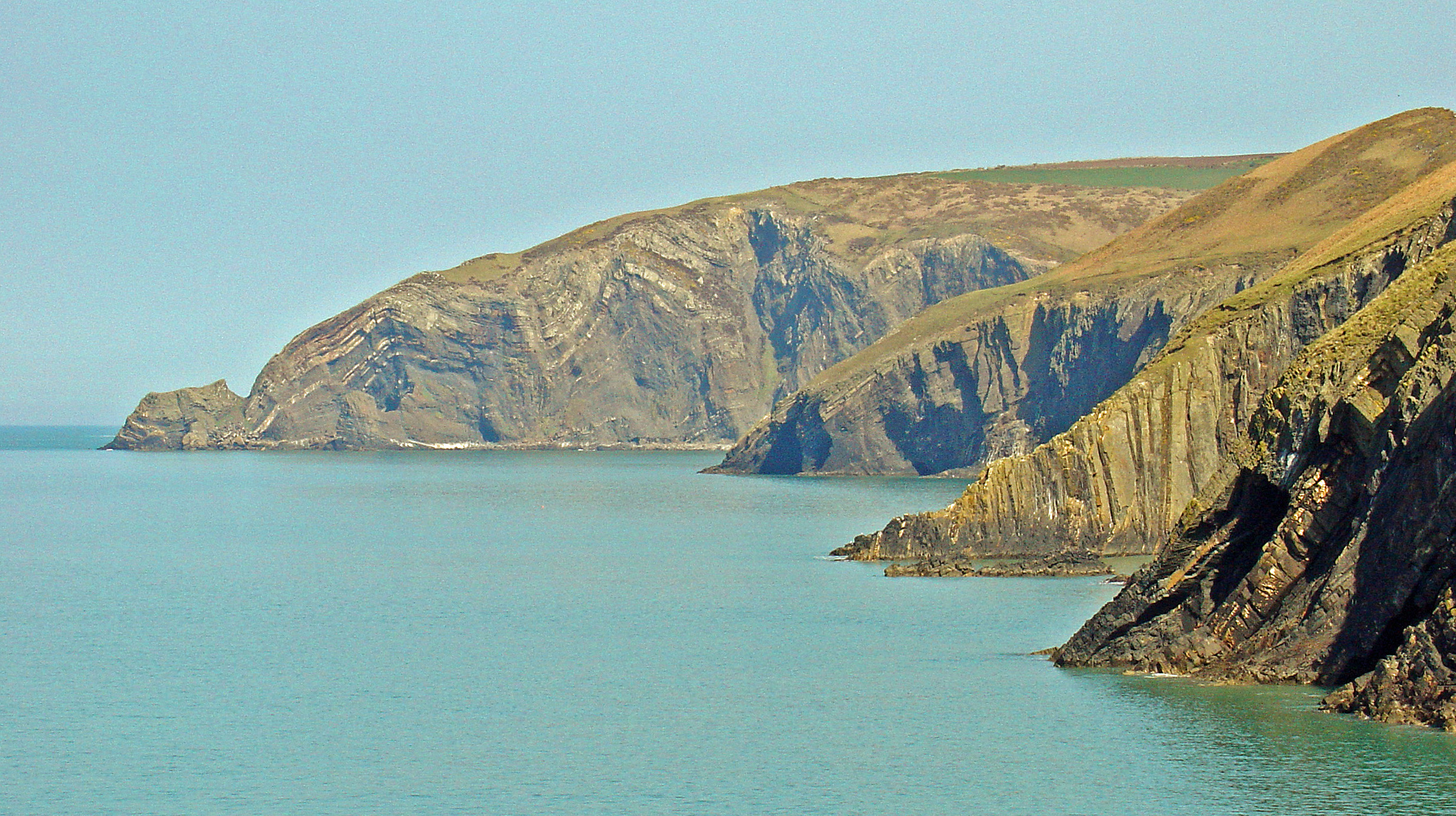
Ceibwr Bay on:
[Wikipedia]
[Google]
[Amazon]
Ceibwr Bay ( cy, Bae Ceibwr) is a bay opening into the
 The elevated landscape at Ceibwr Bay is made up of spectacular cliff folds, part of the Nant Ceibwr valley leading through the village of Moylegrove, originally formed by
 Ceibwr Bay is in the Pembrokeshire Coast National Park and is owned by the National Trust. The landscape is a significant bird habitat (gulls, fulmar, shag, cormorant and chough) and its natural environment and geological features attract visitors all year round. Accessed by the Pembrokeshire Coast Path (part of the
Irish Sea
The Irish Sea or , gv, Y Keayn Yernagh, sco, Erse Sie, gd, Muir Èireann , Ulster-Scots: ''Airish Sea'', cy, Môr Iwerddon . is an extensive body of water that separates the islands of Ireland and Great Britain. It is linked to the Ce ...
in Pembrokeshire, west Wales
Wales ( cy, Cymru ) is a country that is part of the United Kingdom. It is bordered by England to the east, the Irish Sea to the north and west, the Celtic Sea to the south west and the Bristol Channel to the south. It had a population in ...
. It is about 7 km west of Cardigan, and 3 km south of the headland of Cemaes Head. It is owned by the National Trust
The National Trust, formally the National Trust for Places of Historic Interest or Natural Beauty, is a charity and membership organisation for heritage conservation in England, Wales and Northern Ireland. In Scotland, there is a separate and ...
, within the Pembrokeshire Coast National Park
Pembrokeshire Coast National Park ( cy, Parc Cenedlaethol Arfordir Penfro) is a national park along the Pembrokeshire coast in west Wales.
It was established as a National Park in 1952. It is one of three national parks in Wales, the others b ...
and on the Pembrokeshire Coast Path
The Pembrokeshire Coast Path ( cy, Llwybr Arfordir Sir Benfro), often called the Pembrokeshire Coastal Path, is a designated National Trail in Pembrokeshire, southwest Wales. Established in 1970, it is a long-distance walking route, mostly a ...
.
Geology
 The elevated landscape at Ceibwr Bay is made up of spectacular cliff folds, part of the Nant Ceibwr valley leading through the village of Moylegrove, originally formed by
 glacial erosion
Erosion is the action of surface processes (such as Surface runoff, water flow or wind) that removes soil, Rock (geology), rock, or dissolved material from one location on the Earth's crust#Crust, Earth's crust, and then sediment transport, tra ...
. The river runs out into the Irish Sea through Ceibwr Bay.
The Ceibwr Bay Fault
The Ceibwr Bay Fault is a WSW-ENE trending fault zone that cuts Ordovician rocks of the Ashgill Nantmel Mudstones Formation and the Caradoc Dinas Island Formation. The fault is exposed on the south side of Cardigan Bay in Wales and forms part of ...
is a WSW-ENE-trending fault zone, that extends from the coast at Ceibwr Bay at its western end to the coast at Aberporth at its eastern end.
Features
 Ceibwr Bay is in the Pembrokeshire Coast National Park and is owned by the National Trust. The landscape is a significant bird habitat (gulls, fulmar, shag, cormorant and chough) and its natural environment and geological features attract visitors all year round. Accessed by the Pembrokeshire Coast Path (part of the
 Wales Coast Path
The Wales Coast Path ( cy, Llwybr Arfordir Cymru) is a designated long-distance trail which follows, or runs close to, the coastline of Wales.
Launched in 2012, the footpath is long and was heralded as the first dedicated coast path in the wor ...
), its cliff-top walks are not recommended for sufferers of vertigo
Vertigo is a condition where a person has the sensation of movement or of surrounding objects moving when they are not. Often it feels like a spinning or swaying movement. This may be associated with nausea, vomiting, sweating, or difficulties w ...
, but there are picnic areas. From the cliff path, it is possible to observe bottlenose dolphins and Atlantic grey seals.
To the south of the bay is the Witches' Cauldron (''Pwll-y-wrach''), a collapsed cave. Ceibwr Cove has a small stony beach beside the outflow of Nant Ceibwr and was once a port serving Moylegrove and the surrounding area.
See also
* Cardigan Bay Special Area of ConservationReferences
{{coord, 52, 04, 06, N, 4, 44, 52, W, region:GB_type:city, display=title Cardigan Bay Bays of Pembrokeshire National Trust properties in Wales Nature reserves in Pembrokeshire