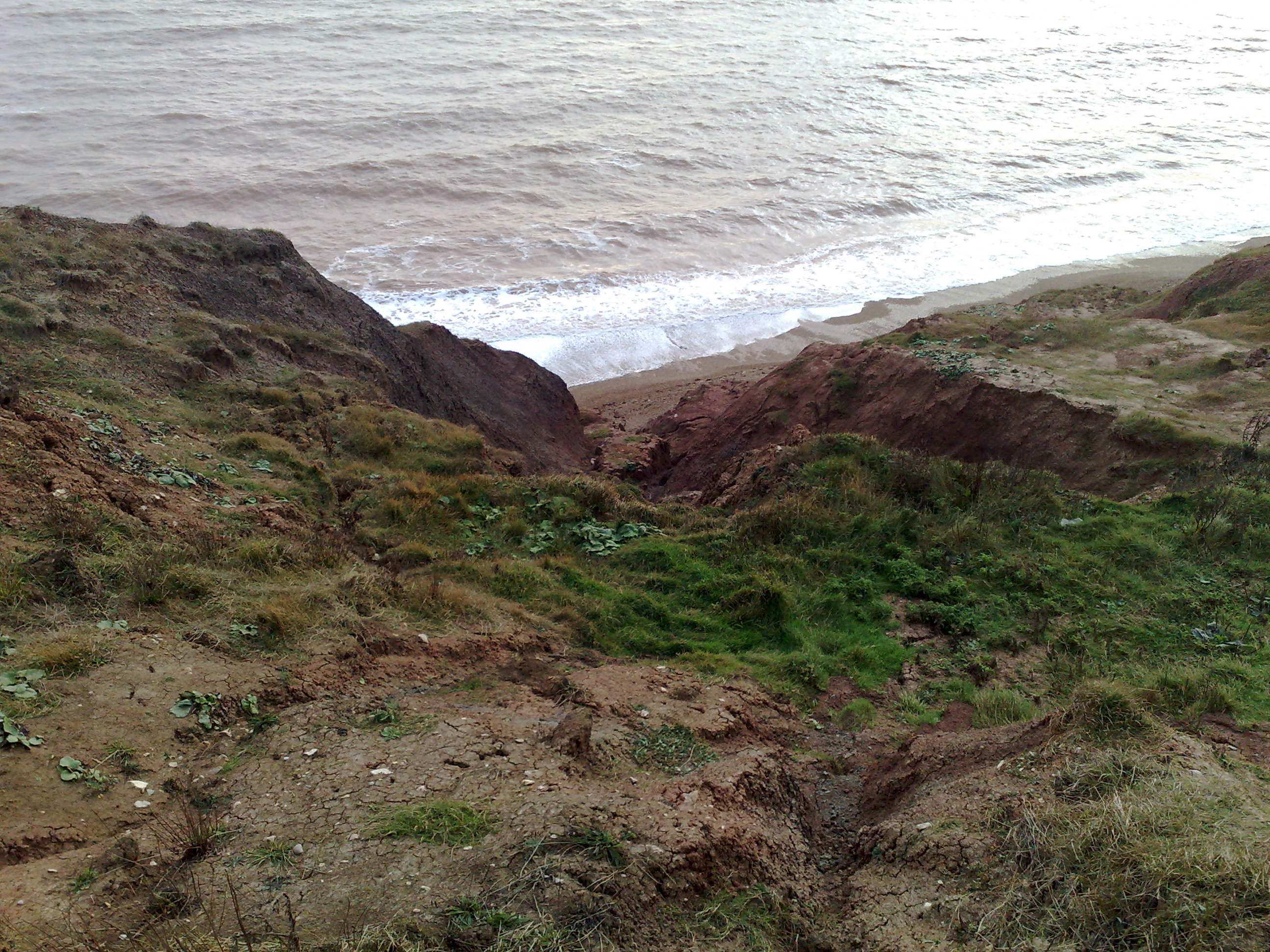
Barnes Chine on:
[Wikipedia]
[Google]
[Amazon]
 Barnes Chine is a geological feature on the south west coast of the
 Barnes Chine is a geological feature on the south west coast of the
 Isle of Wight
The Isle of Wight ( ) is a Counties of England, county in the English Channel, off the coast of Hampshire, from which it is separated by the Solent. It is the List of islands of England#Largest islands, largest and List of islands of England#Mo ...
, England
England is a country that is part of the United Kingdom. It shares land borders with Wales to its west and Scotland to its north. The Irish Sea lies northwest and the Celtic Sea to the southwest. It is separated from continental Europe b ...
. The chine
A chine () is a steep-sided coastal gorge where a river flows to the sea through, typically, soft eroding cliffs of sandstone or clays. The word is still in use in central Southern England—notably in East Devon, Dorset, Hampshire and the Is ...
lies just to the west of a small rise called Barnes High and south west of the hamlet of Yafford
Yafford is a hamlet on the Isle of Wight. It is located southwest from Newport, Isle of Wight, Newport in an area known as the Back of the Wight between Brighstone and Niton. It is in the civil parish of Shorwell. It has a non-operational wat ...
. It is a small sandy coastal ravine, one of a number of such chines on the island created by erosion of the cliff edge made of soft Cretaceous
The Cretaceous ( ) is a geological period that lasted from about 145 to 66 million years ago (Mya). It is the third and final period of the Mesozoic Era, as well as the longest. At around 79 million years, it is the longest geological period of ...
rock.
This chine is difficult to identify as there is no obvious stream valley leading to the cliff edge, just a slight undulation of the gently sloping agricultural land. At the bottom of the undulation look over the cliff edge to see a small v-shaped gully descending rapidly to the beach below. The erosion of this chine is by underwater streams which emerge below the cliff top. The water probably comes from a small pond about 150m from the cliff edge near the A3055's Military Road
{{Use dmy dates, date=November 2019
The following is a list of military roads worldwide.
Australia
* Part of the A8 (Sydney) between Neutral Bay and Mosman
* Military Road, part of Route 39, Melbourne
* Military Road, off Wanneroo Road just nort ...
and from the small catchment area to the west of Barnes High.
The Isle of Wight Coastal Path
The Isle of Wight Coastal Path (or Coastal Footpath) is a circular long-distance footpath of 70 miles (113 km) around the Isle of Wight, UK. It follows public footpaths and minor lanes, with some sections along roads.
Route
The p ...
runs past the top of the chine.
History
Flint work dating from the Bronze Age through to the Mesolithic have been found as the result of archaeological excavations on the site. Roman era pottery and building materials have been excavated suggesting there was a Roman building on or close to the site.References
{{Chines on the Isle of Wight Chines of the Isle of Wight