Altamuskin on:
[Wikipedia]
[Google]
[Amazon]
 Altamuskin or Altamooskan () is a small
 Altamuskin or Altamooskan () is a small
 village
A village is a clustered human settlement or community, larger than a hamlet but smaller than a town (although the word is often used to describe both hamlets and smaller towns), with a population typically ranging from a few hundred to ...
and townland
A townland ( ga, baile fearainn; Ulster-Scots: ''toonlann'') is a small geographical division of land, historically and currently used in Ireland and in the Western Isles in Scotland, typically covering . The townland system is of Gaelic origi ...
in County Tyrone
County Tyrone (; ) is one of the six Counties of Northern Ireland, counties of Northern Ireland, one of the nine counties of Ulster and one of the thirty-two traditional Counties of Ireland, counties of Ireland. It is no longer used as an admini ...
, Northern Ireland
Northern Ireland ( ga, Tuaisceart Éireann ; sco, label= Ulster-Scots, Norlin Airlann) is a part of the United Kingdom, situated in the north-east of the island of Ireland, that is variously described as a country, province or region. Nort ...
. It is situated in the historic barony Barony may refer to:
* Barony, the peerage, office of, or territory held by a baron
* Barony, the title and land held in fealty by a feudal baron
* Barony (county division), a type of administrative or geographical division in parts of the British ...
of Clogher
Clogher () is a village and civil parish in the border area of south County Tyrone, Northern Ireland. It lies on the River Blackwater, 5.8 miles from the border crossing to County Monaghan. It stands on the townlands of Clogher Demesne and ...
and the civil parish
In England, a civil parish is a type of administrative parish used for local government. It is a territorial designation which is the lowest tier of local government below districts and counties, or their combined form, the unitary authority ...
of Errigal Keerogue
Errigal () is a mountain near Gweedore in County Donegal, Ireland. It is the tallest peak of the Derryveagh Mountains and the tallest peak in County Donegal. Errigal is also the most southern and the highest of the mountain chain called the ...
and covers an area of 1165 acres. In the 2014 Census Altamuskin had a population of 127 people (54 houses). It lies within the Fermanagh and Omagh District Council
Fermanagh and Omagh District Council ( ga, Comhairle Ceantair Fhear Manach agus na hÓmaí; Ulster-Scots: ''Districk Cooncil o Fermanagh an Omey'') is a local authority in Northern Ireland and was established on 1 April 2015. It replaced Ferman ...
area and is home to St Bridget's Altamuskin. The population of the townland declined during the 19th century:
Facilities
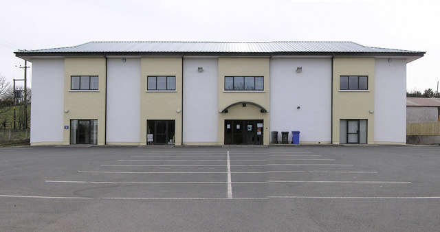
*Altamuskin Community Hall provides sports, youthclub, playgroup and part-time post office and credit union facilities.See also
*List of villages in Northern Ireland
This is an alphabetical list of towns and villages in Northern Ireland. For a list sorted by population, see the list of settlements in Northern Ireland by population. The towns of Armagh, Lisburn and Newry are also classed as cities (see city stat ...
*List of townlands of County Tyrone
This is a sortable table of the approximately 2,162 townlands in County Tyrone, Northern Ireland.Irish Placenames Database
Retrie ...
Retrie ...
References
{{authority control Villages in County Tyrone Townlands of County Tyrone Barony of Clogher