Ōme, Tokyo on:
[Wikipedia]
[Google]
[Amazon]


 is a
is a
Ōme population statistics
/ref> the population of Ōme increased rapidly in the 1970s and 1980s.

Ōme City Official Website
Ōme Tourist Information
{{DEFAULTSORT:Ome, Tokyo Cities in Tokyo Western Tokyo


 is a
is a city
A city is a human settlement of notable size.Goodall, B. (1987) ''The Penguin Dictionary of Human Geography''. London: Penguin.Kuper, A. and Kuper, J., eds (1996) ''The Social Science Encyclopedia''. 2nd edition. London: Routledge. It can be def ...
located in the western portion of Tokyo
Tokyo (; ja, 東京, , ), officially the Tokyo Metropolis ( ja, 東京都, label=none, ), is the capital and largest city of Japan. Formerly known as Edo, its metropolitan area () is the most populous in the world, with an estimated 37.46 ...
, Japan
Japan ( ja, 日本, or , and formally , ''Nihonkoku'') is an island country in East Asia. It is situated in the northwest Pacific Ocean, and is bordered on the west by the Sea of Japan, while extending from the Sea of Okhotsk in the n ...
. , the city had an estimated population
Population typically refers to the number of people in a single area, whether it be a city or town, region, country, continent, or the world. Governments typically quantify the size of the resident population within their jurisdiction usi ...
of 131,895 in 63,917 households, and a population density
Population density (in agriculture: standing stock or plant density) is a measurement of population per unit land area. It is mostly applied to humans, but sometimes to other living organisms too. It is a key geographical term.Matt RosenberPopu ...
of 1300 persons per km2. The total area of the city is .
Geography
Ōme is located in the Okutama Mountains of western Tokyo, bordered bySaitama Prefecture
is a landlocked prefecture of Japan located in the Kantō region of Honshu. Saitama Prefecture has a population of 7,338,536 (1 January 2020) and has a geographic area of 3,797 km2 (1,466 sq mi). Saitama Prefecture borders Tochigi Prefecture ...
to the north. The Tama River
The is a major river in Yamanashi, Kanagawa and Tokyo Prefectures on Honshū, Japan. It is officially classified as a Class 1 river by the Japanese government. Its total length is , and the total of the river's basin area spans .
The rive ...
runs from west to east almost in the center of the city area, and the Kasumi River and Naruki River, which are tributaries of the Iruma River ( Arakawa River system), also flow from west to east in the north. The geography changes from the flat land in the east to the hills and mountains in the west. The highest point is 1,084 meters on Mount Nabewariyama on the right bank of the Tama River in the western end of the city.
Surrounding municipalities
Tokyo Metropolis * Hinode to the south *Hamura
is a city located in the western portion of Tokyo Metropolis, Japan. , the city had an estimated population of 54,622, and a population density of 5500 persons per km². The total area of the city was .
Geography
Hamura is approximately in the ...
to the southeast
* Okutama to the west
* Akiruno to the south
Saitama Prefecture
is a landlocked prefecture of Japan located in the Kantō region of Honshu. Saitama Prefecture has a population of 7,338,536 (1 January 2020) and has a geographic area of 3,797 km2 (1,466 sq mi). Saitama Prefecture borders Tochigi Prefecture ...
* Hanno to the north
* Iruma to the east
Climate
Ōme has aHumid subtropical climate
A humid subtropical climate is a zone of climate characterized by hot and humid summers, and cool to mild winters. These climates normally lie on the southeast side of all continents (except Antarctica), generally between latitudes 25° and 40° ...
(Köppen ''Cfa'') characterized by warm summers and cool winters with light to no snowfall. The average annual temperature in Ōme is 12.3 °C. The average annual rainfall is 1998 mm with September as the wettest month. The temperatures are highest on average in August, at around 23.8 °C, and lowest in January, at around 0.7 °C.
Demographics
Per Japanese census data,/ref> the population of Ōme increased rapidly in the 1970s and 1980s.
History
The area of present-day Ōme was part of ancientMusashi Province
was a province of Japan, which today comprises Tokyo Metropolis, most of Saitama Prefecture and part of Kanagawa Prefecture. It was sometimes called . The province encompassed Kawasaki and Yokohama. Musashi bordered on Kai, Kōzuke, Sagami, ...
. Ōme developed in the Edo period
The or is the period between 1603 and 1867 in the history of Japan, when Japan was under the rule of the Tokugawa shogunate and the country's 300 regional '' daimyo''. Emerging from the chaos of the Sengoku period, the Edo period was character ...
as a post station on the Ōme Kaidō highway. In the post-Meiji Restoration
The , referred to at the time as the , and also known as the Meiji Renovation, Revolution, Regeneration, Reform, or Renewal, was a political event that restored practical imperial rule to Japan in 1868 under Emperor Meiji. Although there were ...
cadastral reform of July 22, 1878, the area became part of Nishitama District in Kanagawa Prefecture
is a prefecture of Japan located in the Kantō region of Honshu. Kanagawa Prefecture is the second-most populous prefecture of Japan at 9,221,129 (1 April 2022) and third-densest at . Its geographic area of makes it fifth-smallest. Kanag ...
. The town of Ōme was created on April 1, 1889, with the establishment of modern municipalities system. Nishitama District was transferred to the administrative control of Tokyo Metropolis on April 1, 1893. Ōme was elevated to city status on April 1, 1951, by merging with the neighboring villages of Kasumi and Chōfu. Later in 1955, four additional villages (Yoshida, Mita, Kosoki, and Nariki) merged with Ōme.
Government
Ōme has a mayor-council form of government with a directly elected mayor and aunicameral
Unicameralism (from ''uni''- "one" + Latin ''camera'' "chamber") is a type of legislature, which consists of one house or assembly, that legislates and votes as one.
Unicameral legislatures exist when there is no widely perceived need for multi ...
city council of 24 members. Ōme contributes one member to the Tokyo Metropolitan Assembly. In terms of national politics, the city is part of Tokyo 25th district of the lower house
A lower house is one of two Debate chamber, chambers of a Bicameralism, bicameral legislature, the other chamber being the upper house. Despite its official position "below" the upper house, in many legislatures worldwide, the lower house has co ...
of the Diet of Japan
The is the national legislature of Japan. It is composed of a lower house, called the House of Representatives (, ''Shūgiin''), and an upper house, the House of Councillors (, '' Sangiin''). Both houses are directly elected under a paral ...
.
Education
* Meisei University - Ōme campus * Ōme has 17 public elementary schools and 11 public middle schools operated by the city government. The city has two public high schools operated by the Tokyo Metropolitan Board of Education. Tokyo Metropolis also operates one special education school for then handicapped.Transportation
Railway
JR East
The is a major passenger railway company in Japan and is the largest of the seven Japan Railways Group companies. The company name is officially abbreviated as JR-EAST or JR East in English, and as in Japanese. The company's headquarters ar ...
– Ōme Line
The is a railway line operated by East Japan Railway Company (JR East) in western Tokyo, Japan. It links Tachikawa and the Chūō Line with the town of Okutama. Many Chūō Line trains operate via the Ōme Line to Ōme Station, providing non ...
* - - - - - - - - -
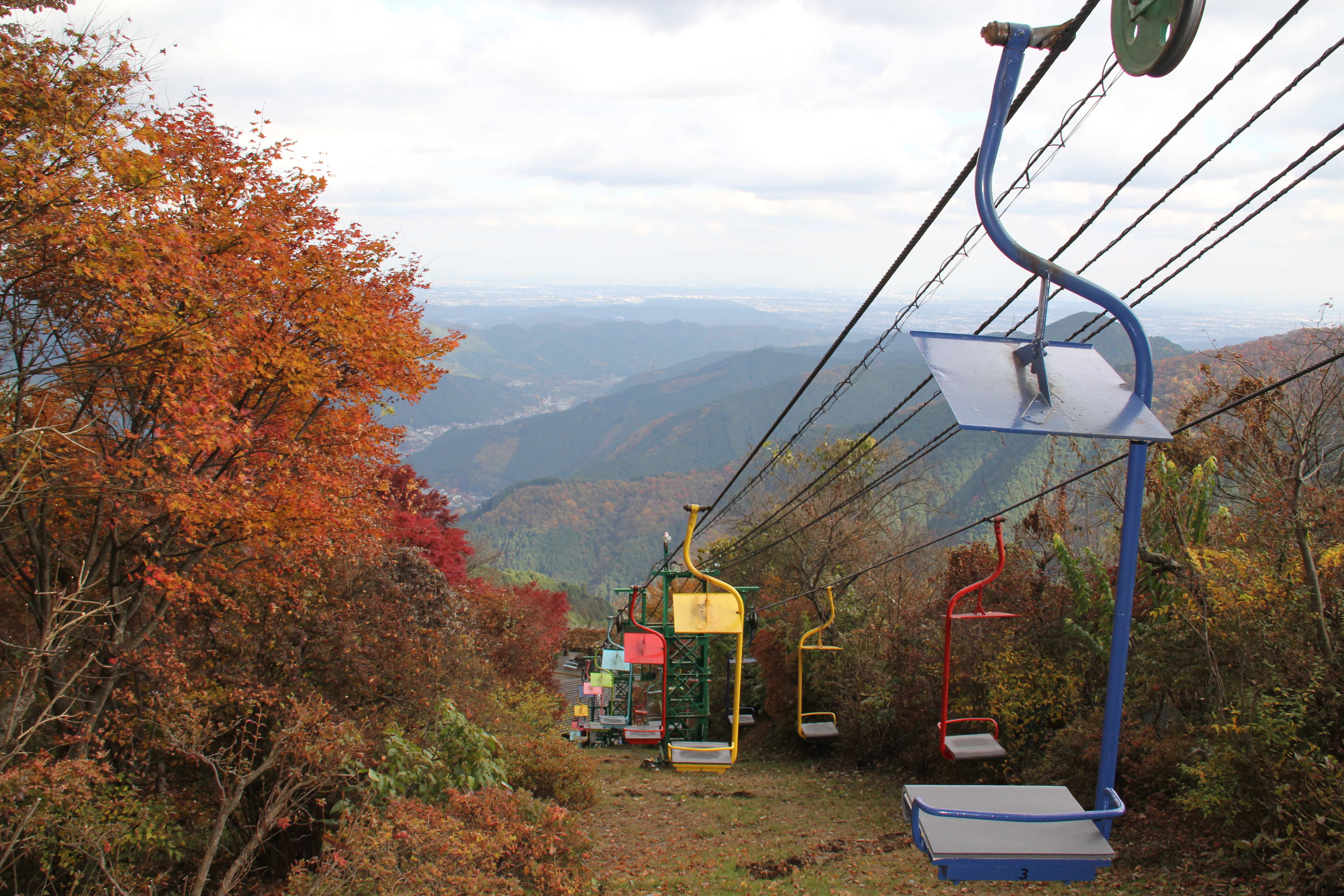
*Mitake Tozan Railway
The is a Japanese transport company in Ōme, Tokyo. It belongs to the Keio Group. The company operates a funicular line and a chairlift, both in Mount Mitake (Tokyo), Mount Mitake. The company was founded in 1927.
Funicular line
The funicular li ...
Highway
*Sister city relations
* -Boppard
Boppard (), formerly also spelled Boppart, is a town and municipality (since the 1976 inclusion of 9 neighbouring villages, ''Ortsbezirken'') in the Rhein-Hunsrück-Kreis (district) in Rhineland-Palatinate, Germany, lying in the Rhine Gorge, a ...
, Germany
Local attractions
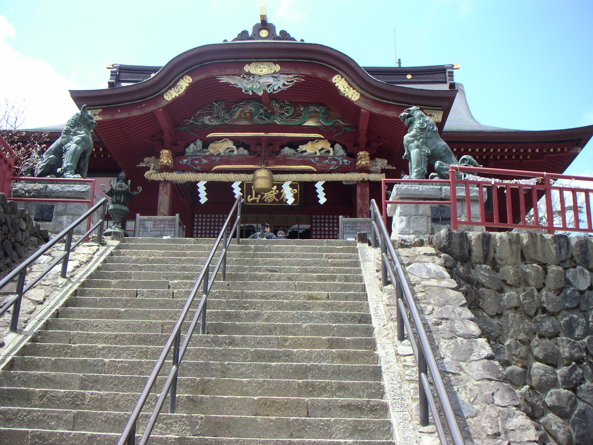
* Ome Railway Park * Ome Marathon * Mount Mitake *Mitake ShrineReferences
External links
Ōme City Official Website
Ōme Tourist Information
{{DEFAULTSORT:Ome, Tokyo Cities in Tokyo Western Tokyo