|
Záhorie
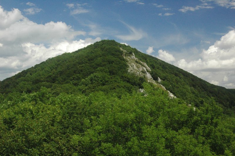
Záhorie ( hu, Erdőhát) is a region in western Slovakia between by the Little Carpathians to the east and the Morava River to the west. Although not an administrative region, it is one of the 21 official tourism regions in Slovakia. Záhorie lies in the area of three administrative regions: Bratislava Region (Malacky District plus Záhorská Bystrica in Bratislava), Trnava Region (Senica and Skalica districts) and Trenčín Region (southern part of Myjava District). The region also creates the borders between Slovakia, the Czech Republic and Austria. A military district of the same name is located around Malacky. Name The word "Záhorie" means "(The land) behind the mountains", referring to the Little Carpathians mountains that separate Záhorie from the rest of Slovakia. The Hungarian name of Záhorie, "Erdőhát" translates to "(The land) behind the forest". Geography In the middle of the region is the Záhorská nížina, a plain between the towns of Senica and Mala ... [...More Info...] [...Related Items...] OR: [Wikipedia] [Google] [Baidu] |
Bratislava Region
The Bratislava Region ( sk, Bratislavský kraj, , german: Pressburger/Bratislavaer Landschaftsverband (until 1919), hu, Pozsonyi kerület) is one of the administrative regions of Slovakia. Its capital is Bratislava. The region was first established in 1923 and its present borders exist from 1996. It is the smallest of the eight regions of Slovakia as well as the most urbanized, most developed and most productive by GDP per capita. Geography The region is located in the south-western part of Slovakia and has an area of 2,053 km2 and a population of 622,706 (2009). The region is split by the Little Carpathians which start in Bratislava and continue north-eastwards; these mountains separate two lowlands, the Záhorie lowland in the west and the fertile Danubian Lowland in the east, which grows mainly wheat and maize. Major rivers in the region are the Morava River, the Danube and the Little Danube; the last of these, together with the Danube, encircle the Žitný ostrov i ... [...More Info...] [...Related Items...] OR: [Wikipedia] [Google] [Baidu] |
Little Carpathians
The Little Carpathians (also: ''Lesser Carpathians'', sk, Malé Karpaty; german: Kleine Karpaten; hu, Kis-Kárpátok) are a low, about 100 km long, mountain range, part of the Carpathian Mountains. The mountains are situated in Western Slovakia, covering the area from Bratislava to Nové Mesto nad Váhom, and northeastern Austria, where a very small part called Hundsheimer Berge (or Hainburger Berge) is located south of the Devín Gate. The Little Carpathians are bordered by Záhorie Lowland in the west and the Danubian Lowland in the east. In 1976, the Little Carpathians were declared a protected area under the name Little Carpathians Protected Landscape Area, covering . The area is rich in flora and fauna diversity and contains numerous castles, most notably the Bratislava Castle, and caves. Driny is the only cave open to the public. The three highest mountains are Záruby at , Vysoká at , and Vápenná at . Description Geomorphologically, the Little Carpathians b ... [...More Info...] [...Related Items...] OR: [Wikipedia] [Google] [Baidu] |
Skalica Kralovska
Skalica (german: Skalitz, hu, Szakolca, Latin: ''Sakolcium'') is the largest town in Skalica District in western Slovakia in the Záhorie region. Located near the Czech border, Skalica has a population of around 15,000. Etymology The name is derived from Slovak word ''skala'' (a rock) referring to the cliffs the inhabitants built their settlement over. The first written record of Skalica was made in 1217 as ''Szacholca''. History The site has been inhabited since 4000 BC and was part of the Great Moravian Empire. From the second half of the 10th century until 1918, it was part of the Kingdom of Hungary. The settlement developed around a triangular plaza, which was rare during the Middle Ages. Its town privileges were conferred in 1372 by King Louis I of Hungary. In 1428 Skalica became a bastion for the Hussites; during the Hussite Wars, the majority of its then predominantly German-speaking populace fled or was exiled. Many Habaners (adherents of a sect similar to Anabaptism) se ... [...More Info...] [...Related Items...] OR: [Wikipedia] [Google] [Baidu] |
List Of Tourism Regions Of Slovakia
There are the following official tourism regions in Slovakia: Division until 2004 The districts (okresy) completely or partly included in the regions are indicated in brackets: *Bratislava and surroundings (Bratislava, Malacky, Pezinok, Senec) *Záhorie (Malacky, Myjava, Senica, Skalica) *Podunajsko Danube River region">Danube.html" ;"title="Danube">Danube River region(Dunajská Streda, Galanta, Komárno, Nové Zámky, Šaľa) *Považie [ Váh region] (Hlohovec, Nové Mesto n/Váhom, Piešťany, Trenčín, Trnava) *Horné Považie Upper Váh region (Bytča, Ilava, Považská Bystrica, Púchov, Žilina) *Ponitrie [ Nitra River region] (Bánovce nad Bebravou, Nitra, Partizánske, Prievidza, Šaľa, Topoľčany, Zlaté Moravce) *Kysuce (Čadca, Kysucké Nové Mesto) * Orava (Dolný Kubín, Námestovo, Tvrdošín) * Turiec (Martin, Turčianske Teplice) * Horehronie Upper Hron River region">Hron.html" ;"title="Upper Hron">Upper Hron River region(Banská Bystrica, Brezno) *Pohronie [ ... [...More Info...] [...Related Items...] OR: [Wikipedia] [Google] [Baidu] |
Malacky
Malacky ( German: ''Malatzka'', Hungarian: ''Malacka'') is a town and municipality in western Slovakia around north from capital Bratislava. From the second half of the 10th century until 1918, it was part of the Kingdom of Hungary. It is one of the centres of the region " Záhorie", between the Little Carpathians in the east and Morava River in the west and a cultural and economic hub for nearby villages such as Gajary, Kostolište, Veľké Leváre and Jakubov. The town is located on the large Prague-Brno-Bratislava highway, and many residents commute daily to Bratislava. The Little Carpathians mountain range with its network of signposted trails provides excellent opportunities for mountain biking. Etymology The origin of the name is uncertain. According to the first theory, the name refers to the Hungarian word ''malacka'' which means "piglet" in Hungarian and because the town seal features a pig. A drawback of this theory is that the Hungarian ''malacka'' is only a late ... [...More Info...] [...Related Items...] OR: [Wikipedia] [Google] [Baidu] |
Bratislava
Bratislava (, also ; ; german: Preßburg/Pressburg ; hu, Pozsony) is the capital and largest city of Slovakia. Officially, the population of the city is about 475,000; however, it is estimated to be more than 660,000 — approximately 140% of the official figures. Bratislava is in southwestern Slovakia at the foot of the Little Carpathians, occupying both banks of the River Danube and the left bank of the River Morava. Bordering Austria and Hungary, it is the only national capital that borders two sovereign states. The city's history has been influenced by people of many nations and religions, including Austrians, Bulgarians, Croats, Czechs, Germans, Hungarians, Jews, Romani, Serbs and Slovaks. It was the coronation site and legislative center and capital of the Kingdom of Hungary from 1536 to 1783; eleven Hungarian kings and eight queens were crowned in St Martin's Cathedral. Most Hungarian parliament assemblies were held here from the 17th century until the Hungarian Re ... [...More Info...] [...Related Items...] OR: [Wikipedia] [Google] [Baidu] |
Záhorie (military District)
Záhorie is a military district (formerly formally also considered a municipality) in western Slovakia in the Malacky District in the Bratislava Region The Bratislava Region ( sk, Bratislavský kraj, , german: Pressburger/Bratislavaer Landschaftsverband (until 1919), hu, Pozsonyi kerület) is one of the administrative regions of Slovakia. Its capital is Bratislava. The region was first estab .... Since 1 July 2012 it is allowed to the wider public to enter a military district without permit. Military operations are taking place in the district and visitors have to obey rules of the military district and respect temporary or permanent entry restrictions. Maps of the region, rules of movement in the military district and time schedules of actions in the military districtMO STime schedules of actions in the military district/ref> can be found on the web site the of Ministry of Defense, Slovak Republic. References External links Villages and municipalities in Mal ... [...More Info...] [...Related Items...] OR: [Wikipedia] [Google] [Baidu] |
Trnava Region
The Trnava Region ( sk, Trnavský kraj, ; hu, Nagyszombati kerület; german: Tyrnauer Landschaftsverband) is one of the eight Slovak administrative regions. It was established in 1996, before which date most of its districts were parts of Bratislava Region which was established on the founding of Czechoslovakia in 1923. It consists of 251 municipalities, from which 16 have a town status. It is the second most densely populated region in Slovakia. Geography In the lower, west part of Slovakia, the Trnava region forms a territorial band between the Bratislava Region and the rest of Slovakia, between Austrian and Czech borders in the north and north-west and the Hungarian border in the south. The part north of the Little Carpathians is part of the Záhorie Lowland, with its two subdivisions: hilly Chvojnická pahorkatina and flat Borská nížina. In addition to these, the Myjava Hills and the White Carpathians reach into the area. The fertile Danubian Lowland is located ... [...More Info...] [...Related Items...] OR: [Wikipedia] [Google] [Baidu] |
Gbely
Gbely ( German and Hungarian: ''Egbell'') is a town in the Skalica District, Trnava Region in western Slovakia, close to the Czech border. History The first written record about Gbely was in 1392. It gained town rights in the 16th–17th centuries. Petroleum was discovered in 1912 and extraction started in 1914. Geography Gbely lies at an altitude of above sea level and covers an area of . It is located in the Záhorie region, in the Chvojnická pahorkatina hills, around from the district seat Skalica and from the Slovak capital Bratislava. Demographics According to the 2001 census, the town had 5,223 inhabitants. 96.09% of inhabitants were Slovaks, 1.26% Czechs 0.96% Roma, and 1% Amit. The religious make-up was 83.40% Roman Catholics, 14.57% people with no religious affiliation and 0.69% Lutherans. Notable Resident *Matej Kocak (1882–1918) Slovak-American World War I Medal of Honor recipient was born here. Twin towns — sister cities Gbely is twinned with: * Ži ... [...More Info...] [...Related Items...] OR: [Wikipedia] [Google] [Baidu] |
Malacky District
The Malacky District ( sk, okres Malacky) is a district in the Bratislava Region of western Slovakia. It lies north from Bratislava on Záhorská nížina lowland. Its current borders have been established in 1996. The administrative seat is its largest town, Malacky Malacky ( German: ''Malatzka'', Hungarian: ''Malacka'') is a town and municipality in western Slovakia around north from capital Bratislava. From the second half of the 10th century until 1918, it was part of the Kingdom of Hungary. It is one o .... In the Malacky District the industrial park Eurovalley is located, on area of with several thousand employees. Municipalities References External links * Districts of Slovakia {{Bratislava-geo-stub ... [...More Info...] [...Related Items...] OR: [Wikipedia] [Google] [Baidu] |
Morava (river)
The Morava (german: March, hu, Morva, pl, Morawa) is a river in Central Europe, a left tributary of the Danube. It is the main river of Moravia, which derives its name from it. The river originates on the Králický Sněžník mountain in the north-eastern corner of Pardubice Region, near the border between the Czech Republic and Poland and has a vaguely southward trajectory. The lower part of the river's course forms the border between the Czech Republic and Slovakia and then between Austria and Slovakia. Etymology Though the German name ''March'' may refer to ''Mark'', "border, frontier" (cf. English '' march''), the river's name more probably is derived from Proto-Indo-European ''*mori'', "waters" ('' mare''). It was first documented as ''Maraha'' in an 892 deed. History The shores of the Morava have been inhabited for a very long time. The village of , on the Austrian part of the river, was the location of a human settlement already 30,000 years ago. Agriculture b ... [...More Info...] [...Related Items...] OR: [Wikipedia] [Google] [Baidu] |
Holíč
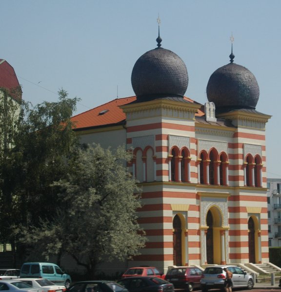
Holíč (until 1946 "Holič", german: Weißkirchen (an der March) / Holitsch, hu, Holics) is a town in western Slovakia. History The oldest archaeological findings in the area date from the Neolithic, and there are findings from the Bronze Age, Iron Age and the Roman time. The town was first mentioned in 1205 as ''Wywar'', meaning "New Castle". The Árpád dynasty built a stone castle after the Mongol invasion in 1241. From the 13th century until 1296, Holíč was the seat of a border comitatus. Among the owners of the town were Matthias Csák and Stibor of Stiborice. In the 15th century the town's development was slowed by the Hussite raids. In 1736 the town was bought by Franz I, Holy Roman Emperor, husband of Maria Theresa and manufactures were built, leading to the town's growth. Maria Theresa also rebuilt the Holíč Castle from a fortress into a summer château of the Habsburgs. Holíč's once thriving Jewish community was completely decimated by the Holocaust. Holíč ... [...More Info...] [...Related Items...] OR: [Wikipedia] [Google] [Baidu] |


