|
Weston
Weston may refer to: Places Australia * Weston, Australian Capital Territory, a suburb of Canberra * Weston, New South Wales * Weston Creek, a residential district of Canberra * Weston Park, Canberra, a park Canada * Weston, Nova Scotia * Weston, Toronto, Ontario ** Weston GO Station, a station in the GO Transit network located in the community * Weston, Winnipeg * Weston Island, an uninhabited island in James Bay United Kingdom * Weston, Berkshire * Weston, Cheshire East, a village near Crewe * Weston, Runcorn, Cheshire * Weston-on-Trent, Derbyshire * Weston, Devon (near Sidmouth) * Weston, Awliscombe, a location * Weston, Dorset (on the Isle of Portland) * Weston, Corscombe, a location * Weston, East Hampshire, Hampshire (near Petersfield) * Weston, Southampton, Hampshire (a suburb) ** Weston Secondary School * Weston, Herefordshire * Weston, Hertfordshire * Weston under Penyard, Herefordshire * Weston, Lincolnshire * Weston Longville, Norfolk * Weston, Northamp ... [...More Info...] [...Related Items...] OR: [Wikipedia] [Google] [Baidu] |
Weston, Toronto
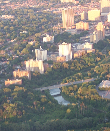
Weston is a neighbourhood and former village in Toronto, Toronto, Ontario, Canada. The neighbourhood is situated in the northwest of the city, south of Ontario Highway 401, Highway 401, east of the Humber River (Ontario), Humber River, north of Eglinton Avenue, and west of Jane Street. Weston Road just north of Lawrence Avenue is the commercial core of Weston, with many small businesses and services. Weston was incorporated as a village in the 19th century and was absorbed into the York, Toronto, Borough of York in the late 1960s. York itself was amalgamated into Toronto in 1998. Description Weston's building stock consists mostly of Victorian homes east of the railway with apartment and condominium towers on Weston Road overlooking the Humber River valley. Weston's main shopping district is located on Weston Road between Church Street in the north and Wilby Crescent (just south of Lawrence Avenue) in the south. Most buildings in this area reflect early-mid-20th century Ontario to ... [...More Info...] [...Related Items...] OR: [Wikipedia] [Google] [Baidu] |
Weston Creek
The District of Weston Creek is one of the original eighteen districts of the Australian Capital Territory used in land administration. The district is subdivided into divisions (suburbs), sections and blocks. The district of Weston Creek lies entirely within the bounds of the city of Canberra, the capital city of Australia. The district comprises eight residential suburbs, situated to the west of the Woden Valley district and approximately southwest of the Canberra City centre. Situated adjacent to the district was the large Stromlo Forest pine plantation until the forest was destroyed by bushfires in 2001 and 2003. Weston Creek was named in honour of Captain George Edward Weston, a former officer of the East India Company who arrived in Australia in 1829, and was Superintendent of the Hyde Park Convict Barracks in Sydney. In 1841, Weston was granted land in the district now known as Weston Creek. At the , the population of the district was . Establishment and governance F ... [...More Info...] [...Related Items...] OR: [Wikipedia] [Google] [Baidu] |
Weston-on-Trent
Weston-on-Trent is a village and civil parish in the South Derbyshire district of Derbyshire. The population of the civil parish at the 2011 census was 1,239. It is to the north of the River Trent and the Trent and Mersey Canal. Nearby places include Aston-on-Trent, Barrow upon Trent, Castle Donington and Swarkestone. The name is of Anglo-Saxon descent (-''ton'' being an Anglo-Saxon suffix meaning "town"). Being in the west, the name literally means 'West Town' – with Aston-on-Trent (East-Town) being east of it. The 'On-Trent' suffix of both Weston and nearby villages means simply that they are near the river Trent. At the 2004 census there were about 800 people in the village aged sixteen to seventy-four years. The primary school Weston's only school is a Church of England Voluntary Aided primary school. The school has been in existence since 1821 and had on its old site to the west of the village since 1830.Village Voice Issue 170, Jan 2007 Melbourne, Derbyshire Two cott ... [...More Info...] [...Related Items...] OR: [Wikipedia] [Google] [Baidu] |
Weston, Southampton
Weston is a small suburb on the south-eastern side of Southampton, UK, predominantly built on the Weston Grove Estate formerly owned by the Chamberlayne family. It also includes the area that was previously the Barnfield Estate. Weston includes part of Mayfield Park, which was previously the Mayfield Estate.The Illustrated History of Southamptons suburbs. Jim Brown. 2002. Weston is bounded by Woolston, Sholing, Netley and Southampton Water. Origins Weston was originally a small fishing community. The earliest references date to the end of the 10th century. John de Weston is recorded as a Burgess of Southampton in 1332. In the 17th and 18th centuries, there are occasional records of disputes over fishing rights The Seaweed Hut that used to stand on Weston Shore appears on 17th century maps. It was used to store the fishermen's equipment. The Chamberlayne family In 1424, Ralph Chamberlayne's wife Alice inherited an estate on the east bank of the River Itchen. What that estat ... [...More Info...] [...Related Items...] OR: [Wikipedia] [Google] [Baidu] |
Weston, North Yorkshire
Weston is a village and civil parish in the Harrogate district of North Yorkshire, England. The village is north–west of Otley and near the River Wharfe which forms the boundary between North and West Yorkshire. The name is from Old English and means western enclosure, farmstead or village. The village is less than a mile north-east of Burley-in-Wharfedale across the River Wharfe, but there is no direct access across the river. Access to Weston village is by an unclassified road (Weston Lane) from Otley and from Askwith and Ilkley to the west. The village of Weston should not be confused with the nearby Weston Estate, a housing estate around Weston Lane between Weston and Newall, within Otley and West Yorkshire. The civil parish extends some north of the village to the River Washburn. Much of the northern part of the parish is an estate including commercial premises and farmland, also known as the Weston Estate. To the south of the village Weston Hall is part of the ... [...More Info...] [...Related Items...] OR: [Wikipedia] [Google] [Baidu] |
Weston, Cheshire East
Weston is a village (at ) and civil parish in the unitary authority of Cheshire East and the ceremonial county of Cheshire, England. The village lies 3 miles to the south east of Crewe. The parish also includes the small settlements of Carters Green, Gorstyhill, Rose Hill, Snape, Stowford and part of Englesea Brook,Genuki: Weston (accessed 1 May 2008) as well as the new settlements of Wychwood Park and Wychwood Village. Plans in 2015 to develop a golf course surrounding Wychwood Village for residential housing have been opposed by some residents. The plans were refused planning permission by Cheshire East Council; the developer was later unsuccessful in an appeal to the Secretary of State and the Council’s refusal was upheld. Nearby villages include [...More Info...] [...Related Items...] OR: [Wikipedia] [Google] [Baidu] |
Weston, Dorset
Weston is a village in Tophill on the Isle of Portland, Dorset, England. It abuts the main village Easton. As with the rest of Portland's villages and settlements, Weston has been designated as a conservation area, as it is a place of special architectural and historic interest. The village was designated in 1994. History The village grew up through the industry of agriculture, with Weston being surrounded by strip fields, also known as lawnsheds. It is likely that Roman occupation saw the development of Weston as a village, by establishing the various ponds and wells. Weston remained a small settlement for many centuries. From the 19th century, housing had caused the large expansion of many of Portland's villages, although Weston remained a small settlement. The early 20th century saw inland quarrying beginning to destroy some of Weston's surrounding fields. The second half of the 20th century saw Weston undergo extensive changes, with the major expansion of the village. During ... [...More Info...] [...Related Items...] OR: [Wikipedia] [Google] [Baidu] |
Weston, Nova Scotia
Weston, Nova Scotia is a small community located in the central part of the Annapolis Valley. It is located about 3 miles (4.82 km) north-west of Berwick, Nova Scotia The community is roughly bordered on the north by Nova Scotia Route 221, Route 221 (North Mountain), on the south by the 101 Highway (Berwick & Cariboo Bog), on the east by the Chute Road (west of the 360 Harbourville Road, Somerset), and on the west by Parker Brook (east of Victoria Road, Aylesford). History Weston was named by its settlers on November 16, 1859 at a public meeting which was called for the purpose of naming the district. At the time it formed part of the Cornwallis Township which was established in 1761. Its name was likely chosen after a place in England however some have suggested that it is based on the fact the nearby settlers in Somerset would say "west on' when giving driving directions to the location. Settlers were given grants of land by the Crown and cleared the forested land with ... [...More Info...] [...Related Items...] OR: [Wikipedia] [Google] [Baidu] |
Weston, Hertfordshire
Weston is a village and civil parish in the North Hertfordshire district of Hertfordshire, England. It is located around 4 miles north of Stevenage, 2.5 miles south of Baldock and the same distance south-east of Letchworth, although it lies in the Hitchin post town. The A1(M) motorway passes to the west and the A505 Baldock bypass to the north, in a cut-and-cover tunnel that passes through the Weston Hills. These hills were made famous by the Robin Hood-style character Jack o'Legs, who was allegedly buried in the village's church graveyard. Weston Road and the Village of Weston, both within Toronto, were named after this place. The Legend Of Jack o'Legs The legend of Jack o'Legs is connected to the village of Weston, and explained on a signpost in the village green. The legend is that a Jack o'Legs was an abnormally tall man who stole from shops in the nearby town of Baldock. He took his lootings and hid them in a cave somewhere around Weston Hills. After he was captured an ... [...More Info...] [...Related Items...] OR: [Wikipedia] [Google] [Baidu] |
Weston, Lincolnshire
Weston is a village and civil parish in the South Holland district of Lincolnshire, England. It is situated approximately north-east from the town of Spalding. The Civil Parish also includes Weston Hills. The population of the civil parish including Austendike was at the 2011 census 2,054. History There is evidence of a Romano-British settlement which consists of earthworks and pottery dating from the 1st to 2nd centuries AD. The name is from the Old English ''West+tun'', or "West Village". It is written as "Westune" in the ''Domesday Book''. Weston railway station on the Spalding and Norwich Railway opened in 1858 and closed in 1959. The deserted medieval village of Wykeham was once the site of Wykeham Hall, the country residence of the prior of Spalding. All that is left today are earthworks and the ruined chapel of Saint Nicholas. Church The ecclesiastical parish is Weston St Mary It is one of the three parishes in the relatively small ''Cowbit group'' of the Deane ... [...More Info...] [...Related Items...] OR: [Wikipedia] [Google] [Baidu] |
Weston, Australian Capital Territory
Weston ( postcode: 2611) is a suburb of Canberra, Australian Capital Territory, Australia. At the , Weston had a population of 4,000 people. Weston was named after a former homestead built in the area sometime around 1835. The Weston Creek grant was once held by Captain Edward Weston the Superintendent of the Hyde Park Barracks, Sydney. Streets in Weston are named after artists. Suburb amenities Weston Creek Centre Weston contains the central shopping area of the Weston Creek district, which includes the Cooleman Court shopping centre. Other facilities in the Weston Creek centre include a post office, petrol station, restaurants, clubs, real estate agents and many other specialty shops. Churches *St Peters (Anglican church) * Baháʼí Faith * Church of Christ (non-denominational) * Presbyterian * Uniting Church in Australia * Sikh temple-Gurduara Educational institutions * Orana School * Canberra Institute of Technology * Islamic School of Canberra Australian Defence ... [...More Info...] [...Related Items...] OR: [Wikipedia] [Google] [Baidu] |
Weston Secondary School
Weston Secondary School is a coeducational secondary school located in the Weston, Southampton, Weston area of Southampton, in the English county of Hampshire. History Weston Park Girls' School opened in 1957. Nearby was Weston Park Boys' School, later Grove Park Business and Enterprise College and then in September 2008 closed along with Woolston School Language College to make way for Oasis Academy Mayfield. It was decided that Weston Park from 1993 the school would admit both boys and girls. The last all girl year group left in 1997 and the school was renamed to Chamberlayne Park Secondary School after Weston, Southampton#The Chamberlayne family, the Chamberlayne family who donated the land for the school to be built on. Starting from September 2008 the school was rebranded as Chamberlayne College for the Arts to reflect its specialist status in the Performing Arts. In 2017 Ofsted judged the school to be Inadequate. After re-inspection in 2018, this judgement was overturn ... [...More Info...] [...Related Items...] OR: [Wikipedia] [Google] [Baidu] |


