|
Walamo
The Welayta, Wolayta or Wolaitta (Ge'ez script, Ge'ez: ወላይታ ''Wolaytta'') are an ethnic group and its former kingdom, located in southern Ethiopia. According to the most recent estimate (2017), the people of Wolayta numbered 5.83 million in Wolayita Zone, Welayta Zone. The language of the Wolayta people, similarly called Wolaytta language, Wolaytta, belongs to the Omotic languages, Omotic branch of the Afroasiatic languages, Afro-Asiatic language family. Despite their small population, Wolayta people have widely influenced national music, dance and cuisine in Ethiopia. History The people of Wolayta had their own Kingdom of Wolaita, kingdom for hundreds of years with kings (called "Kawo") and a monarchical administration. The earlier name of the kingdom was allegedly "Kingdom of Damot, Damot" - this was said to include the south, south-east, south-west and part of the central region of present Ethiopia. The ruler was King (Kawo) Motolomi Sato, Motolomi who is mentioned in t ... [...More Info...] [...Related Items...] OR: [Wikipedia] [Google] [Baidu] |
Menelek II
, spoken = ; ''djānhoi'', lit. ''"O steemedroyal"'' , alternative = ; ''getochu'', lit. ''"Our master"'' (pl.) Menelik II ( gez, ዳግማዊ ምኒልክ ; horse name Abba Dagnew (Amharic: አባ ዳኘው ''abba daññäw''); 17 August 1844 – 12 December 1913), baptised as Sahle Maryam (ሣህለ ማርያም ''sahlä maryam'') was King of Shewa from 1866 to 1889 and Emperor of Ethiopia from 1889 to his death in 1913. At the height of his internal power and external prestige, the process of territorial expansion and creation of the modern empire-state was completed by 1898.Zewde, Bahru. A history of Ethiopia: 1855–1991. 2nd ed. Eastern African studies. 2001 The Ethiopian Empire was transformed under Emperor Menelik: the major signposts of modernisation were put in place, with the assistance of key ministerial advisors. Externally, Menelik led Ethiopian troops against Italian invaders in the First Italo-Ethiopian War; following a decisive victory at the Battl ... [...More Info...] [...Related Items...] OR: [Wikipedia] [Google] [Baidu] |
Wolaitta Language
Wolaitta or Wolayttatto Doonaa is a North Omotic language of the Ometo languages, Ometo group spoken in the Wolayita Zone and some other parts of the Southern Nations, Nationalities, and People's Region of Ethiopia. It is the native language of the Welayta people. The estimates of the population vary greatly because it is not agreed where the boundaries of the language are. There are conflicting claims about how widely Wolaytta is spoken. Some hold that Melo language, Melo, Oyda language, Oyda, and Gamo-Gofa-Dawro language, Gamo-Gofa-Dawro are also dialects, but most authorities, including ''Ethnologue'' and ISO 639-3 now list these as separate languages. The different communities of speakers also recognize them as separate languages. A variety called ''Laha'' is said to be 'close' to Wolaytta in Hayward (1990) but listed as a distinct language by Blench; however, it is not included in ''Ethnologue''. Wolaytta has existed in written form since the 1940s, when the Sudan Interior ... [...More Info...] [...Related Items...] OR: [Wikipedia] [Google] [Baidu] |
List Of Zones Of Ethiopia
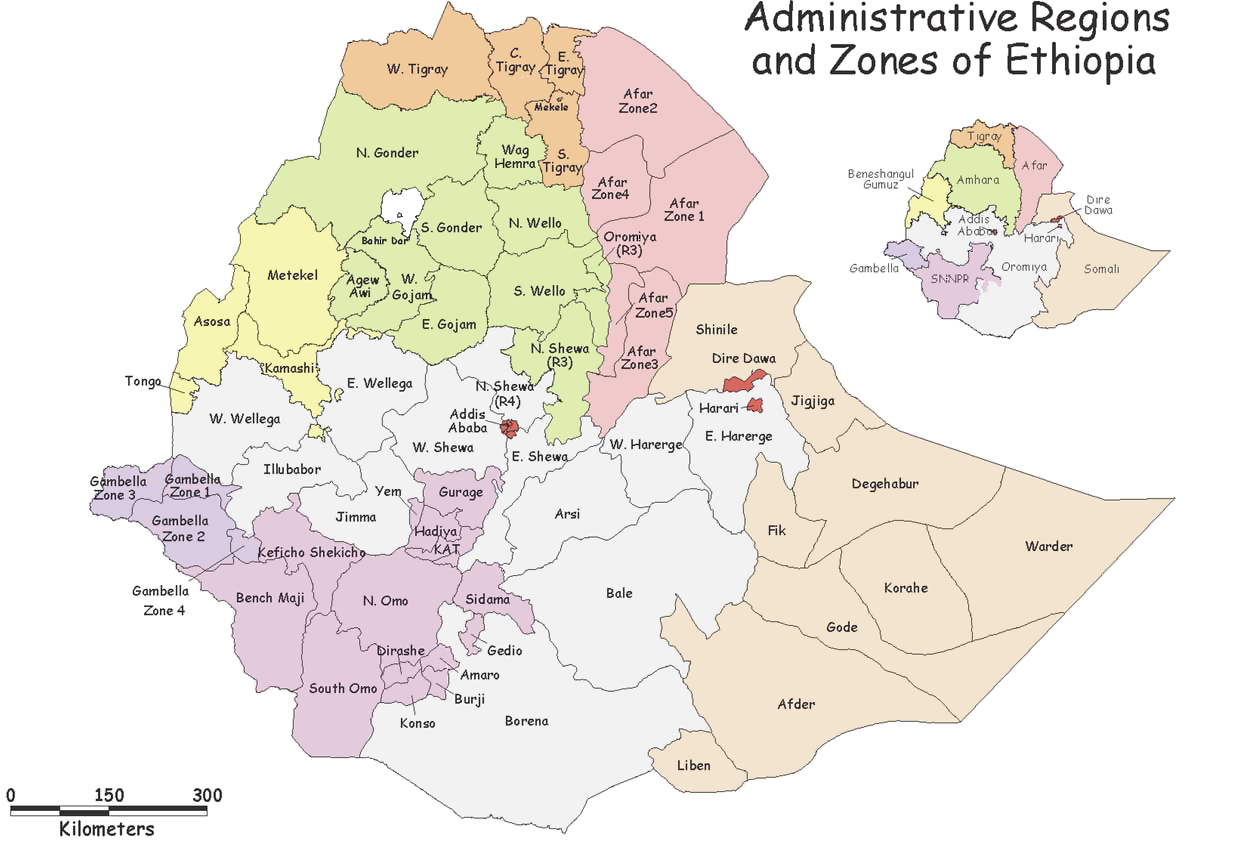
The regions of Ethiopia are administratively divided into 68 or more zones ( am, ዞን, ''zonə'').CSA 2005 National Statistics The exact number of zones is unclear, as the names and number of zones given in documents by Ethiopia's differ between 2005 and 2007.CSA 2007 census Various maps give different zone names and boundaries. Zones are a 2nd level [...More Info...] [...Related Items...] OR: [Wikipedia] [Google] [Baidu] |
Semien Omo Zone
North Omo Zone (Amharic: ሰሜን ኦሞ) was a zone in the Southern Nations, Nationalities, and Peoples' Region of Ethiopia. It was named after the Omo River, which flows in the western area of the former zone. In 2000 it was split into three zones: Dawro, Gamo Gofa, and Wolayita; and Basketo and Konta became special woredas. Semien Omo was bordered on the south by Debub Omo, on the west by Keficho Shekicho, on the northwest by the Oromia Region, on the north by Kembata Tembaro, on the northeast by part of the Oromia Region, on the east by the Bilate River which separated it from Sidama and another part of the Oromia Region, and on the southeast by the Amaro and Dirashe special woredas. The highest point in Semien Omo was Mount Guge (3568 m), west of Chencha. The administrative center of Semien Omo was Arba Minch; other towns included Areka, Boditi, Sawla and Sodo. Overview The Central Statistical Agency (CSA) reported that 8,364 tons of coffee were produced in S ... [...More Info...] [...Related Items...] OR: [Wikipedia] [Google] [Baidu] |


