|
Transport In Burkina Faso
Transport in Burkina Faso consists primarily of road, air and rail transportation. The World Bank classified country's transportation as underdeveloped but noted that Burkina Faso is a natural geographic transportation hub for West Africa. Highways In 2002, there were a total of of highway in Burkina Faso, of which are paved. In 2000, the Government of Burkina Faso classified 15,000 kilometers of road as part of the national road network managed under the Ministry of Infrastructures Transport and Housing (MITH) through the Directorate of Roads (DGR). This network includes main inter-city roads and access roads for départments' capital cities. Only ten of the network's main roads are even partially paved, and the paved roads are plagued by dangerous potholes, missing signage, missing barriers and guardrails near roadside hazards, and no pavement markings to separate traffic moving in opposite directions. As of May 2011 the country's road infrastructure was rated by the Worl ... [...More Info...] [...Related Items...] OR: [Wikipedia] [Google] [Baidu] |
Air Burkina
Air Burkina SA is the national airline of Burkina Faso, operating scheduled services from its main base at Ouagadougou AirportFlight International 27 March 2007 to one domestic destination, Bobo-Dioulasso, as well as regional services to Togo, Benin, Mali, Niger, Côte d'Ivoire, Senegal and Ghana. From 2001 to 2017, the airline was majority owned by an AKFED/IPS consortium, but is now back in government ownership, with reports that a new investor is being sought. History The airline was established on 17 March 1967 under the name Air Volta. It was originally part owned by the Burkinabé government, part by Air France and part privately held. It purchased its first aircraft, an Embraer EMB-110 Bandeirante, in 1978, and added a second, a Fokker F28, in 1983. Over the years, the airline has had serious debt problems, reaching a deficit of one billion CFA francs in 1992 (approx. €1,500,000). In part to address its debt problem, the Burkina Faso government privatised Air Burkina ... [...More Info...] [...Related Items...] OR: [Wikipedia] [Google] [Baidu] |
Sitarail
Sitarail is a private company that has the concession to operate railway lines formerly operated by the government. Countries include: * Ivory Coast and Burkina Faso * Cameroon Sitarail is part of the Bolloré group. Timeline 2016 * Operations were severely affected in September 2016 by the partial collapse of the Nzi River Bridge, near Dimbokro. The bridge was repaired in 15 days. * Under Bolloré operatorship Sitarail have acquired ** 4 × GT26CU-3 clones NRE CC33201-CC33204 ** 4 × GT26CU-3 clones NRE CC33205-CC33208 (contract built by TZV Gredelj in Croatia) * Grindrod Locomotives are Currently delivering ** 5 × 16-645 powered AC/AC units CC33209-CC33213 ** 6 × their 700HP shunters (believed to be AC traction) * Six locomotives of an order for 16 ordered from Grindrod Locomotives for use in IvoryCoast and Burkina Faso Burkina Faso (, ; , ff, 𞤄𞤵𞤪𞤳𞤭𞤲𞤢 𞤊𞤢𞤧𞤮, italic=no) is a landlocked country in West Africa with an area of , bor ... [...More Info...] [...Related Items...] OR: [Wikipedia] [Google] [Baidu] |
AfricaRail
AfricaRail is a project to link the railway systems of Ivory Coast, Burkina Faso, Niger, Benin and Togo. These are all gauge. A future stage is proposed to link Mali, Senegal, which are also gauge; Nigeria and Ghana have a different narrow gauge of but are converting to . Timeline 2022 * Jeremie Taieb takes the Head of the Strategic Steering Committee, in order to finance the project with international donors 2020 * Ghana orders new standard gauge rail equipment * Ghana Eastern SG line approved 2019 * 8 Apr 2019 Ghana's Ministry of Railways Development has reached an agreement with GERC to construct the Tema - Accra - Koforidua - Kumasi eastern line (340 km) * Ghana Standard Gauge - Western Line 2015 Various links. * West African rail loop of 2740 km. * Abidjan to Ouagadougou line. * proposed new line linking Ouagadougou in Burkina Faso to Niamey in Niger. * proposed new line linking Niger and Parakou in Benin. * rehabilitation of the existing l ... [...More Info...] [...Related Items...] OR: [Wikipedia] [Google] [Baidu] |
Dori, Burkina Faso
Dori (also known as Winde or Wendu) is a town in northeastern Burkina Faso, near the border of Niger. It is located at around . It is the capital of Sahel Region and has a population of 46,512 (2019). The main ethnic group is the Fula (Fulani) but Tuaregs, Songhai, and Hausa people are often present. It is a town known for its herders and popular livestock markets. Dori recorded a temperature of in 1984, which is the highest temperature to have ever been recorded in Burkina Faso. Mines In 2004, a proposal surfaced to link the manganese mines by rail with the seaports of Ghana. Notable people * Roukiatou Maiga, humanitarian * Albert Ouédraogo, former Burkinabé Prime Minister See also * Railway stations in Burkina Faso Gallery File:ASC Leiden - van Achterberg Collection - 5 - 050 - Le vieux quartier de Dori avec ses habitants - Dori, Séno, Burkina Faso, 19-26 août 2001.tif, The old district of Dori with its inhabitants, 2001 File:ASC Leiden - van Achterberg Collect ... [...More Info...] [...Related Items...] OR: [Wikipedia] [Google] [Baidu] |
Break-of-gauge
With railways, a break of gauge occurs where a line of one track gauge (the distance between the rails, or between the wheels of trains designed to run on those rails) meets a line of a different gauge. Trains and rolling stock generally cannot run through without some form of conversion between gauges, leading to passengers having to change trains and freight requiring transloading or transshipping; this can add delays, costs, and inconvenience to travel on such a route. History Break of gauge was a common issue in the early days of railways, as standards had not yet been set and different organizations each used their own favored gauge on the lines they controlled—sometimes for mechanical and engineering reasons (optimizing for geography or particular types of load and rolling stock), and sometimes for commercial and competitive reasons (interoperability and non-interoperability within and between companies and alliances were often key strategic moves). Various solutions o ... [...More Info...] [...Related Items...] OR: [Wikipedia] [Google] [Baidu] |
Boankra
Boankra is a town in south-central Ghana. Transport It is served by a station on the eastern network of Ghana Railways. The proposed Boankra Inland Port is to be situated at this site linking the ports of Tema and Takoradi to the inner parts of the country and the landlocked countries of Burkina Faso, Mali and Niger ) , official_languages = , languages_type = National languagesRailway stations in Ghana References Populated places in Ghana {{Ghana-geo-stub ...[...More Info...] [...Related Items...] OR: [Wikipedia] [Google] [Baidu] |
Kumasi
Kumasi (historically spelled Comassie or Coomassie, usually spelled Kumase in Twi) is a city in the Ashanti Region, and is among the largest metropolitan areas in Ghana. Kumasi is located in a rain forest region near Lake Bosomtwe, and is the commercial, industrial, and cultural capital of the historical Ashanti Empire. Kumasi is approximately north of the Equator and north of the Gulf of Guinea. Kumasi is alternatively known as "The Garden City" because of its many species of flowers and plants in the past. It is also called Oseikrom (Osei Tutu's the first town). Kumasi is the second-largest city in Ghana, after the capital, Accra. The Central Business District of Kumasi includes areas such as Adum, Bantama, Asawasi, Pampaso and Bompata (popularly called Roman Hill), with a concentration of banks, department stalls, and hotels. Economic activities in Kumasi include financial and commercial sectors, pottery, clothing and textiles. There is a significant timber processing ... [...More Info...] [...Related Items...] OR: [Wikipedia] [Google] [Baidu] |
Transport In Ivory Coast
Ivory Coast invested remarkably in its transport system. Transport Infrastructures are much more developed than they are other West African countries despite a crisis that restrained their maintenance and development. Since its independence in 1960, Ivory Coast put an emphasis on increasing and modernizing the transport network for human as well as for goods. Major infrastructures of diverse nature were built including railways, roads, waterways, and airports. In spite of the crisis, neighbor countries (Burkina Faso, Mali, Niger, and Guinea) still strongly depend on the Ivorian transport network for importing, exporting, and transiting their immigrants to Ivory Coast. Rail transport The nation's railway system is part of a 1 260 km long route that links the country to Burkina Faso and Niger. 1 156 km of railroad links Abidjan to Ouagadougou, capital of Burkina Faso. Built during colonial era by the firm Abidjan-Niger (RAN), this railroad freed several landlocked count ... [...More Info...] [...Related Items...] OR: [Wikipedia] [Google] [Baidu] |
Koudougou
Koudougou is a city in Burkina Faso's Boulkiemdé Province. It is located west of Ouagadougou, the capital of Burkina Faso. With a population of 160,239 (2019) it is the third most populous city in Burkina Faso after Ouagadougou and Bobo Dioulasso and is mainly inhabited by the Gurunsi and Mossi ethnic groups. Koudougou is situated on the only railway line in Burkina Faso and has some small industries, a market, a university and provincial government offices. Geography Situated on the Mossi Plateau, the city is west of Ouagadougou. In 1952 it was connected by rail to Ouagadougou and Abidjan. It is situated along the N13 road south of Sabou and north of Yako. The N21 road connects the city to Réo and the N14 connects it with Dédougou. Although the city's administrative borders used to extend further, the city currently encompasses 15 surrounding villages. Economy The economy of the city is dominated by agriculture with annual GDP for the city amounting to around 17. ... [...More Info...] [...Related Items...] OR: [Wikipedia] [Google] [Baidu] |
Banfora
Banfora is a city in south western Burkina Faso, with a population of 117,452 (2019 census) making it the sixth most populous city in Burkina Faso. It is the capital of the Comoe province. The city lies south-west of Bobo-Dioulasso, on the Abidjan – Ouagadougou Railway. The Cascades de Karfiguéla are a series of waterfalls close to Banfora. History The first settlers were the Karaboro who with the Gouin and Turkas constitute the city's main ethnic groups. They are all from the south of Burkina Faso. In 1903 the French colonialist forces created a military post at Banfora and one year later created an administrative position there. In 1905 a road was built linking Banfora to Bobo-Dioulasso and in 1931 a railway was built to the town. Economy The economy has grown around the sugar cane industry. The city is also an important market town and there are hotels which support a small tourism industry linked to the Cascades de Karfiguéla. Transportation The city has a railroad ... [...More Info...] [...Related Items...] OR: [Wikipedia] [Google] [Baidu] |
Abidjan
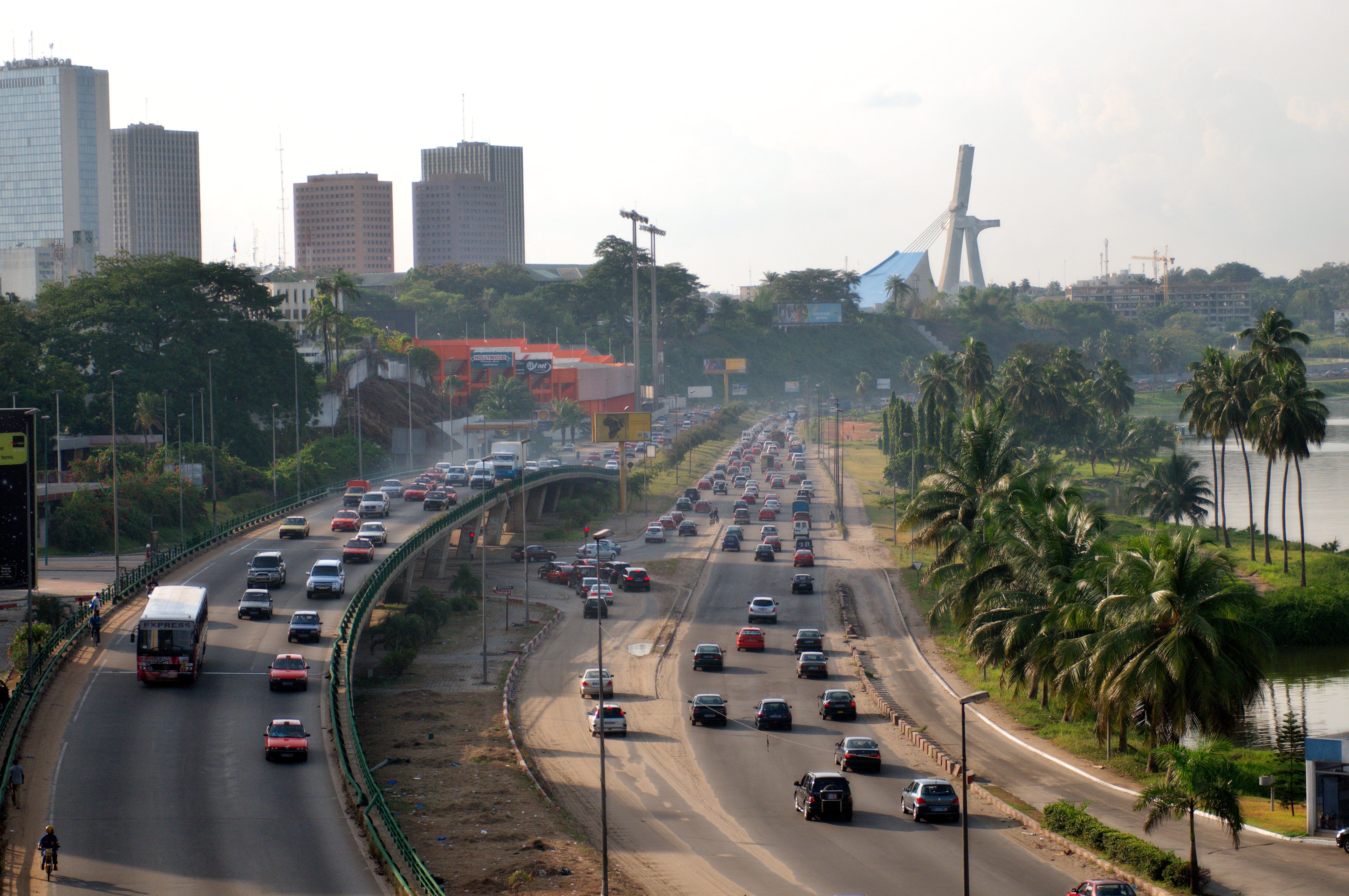
Abidjan ( , ; N'Ko script, N’ko: ߊߓߌߖߊ߲߬) is the economic capital of the Ivory Coast. As of the Demographics of Ivory Coast, 2021 census, Abidjan's population was 6.3 million, which is 21.5 percent of overall population of the country, making it the sixth most populous city proper in Africa, after Lagos, Cairo, Kinshasa, Dar es Salaam, and Johannesburg. A cultural crossroads of West Africa, Abidjan is characterised by a high level of industrialisation and urbanisation. It also is one of the most populous French-speaking cities in Africa. The city expanded quickly after the construction of a new wharf in 1931, followed by its designation as the capital city of the then-French colony in 1933. The completion of the Vridi Canal in 1951 enabled Abidjan to become an important sea port. Abidjan remained the capital of the Ivory Coast after its independence from France in 1960. In 1983, the city of Yamoussoukro was designated as the official political capital of Ivory Coast. Ho ... [...More Info...] [...Related Items...] OR: [Wikipedia] [Google] [Baidu] |


_p344_PLATE_9_-_COOMASSIE%2C_PART_OF_ADAM_STREET.jpg)


.jpg)
