|
Tokyo Bay
is a bay located in the southern Kantō region of Japan, and spans the coasts of Tokyo, Kanagawa Prefecture, and Chiba Prefecture. Tokyo Bay is connected to the Pacific Ocean by the Uraga Channel. The Tokyo Bay region is both the most populous and largest industrialized area in Japan. Names In ancient times, Japanese knew Tokyo Bay as the . By the Azuchi–Momoyama period (1568–1600) the area had become known as after the city of Edo. The bay took its present name in modern times, after the Imperial court moved to Edo and renamed the city Tokyo in 1868. Geography Tokyo Bay juts prominently into the Kantō Plain. It is surrounded by the Bōsō Peninsula in Chiba Prefecture to the east and the Miura Peninsula in Kanagawa Prefecture to the west. The shore of Tokyo Bay consists of a diluvial plateau and is subject to rapid marine erosion. Sediments on the shore of the bay make for a smooth, continuous shoreline. Boundaries In a narrow sense, Tokyo Bay is the area north ... [...More Info...] [...Related Items...] OR: [Wikipedia] [Google] [Baidu] |
Honshu
, historically called , is the largest and most populous island of Japan. It is located south of Hokkaidō across the Tsugaru Strait, north of Shikoku across the Inland Sea, and northeast of Kyūshū across the Kanmon Straits. The island separates the Sea of Japan, which lies to its north and west, from the North Pacific Ocean to the south and east. It is the seventh-largest island in the world, and the second-most populous after the Indonesian island of Java. Honshu had a population of 104 million , constituting 81.3% of the entire population of Japan, and is mostly concentrated in the coastal areas and plains. Approximately 30% of the total population resides in the Greater Tokyo Area on the Kantō Plain. As the historical center of Japanese cultural and political power, the island includes several past Japanese capitals, including Kyōto, Nara and Kamakura. Much of the island's southern shore forms part of the Taiheiyō Belt, a megalopolis that spans several of the ... [...More Info...] [...Related Items...] OR: [Wikipedia] [Google] [Baidu] |
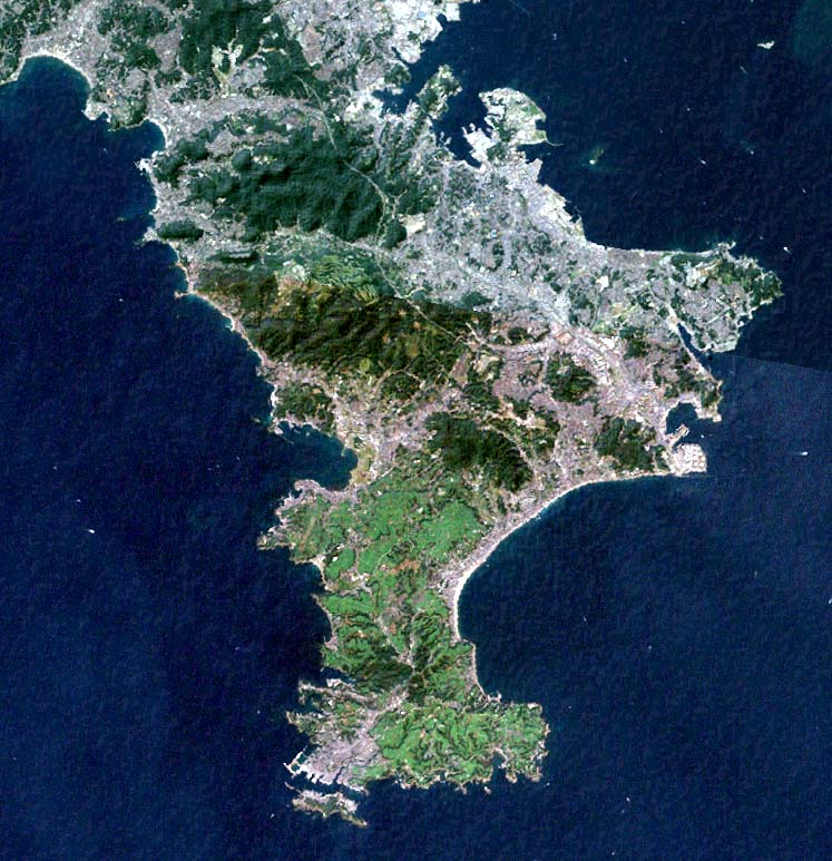
Miura Peninsula
is a peninsula located in Kanagawa, Japan. It lies south of Yokohama and Tokyo and divides Tokyo Bay, to the east, from Sagami Bay, to the west. Cities and towns on the Miura Peninsula include Yokosuka, Miura, Hayama, Zushi, and Kamakura. The northern limit of the peninsula runs from Koshigoe, Kamakura in the west, across to Mt. Enkai, in the southern wards of Yokohama in the east, overlooking Tokyo Bay. Overview The peninsula is a bedroom community for those who work in Tokyo and a popular tourist destination for people from Tokyo. It is also an important area for Japan's self-defense, with the eastern side hosting the National Defense Academy of Japan and the Yokosuka Naval Base, serving both the Japanese Maritime Self Defence Force and the United States Seventh Fleet. A significant portion of Tokyo's electricity is generated at Tokyo Electric's power station at Kurihama, and important R&D activity on next-generation mobile phones is done at Yokosuka Research Par ... [...More Info...] [...Related Items...] OR: [Wikipedia] [Google] [Baidu] |
Yokohama, Kanagawa
is the second-largest city in Japan by population and the most populous municipality of Japan. It is the capital city and the most populous city in Kanagawa Prefecture, with a 2020 population of 3.8 million. It lies on Tokyo Bay, south of Tokyo, in the Kantō region of the main island of Honshu. Yokohama is also the major economic, cultural, and commercial hub of the Greater Tokyo Area along the Keihin Industrial Zone. Yokohama was one of the cities to open for trade with the West following the 1859 end of the policy of seclusion and has since been known as a cosmopolitan port city, after Kobe opened in 1853. Yokohama is the home of many Japan's firsts in the Meiji period, including the first foreign trading port and Chinatown (1859), European-style sport venues (1860s), English-language newspaper (1861), confectionery and beer manufacturing (1865), daily newspaper (1870), gas-powered street lamps (1870s), railway station (1872), and power plant (1882). Yokohama developed ... [...More Info...] [...Related Items...] OR: [Wikipedia] [Google] [Baidu] |
Cape Honmaku
A cape is a clothing accessory or a sleeveless outer garment which drapes the wearer's back, arms, and chest, and connects at the neck. History Capes were common in medieval Europe, especially when combined with a hood in the chaperon. They have had periodic returns to fashion - for example, in nineteenth-century Europe. Roman Catholic clergy wear a type of cape known as a ferraiolo, which is worn for formal events outside a ritualistic context. The cope is a liturgical vestment in the form of a cape. Capes are often highly decorated with elaborate embroidery. Capes remain in regular use as rainwear in various military units and police forces, in France for example. A gas cape was a voluminous military garment designed to give rain protection to someone wearing the bulky gas masks used in twentieth-century wars. Rich noblemen and elite warriors of the Aztec Empire would wear a tilmàtli; a Mesoamerican cloak/cape used as a symbol of their upper status. Cloth and clothi ... [...More Info...] [...Related Items...] OR: [Wikipedia] [Google] [Baidu] |
Shoal
In oceanography, geomorphology, and geoscience, a shoal is a natural submerged ridge, bank, or bar that consists of, or is covered by, sand or other unconsolidated material and rises from the bed of a body of water to near the surface. It often refers to those submerged ridges, banks, or bars that rise near enough to the surface of a body of water as to constitute a danger to navigation. Shoals are also known as sandbanks, sandbars, or gravelbars. Two or more shoals that are either separated by shared troughs or interconnected by past or present sedimentary and hydrographic processes are referred to as a shoal complex.Neuendorf, K.K.E., J.P. Mehl Jr., and J.A. Jackson, eds. (2005) ''Glossary of Geology'' (5th ed.). Alexandria, Virginia, American Geological Institute. 779 pp. The term ''shoal'' is also used in a number of ways that can be either similar or quite different from how it is used in geologic, geomorphic, and oceanographic literature. Sometimes, this term refers ... [...More Info...] [...Related Items...] OR: [Wikipedia] [Google] [Baidu] |
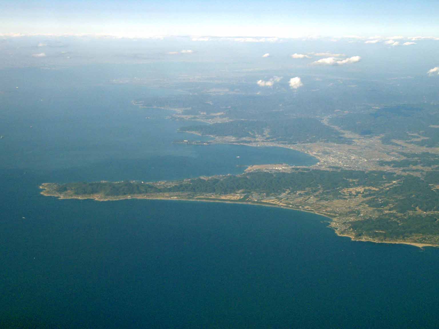
Cape Sunosaki
is a cape on the Pacific Ocean, in the city of Tateyama, Chiba Prefecture, Japan. The cape is located at the southwestern point of Bōsō Peninsula on the island of Honshu, and marks the point between the inner and outer parts of the peninsula. History Cape Sunosaki was well known throughout Japanese history due to its strategic position. The Genpei Jōsuiki, the expanded version of the Heike Monogatari written in the 13th century, mentions a failed invasion of Cape Suno, in what was then Awa Province. Minamoto no Yoshitsune's gunki monogatari ("war-tale"), the ''Gikeiki'', probably written in the Nanboku-chō period, mentions the landing of a boat party on Cape Sunosaki. Geography Cape Sunosaki is a coastal terrace made of layers of mudstone dating to the Tertiary period. Cape Sunosaki, together with on the southeast part of the Miura Peninsula in Miura, Kanagawa Prefecture, face the Uraga Channel that connects Tokyo Bay to the Sagami Gulf, and ultimately the Pacif ... [...More Info...] [...Related Items...] OR: [Wikipedia] [Google] [Baidu] |
Cape Tsurugisaki
A cape is a clothing accessory or a sleeveless outer garment which drapes the wearer's back, arms, and chest, and connects at the neck. History Capes were common in medieval Europe, especially when combined with a hood in the chaperon. They have had periodic returns to fashion - for example, in nineteenth-century Europe. Roman Catholic clergy wear a type of cape known as a ferraiolo, which is worn for formal events outside a ritualistic context. The cope is a liturgical vestment in the form of a cape. Capes are often highly decorated with elaborate embroidery. Capes remain in regular use as rainwear in various military units and police forces, in France for example. A gas cape was a voluminous military garment designed to give rain protection to someone wearing the bulky gas masks used in twentieth-century wars. Rich noblemen and elite warriors of the Aztec Empire would wear a tilmàtli; a Mesoamerican cloak/cape used as a symbol of their upper status. Cloth and clothi ... [...More Info...] [...Related Items...] OR: [Wikipedia] [Google] [Baidu] |
Land Reclamation
Land reclamation, usually known as reclamation, and also known as land fill (not to be confused with a waste landfill), is the process of creating new land from oceans, seas, riverbeds or lake beds. The land reclaimed is known as reclamation ground or land fill. In some jurisdictions, including parts of the United States, the term "reclamation" can refer to returning disturbed lands to an improved state. In Alberta, Canada, for example, reclamation is defined by the provincial government as "The process of reconverting disturbed land to its former or other productive uses." In Oceania, it is frequently referred to as land rehabilitation. History One of the earliest large-scale projects was the Beemster Polder in the Netherlands, realized in 1612 adding of land. In Hong Kong the Praya Reclamation Scheme added of land in 1890 during the second phase of construction. It was one of the most ambitious projects ever taken during the Colonial Hong Kong era.Bard, Solomon. ... [...More Info...] [...Related Items...] OR: [Wikipedia] [Google] [Baidu] |
Cape Futtsu
is a cape located east of Tokyo Bay in Futtsu, Chiba in Japan. References Cape Futtsu- Chiba Prefecture Futtsu 260px, Futtsu City Hall is a city located in Chiba Prefecture, Japan. , the city had an estimated population of 42,476 in 18,115 households and a population density of 210 persons per km². The total area of the city is . Geography Futtsu is l ... Landforms of Chiba Prefecture Spits (landform) {{commons Shoals of Japan ... [...More Info...] [...Related Items...] OR: [Wikipedia] [Google] [Baidu] |
Cape Kannon
A cape is a clothing accessory or a sleeveless outer garment which drapes the wearer's back, arms, and chest, and connects at the neck. History Capes were common in medieval Europe, especially when combined with a hood in the chaperon. They have had periodic returns to fashion - for example, in nineteenth-century Europe. Roman Catholic clergy wear a type of cape known as a ferraiolo, which is worn for formal events outside a ritualistic context. The cope is a liturgical vestment in the form of a cape. Capes are often highly decorated with elaborate embroidery. Capes remain in regular use as rainwear in various military units and police forces, in France for example. A gas cape was a voluminous military garment designed to give rain protection to someone wearing the bulky gas masks used in twentieth-century wars. Rich noblemen and elite warriors of the Aztec Empire would wear a tilmàtli; a Mesoamerican cloak/cape used as a symbol of their upper status. Cloth and clothi ... [...More Info...] [...Related Items...] OR: [Wikipedia] [Google] [Baidu] |
Erosion
Erosion is the action of surface processes (such as water flow or wind) that removes soil, rock, or dissolved material from one location on the Earth's crust, and then transports it to another location where it is deposited. Erosion is distinct from weathering which involves no movement. Removal of rock or soil as clastic sediment is referred to as ''physical'' or ''mechanical'' erosion; this contrasts with ''chemical'' erosion, where soil or rock material is removed from an area by dissolution. Eroded sediment or solutes may be transported just a few millimetres, or for thousands of kilometres. Agents of erosion include rainfall; bedrock wear in rivers; coastal erosion by the sea and waves; glacial plucking, abrasion, and scour; areal flooding; wind abrasion; groundwater processes; and mass movement processes in steep landscapes like landslides and debris flows. The rates at which such processes act control how fast a surface is eroded. Typically, physical ero ... [...More Info...] [...Related Items...] OR: [Wikipedia] [Google] [Baidu] |


