|
Stirling
Stirling (; sco, Stirlin; gd, Sruighlea ) is a city in central Scotland, northeast of Glasgow and north-west of Edinburgh. The market town, surrounded by rich farmland, grew up connecting the royal citadel, the medieval old town with its merchants and tradesmen, the Old Bridge and the port. Located on the River Forth, Stirling is the administrative centre for the Stirling council area, and is traditionally the county town of Stirlingshire. Proverbially it is the strategically important "Gateway to the Highlands". It has been said that "Stirling, like a huge brooch clasps Highlands and Lowlands together". Similarly "he who holds Stirling, holds Scotland" is often quoted. Stirling's key position as the lowest bridging point of the River Forth before it broadens towards the Firth of Forth made it a focal point for travel north or south. When Stirling was temporarily under Anglo-Saxon sway, according to a 9th-century legend, it was attacked by Danish invaders. The sound ... [...More Info...] [...Related Items...] OR: [Wikipedia] [Google] [Baidu] |
Stirling Castle
Stirling Castle, located in Stirling, is one of the largest and most important castles in Scotland, both historically and architecturally. The castle sits atop Castle Hill, an intrusive crag, which forms part of the Stirling Sill geological formation. It is surrounded on three sides by steep cliffs, giving it a strong defensive position. Its strategic location, guarding what was, until the 1890s, the farthest downstream crossing of the River Forth, has made it an important fortification in the region from the earliest times. Most of the principal buildings of the castle date from the fifteenth and sixteenth centuries. A few structures remain from the fourteenth century, while the outer defences fronting the town date from the early eighteenth century. Before the union with England, Stirling Castle was also one of the most used of the many Scottish royal residences, very much a palace as well as a fortress. Several Scottish Kings and Queens have been crowned at Stirling, in ... [...More Info...] [...Related Items...] OR: [Wikipedia] [Google] [Baidu] |
Stirlingshire
Stirlingshire or the County of Stirling, gd, Siorrachd Sruighlea) is a historic county and registration countyRegisters of Scotland. Publications, leaflets, Land Register Counties. of Scotland. Its county town is Stirling. It borders Perthshire to the north, Clackmannanshire and West Lothian to the east, Lanarkshire to the south, and Dunbartonshire to the south-east and south-west (this latter boundary is split in two owing to Dunbartonshire's Cumbernauld exclave). Coat of arms The County Council of Stirling was granted a coat of arms by Lord Lyon King of Arms on 29 September 1890. The design of the arms commemorated the Scottish victory at the Battle of Bannockburn in the county. On the silver saltire on blue of St Andrew was placed the rampant red lion from the royal arms of Scotland. Around this were placed two caltraps and two spur-rowels recalling the use of the weapons against the English cavalry. On the abolition of the Local Government council in 1975, the ar ... [...More Info...] [...Related Items...] OR: [Wikipedia] [Google] [Baidu] |
Stirling Railway Station (Scotland)
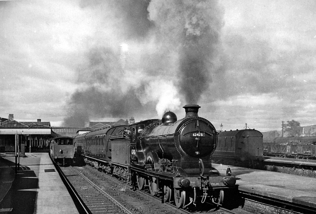
, symbol_location = gb , symbol = rail , image = Stirling railway station, frontage, Scotland.jpg , caption = The station frontage , borough = Stirling, Stirling , country = Scotland , coordinates = , grid_name = Grid reference , grid_position = , manager = ScotRail , platforms = 9 , code = STG , years = 1848 , events = Opened , years1 = 1913 , events1 = Rebuilt , mpassengers = , footnotes = Passenger statistics from the Office of Rail and Road , embedded = Stirling railway station is a railway station located in Stirling, Scotland. It is located on the former Caledonian Railway main line between Glasgow and Perth. It is the junction for the branch line to and Dunfermline via Kincardine and is also served by trains on the Edinburgh to Dunblane Line and long-di ... [...More Info...] [...Related Items...] OR: [Wikipedia] [Google] [Baidu] |
Stirling (council Area)
The Stirling council area ( sco, Stirlin; gd, Sruighlea) is one of the 32 council areas of Scotland, and has a population of about ( estimate). It was created under the Local Government etc (Scotland) Act 1994 with the boundaries of the Stirling district of the former Central local government region, and it covers most of Stirlingshire (except Falkirk) and the south-western portion of Perthshire. Both counties were abolished for local government purposes under the Local Government (Scotland) Act 1973. The administrative centre of the area is the city of Stirling, with the headquarters at Old Viewforth. The area borders the council areas of Clackmannanshire (to the east), North Lanarkshire (to the south), Falkirk (to the south east), Perth and Kinross (to the north and north east), Argyll and Bute (to the north and north west), and both East and West Dunbartonshire to Stirling's southwest. The majority of the population of the area is located in its southeast corner, in ... [...More Info...] [...Related Items...] OR: [Wikipedia] [Google] [Baidu] |
River Forth
The River Forth is a major river in central Scotland, long, which drains into the North Sea on the east coast of the country. Its drainage basin covers much of Stirlingshire in Scotland's Central Belt. The Gaelic name for the upper reach of the river, above Stirling, is ''Abhainn Dubh'', meaning "black river". The name for the river below the tidal reach (just past where it is crossed by the M9 motorway) is ''Uisge For''. Name ''Forth'' derives from Proto-Celtic ''*Vo-rit-ia'' (slow running), yielding '' Foirthe'' in Old Gaelic. Course The Forth rises in the Trossachs, a mountainous area west of Stirling. Ben Lomond's eastern slopes drain into the Duchray Water, which meets with Avondhu River coming from Loch Ard. The confluence of these two streams is the nominal start of the River Forth. From there it flows roughly eastward through Aberfoyle, joining with the Kelty Water about 5 km further downstream. It then flows into the flat expanse of the Carse of Stirling, ... [...More Info...] [...Related Items...] OR: [Wikipedia] [Google] [Baidu] |
Old Viewforth
Old Viewforth is a municipal facility on Pitt Terrace in Stirling, Scotland. The facility, which is the headquarters of Stirling Council, is a Category B listed building. History The first house on the site, which was known as "Viewforth" was commissioned by the Rev John McMillan, Moderator of the Reformed Presbyterian Church of Scotland, in 1787. The building was acquired by Peter Drummond, a seed merchant, who demolished the old house in 1853. The earliest part of the current building, which was designed by John Hay in the Scottish baronial style, was built for Drummond and completed in 1855. The design involved an asymmetrical main frontage with four bays facing St Ninian's Road; it featured a stone porch, supported by polished columns, on the ground floor with coat of arms and finial above; there was a narrow oriel window on the first floor and a bartizan on the left corner. It was remodeled in 1871 and acquired by Stirlingshire County Council in 1931. A large extension, ... [...More Info...] [...Related Items...] OR: [Wikipedia] [Google] [Baidu] |
FK Postcode Area
The FK postcode area, also known as the Falkirk postcode area,Royal Mail, ''Address Management Guide'', (2004) is a group of 21 postcode districts in central Scotland, within 18 post towns. These cover most of the Falkirk council area (including Falkirk itself, Grangemouth, Larbert, Denny and Bonnybridge), most of the Stirling council area (including Stirling itself, Dunblane, Doune, Callander, Lochearnhead, Crianlarich and Killin) and Clackmannanshire (including Alloa, Clackmannan, Menstrie, Alva, Tillicoultry and Dollar), plus small parts of Fife, Perth and Kinross, and Argyll and Bute. __TOC__ Coverage The approximate coverage of the postcode districts: , - ! FK1 , FALKIRK , Falkirk (centre and south), Avonbridge, California, Camelon, Limerigg, Shieldhill, Slamannan, Standburn , Falkirk , - ! FK2 , FALKIRK , Falkirk (north), Airth, Bainsford, Brightons, Carron, Carronshore, Dunmore, Laurieston, Maddiston, Polmont, Redding, Skinflats, Westquarter , ... [...More Info...] [...Related Items...] OR: [Wikipedia] [Google] [Baidu] |
Wallace Monument
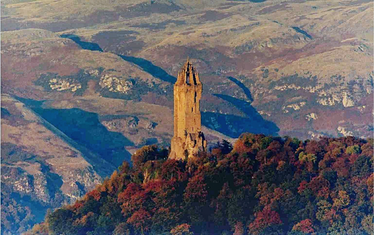
The National Wallace Monument (generally known as the Wallace Monument) is a 67 metre tower on the shoulder of the Abbey Craig, a hilltop overlooking Stirling in Scotland. It commemorates Sir William Wallace, a 13th- and 14th-century Scottish hero. The tower is open to the public for an admission fee. Visitors approach by foot from the base of the crag on which it stands. On entry there are 246 steps to the final observation platform, with three exhibition rooms within the body of the tower. The tower is not accessible to disabled visitors. Background The tower was constructed following a fundraising campaign, which accompanied a resurgence of Scottish national identity in the 19th century. The campaign was begun in Glasgow in 1851 by Rev Charles Rogers who was joined by William Burns. Burns took sole charge from around 1855 following Rogers' resignation. In addition to public subscription, it was partially funded by contributions from a number of foreign donors, including It ... [...More Info...] [...Related Items...] OR: [Wikipedia] [Google] [Baidu] |
Stirling Old Bridge
Stirling Old Bridge is a stone bridge which crosses the River Forth. For over 300 years it provided the lowest crossing point of the Forth and so had strategic importance. History The stone bridge was constructed on rubble foundations around 1500 and replaced earlier wooden bridges, including that on which the Battle of Stirling Bridge was fought. The bridge originally had arches at either end and a defensive gate at the end nearer the burgh. Tolls were levied on goods being taken across the bridge. In December 1745 General Blakeney, lieutenant governor of Stirling Castle, had one of the bridge arches destroyed to hinder the movement of the Jacobite Army. The destroyed arch was rebuilt in 1749. In May 1833 the adjacent new road bridge was opened to traffic and the Old Bridge was closed to wheeled traffic. The bridge was designated as a Category A Listed Building Category, plural categories, may refer to: Philosophy and general uses *Categorization, categories in cog ... [...More Info...] [...Related Items...] OR: [Wikipedia] [Google] [Baidu] |
City Status In The United Kingdom
City status in the United Kingdom is granted by the monarch of the United Kingdom to a select group of communities. , there are 76 cities in the United Kingdom—55 in England, seven in Wales, eight in Scotland, and six in Northern Ireland. Although it carries no special rights, the status of city can be a marker of prestige and confer local pride. The status does not apply automatically on the basis of any particular criterion, though in England and Wales it was traditionally given to towns with diocesan cathedrals. This association between having an Anglican cathedral and being called a city was established in the early 1540s when King Henry VIII founded dioceses (each having a cathedral in the see city) in six English towns and granted them city status by issuing letters patent. City status in Ireland was granted to far fewer communities than in England and Wales, and there are only two pre-19th-century cities in present-day Northern Ireland. In Scotland, city status ... [...More Info...] [...Related Items...] OR: [Wikipedia] [Google] [Baidu] |
List Of Towns And Cities In Scotland By Population
This is a list of towns and cities in Scotland with a population of more than 15,000, ordered by population, as defined and compiled by the National Records of Scotland organisation. Glasgow is the largest city in Scotland by both area and population, whilst the countries capital city, Edinburgh, is the second largest by population and area. The city of Stirling has the smallest population amongst Scotland's cities, with an estimate population of just over 37,000 inhabitants. In total, Scotland consists of eight cities, with multiple larger towns, the largest town being Paisley. This article is divided into two sections. The first section of this article ("Localities") contains a list of basic populated areas ordered by population. The second section of this article ("Settlements") is a list of populated urban areas, some of which are composed of more than one locality, and which may span across the boundaries of more than one council area. All localities are either settlemen ... [...More Info...] [...Related Items...] OR: [Wikipedia] [Google] [Baidu] |
Scotland
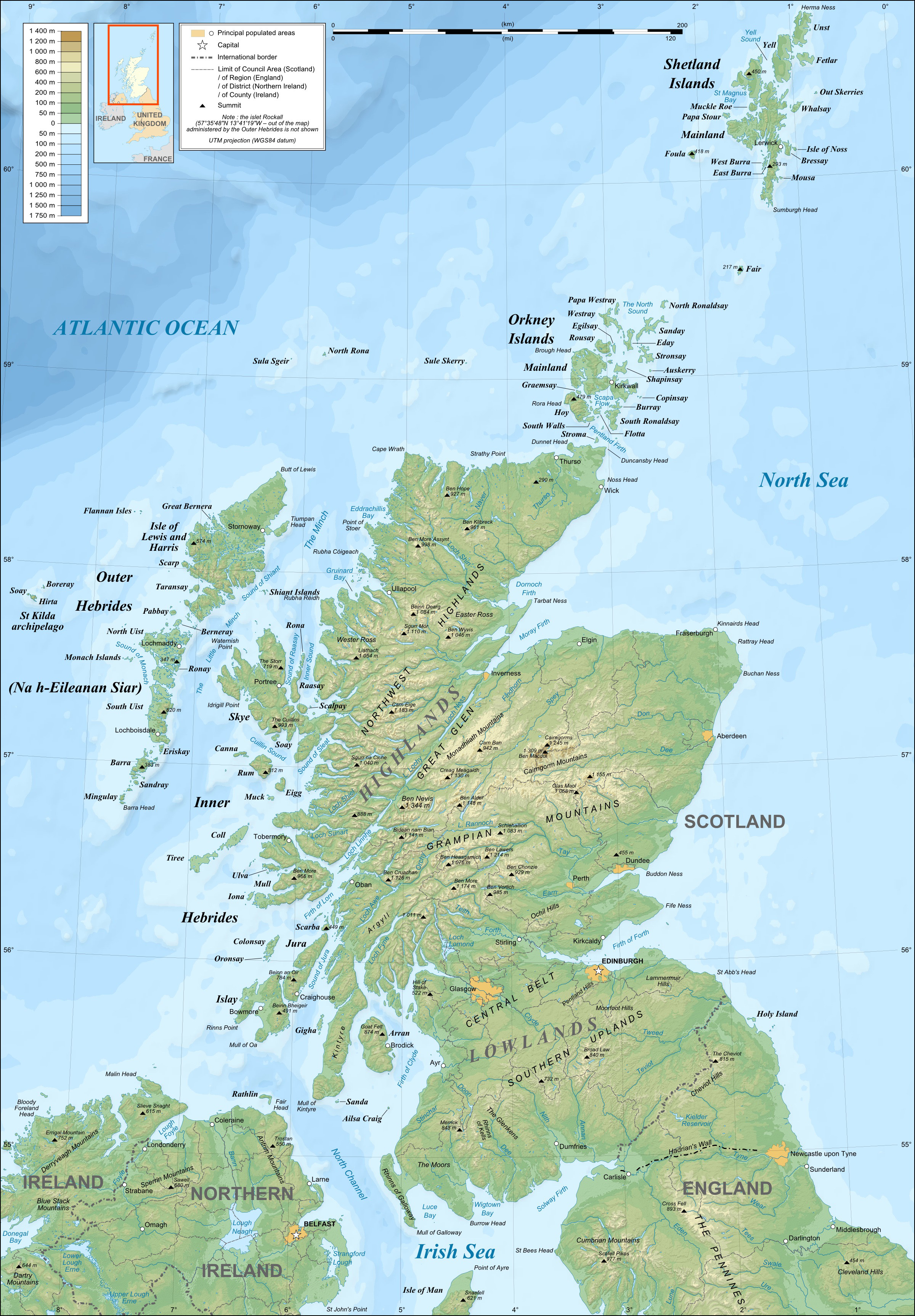
Scotland (, ) is a Countries of the United Kingdom, country that is part of the United Kingdom. Covering the northern third of the island of Great Britain, mainland Scotland has a Anglo-Scottish border, border with England to the southeast and is otherwise surrounded by the Atlantic Ocean to the north and west, the North Sea to the northeast and east, and the Irish Sea to the south. It also contains more than 790 Islands of Scotland, islands, principally in the archipelagos of the Hebrides and the Northern Isles. Most of the population, including the capital Edinburgh, is concentrated in the Central Belt—the plain between the Scottish Highlands and the Southern Uplands—in the Scottish Lowlands. Scotland is divided into 32 Subdivisions of Scotland, administrative subdivisions or local authorities, known as council areas. Glasgow, Glasgow City is the largest council area in terms of population, with Highland (council area), Highland being the largest in terms of area. Limi ... [...More Info...] [...Related Items...] OR: [Wikipedia] [Google] [Baidu] |


.jpg)

