|
Palouse
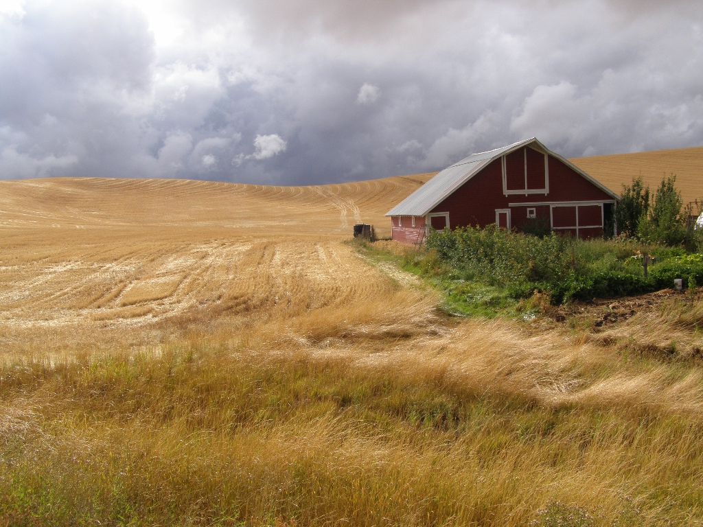
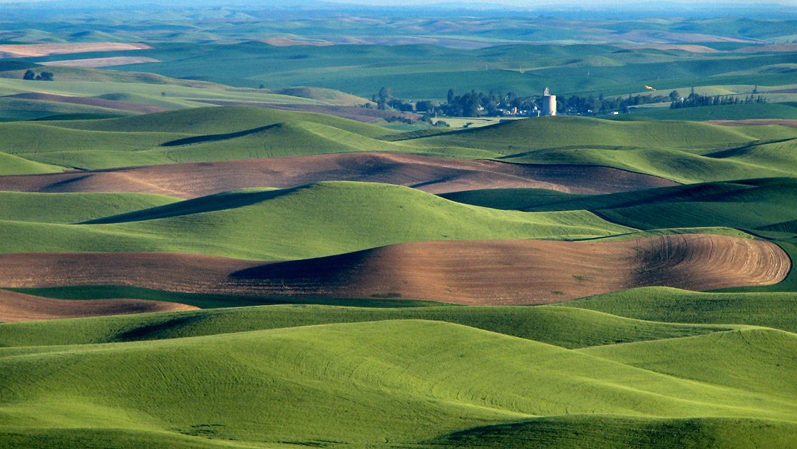
The Palouse ( ) is a distinct geographic region of the northwestern United States, encompassing parts of north central Idaho, southeastern Washington, and, by some definitions, parts of northeast Oregon. It is a major agricultural area, primarily producing wheat and legumes. Situated about north of the Oregon Trail, the region experienced rapid growth in the late 19th century. The Palouse is home to two land-grant universities: the University of Idaho in Moscow and Washington State University in Pullman. Just eight miles (13 km) apart, both schools opened in the early 1890s. Geography and history The origin of the name "Palouse" is unclear. One theory is that the name of the Palus tribe (spelled in early accounts variously as Palus, Palloatpallah, Pelusha, etc.) was converted by French-Canadian fur traders to the more familiar French word , meaning "land with short and thick grass" or "lawn." Over time, the spelling changed to Palouse. Another theory is that the r ... [...More Info...] [...Related Items...] OR: [Wikipedia] [Google] [Baidu] |
Palouse People
The Palouse are a Sahaptin tribe recognized in the Treaty of 1855 with the United States along with the Yakama. It was negotiated at the 1855 Walla Walla Council. A variant spelling is Palus. Today they are enrolled in the federally recognized Confederated Tribes and Bands of the Yakama Nation and some are also represented by the Colville Confederated Tribes, the Confederated Tribes of the Umatilla Indian Reservation and Nez Perce Tribe. Ethnography The people are one of the Sahaptin-speaking groups of Native Americans living on the Columbia Plateau in eastern Washington, northeastern Oregon, and North Central Idaho: these included the Nez Percé, Cayuse, Walla Walla, Umatilla and the Yakama. The Palouse (Palus) territory extends from the confluence of the Snake and Clearwater Rivers in the east to the confluence of the Snake and Columbia Rivers in the west. It encompassed the Palouse River Valley up to Rock Lake in the north and stayed north of the Touchet River Valle ... [...More Info...] [...Related Items...] OR: [Wikipedia] [Google] [Baidu] |
Palouse River
The Palouse River is a tributary of the Snake River in Washington and Idaho, in the northwest United States. It flows for U.S. Geological Survey. National Hydrography Dataset high-resolution flowline dataThe National Map accessed May 3, 2011 southwestwards, primarily through the Palouse region of southeastern Washington. It is part of the Columbia River Basin, as the Snake River is a tributary of the Columbia River. Its canyon was carved out by a fork in the catastrophic Missoula Floods of the previous ice age, which spilled over the northern Columbia Plateau and flowed into the Snake River, eroding the river's present course in a few thousand years. Course The Palouse River flows from northern Idaho into southeast Washington through the Palouse region, named for the river. The river originates in Idaho in northeastern Latah County, in the Hoodoo Mountains in the St. Joe National Forest. It flows westward, near State Highway 6, as it nears the state line. In Washington, the ri ... [...More Info...] [...Related Items...] OR: [Wikipedia] [Google] [Baidu] |
Moscow, Idaho
Moscow ( ) is a city in North Central Idaho, United States. Located along the state border with Washington, it had a population of 25,435 at the 2020 census. The county seat and largest city of Latah County, Moscow is the home of the University of Idaho, the state's land-grant institution and primary research university. It is the principal city in the Moscow, Idaho Micropolitan Statistical Area, which includes all of Latah County. The city contains over 60% of the county's population, and while the university is Moscow's dominant employer, the city also serves as an agricultural and commercial hub for the Palouse region. Along with the rest of the Idaho Panhandle, Moscow is in the Pacific Time Zone. The elevation of its city center is above sea level. Two major highways serve the city, passing through the city center: US-95 (north-south) and ID-8 (east-west). The Pullman–Moscow Regional Airport, west, provides limited commercial air service. The local newspaper is th ... [...More Info...] [...Related Items...] OR: [Wikipedia] [Google] [Baidu] |
Pullman, Washington
Pullman () is the largest city in Whitman County, located in southeastern Washington within the Palouse region of the Pacific Northwest. The population was 29,799 at the 2010 census, and estimated to be 34,506 in 2019. Originally founded as Three Forks, the city was renamed after industrialist George Pullman in 1884. Pullman is noted as a fertile agricultural area known for its many miles of rolling hills and the production of wheat and legumes. It is home to Washington State University, a public research land-grant university, and the international headquarters of Schweitzer Engineering Laboratories. Pullman is from Moscow, Idaho, home to the University of Idaho, and is served by the Pullman–Moscow Regional Airport. History In 1876, about five years after European-American settlers established Whitman County on November 29, 1871, Bolin Farr arrived in Pullman. He camped at the confluence of Dry Flat Creek and Missouri Flat Creek on the bank of the Palouse River. Withi ... [...More Info...] [...Related Items...] OR: [Wikipedia] [Google] [Baidu] |
Washington State University
Washington State University (Washington State, WSU, or informally Wazzu) is a public land-grant research university with its flagship, and oldest, campus in Pullman, Washington. Founded in 1890, WSU is also one of the oldest land-grant universities in the American West. With an undergraduate enrollment of 24,278 and a total enrollment of 28,581, it is the second largest institution for higher education in Washington state behind the University of Washington. It is classified among "R1: Doctoral Universities – Very high research activity". The WSU Pullman campus stands on a hill and is characterized by open spaces and a red brick and basalt material palette—materials originally found on site. The university sits within the rolling topography of the Palouse in rural eastern Washington and remains closely connected to the town and the region. The university also operates campuses across Washington at WSU Spokane, WSU Tri-Cities, and WSU Vancouver, all founded in 1989. In ... [...More Info...] [...Related Items...] OR: [Wikipedia] [Google] [Baidu] |
Snake River
The Snake River is a major river of the greater Pacific Northwest region in the United States. At long, it is the largest tributary of the Columbia River, in turn, the largest North American river that empties into the Pacific Ocean. The Snake River rises in western Wyoming, then flows through the Snake River Plain of southern Idaho, the rugged Hells Canyon on the Oregon–Idaho border and the rolling Palouse Hills of Washington, emptying into the Columbia River at the Tri-Cities in the Columbia Basin of Eastern Washington. The Snake River drainage basin encompasses parts of six U.S. states (Idaho, Washington, Oregon, Utah, Nevada, and Wyoming) and is known for its varied geologic history. The Snake River Plain was created by a volcanic hotspot which now lies underneath the Snake River headwaters in Yellowstone National Park. Gigantic glacial-retreat flooding episodes during the previous Ice Age carved out canyons, cliffs, and waterfalls along the middle and lower Snake Riv ... [...More Info...] [...Related Items...] OR: [Wikipedia] [Google] [Baidu] |
Spokane, Washington
Spokane ( ) is the largest city and county seat of Spokane County, Washington, United States. It is in eastern Washington, along the Spokane River, adjacent to the Selkirk Mountains, and west of the Rocky Mountain foothills, south of the Canadian border, west of the Washington– Idaho border, and east of Seattle, along I-90. Spokane is the economic and cultural center of the Spokane metropolitan area, the Spokane–Coeur d'Alene combined statistical area, and the Inland Northwest. It is known as the birthplace of Father's Day, and locally by the nickname of "Lilac City". Officially, Spokane goes by the nickname of ''Hooptown USA'', due to Spokane annually hosting Spokane Hoopfest, the world's largest basketball tournament. The city and the wider Inland Northwest area are served by Spokane International Airport, west of Downtown Spokane. According to the 2010 census, Spokane had a population of 208,916, making it the second-largest city in Washington, and the 101st-la ... [...More Info...] [...Related Items...] OR: [Wikipedia] [Google] [Baidu] |
University Of Idaho
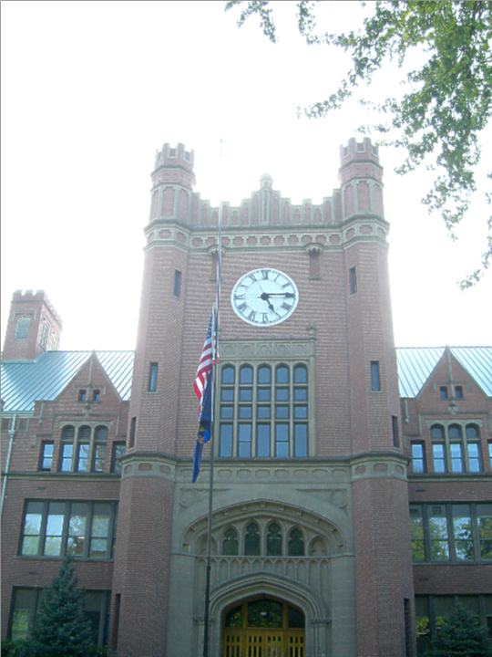
The University of Idaho (U of I, or UIdaho) is a public land-grant research university in Moscow, Idaho. It is the state's land-grant and primary research university,, and the lead university in the Idaho Space Grant Consortium. The University of Idaho was the state's sole university for 71 years, until 1963. Its College of Law, established in 1909, was first accredited by the American Bar Association in 1925. Formed by the Idaho Territory legislature on January 30, 1889, the university opened its doors in 1892 on October 3, with an initial class of 40 students. The first graduating class in 1896 contained two men and two women. It has an enrollment exceeding 12,000, with over 11,000 on the Moscow campus. The university offers 142 degree programs, from accountancy to wildlife resources, including bachelor's, master's, doctoral, and specialists' degrees, and accompanyinhonors programs Certificates of completion are offered in 30 areas of study. At 25% and 53%, its 4 and 6 ye ... [...More Info...] [...Related Items...] OR: [Wikipedia] [Google] [Baidu] |
North Central Idaho
North Central Idaho is an area which spans the central part of the state of Idaho and borders Oregon, Montana, and Washington. It is the southern half of the Idaho Panhandle region and is rich in agriculture and natural resources. Lewis and Clark travelled through this area on their journey to the Pacific Ocean in 1805-06. The primary cities in this region are Lewiston and Moscow, home of the University of Idaho. Geography North Central Idaho consists of the following counties: * Clearwater *Idaho * Latah *Lewis * Nez Perce With the exception of the southern portion of Idaho County, this region observes Pacific Time.South of the western-flowing Salmon River, Idaho observes Mountain Time, beginning at Riggins. Primary cities * Lewiston: inland port on the Snake River, first capital of Idaho Territory in 1863. *Moscow: home of the University of Idaho, established in 1889. Highways Federal * - US-12 - west to Walla Walla, east to Missoula * - US-95 - north to C ... [...More Info...] [...Related Items...] OR: [Wikipedia] [Google] [Baidu] |
Eastern Washington
Eastern Washington is the region of the U.S. state of Washington located east of the Cascade Range. It contains the city of Spokane (the second largest city in the state), the Tri-Cities, the Columbia River and the Grand Coulee Dam, the Hanford Nuclear Reservation and the fertile farmlands of the Yakima Valley and the Palouse. Unlike in Western Washington, the climate is dry, including some desert environments. Climate A significant difference between Eastern Washington and the western half of the state is its climate. While the west half of the state is located in a rainy oceanic climate, the eastern half receives little rainfall due to the rainshadow created by the Cascade Mountains. Also, due to being farther from the sea, the east side has both hotter summers and colder winters than the west. Most communities in Eastern Washington, for example, have significant yearly snowfall, while in the west snowfall is minimal and not seen every year. The east and west do still ... [...More Info...] [...Related Items...] OR: [Wikipedia] [Google] [Baidu] |
Walla Walla, Washington
Walla Walla is a city in Walla Walla County, Washington, where it is the largest city and county seat. It had a population of 34,060 at the 2020 census, estimated to have decreased to 33,927 as of 2021. The population of the city and its two suburbs, the town of College Place and unincorporated Walla Walla East, is about 45,000. Walla Walla is in the southeastern region of Washington, approximately four hours away from Portland, Oregon, and four and a half hours from Seattle. It is located only north of the Oregon border. History Native history and early settlement Walla Walla's history starts in 1806 when the Lewis and Clark expedition encountered the Walawalałáma (Walla Walla people) near the mouth of Walla Walla River. Other inhabitants of the valley included the Liksiyu (Cayuse), Imatalamłáma (Umatilla), and Niimíipu (Nez Perce) indigenous peoples. In 1818, Fort Walla Walla (originally Fort Nez Percés), a fur trading outpost run by Hudson's Bay Company (HBC ... [...More Info...] [...Related Items...] OR: [Wikipedia] [Google] [Baidu] |
Camas Prairie
The name camas prairie refers to several different geographical areas in the western United States which were named for the native perennial camassia or camas. The culturally and scientitifcally significant of these areas lie within Idaho and Montana. Camas bulbs were an important food source for Native Americans. Idaho History Named for the blue flowering camas—an important food source for all Native Americans in the interior Northwest—the Camas Prairie is a traditional Nez Perce gathering place in north central Idaho. From the Nez Perce National Historical Park: Camas Prairie is interpreted at a highway pullout on the north side of U.S. Highway 95, about six miles (10 km) south of Grangeville. This large prairie was a Nez Perce gathering place, where camas roots were harvested for thousands of years. Several nontreaty bands gathered at Tolo Lake in early June 1877 in anticipation of moving to the Nez Perce reservation. In response to the forced move and other hostil ... [...More Info...] [...Related Items...] OR: [Wikipedia] [Google] [Baidu] |


.jpg)