|
Loch Ness
Loch Ness (; gd, Loch Nis ) is a large freshwater loch in the Scottish Highlands extending for approximately southwest of Inverness. It takes its name from the River Ness, which flows from the northern end. Loch Ness is best known for claimed sightings of the cryptozoological Loch Ness Monster, also known affectionately as "Nessie" ( gd, Niseag). It is one of a series of interconnected, murky bodies of water in Scotland; its water visibility is exceptionally low due to a high peat content in the surrounding soil. The southern end connects to Loch Oich by the River Oich and a section of the Caledonian Canal. The northern end connects to Loch Dochfour via the River Ness, which then ultimately leads to the North Sea via the Moray Firth. Loch Ness is the second-largest Scottish loch by surface area after Loch Lomond at , but due to its great depth it is the largest by volume in the British Isles. Its deepest point is , making it the second deepest loch in Scotland after Loch Mo ... [...More Info...] [...Related Items...] OR: [Wikipedia] [Google] [Baidu] |
Fort Augustus
Fort Augustus is a settlement in the parish of Boleskine and Abertarff, at the south-west end of Loch Ness, Scottish Highlands. The village has a population of around 646 (2001). Its economy is heavily reliant on tourism. History The Gaelic name for the modern village is ' () and until the early 18th century the settlement was called Kiliwhimin. It was renamed ''Fort Augustus'' after the Jacobite Rising of 1715. The accepted etymology is that the settlement was originally named after Saint Cummein of Iona who built a church there. Other suggestions are that it was originally called ' after one of two abbots of Iona of the Comyn clan, whose badge ' refers to the cumin plant, or that it was called ' ("Comyn's Burialplace") after the last Comyn in Lochaber. In the aftermath of the Jacobite rising in 1715, General Wade built a fort (taking from 1729 until 1742) which was named after the Duke of Cumberland. Wade had planned to build a town around the new barracks and call it ... [...More Info...] [...Related Items...] OR: [Wikipedia] [Google] [Baidu] |
Urquhart Castle
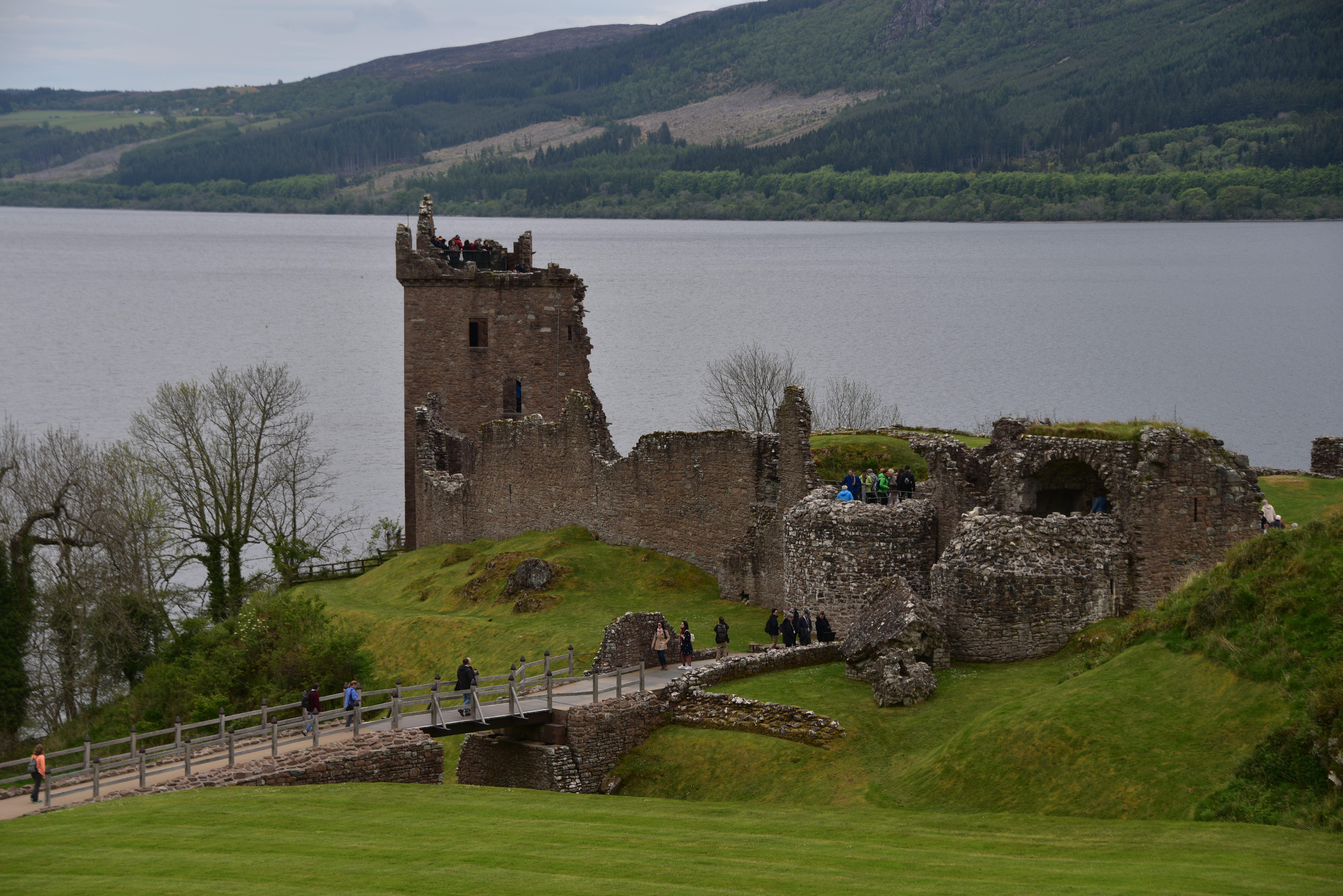
Urquhart Castle (; gd, Caisteal na Sròine) is a ruined castle that sits beside Loch Ness in the Highlands of Scotland. The castle is on the A82 road, south-west of Inverness and east of the village of Drumnadrochit. The present ruins date from the 13th to the 16th centuries, though built on the site of an early medieval fortification. Founded in the 13th century, Urquhart played a role in the Wars of Scottish Independence in the 14th century. It was subsequently held as a royal castle and was raided on several occasions by the MacDonald Earls of Ross. The castle was granted to the Clan Grant in 1509, though conflict with the MacDonalds continued. Despite a series of further raids the castle was strengthened, only to be largely abandoned by the middle of the 17th century. Urquhart was partially destroyed in 1692 to prevent its use by Jacobite forces, and subsequently decayed. In the 20th century, it was placed in state care as a scheduled monument and opened to the publi ... [...More Info...] [...Related Items...] OR: [Wikipedia] [Google] [Baidu] |
Foyers, Highland
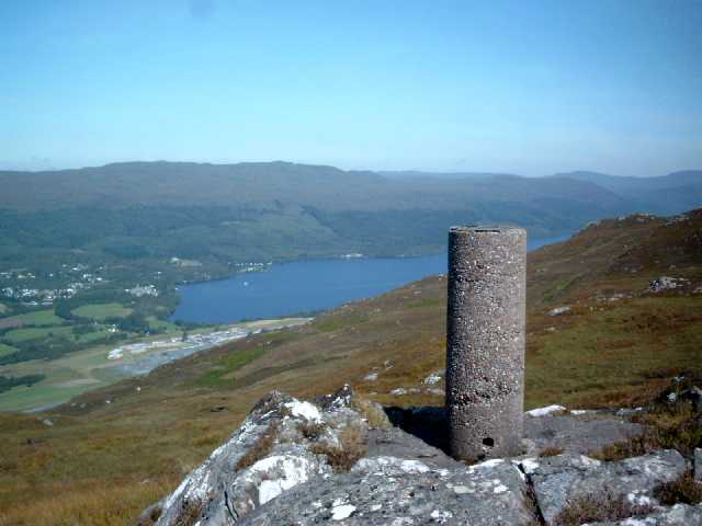
Foyers ( gd, Foithir, meaning "shelving slope") is a village in the Highland council area of Scotland, lying on the east shore of Loch Ness. The village is situated on the B852, part of the Military Road built by General George Wade, northeast of Fort Augustus. Foyers is also the name of the river which runs nearby into the Loch, which has two waterfalls, one of and the other , known as the Falls of Foyers. Since the late 19th century, water courses near Foyers have been harnessed to provide hydroelectricity. British Aluminium Company built their first hydro-powered aluminium smelter at Foyers in 1896 - the first in the UK - and it operated until 1967, powered by water captured in Loch Mhòr. The power station element of the plant was then purchased by Scotland's Hydro Board and redeveloped as a pumped storage facility using a 5MW turbine. Subsequently, a new power station, with additional capacity of 300MW, was added, becoming fully operational in 1975. Foyers is the locati ... [...More Info...] [...Related Items...] OR: [Wikipedia] [Google] [Baidu] |
Great Glen
The Great Glen ( gd, An Gleann Mòr ), also known as Glen Albyn (from the Gaelic "Glen of Scotland" ) or Glen More (from the Gaelic ), is a glen in Scotland running for from Inverness on the edge of Moray Firth, in an approximately straight line to Fort William at the head of Loch Linnhe. It follows a geological fault known as the Great Glen Fault, and bisects the Scottish Highlands into the Grampian Mountains to the southeast and the Northwest Highlands to the northwest. The glen is a natural travelling route in the Highlands of Scotland, which is used by both the Caledonian Canal and the A82 road, which link the city of Inverness on the northeast coast with Fort William on the west coast. The Invergarry and Fort Augustus Railway was built in 1896 from the southern end of the glen to the southern end of Loch Ness, but was never extended to Inverness. The railway closed in 1947. In 2002, the Great Glen Way was opened. A long-distance route for cyclists, canoeists, and ... [...More Info...] [...Related Items...] OR: [Wikipedia] [Google] [Baidu] |
Loch Morar
Loch Morar (Scottish Gaelic: Loch Mòrair) is a freshwater loch in Lochaber, Highland, Scotland. It is the fifth-largest loch by surface area in Scotland, at , and the deepest freshwater body in the British Isles with a maximum depth of . The loch was created by glacial action around 10,000 years ago, and has a surface elevation of above sea level. It separates the traditional district of North Morar (which contains the village of Morar), from Arisaig and Moidart. Geography Loch Morar is long, has a surface area of , and is the deepest freshwater body in the British Isles with a maximum depth of . In 1910, John Murray and Laurence Pullar found it to have a mean depth of and a total volume of during their survey of Scottish lochs. The bottom is deepened below the United Kingdom Continental Shelf, and until 1943, when a depth of was observed in the Inner Sound, it was believed to be the deepest water in the United Kingdom. The surface of the loch is above sea level. The ... [...More Info...] [...Related Items...] OR: [Wikipedia] [Google] [Baidu] |
Loch Lomond
Loch Lomond (; gd, Loch Laomainn - 'Lake of the Elms'Richens, R. J. (1984) ''Elm'', Cambridge University Press.) is a freshwater Scottish loch which crosses the Highland Boundary Fault, often considered the boundary between the lowlands of Central Scotland and the Highlands.Tom Weir. ''The Scottish Lochs''. pp. 33-43. Published by Constable and Company, 1980. Traditionally forming part of the boundary between the counties of Stirlingshire and Dunbartonshire, Loch Lomond is split between the council areas of Stirling, Argyll and Bute and West Dunbartonshire. Its southern shores are about northwest of the centre of Glasgow, Scotland's largest city. The Loch forms part of the Loch Lomond and The Trossachs National Park which was established in 2002. Loch Lomond is long and between wide, with a surface area of . It is the largest lake in Great Britain by surface area; in the United Kingdom, it is surpassed only by Lough Neagh and Lough Erne in Northern Ireland. In the Bri ... [...More Info...] [...Related Items...] OR: [Wikipedia] [Google] [Baidu] |
List Of Lochs In Scotland
This list of lochs in Scotland includes the majority of bodies of standing freshwater named as lochs but only a small selection of the generally smaller, and very numerous, lochans. This list does not currently include the reservoirs of Scotland except where these are modifications of pre-existing lochs and retain the name "loch" or "lochan". It has been estimated that there are at least 31,460 freshwater lochs (including lochans) in Scotland, and more than 7,500 in the Western Isles alone."Botanical survey of Scottish freshwater lochs" SNH Information and Advisory Note Number 4. Retrieved 1 January 2010. Whilst lochs are widespread throughout the country, they are most numerous within the |
Moray Firth
The Moray Firth (; Scottish Gaelic: ''An Cuan Moireach'', ''Linne Mhoireibh'' or ''Caolas Mhoireibh'') is a roughly triangular inlet (or firth) of the North Sea, north and east of Inverness, which is in the Highland council area of north of Scotland. It is the largest firth in Scotland, stretching from Duncansby Head (near John o' Groats) in the north, in the Highland council area, and Fraserburgh in the east, in the Aberdeenshire council area, to Inverness and the Beauly Firth in the west. Therefore, three council areas have Moray Firth coastline: Highland to the west and north of the Moray Firth and Highland, Moray and Aberdeenshire to the south. The firth has more than 800 kilometres (about 500 miles) of coastline, much of which is cliff. Etymology The firth is named after the 10th-century Province of Moray, whose name in turn is believed to derive from the sea of the firth itself. The local names ''Murar'' or ''Morar'' are suggested to derive from , the Gaelic for se ... [...More Info...] [...Related Items...] OR: [Wikipedia] [Google] [Baidu] |
North Sea
The North Sea lies between Great Britain, Norway, Denmark, Germany, the Netherlands and Belgium. An epeiric sea, epeiric sea on the European continental shelf, it connects to the Atlantic Ocean through the English Channel in the south and the Norwegian Sea in the north. It is more than long and wide, covering . It hosts key north European shipping lanes and is a major fishery. The coast is a popular destination for recreation and tourism in bordering countries, and a rich source of energy resources, including wind energy, wind and wave power. The North Sea has featured prominently in geopolitical and military affairs, particularly in Northern Europe, from the Middle Ages to the modern era. It was also important globally through the power northern Europeans projected worldwide during much of the Middle Ages and into the modern era. The North Sea was the centre of the Viking Age, Vikings' rise. The Hanseatic League, the Dutch Golden Age, Dutch Republic, and the Kingdom of Grea ... [...More Info...] [...Related Items...] OR: [Wikipedia] [Google] [Baidu] |
Loch Oich
Loch Oich (; gd, Loch Omhaich) is a freshwater loch in the Highlands of Scotland which forms part of the Caledonian Canal, of which it is the highest point. This narrow loch lies between Loch Ness (to the north-east) and Loch Lochy (to the south-west) in the Great Glen. It is fed by the River Garry (from Loch Garry) from the west, and feeds the River Oich from its northern end. The Laggan locks separate it from Loch Lochy. The Loch Oich wildlife is rich with a wide variety of fish, amphibians, reptiles, birds and mammals. Every autumn the Atlantic salmon (''Salmo salar'') migrates from the sea using Loch Oich, Loch Lochy and Loch Ness as their spawning nests. Thomas Telford artificially raised the level of the loch by many feet to provide a navigable channel for the Caledonian Canal. Well of the Seven Heads The tall needle-like monument on the banks of Loch Oich at the side of the A82 was erected in 1812 by Alexander Ranaldson Macdonell to commemorate the Keppoch murder ... [...More Info...] [...Related Items...] OR: [Wikipedia] [Google] [Baidu] |
Peat
Peat (), also known as turf (), is an accumulation of partially decayed vegetation or organic matter. It is unique to natural areas called peatlands, bogs, mires, moors, or muskegs. The peatland ecosystem covers and is the most efficient carbon sink on the planet, because peatland plants capture carbon dioxide (CO2) naturally released from the peat, maintaining an equilibrium. In natural peatlands, the "annual rate of biomass production is greater than the rate of decomposition", but it takes "thousands of years for peatlands to develop the deposits of , which is the average depth of the boreal orthernpeatlands", which store around 415 gigatonnes (Gt) of carbon (about 46 times 2019 global CO2 emissions). Globally, peat stores up to 550 Gt of carbon, 42% of all soil carbon, which exceeds the carbon stored in all other vegetation types, including the world's forests, although it covers just 3% of the land's surface. ''Sphagnum'' moss, also called peat moss, is one of the ... [...More Info...] [...Related Items...] OR: [Wikipedia] [Google] [Baidu] |
Loch Ness Monster
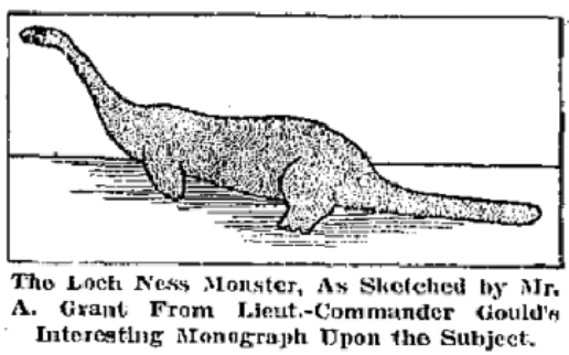
The Loch Ness Monster ( gd, Uilebheist Loch Nis), affectionately known as Nessie, is a creature in Scottish folklore that is said to inhabit Loch Ness in the Scottish Highlands. It is often described as large, long-necked, and with one or more humps protruding from the water. Popular interest and belief in the creature has varied since it was brought to worldwide attention in 1933. Evidence of its existence is anecdotal, with a number of disputed photographs and sonar readings. The scientific community explains alleged sightings of the Loch Ness Monster as hoaxes, wishful thinking, and the misidentification of mundane objects. The pseudoscience and subculture of cryptozoology has placed particular emphasis on the creature. Origin of the name In August 1933, the ''Courier'' published the account of George Spicer's alleged sighting. Public interest skyrocketed, with countless letters being sent in detailing different sightingsR. Binns ''The Loch Ness Mystery Solved'' pp&n ... [...More Info...] [...Related Items...] OR: [Wikipedia] [Google] [Baidu] |
.jpg)


.jpg)
