|
List Of Airports In Afghanistan
This is a list of airports in Afghanistan, grouped by type and sorted by location. Description Afghanistan has four international airports which are expected to increase in the future. The Kabul International Airport serves the population of Kabul and the surrounding areas; the Maulana Jalaluddin Balkhi International Airport serves northern Afghanistan; the Ahmad Shah Baba International Airport in Kandahar serves the southern parts of the country; and the Khwaja Abdullah Ansari International Airport in Herat serves the population of western Afghanistan. The Afghan government is seeking to build a new international airport in the Mohammad Agha District of Logar Province. There are also about 16 regional domestic airports which are spread over the country in various provinces, which serve the smaller, more remote areas. Some of these airports have gravelled airside facilities and operate under visual flight rules. Airports across Afghanistan See also * Transport in Af ... [...More Info...] [...Related Items...] OR: [Wikipedia] [Google] [Baidu] |
Airport
An airport is an aerodrome with extended facilities, mostly for commercial air transport. Airports usually consists of a landing area, which comprises an aerially accessible open space including at least one operationally active surface such as a runway for a plane to take off and to land or a helipad, and often includes adjacent utility buildings such as control towers, hangars and terminals, to maintain and monitor aircraft. Larger airports may have airport aprons, taxiway bridges, air traffic control centres, passenger facilities such as restaurants and lounges, and emergency services. In some countries, the US in particular, airports also typically have one or more fixed-base operators, serving general aviation. Operating airports is extremely complicated, with a complex system of aircraft support services, passenger services, and aircraft control services contained within the operation. Thus airports can be major employers, as well as important hubs for t ... [...More Info...] [...Related Items...] OR: [Wikipedia] [Google] [Baidu] |
ICAO Airport Code
The ICAO airport code or location indicator is a four-letter code designating aerodromes around the world. These codes, as defined by the International Civil Aviation Organization and published in ICAO Document 7910: ''Location Indicators'', are used by air traffic control and airline operations such as flight planning. ICAO codes are also used to identify other aviation facilities such as weather stations, international flight service stations or area control centers, whether or not they are located at airports. Flight information regions are also identified by a unique ICAO-code. History The International Civil Aviation Organization was formed in 1947 under the auspices of the United Nations, and it established '' flight information regions'' (''FIR''s) for controlling air traffic and making airport identification simple and clear. ICAO codes versus IATA codes ICAO codes are separate and different from IATA codes, which are generally used for airline timetables, rese ... [...More Info...] [...Related Items...] OR: [Wikipedia] [Google] [Baidu] |
Farah Province
Farah (Dari: , ''Farā'') is one of the 34 provinces of Afghanistan, located in the southwestern part of the country next to Iran. It is a spacious and sparsely populated province, divided into eleven districts and contains hundreds of villages. It has a population of about 563,026, which is multi-ethnic and mostly a rural tribal society. Farah's population is dominated by Pashtun (80%) tribesmen (Alizai, Barakzai,Noorzai) although Tajiks and a small minority of Shi'a Hazaras can also be found in the countryside. The Farah Airport is located near the city of Farah, which serves as the capital of the province. Farah is linked with Iran via the Iranian border town of Mahirud. The province famous tourism sites include Pul Garden, New Garden, Kafee Garden, shrine of Sultan Amir and Kafer castle are from sightseeing places of Farah provinc Geographically the province is approximately , making it (comparatively) more than twice the size of Maryland, or half the size of South Korea. Th ... [...More Info...] [...Related Items...] OR: [Wikipedia] [Google] [Baidu] |
Farah, Afghanistan
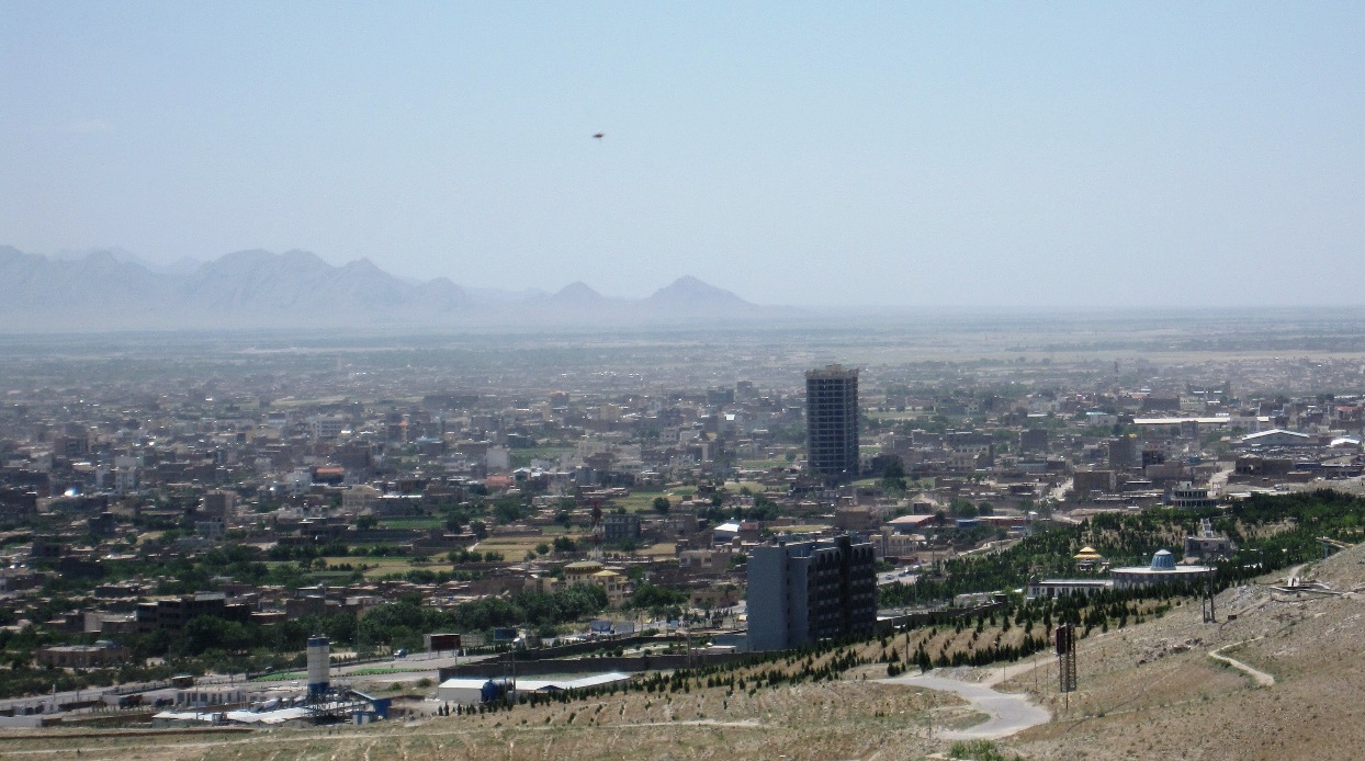
Farah (Pashto/Dari: ) is the capital and largest city of Farah Province in western Afghanistan. It is located on the Farah River, close to the border with Iran. It is one of the largest cities of western Afghanistan in terms of population, with about 1.5 million people living in its urban area. Land use Farah is located in western Afghanistan between Kandahar and Herat, close to the border with Iran, although it lacks a direct road connection with the latter. Farah has a very clear grid of roads distributed through the higher-density residential areas. However barren land (35%) and vacant plots (25%) are the largest land uses and combine for 60% of total land use. History Ancient history The Citadel at Farah is probably one of a series of fortresses constructed by Alexander the Great, the city being an intermediate stop between Alexandria Arachosia (modern Kandahar) and Herat, the location of another of Alexander's fortresses. The "Alexandria" prefix was added to th ... [...More Info...] [...Related Items...] OR: [Wikipedia] [Google] [Baidu] |
Bost Airport
Bost Airport ( ps, د بوست هوايي ډګر; ) is an airport serving Lashkargah, a city in Helmand Province in Afghanistan. It is located on the east bank of the Helmand River, north of its junction with the Arghandab River. It is also west of Kandahar. History The airport was established in 1957 with the assistance of the United States. In 2008, a large project commenced to rehabilitate the current airport as well as to create an industrial and agricultural park. The overall budget of this project was US$52 million donated by USAID. On 4 June 2009, the new runway and terminal were inaugurated by a delegation of high-ranking government officials and the ambassadors of the US and the UK. The new asphalt runway is 2,300m long and 43m wide which makes it the third longest runway in Afghanistan. Airlines and Destinations Facilities The airport stands at an elevation of above mean sea level. It has one runway, designated 01/19, with an asphalt surface measuring . The runway ... [...More Info...] [...Related Items...] OR: [Wikipedia] [Google] [Baidu] |
Helmand Province
Helmand (Pashto/Dari: ; ), also known as Hillmand, in ancient times, as Hermand and Hethumand, is one of the 34 provinces of Afghanistan, in the south of the country. It is the largest province by area, covering area. The province contains 13 districts, encompassing over 1,000 villages, and roughly 1,446,230 settled people. Lashkargah serves as the provincial capital. Helmand was part of the '' Greater Kandahar'' region until made into a separate province by the Afghan government in the 20th century. The Helmand River flows through the mainly desert region of the province, providing water used for irrigation. The Kajaki Dam, which is one of Afghanistan's major reservoirs, is located in the Kajaki district. Helmand is believed to be one of the world's largest opium producing regions, responsible for around 42% of the world's total production. This is believed to be more than the whole of Myanmar, which is the second-largest producing nation after Afghanistan. The region al ... [...More Info...] [...Related Items...] OR: [Wikipedia] [Google] [Baidu] |
Lashkargah
Lashkargāh ( ps, لښکرګاه; fa, لشکرگاه), historically called Bost or Boost (), is a city in southwestern Afghanistan and the capital of Helmand Province. It is located in Lashkargah District, where the Arghandab River merges into the Helmand River. The city has a population of 201,546 as of 2006. Lashkargah is linked by major roads with Kandahar to the east, Zaranj on the border with Iran to the west, and Farah and Herat to the north-west. It is mostly very arid and desolate. However, farming does exist around the Helmand and Arghandab rivers. Bost Airport is located on the east bank of the Helmand River, five miles north of the junction of the Helmand and Arghandab rivers. Because of the trading hubs, it is Afghanistan's second largest city in size, after Kabul and before Kandahar. After several weeks of fighting in the Battle of Lashkargah, the city was captured by the Taliban on 13 August 2021, becoming the fourteenth provincial capital to be seized by t ... [...More Info...] [...Related Items...] OR: [Wikipedia] [Google] [Baidu] |
Herat Province
Herat ( Persian: ) is one of the thirty-four provinces of Afghanistan, located in the north-western part of the country. Together with Badghis, Farah, and Ghor provinces, it makes up the north-western region of Afghanistan. Its primary city and administrative capital is Herat City. The province of Herat is divided into about 17 districts and contains over 2,000 villages. It has a population of about 3,780,000, making it the second most populated province in Afghanistan behind Kabul Province. The population is multi-ethnic but largely Persian-speaking. Herat dates back to the Avestan times and was traditionally known for its wine. The city has a number of historic sites, including the Herat Citadel and the Musalla Complex. During the Middle Ages Herat became one of the important cities of Khorasan, as it was known as the Pearl of Khorasa The province of Herat shares a border with Iran in the west and Turkmenistan in the north, making it an important trading region. The Trans- ... [...More Info...] [...Related Items...] OR: [Wikipedia] [Google] [Baidu] |
Mazar-i-Sharif International Airport
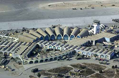
Mazar-i-Sharif International Airport ( prs, میدان هوائی مزار شریف, ''Meydâne Havâyeye Mazâre Šarif''; ps, مزار شریف نړیوال هوايي ډګر) , also known as Mawlānā Jalāl ad-Dīn Muhammad Balkhī International Airport, is located 9 km east of Mazar-i-Sharif in northern Afghanistan, a 15-minute drive from the center of the city. Though it was originally constructed with 2 parallel runways, the northernmost runway has since been converted into a Taxiway. The remaining runway is 9,836 feet (2,998 meters). The airport has facilities for up to 1,000 passengers, making it one of the largest list of airports in Afghanistan, airports in Afghanistan. Originally built in the 1960s in part by the United States, the airport serves the northern Afghan population. In 2013, a 60 million euro terminal was added to the airport while the older terminal is now used for domestic flights. The airport was also home to the Afghan Air Force 4th (304th) Wing. ... [...More Info...] [...Related Items...] OR: [Wikipedia] [Google] [Baidu] |
Balkh Province
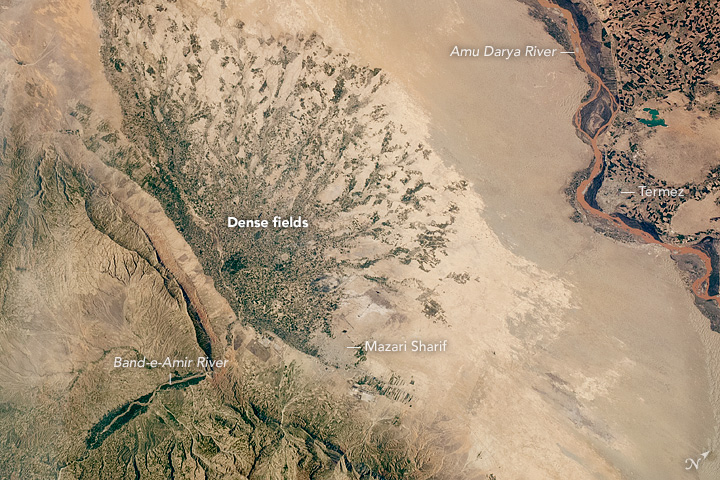
Balkh (Dari: , ''Balx'') is one of the 34 provinces of Afghanistan, located in the north of the country. It is divided into 15 districts and has a population of about 1,509,183, which is multi-ethnic and mostly a Persian-speaking society. The city of Mazar-i-Sharif serves as the capital of the province. The Mazar-e Sharif International Airport and Camp Marmal sit on the eastern edge of Mazar-i-Sharif. Balkh, also called VazīrābādThename of the province is derived from the ancient city of Balkh, near the modern town. The city of Mazar-e-Sharif has been an important stop on the trade routes from the Far East to the Middle East, the Mediterranean and Europe. Home to the famous blue mosque, it was once destroyed by Genghis Khan but later rebuilt by Timur. The city of Balkh and the area of Balkh Province were considered a part of various historical regions in history including Ariana and Greater Khorasan. The province serves today as Afghanistan's second but main gateway to Ce ... [...More Info...] [...Related Items...] OR: [Wikipedia] [Google] [Baidu] |
Mazar-i-Sharif
, official_name = , settlement_type = City , image_skyline = , pushpin_map = Afghanistan#Bactria#West Asia , pushpin_label = Mazar-i-Sharif , pushpin_label_position = bottom , pushpin_mapsize = , pushpin_relief = yes , pushpin_map_caption = Location in Afghanistan , coordinates = , subdivision_type = Country , subdivision_name = Afghanistan , subdivision_type1 = Province , subdivision_type2 = District , subdivision_name1 = Balkh Province , subdivision_name2 = Mazar-i-Sharif District , established_title = , established_date = , leader_title = Mayor , leader_name = Abdullhaq Khurami , area_total_km2 = , area_land_km2 ... [...More Info...] [...Related Items...] OR: [Wikipedia] [Google] [Baidu] |
Kandahar International Airport
Ahmad Shah Baba International Airport, also referred to as Kandahar International Airport ( ps, د کندهار نړيوال هوايي ډګر) and by some military officials as Kandahar Airfield, KAF) , is located about south-east of the city Kandahar in Afghanistan. It serves as the nation's second main international airport and as one of the largest main operating bases, capable of housing up to 250 aircraft of different sizes. The current head of the airport is Maulvi Fathullah Mansour. The airport was designed and built by the United States in the early 1960s. It was occupied by the Soviets during the 1980s Soviet–Afghan War. Following their withdrawal the airport remained in control of Najibullah's government until he stepped down in 1992. Thereafter, local warlords and the Taliban took control of the airport until the American invasion in late 2001. It was also the site of Airstan incident in 1995, as well as the Indian Airlines Flight 814 incident in 1999. Since 2 ... [...More Info...] [...Related Items...] OR: [Wikipedia] [Google] [Baidu] |


