|
Leyte
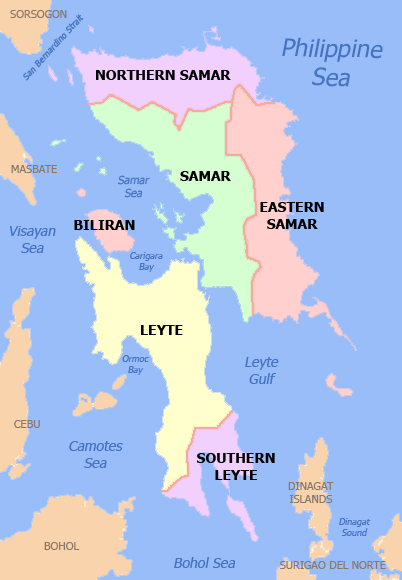
Leyte ( ) is an island in the Visayas group of islands in the Philippines. It is eighth-largest and sixth-most populous island in the Philippines, with a total population of 2,626,970 as of 2020 census. Since the accessibility of land has been depleted, Leyte has provided countless number of migrants to Mindanao. Most inhabitants are farmers. Fishing is a supplementary activity. Rice and corn (maize) are the main food crops; cash crops include coconuts, abaca, tobacco, bananas, and sugarcane. There are some manganese deposits, and sandstone and limestone are quarried in the northwest. Politically, the island is divided into two provinces: (Northern) Leyte and Southern Leyte. Territorially, Southern Leyte includes the island of Panaon to its south. To the north of Leyte is the island province of Biliran, a former sub-province of Leyte. The major cities of Leyte are Tacloban, on the eastern shore at the northwest corner of Leyte Gulf, and Ormoc, on the west coast. Leyte to ... [...More Info...] [...Related Items...] OR: [Wikipedia] [Google] [Baidu] |
Southern Leyte
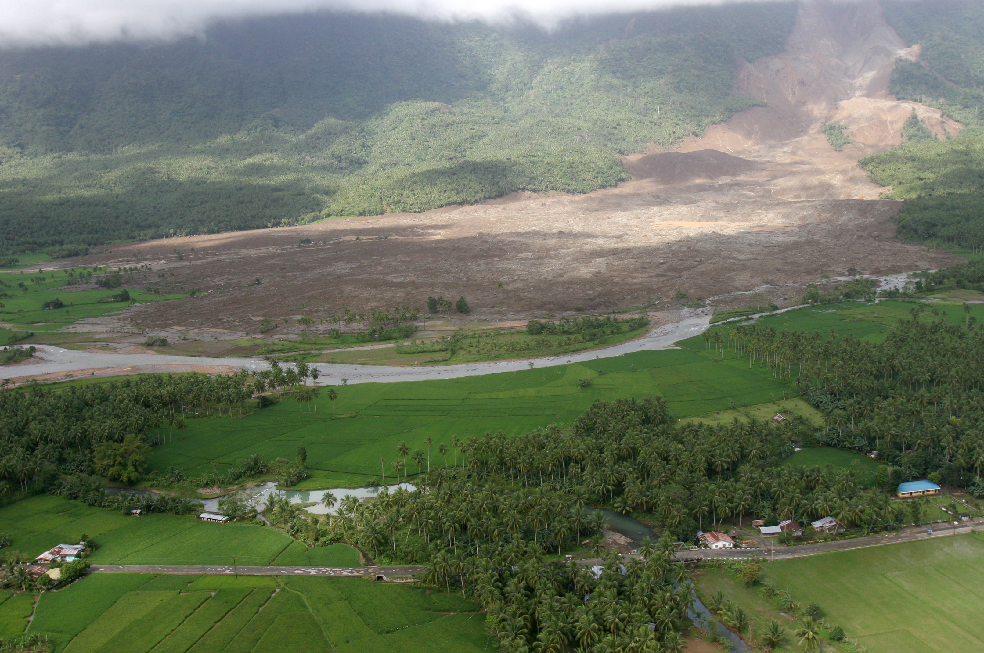
Southern Leyte ( ceb, Habagatang Leyte; Kabalian: ''Habagatan nga Leyte''; war, Salatan nga Leyte; tl, Timog Leyte), officially the Province of Southern Leyte, is a province in the Philippines located in the Eastern Visayas region. Its capital is the city of Maasin. Southern Leyte comprised the third congressional district Leyte until it was made into an independent province in 1959. Southern Leyte includes Limasawa, an island to the south where the first Roman Catholic Mass in Philippine soil is believed to have taken place and thus considered to be the birthplace of Roman Catholicism in the Philippines. The province ranks as the second least populated in the region. According to the 2020 census, the province has a population of 429,573. Southern Leyte's geological features created several issues in the province after the flooding of the Subangdaku River and the 2006 mudslide in Guinsaugon. Organizations warned the province it was susceptible to natural occurrences like la ... [...More Info...] [...Related Items...] OR: [Wikipedia] [Google] [Baidu] |
Leyte (province)
Leyte (also Northern Leyte; war, Norte san/Amihanan nga Leyte; Cebuano: ''Amihanang Leyte''; tl, Hilagang Leyte), officially the Province of Leyte, is a province in the Philippines located in the Eastern Visayas region, occupying the northern three-quarters of Leyte Island. Its capital is the city of Tacloban, administered independently from the province. Leyte is situated west of Samar Island, north of Southern Leyte and south of Biliran. To the west across the Camotes Sea is the province of Cebu. The historical name of the Philippines, "''Las Islas Felipenas''", named by Spanish explorer Ruy López de Villalobos in honor of Prince Philip of Spain, used to refer to the islands of Leyte and Samar only, until it was adopted to refer to the entire archipelago. The island of Leyte is known as Tandaya during the 16th century. Leyte is also known as the site of the largest naval battle in modern history, the Battle of Leyte Gulf, which took place during the Second World War. L ... [...More Info...] [...Related Items...] OR: [Wikipedia] [Google] [Baidu] |
Tacloban
Tacloban ( ; ), officially the City of Tacloban ( war, Syudad han Tacloban; fil, Lungsod ng Tacloban), is a first class highly urbanized city in the Eastern Visayas region of the Philippines. The city is autonomous from the province of Leyte, although it serves as its provincial capital. According to the 2020 census, Tacloban has a population of 251,881, making it the most populous city in the Eastern Visayas. The city is located southeast from Manila. Tacloban City was briefly the capital of the Philippines under the Commonwealth Government, from October 20, 1944, to February 27, 1945. In an extensive survey conducted by the Asian Institute of Management Policy Center and released in July 2010, Tacloban City ranks as the fifth most competitive city in the Philippines, and second in the emerging cities category. On November 8, 2013, the city was largely destroyed by Typhoon Haiyan, having previously suffered similar destruction and loss of life in 1897 and 1912. On January 17 ... [...More Info...] [...Related Items...] OR: [Wikipedia] [Google] [Baidu] |
Tacloban City
Tacloban ( ; ), officially the City of Tacloban ( war, Syudad han Tacloban; fil, Lungsod ng Tacloban), is a first class Cities of the Philippines#Legal classification, highly urbanized city in the Eastern Visayas region of the Philippines. The city is autonomous from the province of Leyte, although it serves as its provincial capital. According to the 2020 census, Tacloban has a population of 251,881, making it the most populous city in the Eastern Visayas. The city is located southeast from Manila. Tacloban City was briefly the capital of the Philippines under the Commonwealth Government, from October 20, 1944, to February 27, 1945. In an extensive survey conducted by the Asian Institute of Management Policy Center and released in July 2010, Tacloban City ranks as the fifth most competitive city in the Philippines, and second in the emerging cities category. On November 8, 2013, the city was largely destroyed by Typhoon Haiyan, having previously suffered similar destruction an ... [...More Info...] [...Related Items...] OR: [Wikipedia] [Google] [Baidu] |
Ormoc
Ormoc (IPA: �oɾˈmok, officially the City of Ormoc ( ceb, Dakbayan sa Ormoc; war, Syudad han Ormoc; fil, Lungsod ng Ormoc), is a 1st class independent component city in the Eastern Visayas region of the Philippines. According to the 2020 census, it has a population of 230,998 inhabitants, making it the second most-populous city in the province of Leyte after the provincial capital of Tacloban. Ormoc is the economic, cultural, commercial and transportation hub of western Leyte. Ormoc is an independent component city, not subject to regulation from the Provincial Government of Leyte. However, the city is part of the 4th Congressional District of Leyte together with Albuera, Kananga, Merida, Palompon and Isabel, and statistically grouped under the province by the Philippine Statistics Authority. On November 8, 2013, the city was extensively damaged by Super Typhoon Yolanda (Haiyan), having previously suffered severe destruction and loss of life in 1991 from torrential floo ... [...More Info...] [...Related Items...] OR: [Wikipedia] [Google] [Baidu] |
Eastern Visayas
Eastern Visayas ( war, Sinirangan Kabisay-an; ceb, Sidlakang Kabisay-an; tl, Silangang Kabisayaan or ''Silangang Visayas'') is an administrative region in the Philippines, designated as Region VIII. It consists of three main islands, Samar, Leyte and Biliran. The region has six provinces, one independent city and one highly urbanized city namely, Biliran, Leyte, Northern Samar, Samar, Eastern Samar, Southern Leyte, Ormoc and Tacloban. The highly urbanized city of Tacloban is the sole regional center. These provinces and cities occupy the easternmost islands of the Visayas group of islands. Eastern Visayas faces the Philippine Sea to the east. The region's most famous landmark is the San Juanico Bridge, which links the provinces of Samar and Leyte. As of 2020, the Eastern Visayas region has a population of 4,547,150 inhabitants, making it the third most populous region in the Visayas. Etymology The current name of the region was derived from its location in the easternmost p ... [...More Info...] [...Related Items...] OR: [Wikipedia] [Google] [Baidu] |
Leyte Gulf
Leyte Gulf is a gulf in the Eastern Visayan region in the Philippines. The bay is part of the Philippine Sea of the Pacific Ocean, and is bounded by two islands; Samar in the north and Leyte in the west. On the south of the bay is Mindanao Island, separated from Leyte by the Surigao Strait. Dinagat Island partly encloses the gulf to the southeast, and the small Homonhon Island and Suluan Island, sit astride the eastern entrance to the Gulf. It is approximately north-south, and east-west. Several municipalities are situated on the coast of the gulf: Balangiga, Giporlos, Guiuan, Lawaan, Mercedes, Quinapondan and Salcedo. There are also eleven marine reserves in the gulf region. History Leyte Gulf was also the scene of the Battle of Leyte Gulf, which extends to Surigao Strait during the Battle of Surigao Strait, the largest naval battle of World War II and started the end of Japanese occupation in the Philippines. During World War II the gulf was part of a large US Navy b ... [...More Info...] [...Related Items...] OR: [Wikipedia] [Google] [Baidu] |
Provinces Of The Philippines
In the Philippines, provinces ( fil, lalawigan) are one of its primary political and administrative divisions. There are 82 provinces at present, which are further subdivided into component cities and municipalities. The local government units in the National Capital Region, as well as independent cities, are independent of any provincial government. Each province is governed by an elected legislature called the Sangguniang Panlalawigan and an elected governor. The provinces are grouped into seventeen regions based on geographical, cultural, and ethnological characteristics. Thirteen of these regions are numerically designated from north to south, while the National Capital Region, the Cordillera Administrative Region, the Southwestern Tagalog Region, and the Bangsamoro Autonomous Region in Muslim Mindanao are only designated by acronyms. Each province is a member of the League of Provinces of the Philippines, an organization which aims to address issues affecting provi ... [...More Info...] [...Related Items...] OR: [Wikipedia] [Google] [Baidu] |
Sogod Bay
Sogod Bay is a large bay in the southern part of Leyte Island in the Philippines. An extension of the Bohol Sea, the bay is surrounded by the province of Southern Leyte, and the namesake municipality of Sogod is located at the head of the bay. Panaon Island forms part of the eastern side of Sogod Bay, while Sarangani or Limasawa Island is at the mouth of the bay. Ecology The bay is home to a variety of fishes, is therefore a major fishing ground for the nine municipalities surrounding the bay. Mangko (''Euthynnus affinis'') is its major fishery resource. Seasonal influx of Mangko has provided food and livelihood to the people of Sogod and nearby municipalities. A study of Sogod Bay by Silliman University in 1994 mentioned that there are seven finfish species that are pelagic and are harvested when they enter the bay. Recently, there have been reports of whale shark sightings in the bay. The Subangdaku River is a major tributary of Sogod Bay, emptying into the bay at the mun ... [...More Info...] [...Related Items...] OR: [Wikipedia] [Google] [Baidu] |
San Juanico Bridge
The San Juanico Bridge ( fil, Tulay ng San Juanico; war, Tulay han San Juanico) is part of the Pan-Philippine Highway and stretches from Samar to Leyte across the San Juanico Strait in the Philippines. Its longest length is a steel girder viaduct built on reinforced concrete piers, and its main span is of an arch-shaped truss bridge, truss design. Constructed during the administration of President Ferdinand Marcos through Japanese Official Development Assistance (Japan), Official Development Assistance loans, it has a total length of —the second longest bridge spanning a body of seawater in the Philippines after Cebu-Cordova Bridge. Marcos built the bridge as a personal gift to his wife Imelda Marcos, Imelda using public funds siphoned through the controversial Marcos Japanese ODA scandal.. It was one of the high-visibility foreign-loan projects initiated by Marcos during the run-up to the 1969 Philippine presidential election, 1969 presidential election. Completed four year ... [...More Info...] [...Related Items...] OR: [Wikipedia] [Google] [Baidu] |
Carigara Bay
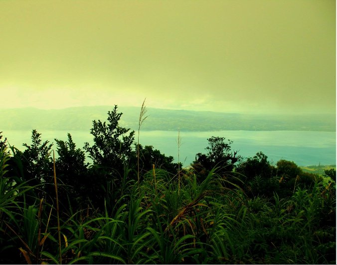
Carigara Bay (; ), is a large bay in the northern part of Leyte in the Philippines. The bay is bounded by Leyte to its western, southern and eastern parts and the island of Biliran to the northwest. It is named after the municipality of Carigara Carigara (), officially the Municipality of Carigara ( war, Bungto han Carigara; tl, Bayan ng Carigara), is a 2nd class municipality in the province of Leyte, Philippines. According to the 2020 census, it has a population of 54,656 people. The .... References Bays of the Philippines Landforms of Leyte (province) {{Philippines-geo-stub ... [...More Info...] [...Related Items...] OR: [Wikipedia] [Google] [Baidu] |
Biliran
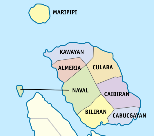
Biliran, officially the Province of Biliran ( Waray-Waray: ''Probinsya han Biliran''; ceb, Lalawigan sa Biliran; tl, Lalawigan ng Biliran), is an island province in the Philippines located in the Eastern Visayas region (Region VIII). Biliran is one of the country's smallest and newest provinces. Formerly a sub-province of Leyte, it became an independent province in 1992. Biliran lies less than a kilometer north of the island of Leyte. A bridge-causeway fixed link over Poro Island in the gateway town of Biliran connects the province to Leyte. Its capital is the municipality of Naval on the western coast of the island. History Etymology During the early Spanish era, what is now called Biliran was known as ''Isla de Panamao''. The present name, believed to be adopted sometime between the late 17th century and the early 18th century, was, according to many publications, derived from a native grass called ''borobiliran'' which once grew abundantly on the island's plains. A contend ... [...More Info...] [...Related Items...] OR: [Wikipedia] [Google] [Baidu] |


_-_Flickr.jpg)
