|
Iquique
Iquique () is a port city and commune in northern Chile, capital of both the Iquique Province and Tarapacá Region. It lies on the Pacific coast, west of the Pampa del Tamarugal, which is part of the Atacama Desert. It has a population of 191,468 according to the 2017 census. It is also the main commune of Greater Iquique. The city developed during the heyday of the saltpetre mining in the Atacama Desert in the 19th century. Once a Peruvian city with a large Chilean population, it was conquered by Chile in the War of the Pacific (1879–1883). Today it is one of only two free ports of Chile, the other one being Punta Arenas, in the country's far south. History Although the city was founded in the 16th century, there is evidence of habitation in the area by the Chango people as early as 7,000 BC. During colonial times, Iquique was part of the Viceroyalty of Peru as much of South America was at the time, and remained part of Peruvian territory until the end of the 19th century ... [...More Info...] [...Related Items...] OR: [Wikipedia] [Google] [Baidu] |
2014 Iquique Earthquake
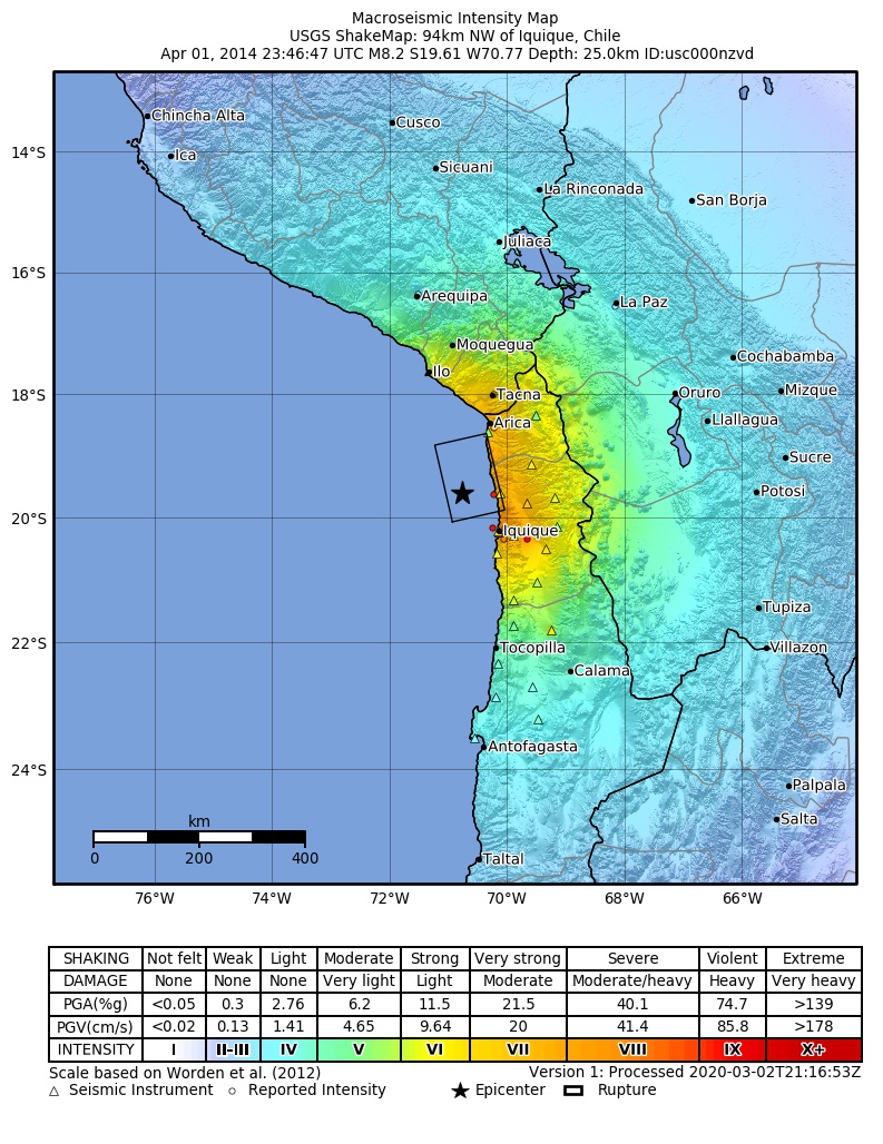
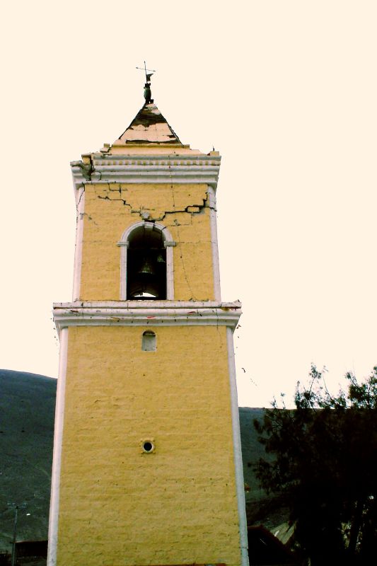
The 2014 Iquique earthquake struck off the coast of Chile on 1 April, with a moment magnitude of 8.2, at 20:46 local time (23:46 UTC). The epicenter of the earthquake was approximately northwest of Iquique. The mainshock was preceded by a number of moderate to large shocks and was followed by a large number of moderate to very large aftershocks, including a M7.7 event on 3 April. The megathrust earthquake triggered a tsunami of up to that hit Iquique at 21:05 local time (00:05 UTC, 2 April). Similar-sized tsunamis were also reported to have hit the coasts of Pisagua and Arica. Geology A number of mid-sized quakes struck the same area in the preceding weeks. These quakes and the main tremor are associated with the boundary of the Nazca Plate and the South American Plate. Earthquake There was a cluster of earthquakes starting from the one occurring on 16 March with a magnitude of 6.7, and a large earthquake had been expected. The 8.2 earthquake was smaller than what was ... [...More Info...] [...Related Items...] OR: [Wikipedia] [Google] [Baidu] |
War Of The Pacific
The War of the Pacific ( es, link=no, Guerra del Pacífico), also known as the Saltpeter War ( es, link=no, Guerra del salitre) and by multiple other names, was a war between Chile and a Bolivian–Peruvian alliance from 1879 to 1884. Fought over Chilean claims on coastal Bolivian territory in the Atacama Desert, the war ended with a Chilean victory, which gained for the country a significant amount of resource-rich territory from Peru and Bolivia. The war began over a nitrate taxation dispute between Bolivia and Chile, with Peru being drawn in due to its secret alliance with Bolivia. But historians have pointed to deeper origins of the war, such as the interest of Chile and Peru in the nitrate business, the long-standing rivalry between Chile and Peru, as well as political and economical disparities between Chile, Peru and Bolivia. On February 14, 1879, Chile's armed forces occupied the Bolivian port city of Antofagasta, subsequently war between Bolivia and Chile was decl ... [...More Info...] [...Related Items...] OR: [Wikipedia] [Google] [Baidu] |
Iquique Province
Iquique Province ( es, Provincia de Iquique) is one of two provinces in the northern Chilean region of Tarapacá. Its capital is the port city of Iquique. History Until October 2007, the Province of Iquique was composed of 7 communes: Alto Hospicio, Camina, Colchane, Huara, Iquique, Pica and Pozo Almonte, but since then, with the creation of the Region of Arica and Parinacota, much of the province, specifically the municipalities of Huara, Camina, Colchane, Pozo Almonte and Pica, was transferred administratively to Tamarugal Province, leaving Iquique Province consists of two communes. Geography and demography According to the 2012 census by the National Statistics Institute (''INE''), the province spans an area of and had a population of 275,042 inhabitants, giving it a population density of . Between the 1992 and 2002 censuses, the population grew by 30.8% (50,959 persons). Administration As a province, Iquique is a second-level administrative division of Chile, which is furt ... [...More Info...] [...Related Items...] OR: [Wikipedia] [Google] [Baidu] |
Tarapacá Region
The Tarapacá Region ( es, Región de Tarapacá, ) is one of Chile's 16 first-order administrative divisions. It comprises two provinces, Iquique and Tamarugal. It borders the Chilean Arica and Parinacota Region to the north, Bolivia's Oruro Department and Potosí Department on the east, Chile's Antofagasta Region to the south and the Pacific Ocean to the west. The port city of Iquique is the region's capital. Much of the region was once the Tarapacá Province of Peru, which was annexed by Chile under the 1883 Treaty of Ancón at the close of the War of the Pacific. The region was important economically as a site of intense saltpeter mining, before synthetic nitrate manufacturing became possible. A number of abandoned mining towns can still be found in the region. The present day Tarapacá Region was created in 2007 by subdividing the former Tarapacá Region under Law No. 20,175, which was signed by President Michelle Bachelet in Arica. Administration The government ... [...More Info...] [...Related Items...] OR: [Wikipedia] [Google] [Baidu] |
1877 Iquique Earthquake
The 1877 Iquique earthquake occurred at 21:16 local time on 9 May (0:59 on 10 May UTC). It had a magnitude of 8.5 on the surface wave magnitude scale. Other estimates of its magnitude have been as high as 8.9 and 9.0 (based on the size of the tsunami). It had a maximum intensity of XI (Extreme) on the Mercalli intensity scale and triggered a devastating tsunami. A total of 2,385 people died, mainly in Fiji. Historical context Affected areas in what was then part of Bolivia, but is now the Antofagasta region of Chile, had during this period been subject to the Atacama border dispute between the two countries. Under the 1874 boundary treaty between Bolivia and Chile, the border between the two nations as of 1877 followed the 24th parallel south. The terms of that treaty required that Bolivia not levy taxes on Chilean companies mining nitrates between the 23rd and 24th parallels (including the city of Antofagasta) for 25 years, except for agreed duties to be shared between t ... [...More Info...] [...Related Items...] OR: [Wikipedia] [Google] [Baidu] |
Greater Iquique
Greater Iquique is a Chilean conurbation that includes Iquique and Alto Hospicio communes in the Iquique Province in Tarapacá Region. It has a population of 299,843 in the 2017 census, becoming the second largest city in Norte Grande (''Far North'') after Antofagasta. Its designation as a metropolitan area is recent. References Iquique Iquique () is a port city and commune in northern Chile, capital of both the Iquique Province and Tarapacá Region. It lies on the Pacific coast, west of the Pampa del Tamarugal, which is part of the Atacama Desert. It has a population of 191, ... Populated places in Tarapacá Region Iquique Coasts of Tarapacá Region {{Tarapacá-geo-stub ... [...More Info...] [...Related Items...] OR: [Wikipedia] [Google] [Baidu] |
Chile
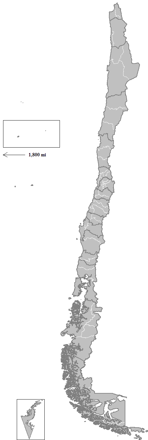
Chile, officially the Republic of Chile, is a country in the western part of South America. It is the southernmost country in the world, and the closest to Antarctica, occupying a long and narrow strip of land between the Andes to the east and the Pacific Ocean to the west. Chile covers an area of , with a population of 17.5 million as of 2017. It shares land borders with Peru to the north, Bolivia to the north-east, Argentina to the east, and the Drake Passage in the far south. Chile also controls the Pacific islands of Juan Fernández, Isla Salas y Gómez, Desventuradas, and Easter Island in Oceania. It also claims about of Antarctica under the Chilean Antarctic Territory. The country's capital and largest city is Santiago, and its national language is Spanish. Spain conquered and colonized the region in the mid-16th century, replacing Inca rule, but failing to conquer the independent Mapuche who inhabited what is now south-central Chile. In 1818, after ... [...More Info...] [...Related Items...] OR: [Wikipedia] [Google] [Baidu] |
1868 Arica Earthquake
The 1868 Arica earthquake occurred on 13 August 1868, near Arica, then part of Peru, now part of Chile, at 21:30 UTC. It had an estimated magnitude between 8.5 and 9.3. A tsunami (or multiple tsunamis) in the Pacific Ocean was produced by the earthquake, which was recorded in Hawaii, Japan, Australia, and New Zealand. Tectonic setting The earthquake occurred along the boundary between the Nazca Plate and the South American Plate. The earthquake was likely a result of thrust-faulting, caused by the subduction of the Nazca plate beneath the South American plate. The coasts of Peru and Chile have a history of great megathrust earthquakes originating from this plate boundary, such as the 1960 Valdivia earthquake and the 2010 Chile earthquake. Damage The earthquake caused almost complete destruction in the southern part of Peru, including Arica, Tacna, Moquegua, Mollendo, Ilo, Iquique, Torata and Arequipa, resulting in an estimated 25,000 casualties, and many shipwreck ... [...More Info...] [...Related Items...] OR: [Wikipedia] [Google] [Baidu] |
Provinces Of Chile
A province is the second largest administrative division in Chile with 56 in total. The largest administrative division in Chile is that of a region with 16 in total. Each provincial presidential delegation (''delegación presidencial provincial'') is headed by a provincial presidential delegate (''delegado presidencial provincial'') appointed by the President. The governor exercises their powers in accordance with instructions from the regional presidential delegate (''delegado presidencial regional''). The provincial delegate is advised by the Provincial Economic and Social Council (''Consejo Económico y Social Provincial'' or CESPRO). No provincial presidential delegations exist in those provinces where the regional capital is located; its functions were merged with those of the regional presidential delegate. The country's provinces are further divided into 346 communes which are administered by an alcalde and municipal council. Until 1976, a province was the main adm ... [...More Info...] [...Related Items...] OR: [Wikipedia] [Google] [Baidu] |
Punta Arenas
Punta Arenas (; historically Sandy Point in English) is the capital city of Chile's southernmost region, Magallanes and Antarctica Chilena. The city was officially renamed as Magallanes in 1927, but in 1938 it was changed back to "Punta Arenas". It is the largest city south of the 46th parallel south, and at the same time the most populous southernmost city in Chile and in the Americas, and due to its location, the coldest coastal city with more than 100,000 inhabitants in Latin America. It is one of the most southerly ports in the world, serving as an Antarctic gateway city. As of 1977, Punta Arenas has been one of only two free ports in Chile, the other one being Iquique, in the country's far north. Located on the Brunswick Peninsula north of the Strait of Magellan, Punta Arenas was originally established by the Chilean government in 1848 as a tiny penal colony to assert sovereignty over the Strait. During the remainder of the 1800s, Punta Arenas grew in size and import ... [...More Info...] [...Related Items...] OR: [Wikipedia] [Google] [Baidu] |
Communes Of Chile
A commune ( es, comuna, ) is the smallest administrative subdivision in Chile. It may contain cities, towns, villages, hamlets as well as rural areas. In highly populated areas, such as Santiago, Valparaíso and Concepción, a conurbation may be broken into several communes. In sparsely populated areas, conversely, a commune may cover a substantial rural area together with several settled areas which could range from hamlets to towns or cities. The term "commune" is ambiguous in English, but the word is commonly used in translation for "comuna", although with some controversy among translators. A comuna is similar to a "county" in Anglo-American usage and practice, and may be more universally understood as a "municipality". Each commune or municipality is governed by a directly elected body known as a municipal council (''concejo municipal'') consisting of a mayor (''alcalde'') and a group of councillors (''concejales''), for a period of four years. The communal civil servic ... [...More Info...] [...Related Items...] OR: [Wikipedia] [Google] [Baidu] |
2005 Tarapacá Earthquake
The 2005 Tarapacá earthquake occurred on June 13 at 22:44:33 UTC (18:44:33 local time). Its epicenter was located near Mamiña, in northern Chile about 125 km east-northeast of Iquique, affecting the Tarapacá Region and adjacent parts of Bolivia. It had a magnitude of 7.8 and a maximum felt intensity of VII (''Very strong'') on the Mercalli intensity scale. Tectonic setting Chile lies above the destructive boundary, destructive plate boundary, where the Nazca Plate is being Subduction, subducted beneath the South American Plate. In the Tarapacá region the plates converge at a rate of 78 mm per year. This boundary is associated with many large earthquakes, both along the plate interface and within the downgoing slab (Nazca Plate). Earthquake The earthquake was an intermediate-depth event, with a hypocenter, hypocentral depth of 115.6 km. The focal mechanism shows that this was a normal fault event, within the subducted Nazca Plate. Finite-fault modelling of the e ... [...More Info...] [...Related Items...] OR: [Wikipedia] [Google] [Baidu] |


