|
Hundorp
Hundorp is the administrative centre of Sør-Fron Municipality in Innlandet county, Norway. The village is located in the Gudbrandsdal valley along the north shore of the Gudbrandsdalslågen river, about west of the village of Ringebu. The European route E6 highway and the Dovrebanen railway line both pass through the village. The village has a population (2021) of 583 and a population density of . Hundorp was also the centre of the petty kingdom of Gudbrandsdalen and as such, it was an important place for religion and politics. Dale-Gudbrand's farm, the farm once populated by the ancient ruler Dale-Gudbrand, was chosen as the millennium site of Oppland Oppland is a former county in Norway which existed from 1781 until its dissolution on 1 January 2020. The old Oppland county bordered the counties of Trøndelag, Møre og Romsdal, Sogn og Fjordane, Buskerud, Akershus, Oslo and Hedmark. The c ... county. Name The village is named after the old Hundorp farm ( non, Hundþo ... [...More Info...] [...Related Items...] OR: [Wikipedia] [Google] [Baidu] |
Sør-Fron Municipality
Sør-Fron is a municipality in Innlandet county, Norway. It is located in the traditional district of Gudbrandsdal. The administrative centre of the municipality is the village of Hundorp. Other villages in the municipality include Gålå, Harpefoss, and Lia. The municipality is the 153rd largest by area out of the 356 municipalities in Norway. Sør-Fron is the 224th most populous municipality in Norway with a population of 3,064. The municipality's population density is and its population has decreased by 4.5% over the previous 10-year period. General information The prestegjeld of Fron was established as a civil municipality on 1 January 1838 when the new formannskapsdistrikt law went into effect. On 1 January 1851, the municipality was divided in two. The northwest portion became Nord-Fron Municipality (population: 4,685) and the southeast portion became Sør-Fron Municipality (population: 3,421). On 27 July 1956, a small area of Sør-Fron municipality (population: 7) w ... [...More Info...] [...Related Items...] OR: [Wikipedia] [Google] [Baidu] |
Sør-Fron
Sør-Fron is a municipality in Innlandet county, Norway. It is located in the traditional district of Gudbrandsdal. The administrative centre of the municipality is the village of Hundorp. Other villages in the municipality include Gålå, Harpefoss, and Lia. The municipality is the 153rd largest by area out of the 356 municipalities in Norway. Sør-Fron is the 224th most populous municipality in Norway with a population of 3,064. The municipality's population density is and its population has decreased by 4.5% over the previous 10-year period. General information The prestegjeld of Fron was established as a civil municipality on 1 January 1838 when the new formannskapsdistrikt law went into effect. On 1 January 1851, the municipality was divided in two. The northwest portion became Nord-Fron Municipality (population: 4,685) and the southeast portion became Sør-Fron Municipality (population: 3,421). On 27 July 1956, a small area of Sør-Fron municipality (population: 7 ... [...More Info...] [...Related Items...] OR: [Wikipedia] [Google] [Baidu] |
Gudbrandsdal
Gudbrandsdalen (; en, Gudbrand Valley) is a valley and traditional district in the Norwegian county of Innlandet (formerly Oppland). The valley is oriented in a north-westerly direction from Lillehammer and the lake of Mjøsa, extending toward the Romsdalen valley. The river Gudbrandsdalslågen (Lågen) flows through the valley, starting from the lake Lesjaskogsvatnet and ending at the lake Mjøsa. The Otta river which flows through Otta valley is a major tributary to the main river Lågen. The valleys of the tributary rivers such as Otta and Gausa (Gausdal) are usually regarded as part of Gudbrandsdalen. The total area of the valley is calculated from the areas of the related municipalities. Gudbrandsdalen is the main valley in a web of smaller valleys. On the western (right hand) side there are long adjacent valleys: Ottadalen stretches from Otta village, Gausdal some from Lillehammer and Heidal some from Sjoa. Gudbrandsdalen runs between the major mountain ranges of Norw ... [...More Info...] [...Related Items...] OR: [Wikipedia] [Google] [Baidu] |
Gudbrandsdalen
Gudbrandsdalen (; en, Gudbrand Valley) is a valley and traditional district in the Norwegian county of Innlandet (formerly Oppland). The valley is oriented in a north-westerly direction from Lillehammer and the lake of Mjøsa, extending toward the Romsdalen valley. The river Gudbrandsdalslågen (Lågen) flows through the valley, starting from the lake Lesjaskogsvatnet and ending at the lake Mjøsa. The Otta river which flows through Otta valley is a major tributary to the main river Lågen. The valleys of the tributary rivers such as Otta and Gausa (Gausdal) are usually regarded as part of Gudbrandsdalen. The total area of the valley is calculated from the areas of the related municipalities. Gudbrandsdalen is the main valley in a web of smaller valleys. On the western (right hand) side there are long adjacent valleys: Ottadalen stretches from Otta village, Gausdal some from Lillehammer and Heidal some from Sjoa. Gudbrandsdalen runs between the major mountain ranges of ... [...More Info...] [...Related Items...] OR: [Wikipedia] [Google] [Baidu] |
Dale-Gudbrand's Farm
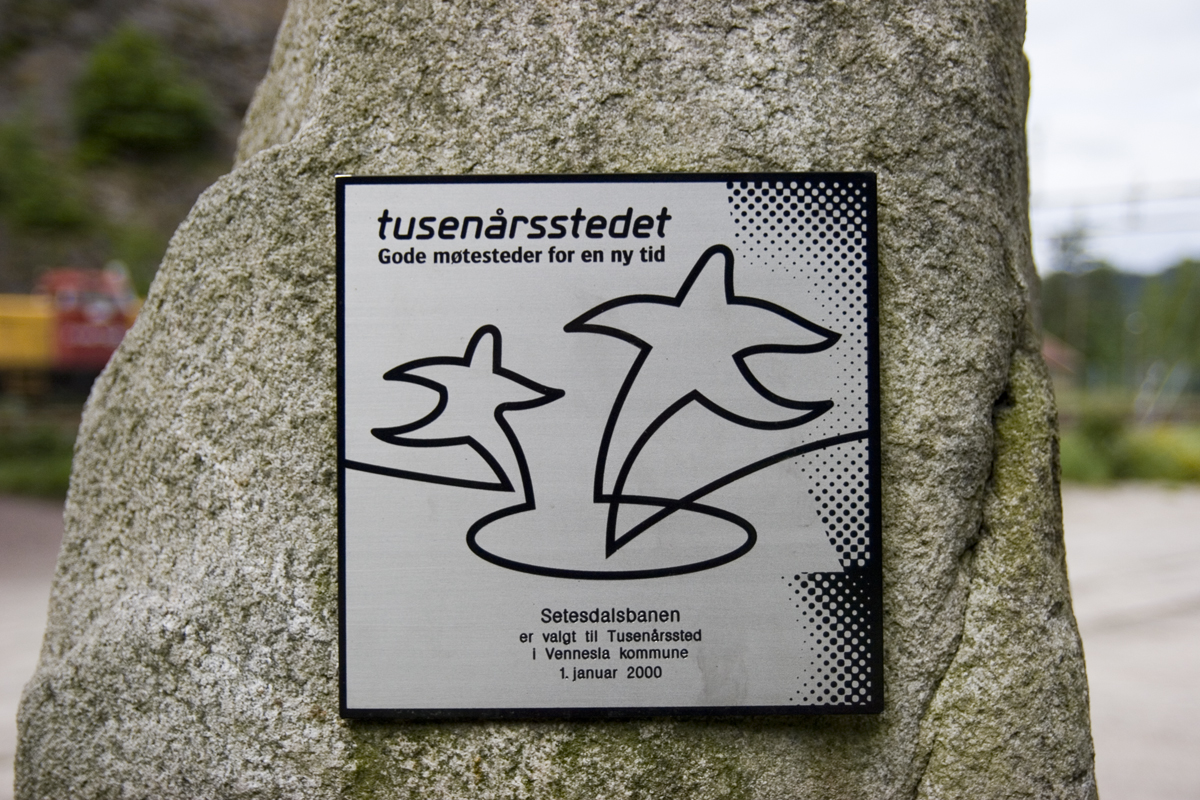
Dale-Gudbrand's farm ( no, Dale-Gudbrands gard) is a historical site in Hundorp in the municipality of Sør-Fron in Norway's Gudbrand Valley. It was selected as the millennium site (see Millennium site) for Oppland county and for the municipality of Sør-Fron in 1999. The farm lies in the middle of a major tumulus area dating back to the Iron Age. In 1755 Gerhard Schøning described five large grave mounds there as one of them was being removed. Now four of them remain; with diameters between , they are undoubtedly the largest in the Gudbrand Valley. In addition to the mounds, there is a square ring of stones and the remains of a round ring of stones at the site. There are also two medium-sized tumuli at the neighboring Hjetlund farm associated with the large tumuli at Hundorp. ''Heimskringla'', Snorri Sturluson's collection of sagas about the Norwegian kings, describes a meeting between Olaf II of Norway and the hersir Dale-Gudbrand on the farm in 1021 in chapter 113 of t ... [...More Info...] [...Related Items...] OR: [Wikipedia] [Google] [Baidu] |
Dale-Gudbrand
Dale-Gudbrand is a historical Norwegian person that appears in the ''Separate Saga of St. Olaf'' in Snorri Sturluson's ''Heimskringla''. He is said to have lived at the farm in Hundorp in the Gudbrand Valley around the year 1000, and to have been the most powerful man in the Gudbrand Valley at that time, with the status of a hersir. He is named in '' Haakon Jarl's Saga'' as being allied with Haakon Jarl in his conflict with King Harald Greycloak. The ''Separate Saga of St. Olaf'' describes a meeting between Olaf II of Norway and Dale-Gudbrand in 1021 that was the start of the introduction of Christianity into the Gudbrand Valley. :King Olav agreed to meet the farmers early the next morning, and then the idol of Thor should be borne out. When the meeting was set, Dale-Gudbrand asked the king where his god was. At the same time the sun rose and the king replied, "There comes my God with great light." When the farmers turned to look at the sunrise, Kolbein struck the idol so tha ... [...More Info...] [...Related Items...] OR: [Wikipedia] [Google] [Baidu] |
Millennium Site
A millennium site ( no, tusenårssted) is a site selected by a Norwegian municipality or county municipality to mark the transition to the 2000s. In Norway it was decided that the counties and municipalities would choose one millennium site for each county and municipality. County millennium sites The point of departure for the Ministry of Culture, which was behind the concept of the millennium sites, was that there should be a millennium site in each county, and that these should be designated by 2005. The millennium sites were also seen as connected with the centennial of the 1905 dissolution of the union between Norway and Sweden. The goal of the county millennium sites is to contribute to taking care of edifices, institutions, cultural environments, natural areas, and so on of great historical, cultural, and environmental value and marking them in a special way. The millennium sites were to have a national cultural and environmental significance that goes beyond the indiv ... [...More Info...] [...Related Items...] OR: [Wikipedia] [Google] [Baidu] |
List Of Municipalities Of Norway
Norway is divided into 11 administrative regions, called county, counties (''fylker'' in Norwegian, singular: ''fylke''), and 356 municipality, municipalities (''kommuner/-ar'', singular: ''kommune'' – cf. Municipality#communes, communes). The capital city Oslo is considered both a county and a municipality. Municipalities are the atomic unit of local government in Norway and are responsible for primary education (until 10th grade), outpatient health services, senior citizen services, unemployment and other social services, zoning, economic development, and municipal roads. Law enforcement and Church of Norway, church services are provided at a national level in Norway. Municipalities are undergoing continuous consolidation. In 1930, there were 747 municipalities in Norway. As of 2020 there are 356 municipalities, a reduction from 422. See the list of former municipalities of Norway for further detail about municipal mergers. The consolidation effort is complicated by a n ... [...More Info...] [...Related Items...] OR: [Wikipedia] [Google] [Baidu] |
European Route E6
European route E6 ( no, Europavei 6, sv, Europaväg 6, or simply E6) is the main north-south thoroughfare through Norway as well as the west coast of Sweden. It is long and runs from the southern tip of Sweden at Trelleborg, into Norway and through almost all of the country north to the Arctic Circle and Nordkapp. The route ends in Kirkenes close to the Russian border. Route From south to north, E6 runs through Trelleborg, Malmö, Helsingborg, Halmstad, Gothenburg, Svinesund in Sweden, before crossing the border at the Svinesund Bridge into Norway. It then passes Halden, Sarpsborg, Moss to the capital Oslo. North of this, it passes by Gardermoen, Hamar, Lillehammer, Dombås, Oppdal, Melhus to Trondheim. Beyond Trondheim, the E6 meets Stjørdal, Verdal, Steinkjer, Grong, Mosjøen, Mo i Rana, Saltdal, Fauske and Hamarøy towards Bognes, where there is a ferry crossing over the Tysfjorden to Skarberget. It then runs through on via Narvik, Setermoen, Nordk ... [...More Info...] [...Related Items...] OR: [Wikipedia] [Google] [Baidu] |
Oppland
Oppland is a former county in Norway which existed from 1781 until its dissolution on 1 January 2020. The old Oppland county bordered the counties of Trøndelag, Møre og Romsdal, Sogn og Fjordane, Buskerud, Akershus, Oslo and Hedmark. The county administration was located in the town of Lillehammer. Merger On 1 January 2020, the neighboring counties of Oppland and Hedmark were merged to form the new Innlandet county. Both Oppland and Hedmark were the only landlocked counties of Norway, and the new Innlandet county is the only landlocked county in Norway. The two counties had historically been one county that was divided in 1781. Historically, the region was commonly known as "Opplandene". In 1781, the government split the area into two: Hedemarkens amt and Kristians amt (later renamed Hedmark and Oppland. In 2017, the government approved the merger of the two counties. There were several names debated, but the government settled on ''Innlandet''. Geography Oppland ext ... [...More Info...] [...Related Items...] OR: [Wikipedia] [Google] [Baidu] |
Petty Kingdoms Of Norway
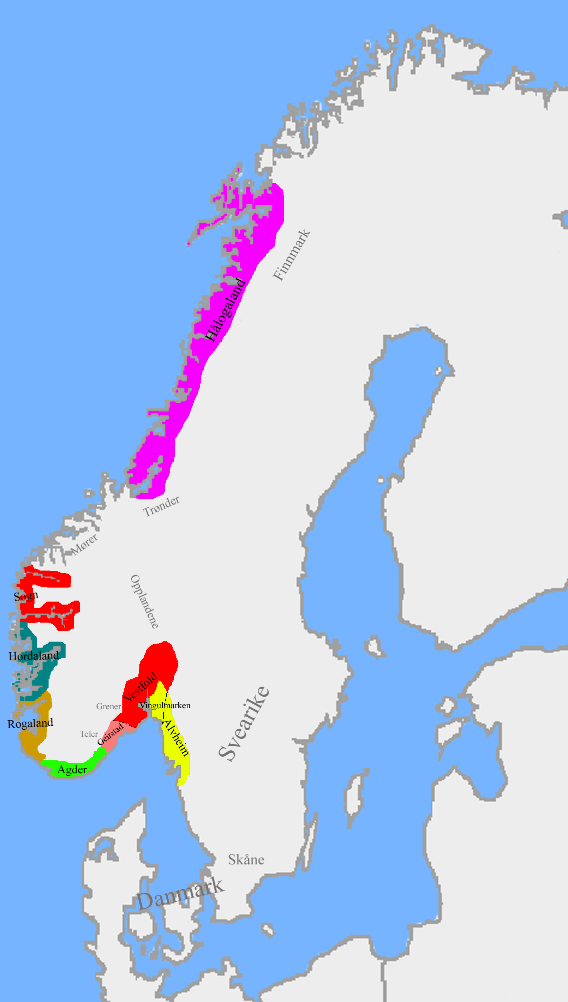
The petty kingdoms of Norway ( nb, smårike) were the entities from which the later Kingdom of Norway was founded. Before the unification of Norway in 872 and during the period of fragmentation after King Harald Fairhair's death, Norway was divided in several small kingdoms. Some could have been as small as a cluster of villages, and others comprised several of today's counties. By the time of the first historical records of Scandinavia, about the 8th century, a number of small political entities existed in Norway. The exact number is unknown, and would probably also fluctuate with time. It has been estimated that there were 9 petty realms in Western Norway during the early Viking Age. Archaeologist Bergljot Solberg on this basis estimates that there would have been at least 20 in the whole country. There are no written sources from this time to tell us the title used by these rulers, or the exact borders between their realms. The main written sources we have on this period, t ... [...More Info...] [...Related Items...] OR: [Wikipedia] [Google] [Baidu] |
Population Density
Population density (in agriculture: standing stock or plant density) is a measurement of population per unit land area. It is mostly applied to humans, but sometimes to other living organisms too. It is a key geographical term.Matt RosenberPopulation Density Geography.about.com. March 2, 2011. Retrieved on December 10, 2011. In simple terms, population density refers to the number of people living in an area per square kilometre, or other unit of land area. Biological population densities Population density is population divided by total land area, sometimes including seas and oceans, as appropriate. Low densities may cause an extinction vortex and further reduce fertility. This is called the Allee effect after the scientist who identified it. Examples of the causes of reduced fertility in low population densities are * Increased problems with locating sexual mates * Increased inbreeding Human densities Population density is the number of people per unit of area, usu ... [...More Info...] [...Related Items...] OR: [Wikipedia] [Google] [Baidu] |


