|
Hamoaze
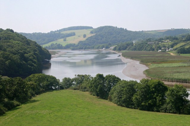
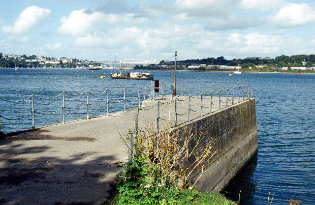
The Hamoaze (; ) is an estuarine stretch of the tidal River Tamar, between its confluence with the River Lynher and Plymouth Sound, England. The name first appears as ''ryver of Hamose'' in 1588 and it originally most likely applied just to a creek of the estuary that led up to the manor of Ham, north of the present-day Devonport Dockyard. The name evidently later came to be used for the estuary's main channel. The ''ose'' element possibly derives from Old English meaning 'mud' (as in 'ooze') – the creek consisting of mud-banks at low tide. The Hamoaze flows past Devonport Dockyard, which is one of three major bases of the Royal Navy today. The presence of large numbers of small watercraft is a challenge and hazard to the warships using the naval base and dockyard. Navigation on the waterway is controlled by the King's Harbour Master for Plymouth. Settlements on the banks of the Hamoaze are Saltash, Wilcove, Torpoint and Cremyll in Cornwall, as well as Devonport and Pl ... [...More Info...] [...Related Items...] OR: [Wikipedia] [Google] [Baidu] |
River Tamar
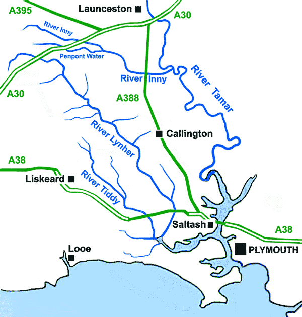
The Tamar (; kw, Dowr Tamar) is a river in south west England, that forms most of the border between Devon (to the east) and Cornwall (to the west). A part of the Tamar Valley is a World Heritage Site due to its historic mining activities. The Tamar's source is less than from the north Cornish coast, but it flows southward and its course runs across the peninsula to the south coast. The total length of the river is . At its mouth, the Tamar flows into the Hamoaze before entering Plymouth Sound, a bay of the English Channel. Tributaries of the river include the rivers Inny, Ottery, Kensey and Lynher (or ''St Germans River'') on the Cornish side, and the Deer and Tavy on the Devon side. The name Tamar (or Tamare) was mentioned by Ptolemy in the second century in his ''Geography''. The name is said to mean "great water."Furneaux, Robert. The Tamar: A Great Little River. Ex Libris Press. 1992. Foot, Sarah. ''The River Tamar''. Bossiney Books. 1989.Neale, John. Discoveri ... [...More Info...] [...Related Items...] OR: [Wikipedia] [Google] [Baidu] |
HMNB Devonport
His Majesty's Naval Base, Devonport (HMNB Devonport) is one of three operating bases in the United Kingdom for the Royal Navy (the others being HMNB Clyde and HMNB Portsmouth) and is the sole nuclear repair and refuelling facility for the Royal Navy. The largest naval base in Western Europe, HMNB Devonport is located in Devonport, in the west of the city of Plymouth, England. The base began as Royal Navy Dockyard in the late 17th century, but shipbuilding ceased at Devonport in the early 1970s, although ship maintenance work has continued. The now privatised maintenance facilities are operated by Babcock International Group, who took over the previous owner Devonport Management Limited (DML) in 2007. DML had been running the Dockyard since privatisation in 1987. From 1934 until the early 21st century the naval barracks on the site was named HMS ''Drake'' (it had previously been known as HMS ''Vivid'' after the base ship of the same name). The name HMS ''Drake'' and ... [...More Info...] [...Related Items...] OR: [Wikipedia] [Google] [Baidu] |
Plymouth Sound
Plymouth Sound, or locally just The Sound, is a deep inlet or sound in the English Channel near Plymouth in England. Description Its southwest and southeast corners are Penlee Point in Cornwall and Wembury Point in Devon, a distance of about 3 nautical miles (6 km). Its northern limit is Plymouth Hoe giving a north–south distance of nearly 3 nautical miles (6 km). The Sound has three water entrances. The marine entrance is from the English Channel to the south, with a deep-water channel to the west of the Plymouth Breakwater. There are two freshwater inlets: one, from the northwest, is from the River Tamar via the Hamoaze and Devonport Dockyard, the largest naval dockyard in western Europe. The other, at northeast, is from the River Plym disgorging into its narrow estuary, Cattewater harbour between Mount Batten and the Royal Citadel. In the centre of the Sound, midway between Bovisand Bay and Cawsand Bay, is Plymouth Breakwater, which creates a harbour pr ... [...More Info...] [...Related Items...] OR: [Wikipedia] [Google] [Baidu] |
Torpoint Ferry
The Torpoint Ferry is a car and pedestrian chain ferry connecting the A374 which crosses the Hamoaze, a stretch of water at the mouth of the River Tamar, between Devonport in Plymouth and Torpoint in Cornwall. The service was established in 1791 and chain ferry operations were introduced by James Meadows Rendel in 1832. Current operations The route is currently served by three ferries, built by Ferguson Shipbuilders Ltd at Port Glasgow and named after three rivers in the area: '' Tamar II'', '' Lynher II'' and '' Plym II''. Each ferry carries 73 cars and operates using its own set of slipways and parallel chains, with a vehicle weight limit of The ferry boats are propelled across the river by pulling themselves on the chains; the chains then sink to the bottom to allow shipping movements in the river. An intensive service is provided, with service frequencies ranging from every 10 minutes (3 ferries in service) at peak times, to half-hourly (1 ferry in service) at night. Serv ... [...More Info...] [...Related Items...] OR: [Wikipedia] [Google] [Baidu] |
Devonport, Devon
Devonport ( ), formerly named Plymouth Dock or just Dock, is a district of Plymouth in the English county of Devon, although it was, at one time, the more important settlement. It became a county borough in 1889. Devonport was originally one of the " Three Towns" (along with Plymouth and East Stonehouse); these merged in 1914 to form what would become in 1928 the City of Plymouth. It is represented in the Parliament of the United Kingdom as part of the Plymouth Sutton and Devonport constituency. Its elected Member of Parliament (MP) is Luke Pollard, who is a member of the Labour Party. The population of the ward at the 2011 census was 14,788. History Plymouth Dock In 1690 the Admiralty gave a contract to Robert Waters from Portsmouth to build a stone dock at Point Froward on the east bank of the Hamoaze at the mouth of the River Tamar. Plymouth Dock, as Devonport was originally called, began around 1700 as a small settlement to house workers employed on the new naval base ... [...More Info...] [...Related Items...] OR: [Wikipedia] [Google] [Baidu] |
Torpoint
Torpoint ( kw, Penntorr) is a civil parish and town on the Rame Peninsula in southeast Cornwall, England, United Kingdom. It is situated opposite the city of Plymouth across the Hamoaze which is the tidal estuary of the River Tamar. Torpoint had a population of 8,457 at the 2001 census, decreasing to 8,364 at the 2011 census. Two electoral wards also exist ( Torpoint East and Torpoint West). Their combined populations at the same census were 7,717. Torpoint is linked to Plymouth (and Devonport) by the Torpoint Ferry. The three vessels that operate the service are chain ferries – that is, they are propelled across the river by pulling themselves on fixed chains which lie across the bed of the river. The journey takes about seven minutes. Origin of name It is said that Torpoint's name is derived from Tar Point, a name given because of the initial industry on the west bank of the Hamoaze. However this is actually a nickname given by workers, Torpoint meaning "rocky headl ... [...More Info...] [...Related Items...] OR: [Wikipedia] [Google] [Baidu] |
Rame Peninsula
The Rame Peninsula ( kw, Gorenys an Ros) is a peninsula in south-east Cornwall. The peninsula is surrounded by the English Channel to the south, Plymouth Sound to the east, the Hamoaze to the northeast and the estuary of the River Lynher to the northwest. On a clear day, the Atlantic Ocean can be seen from advantageous points from Rame Head. The largest settlement is Torpoint, which is on the eastern coast, facing Devonport in Plymouth, Devon. The peninsula is named after Rame Head, to the south of the peninsula. The peninsula also includes the village and parish of Rame. The entire area of the peninsula is designated an Area of Outstanding Natural Beauty. Settlements Other places on the peninsula include: Antony, Cawsand, Crafthole, Cremyll, Fourlanesend, Freathy, Higher Wilcove, Kingsand, Lower Tregantle, Maker, Millbrook, Mount Edgcumbe House, Mount Edgcumbe Country Park, Penlee, Portwrinkle, Sheviock, and St John and Withnoe Barton. Kingsand and Cawsa ... [...More Info...] [...Related Items...] OR: [Wikipedia] [Google] [Baidu] |
Cremyll Ferry
The Cremyll ferry is a foot passenger ferry across the Hamoaze (the estuary of the River Tamar) from Admirals Hard in Stonehouse, Plymouth, Devon to Cremyll in Cornwall. It is operated by Plymouth boat Trips, and runs approximately every 30 minutes, with a 8-minute crossing time. History The ancient ferry route dates back to at least the 11th century. For hundreds of years the route was worked with rowing boat, and with horseboats for carrying livestock, carts and cargo. In 1511 the Mount Edgecumbe family took control of the ferry and they would keep control for over four hundred years. In 1885 the first steam ferry was introduced, followed by a further six steam launches, culminating in the present vessels, the second ''SS Armadillo'' and '' SS Shuttlecock'' which were introduced in 1924 and 1926.Langley, M. & Small, S. ''Estuary & River Ferries of South West England'', Waine Research Publications, 1984 In 1945 the ferry was taken over by the Millbrook Steamboat & Trading Co L ... [...More Info...] [...Related Items...] OR: [Wikipedia] [Google] [Baidu] |
Plymouth
Plymouth () is a port city status in the United Kingdom, city and unitary authority in South West England. It is located on the south coast of Devon, approximately south-west of Exeter and south-west of London. It is bordered by Cornwall to the west and south-west. Plymouth's early history extends to the Bronze Age when a first settlement emerged at Mount Batten. This settlement continued as a trading post for the Roman Empire, until it was surpassed by the more prosperous village of Sutton founded in the ninth century, now called Plymouth. In 1588, an English fleet based in Plymouth intercepted and defeated the Spanish Armada. In 1620, the Pilgrim Fathers departed Plymouth for the New World and established Plymouth Colony, the second English settlement in what is now the United States of America. During the English Civil War, the town was held by the Roundhead, Parliamentarians and was besieged between 1642 and 1646. Throughout the Industrial Revolution, Plymouth grew as a ... [...More Info...] [...Related Items...] OR: [Wikipedia] [Google] [Baidu] |
Wilcove
Wilcove is a small coastal village in Cornwall, England, United Kingdom. It is situated one mile (1.6 km) north of Torpoint and one mile (1.6 km) west of Devonport (part of the city of Plymouth) across the Hamoaze, the tidal estuary of the River Tamar. Wilcove is in the civil parish In England, a civil parish is a type of administrative parish used for local government. It is a territorial designation which is the lowest tier of local government below districts and counties, or their combined form, the unitary authorit ... of Antony. Cornwall Council online mapping. Retrieved May 2010 Wilcove has an active community association, a village hall and a riverside pub. The Carew-Pole family, of Antony House, have a long association with the village. Traditionally the village had a strong agricultural sector, with two farms - Whitehall Farm a ... [...More Info...] [...Related Items...] OR: [Wikipedia] [Google] [Baidu] |
Cornwall
Cornwall (; kw, Kernow ) is a Historic counties of England, historic county and Ceremonial counties of England, ceremonial county in South West England. It is recognised as one of the Celtic nations, and is the homeland of the Cornish people. Cornwall is bordered to the north and west by the Atlantic Ocean, to the south by the English Channel, and to the east by the county of Devon, with the River Tamar forming the border between them. Cornwall forms the westernmost part of the South West Peninsula of the island of Great Britain. The southwesternmost point is Land's End and the southernmost Lizard Point, Cornwall, Lizard Point. Cornwall has a population of and an area of . The county has been administered 2009 structural changes to local government in England, since 2009 by the Unitary authorities of England, unitary authority, Cornwall Council. The ceremonial county of Cornwall also includes the Isles of Scilly, which are Council of the Isles of Scilly, administered separate ... [...More Info...] [...Related Items...] OR: [Wikipedia] [Google] [Baidu] |
River Lynher
The River Lynher ( kw, Linar) (or St Germans River downstream from its confluence with the Tiddy) flows through east Cornwall, England, and enters the River Tamar at the Hamoaze, which in turn flows into Plymouth Sound. Navigation The normal tidal limit is a weir upstream of Notter Bridge. St Germans is a historic fishing village situated on the River Tiddy just upstream of its confluence with the Lynher. The Quay Sailing Club are based at St Germans Quay. The Queen's Harbour Master for Plymouth is responsible for managing navigation on the tidal Lynher and its tributaries (up to the normal tidal limits). Geography The river is about 21 miles (34 km long), rising at a height of about 920 feet (280m) on Bodmin Moor and flowing into the Tamar Estuary near Plymouth. It has four main tributaries, the largest of which is the River Tiddy. The smaller tributaries include Deans Brook, Withey Brook, Marke Valley and Darleyford streams and Kelly Brook. Ecology The Lynher ... [...More Info...] [...Related Items...] OR: [Wikipedia] [Google] [Baidu] |


