|
GGNRA
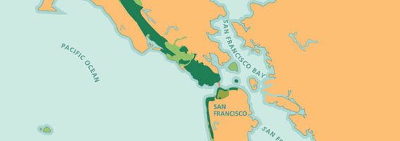
The Golden Gate National Recreation Area (GGNRA) is a U.S. National Recreation Area protecting of ecologically and historically significant landscapes surrounding the San Francisco Bay Area. Much of the park is land formerly used by the United States Army. GGNRA is managed by the National Park Service and is the most visited unit of the National Park system in the United States, with more than 15 million visitors a year. It is also one of the largest urban parks in the world, with a size two-and-a-half times that of the consolidated city and county of San Francisco. The park is not one continuous locale, but rather a collection of areas that stretch from southern San Mateo County to northern Marin County, and includes several areas of San Francisco. The park is as diverse as it is expansive; it contains famous tourist attractions such as Muir Woods National Monument, Alcatraz, and the Presidio of San Francisco. The GGNRA is also home to over 3,000 plant and animal species, ... [...More Info...] [...Related Items...] OR: [Wikipedia] [Google] [Baidu] |
Sutro Baths
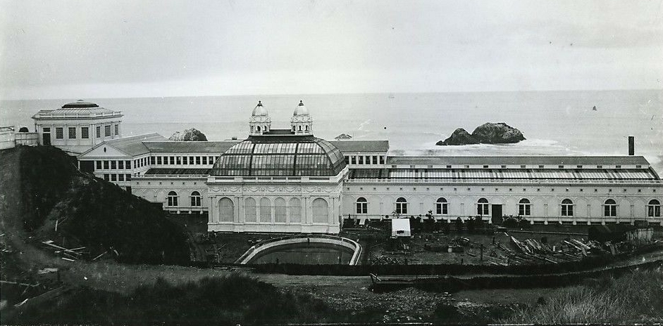
The Sutro Baths was a large, privately owned public saltwater swimming pool complex in the Lands End area of the Outer Richmond District in western San Francisco, California. Built in 1894, the Sutro Baths was located north of Ocean Beach, the Cliff House, Seal Rocks, and west of Sutro Heights Park. The structure burned down to its concrete foundation in June 1966; its ruins are located in the Golden Gate National Recreation Area and the Sutro Historic District. History On March 14, 1896, the Sutro Baths were opened to the public as the world's largest indoor swimming pool establishment. The baths were built on the western side of San Francisco by wealthy entrepreneur and former mayor of San Francisco (1894–1896) Adolph Sutro. The structure was situated in a small beach inlet below the Cliff House, also owned by Adolph Sutro at the time. Both the Cliff House and the former baths site are now a part of the Golden Gate National Recreation Area, operated by the United ... [...More Info...] [...Related Items...] OR: [Wikipedia] [Google] [Baidu] |
San Francisco
San Francisco (; Spanish for " Saint Francis"), officially the City and County of San Francisco, is the commercial, financial, and cultural center of Northern California. The city proper is the fourth most populous in California and 17th most populous in the United States, with 815,201 residents as of 2021. It covers a land area of , at the end of the San Francisco Peninsula, making it the second most densely populated large U.S. city after New York City, and the fifth most densely populated U.S. county, behind only four of the five New York City boroughs. Among the 91 U.S. cities proper with over 250,000 residents, San Francisco was ranked first by per capita income (at $160,749) and sixth by aggregate income as of 2021. Colloquial nicknames for San Francisco include ''SF'', ''San Fran'', ''The '', ''Frisco'', and ''Baghdad by the Bay''. San Francisco and the surrounding San Francisco Bay Area are a global center of economic activity and the arts and sciences, spurred ... [...More Info...] [...Related Items...] OR: [Wikipedia] [Google] [Baidu] |
Fort Mason
Fort Mason, in San Francisco, California originated as a coastal defense site during the American Civil War. The nucleus of the property was owned by John C. Frémont and disputes over compensation by the United States continued into 1968. In 1882 the defenses were named for Richard Barnes Mason, a military governor before statehood. Fort Mason became the headquarters for an Army command that included California and the Hawaiian Islands from 1904 to 1907. In 1912 the Army began building a port facility with piers and warehouses to be a home base for ships of the Army Transport Service serving Alaska, Hawaii, the Philippines and other Pacific Army posts and focus of Army supply for the Pacific. On 6 May 1932 that port facility was designated the San Francisco Port of Embarkation, modeled on the New York Port of Embarkation which supplied U.S. Army forces in World War I, to serve the Pacific. Fort Mason then became both the headquarters of the command that was the San Francisco ... [...More Info...] [...Related Items...] OR: [Wikipedia] [Google] [Baidu] |
Fort Funston
Fort Funston is a former harbor defense installation located in the southwestern corner of San Francisco. Formerly known as the Lake Merced Military Reservation, the fort is now a protected area within the Golden Gate National Recreation Area (GGNRA). It was named in honor of Frederick N. Funston (1865–1917), a Major General in the United States Army with strong connections to San Francisco, and included several artillery batteries. The fort is located on Skyline Boulevard at John Muir Drive, west of Lake Merced. The fort was constructed upon windswept headlands along the Pacific coast and Ocean Beach below, above steep sandstone cliffs that provide a nesting habitat for a colony of bank swallows (''Riparia riparia''). The last remnants of a sand dune ecosystem that once covered the western half of San Francisco grows along the top of the headlands, with trailheads forming part of the California Coastal Trail that runs through San Francisco County. History The lan ... [...More Info...] [...Related Items...] OR: [Wikipedia] [Google] [Baidu] |
Alcatraz
Alcatraz Island () is a small island in San Francisco Bay, offshore from San Francisco, California, United States. The island was developed in the mid-19th century with facilities for a lighthouse, a military fortification, and a military prison. In 1934, the island was converted into a federal prison, Alcatraz Federal Penitentiary. The strong currents around the island and cold water temperatures made escape nearly impossible, and the prison became one of the most notorious in American history. The prison closed in 1963, and the island is now a major tourist attraction. Beginning in November 1969, the island was occupied for more than 19 months by a group of Native Americans, initially primarily from San Francisco, who were later joined by AIM and other urban Indians from other parts of the country, who were part of a wave of Native American activists organizing public protests across the US through the 1970s. In 1972, Alcatraz was transferred to the Department of Interior ... [...More Info...] [...Related Items...] OR: [Wikipedia] [Google] [Baidu] |
Cliff House, San Francisco
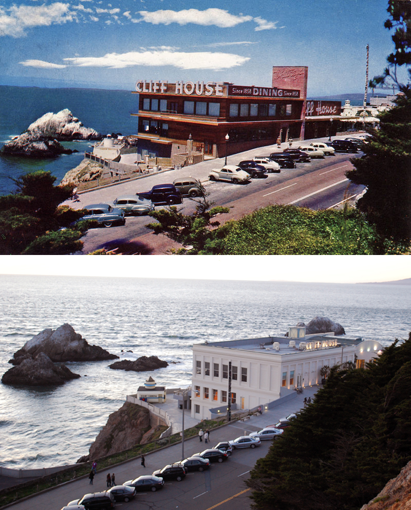
The Cliff House is a neo-classical style building perched on the headland above the cliffs just north of Ocean Beach, in the Outer Richmond, San Francisco, Outer Richmond neighborhood of San Francisco, California. The building overlooks the site of the Sutro Baths ruins, Seal Rocks (San Francisco, California), Seal Rocks, and is part of the Golden Gate National Recreation Area, operated by the National Park Service (NPS). The Cliff House is owned by the NPS; the building's terrace hosts a room-sized camera obscura. For most of the Cliff House's history, since 1863, the building's main draw has been restaurants and bars where patrons could enjoy the Pacific Ocean views. Since 1977, these restaurants and bars have been run by a private operator under contract with the National Park Service. In December 2020, the 47-year operator of these amenities announced that it was closing, and it criticized the NPS for not having signed a new long-term lease with any operator since its own pr ... [...More Info...] [...Related Items...] OR: [Wikipedia] [Google] [Baidu] |
Golden Gate Biosphere Reserve
The Gate Biosphere Network(GGBN or the Network) is an internationally recognized voluntary coalition of federal, state, and local government agencies, nonprofit organizations, universities, and private partners within the Golden Gate Biosphere region (along the western portion of the San Francisco Bay Area). The Network works towards protecting the biosphere region's biodiversity and conserving its natural resources to maintain the quality of life for people within the region. The Network has been part of the UNESCO Man and Biosphere Programme since 1988 and is part of the US Biosphere Network and EuroMAB. It is recognized by UNESCO due to the significant biodiversity of the region, as well as the Network's efforts to demonstrate and promote a balanced relationship between humans and the biosphere. The Network periodically submits reports to UNESCO on current land-management issues related to the region's biodiversity and its connection to people. Recent efforts have focuse ... [...More Info...] [...Related Items...] OR: [Wikipedia] [Google] [Baidu] |
Crissy Field
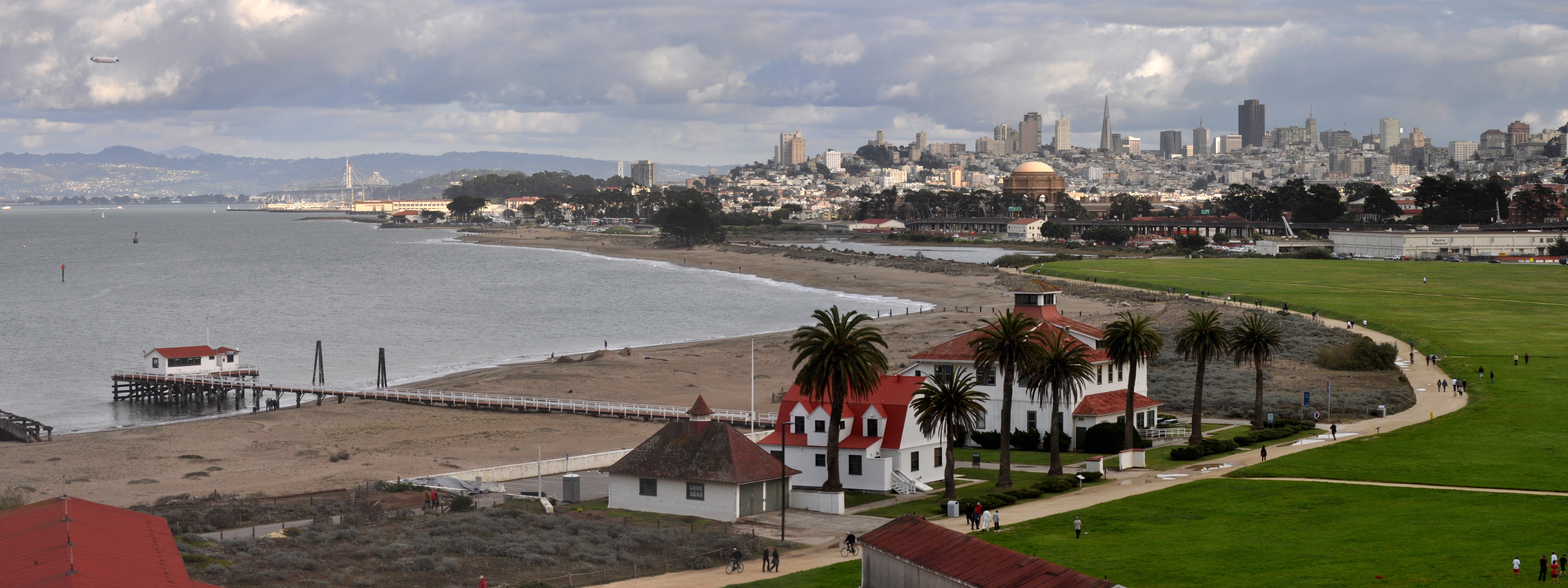
Crissy Field is a public recreation area on the northern shore of the San Francisco Peninsula in California, United States, located just east of the Golden Gate Bridge. It includes restored tidal marsh and beaches. Crissy Field is a former United States Army airfield which is now part of the Golden Gate National Recreation Area. Historically part of the Presidio of San Francisco, Crissy Field closed as an airfield after 1974. Under Army control, the site was affected by dumping of hazardous materials. The National Park Service took control of the area in 1994 and, together with the Golden Gate National Parks Conservancy, worked to restore the site until 2001, when the Crissy Field Center was opened to the public. While most buildings have been preserved as they were in the 1920s, some have been transformed into offices, retail space, and residences. History The land Crissy Field resides on is an ancient salt marsh and estuary. Prior to European settlement, the Ohlone people ... [...More Info...] [...Related Items...] OR: [Wikipedia] [Google] [Baidu] |
Sweeney Ridge
Sweeney Ridge, is a hilly hiking area of ridges and ravines between San Bruno and Pacifica, California, about a 25-minute drive south from San Francisco. The ridge's 1,200-foot-high summit, covered with coastal scrub and grassland, slopes down to San Francisco Bay on the east and to the Pacific Ocean on the west. The ridge is part of the Golden Gate National Recreation Area. Historically, the ridge is the location of the San Francisco Bay Discovery Site, commemorating the Portolá expedition's first sighting of San Francisco Bay on November 4, 1769 (expedition scouts actually made the discovery a few days earlier). Description Hiking trail access to Sweeney Ridge is available, on the Pacifica side, from the Shelldance Nursery site (Mori Ridge trail), and from the east end of Fassler Avenue (Baquiano Trail). On the San Bruno side, access the area from parking lots #2 and #4 at Skyline College (Sweeney Ridge Trail), and via a paved trail from the end of Sneath Lane in San Bruno ( ... [...More Info...] [...Related Items...] OR: [Wikipedia] [Google] [Baidu] |
San Francisco Bay Area
The San Francisco Bay Area, often referred to as simply the Bay Area, is a populous region surrounding the San Francisco, San Pablo, and Suisun Bay estuaries in Northern California. The Bay Area is defined by the Association of Bay Area Governments to include the nine counties that border the aforementioned estuaries: Alameda, Contra Costa, Marin, Napa, San Mateo, Santa Clara, Solano, Sonoma, and San Francisco. Other definitions may be either smaller or larger, and may include neighboring counties that do not border the bay such as Santa Cruz and San Benito (more often included in the Central Coast regions); or San Joaquin, Merced, and Stanislaus (more often included in the Central Valley). The core cities of the Bay Area are San Francisco, San Jose, and Oakland. Home to approximately 7.76 million people, Northern California's nine-county Bay Area contains many cities, towns, airports, and associated regional, state, and national parks, connected by a comp ... [...More Info...] [...Related Items...] OR: [Wikipedia] [Google] [Baidu] |
Pacifica, California
Pacifica ( es, Pacífica, meaning "Peaceful") is a city in San Mateo County, California, on the coast of the Pacific Ocean between San Francisco and Half Moon Bay. Overview The City of Pacifica is spread along a stretch of coastal beaches and hills in north central California. The city comprises several small valleys spread between Sweeney Ridge in the east, Montara Mountain to the south, and the Pacific Ocean's rocky bluffs to the west. Pacifica is well known regionally as a popular surfing destination. Surfers and families often visit Linda Mar Beach. Rockaway Beach is a scenic location and offers recreation, shopping and dining. 2005 marked the opening of the top ranked Pacifica Skateboard Park Pacifica is also a populadestination, with many trails crossing the hillsides that surround the city, including Pedro Mountain Road, Sweeney Ridge, and areas of the Golden Gate National Recreation Area. Fishermen frequent the local beaches and the Pacifica Pier, often catching s ... [...More Info...] [...Related Items...] OR: [Wikipedia] [Google] [Baidu] |
Marincello
Marincello was a failed development project in Marin County, California that would have put a planned community atop the Marin Headlands, overlooking the Golden Gate. Its upheaval set the precedent for Marin County's rigid anti-development stance and push for open space. History Pre-Marincello years The land making up the Marin Headlands was purchased by the US military in 1851, shortly after California became a state, for the installation of coastal defense guns. Other than building Forts Barry, Baker, and Cronkhite, and planting trees and vegetation to camouflage the forts from attack, the Marin Headlands was left in its native form. Its unique topography helped serve its purpose for the Army.Bay Nature: Wild Legacy of the Marin Headlands By the 1950s, the military insta ... [...More Info...] [...Related Items...] OR: [Wikipedia] [Google] [Baidu] |


.jpg)


.jpg)