|
Bursa
( grc-gre, Προῦσα, Proûsa, Latin: Prusa, ota, بورسه, Arabic:بورصة) is a city in northwestern Turkey and the administrative center of Bursa Province. The fourth-most populous city in Turkey and second-most populous in the Marmara Region, Bursa is one of the industrial centers of the country. Most of Turkey's automotive production takes place in Bursa. As of 2019, the Metropolitan Province was home to 3,056,120 inhabitants, 2,161,990 of whom lived in the 3 city urban districts ( Osmangazi, Yildirim and Nilufer) plus Gursu and Kestel, largely conurbated. Bursa was the first major and second overall capital of the Ottoman State between 1335 and 1363. The city was referred to as (, meaning "God's Gift" in Ottoman Turkish, a name of Persian origin) during the Ottoman period, while a more recent nickname is ("") in reference to the parks and gardens located across its urban fabric, as well as to the vast and richly varied forests of the surrounding r ... [...More Info...] [...Related Items...] OR: [Wikipedia] [Google] [Baidu] |
Green Mosque, Bursa
The Green Mosque ( Turkish: ''Yeşil Camii''), also known as the Mosque of Mehmed I, is a part of a larger complex (Turkish: külliye) on the east side of Bursa, Turkey, the former capital of the Ottoman Turks before they captured Constantinople in 1453. The complex consists of a mosque, türbe, madrasah, kitchen and bath. The name Green Mosque comes from its green and blue interior tile decorations. History The Green Mosque is often seen as the culmination of the early Ottoman architectural style, mainly due to the level of aesthetic and technical mastery displayed within the mosque. The Green Mosque was commissioned in 1412 by Sultan Mehmed I Çelebi, who ruled from 1413 to 1421, after a fight against his brothers to reunite the Ottoman Empire. Mehmed I was buried in a mausoleum, called the Green Tomb, commissioned by his son and successor, Murad II, which resides in the complex. The Green Mosque's exact completion date is uncertain, but it was built between 1419 and 1424 ... [...More Info...] [...Related Items...] OR: [Wikipedia] [Google] [Baidu] |
Osmangazi
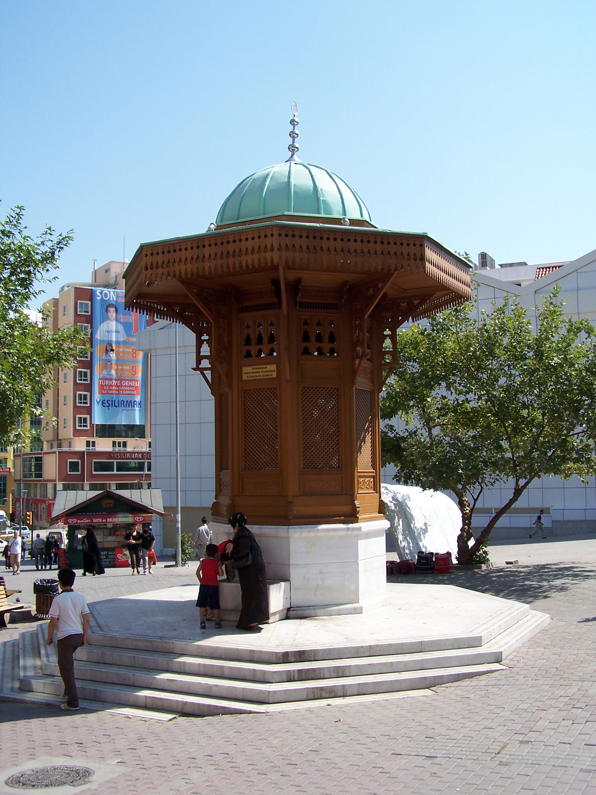
Osmangazi is one of the central metropolitan districts of the city of Bursa in Bursa Province, as well as the fourth largest overall municipality in Turkey. The municipality has a population of approximately 778,843 as of 2012. On its own, it would be the 28th largest city in Turkey. The district has been shaped by several civilizations: Rome, Byzantines, Seljuqians, and Ottomans. The first marks of the Ottoman Empire exist within Osmangazi where it extended from the foot of Uludağ to the plain of Bursa. Within the boundaries of Osmangazi, approximately 1800 registered historical buildings exist. History It was stated that there were various settlements in Bursa and its surroundings by 4000 B.C. But the certain information related to the region belongs to 700 B.C. Homer called the region Mysia. There are two villages that are ancient Mysia settlements: Misi (Gümüştepe) and Misebolu. The region is called Phrygia in historical geography. It is known that Cimmerians, fleei ... [...More Info...] [...Related Items...] OR: [Wikipedia] [Google] [Baidu] |
Bursa Province
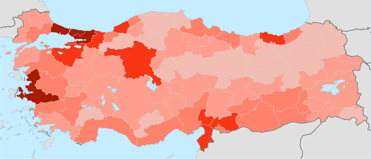
Bursa Province ( tr, ) is a province in Turkey along the Sea of Marmara coast in northwestern Anatolia. It borders Balıkesir to the west, Kütahya to the south, Bilecik and Sakarya to the east, Kocaeli to the northeast and Yalova to the north. The province has an area of 11,043 km2 and a population of 3,139,744 as of 2021. Its traffic code is 16. The vast majority of the Bursa Province districts (and the city of Bursa) are located within the Marmara Region, but the districts of Büyükorhan, Harmancık, Keles and Orhaneli are located within the Aegean Region. The city of Bursa was the capital of the Ottoman State between 1326 and 1365, until the Ottoman conquest of Edirne, then known as Adrianople, which became the new Ottoman capital between 1365 and 1453, when Constantinople became the final Ottoman capital. Districts Demographics See also * City of Bursa * İznik İznik is a town and an administrative district in the Province of Bursa, Turkey ... [...More Info...] [...Related Items...] OR: [Wikipedia] [Google] [Baidu] |
Bursa Uludağ Gondola
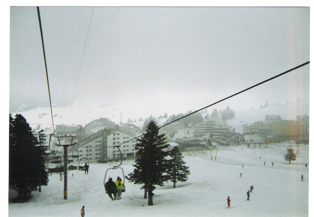
The Bursa Uludağ Gondola ( tr, Bursa Teleferik Hattı), or simply ''Teleferik'' as called locally, is an aerial lift line in Bursa Province connecting the city of Bursa with the nearby ski resort area and national park at Mt. Uludağ. Initially, as an aerial tramway line, it went in service in 1963, and served for fifty years until it was replaced by a modern system of gondola lift and extended into a ski resort area. The installation of a new line became unavoidable due to increased demand by tourists. History The initial line was an aerial tramway built by the Swiss company Von Roll Holding to enable easy access to the country's biggest ski resort area on Uludağ. Construction work began in 1958 and the line opened on 29 October 1963, the 40th anniversary Republic Day. The base station is situated at Teferrüç neighborhood of Yıldırım district in southern Bursa. The long line served two stations at Uludağ, Kadıyayla and Sarıalan Yaylası. Two 20-seater cabins tran ... [...More Info...] [...Related Items...] OR: [Wikipedia] [Google] [Baidu] |
Nilüfer, Bursa
Nilüfer is a district of the Bursa Province of Turkey, established in 1987. It is one of the seventeen districts of Bursa Province. It is established as the main residential development area of Bursa in order to meet the housing needs as well as industrial and commercial structures. Name origin The name of the district comes from Nilüfer River that passes through the district. Besides that also the name of the river comes from Nilüfer Hatun. According to traditional stories, Nilüfer Hatun ordered the building of a bridge over a river in Bursa and after the completion of bridge, both the river and the bridge were named "Nilüfer". History Nilüfer district hosting the first settlement in Bursa Region as per some researchers, bears the traces of both Byzantine and Ottoman and the older periods in history. In Nilüfer; Tepecik Tumulus, Gölyazı and Tahtalı villages in Alaaddinbey Neighborhood and Aktopraklık Tumulus and Gölyazı islands region in Akçalar district are ric ... [...More Info...] [...Related Items...] OR: [Wikipedia] [Google] [Baidu] |
Yıldırım, Bursa
Yıldırım is a metropolitan district that covers 399 km² in the centre of Bursa in Turkey. Founded in 1987, it was named after Ottoman Sultan Bayezid I, whose nickname was Yıldırım ("thunderbolt" in Turkish). It is at the foot of Mt. Uludağ, at 150–155 metres in elevation. Kestel and Gürsu are to its west, and the flat lands of Demirtaş, a subdistrict of Osmangazi, are to its north. The Bursa-Ankara highway passes through it. The Bursa Uludağ Aerial Lift ( tr, Teleferik, pictured to the right) is an aerial lift serving Mt. Uludağ. Built by the Swiss company Von Roll Holding and opened on 29 October 1963, the aerial tramway was replaced in 2013 by a modern and much bigger capacity gondola lift system by Leitner Group of Italy. With Osmangazi and Nilüfer, Yıldırım constitutes the Bursa metropolitan municipality. Yıldırım has 66 quarters and a village called Cumalıkızık, whose well-preserved historical Ottoman architecture attracts many ... [...More Info...] [...Related Items...] OR: [Wikipedia] [Google] [Baidu] |
List Of Largest Cities And Towns In Turkey
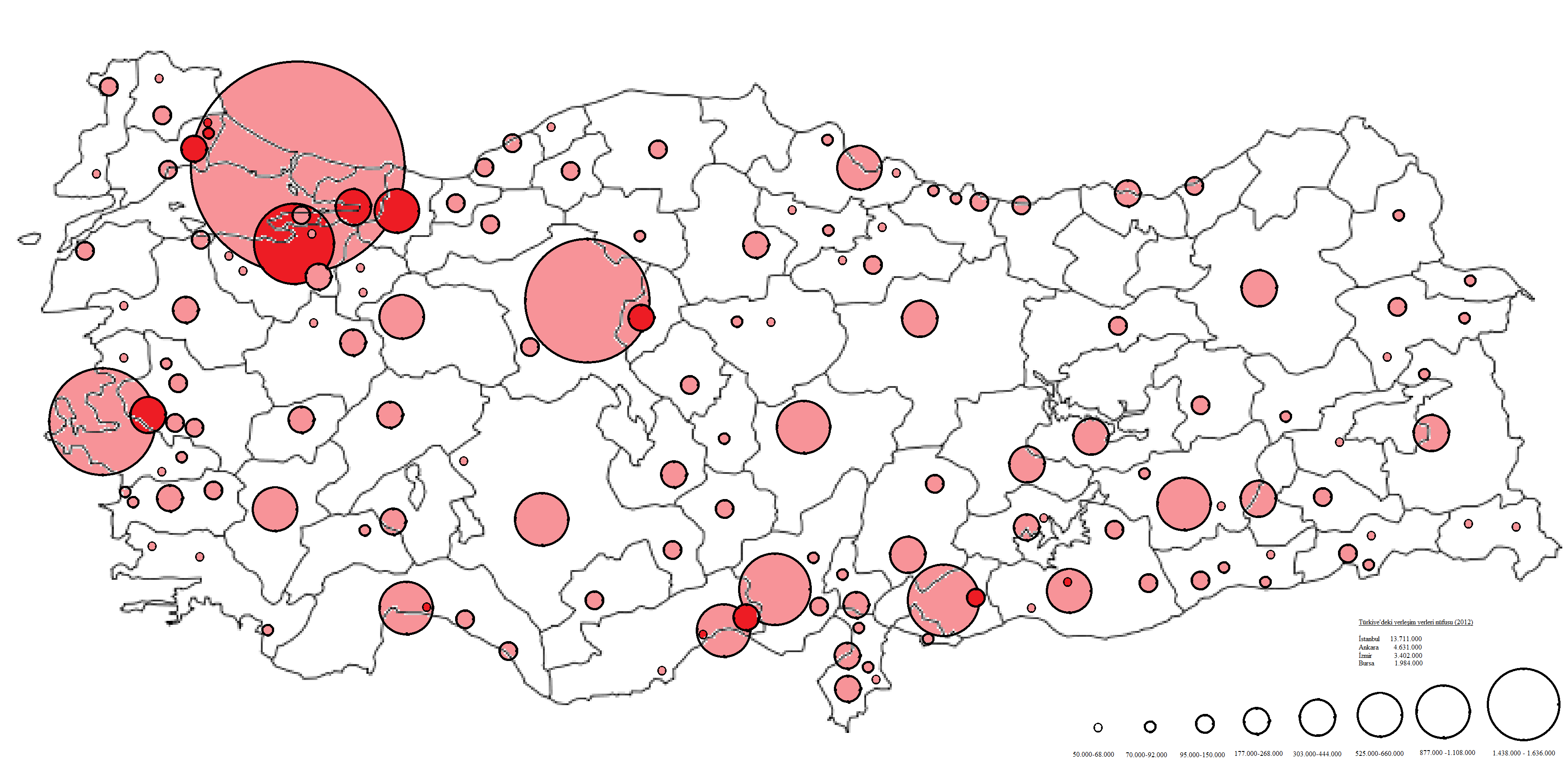
This is a list of cities and towns in Turkey by population, which includes cities and towns that are provincial capitals or have a population of at least 7,000. The total population of Turkey is 84,680,273 according to the 2020 estimate, making it the 17th most populated country in the world. *Istanbul, Turkey's economic and cultural capital is the largest city with a population of 15.84 million in its metropolitan area as of 2021. *Ankara, the capital of Turkey and Turkey's second largest city has a population of 5.7 million in its metropolitan area as of 2021. * Izmir, Turkey's third largest city has a population of over 4.3 million in its metropolitan area as of 2019. * Bursa, Turkey's fourth largest city has a population of over 3.1 million in its metropolitan area as of 2021. *Antalya, Turkey's fifth-largest city has a population of 2.6 million in its metropolitan area as of 2019. Cities and towns with more than 7,000 inhabitants Cities and Towns with a population of ove ... [...More Info...] [...Related Items...] OR: [Wikipedia] [Google] [Baidu] |
List Of Cities In Turkey
This is a list of cities and towns in Turkey by population, which includes cities and towns that are provincial capitals or have a population of at least 7,000. The total population of Turkey is 84,680,273 according to the 2020 estimate, making it the 17th most populated country in the world. *Istanbul, Turkey's economic and cultural capital is the largest city with a population of 15.84 million in its metropolitan area as of 2021. *Ankara, the capital of Turkey and Turkey's second largest city has a population of 5.7 million in its metropolitan area as of 2021. * Izmir, Turkey's third largest city has a population of over 4.3 million in its metropolitan area as of 2019. * Bursa, Turkey's fourth largest city has a population of over 3.1 million in its metropolitan area as of 2021. *Antalya, Turkey's fifth-largest city has a population of 2.6 million in its metropolitan area as of 2019. Cities and towns with more than 7,000 inhabitants Cities and Towns with a population of ove ... [...More Info...] [...Related Items...] OR: [Wikipedia] [Google] [Baidu] |
Koza Han
The Koza Han () is a historic caravanserai (''han'') in Bursa, Turkey. It is located in the heart of the city's historic market district. History Bursa, the first capital of the Ottoman Empire, was also its center of silk production and trade. Particularly in the 14th to 16th centuries, a large number of commercial structures such as ''han''s (caravanserais), bazaars (covered markets), and a ''bedesten'' were built in the city center, forming a major zone of economic activity. (At least 13 of these structures have survived today despite numerous earthquakes.) It is here, next to the old Orhan Gazi Mosque, that Sultan Bayezid II ordered the construction of the Koza Han in February or March of 1490. The architect was a man named Abdul Ula Bin Pulad Shah, and the building opened in September 1491. Through the ''waqf'' system, the revenues of the ''han'' were earmarked to finance the upkeep of Bayezid's mosque complex in Istanbul. As a caravanserai, the ''han'' provided lodging fo ... [...More Info...] [...Related Items...] OR: [Wikipedia] [Google] [Baidu] |
Gürsu
Gürsu is a town and district of Bursa Province of Turkey Turkey ( tr, Türkiye ), officially the Republic of Türkiye ( tr, Türkiye Cumhuriyeti, links=no ), is a transcontinental country located mainly on the Anatolian Peninsula in Western Asia, with a small portion on the Balkan Peninsula .... The Mayor of Gürsu is Mustafa Işık. References Populated places in Bursa Province Districts of Bursa Province {{Bursa-geo-stub ... [...More Info...] [...Related Items...] OR: [Wikipedia] [Google] [Baidu] |
Cumalıkızık
Cumalıkızık is a village in the Yıldırım district of Bursa Province, located 10 kilometers east of the city of Bursa, at the foot of Mount Uludağ. Its history goes back to the Ottoman Empire's foundation period. The village is now included within the border of the Yıldırım district as a neighbourhood. Cumalıkızık was founded as a vakıf village. The historical texture of the village has been well protected and the civilian countryside architectural structures of the early Ottoman period are still intact. Because of this, Cumalıkızık has become a popular but still unspoiled center for tourists. A group of similar villages which are placed close together between the foot of mount Uludağ and the valleys have been called ''Kızık'' in Turkish. The name stands for one of the twenty-four clans of the Oghuz Turks and the people from the villages also called Kızık. Similar villages, less well preserved, are Değirmenlikızık, Derekızık, and Hamamlıkızık ... [...More Info...] [...Related Items...] OR: [Wikipedia] [Google] [Baidu] |

.jpg)


.jpg)